NASA
NASA Science
Mars Exploration Program
Skip Navigation
menu
Images
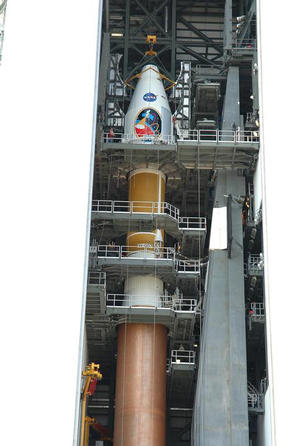
Countdown Nears: Final Tests
July 14, 2009
Credits
NASA
ENLARGE
[51, 178]
Related
This image, taken with the High Resolution Imaging Science Experiment (HiRISE) camera, shows the transition between the "Murray Formation," in which layers are poorly expressed and difficult to tra...
Geological Transition
Lobate Debris Apron in Deuteronilus Mensae
Lobate Debris Apron in Deuteronilus Mensae
Northern Hemisphere Gullies on West-Facing Crater Slope, Mars
Northern Hemisphere Gullies on West-Facing Crater Slope, Mars
This pit crater was created by an empty lava tube in Mars’ Arsia Mons region. The image was captured by NASA’s Mars Reconnaissance Orbiter on Aug. 16, 2020.
HiRISE Spots the Mouth of a Martian Lava Tube
Three pairs of before and after images from the High Resolution Imaging Science Experiment (HiRISE) camera on NASA's Mars Reconnaissance Orbiter illustrate movement of ripples on dark sand dunes in...
Changes in Ripples on Martian Dunes in Nili Patera
This image taken by NASA’s Mars Reconnaissance Orbiter shows ice sheets at Mars’ south pole. The spacecraft detected clays nearby this ice; scientists have proposed such clays are the source of rad...
MRO Spots Clays and Ice
A portion of a trough in the Nili Fossae region of Mars is shown in enhanced color in this image from the High Resolution Imaging Science Experiment (HiRISE) camera on NASA's Mars Reconnaissance Or...
Color Image of Layers in Holden Crater, a Candidate MSL Landing Site
This is a small volcano superimposed on the flanks of a larger one of the Cerberus Tholi.
Small Floral-Shaped Volcano
Researchers estimating the amount of carbon held in the ground at the largest known carbonate-containing deposit on Mars utilized data from three different NASA Mars orbiters.
Multiple Instruments Used for Mars Carbon Estimate
The smaller, narrow ridges oriented vertically are yardangs, which are created by wind erosion; the wind strips away the surrounding terrain, and the ridges remain because they contain more hardene...
Meanders and Tributaries in Ridge Form in the Zephyria Region (3-D)
The high resolution imaging science experiment (HiRISE) is one of six science instruments for NASA's Mars Reconnaissance Orbiter.
Telescopic Camera for Mars Reconnaissance Orbiter, Front End
On Nov. 1, 2016, the HiRISE camera on NASA's Mars Reconnaissance Orbiter observed the impact site of Europe's Schiaparelli test lander, gaining the first color view of the site since the lander's O...
Schiaparelli Impact Site on Mars, in Color
Mars Reconnaissance Orbiter captures the springtime thaw of seasonal carbon dioxide ice on Mars.
Mars: Dry Ice and Dunes
This image acquired on January 21, 2019 by NASAs Mars Reconnaissance Orbiter, shows the south polar layered deposits are well illuminated to accentuate the topography.
Everything is (Well) Illuminated
This cross-section view of underground layers near Mars' south pole is a radargram based on data from the Shallow Subsurface Radar (SHARAD) instrument on NASA's Mars Reconnaissance Orbiter
Cross Section of Buried Carbon-Dioxide Ice on Mars
In the novel and movie "The Martian," an astronaut's adventures take him to the rim of Mawrth Crater. This image from the HiRISE camera on NASA's Mars Reconnaissance Orbiter shows the nature of thi...
Western Edge of Mars' Marth Crater, a Movie Location
Observations by NASA's Mars Reconnaissance Orbiter have detected carbon-dioxide snow clouds on Mars and evidence of carbon-dioxide snow falling to the surface.
Carbon-Dioxide Snowfall on Mars
This sequence of three HiRISE images from NASA's Mars Reconnaissance Orbiter shows the growth of a branching network of troughs carved by thawing carbon dioxide over the span of three Martian years...
'Baby Spider': Growth of a Martian Trough Network
This area at the base of Mount Sharp on Mars includes a pale outcrop, called "Pahrump Hills," that NASA's Curiosity Mars rover investigated from September 2014 to March 2015, and the "Artist's Driv...
Curiosity Heading Away from 'Pahrump Hills'
This terrain is covered by pits and scallops (pits open on one side), perhaps due to collapse after sublimation of subsurface ice.
Utopia Planitia Scallops, Polygons, and Boulders (3-D)
This map shows the route driven by NASA's Curiosity Mars rover from the location where it landed in August 2012 to its location in mid-November 2015, approaching examples of dunes in the "Bagnold D...
Curiosity Rover's Traverse, First 1,163 Sols on Mars
Martian gullies as seen in the top image from HiRISE on NASA's Mars Reconnaissance Orbiter resemble gullies on Earth that are carved by liquid water. However, when they are observed with the additi...
Adding Composition Data About Mars Gullies
Images like this from the High Resolution Imaging Science Experiment (HiRISE) camera on NASA's Mars Reconnaissance Orbiter show portions of the Martian surface in unprecedented detail.
True Gullies on Mars
This graphic maps locations of the sites where NASA's Curiosity Mars rover collected its first 19 rock or soil samples for laboratory analysis inside the vehicle. It also presents images of the dri...
Curiosity's Rock or Soil Sampling Sites on Mars, Through November 2016
The largest crater in this mosaic of images taken by the Context Camera on NASA's Mars Reconnaissance Orbiter is Endeavour Crater, which is 22 kilometers (14 miles) in diameter.
Endeavour Crater in Context
You Might Also Like
The agency established the board in May 2023 to evaluate the technical, cost, and schedule plans prior to confirmation of the mission’s design.
NASA Releases Independent Review's Mars Sample Return Report
A pair of quakes in 2021 sent seismic waves deep into the Red Planet’s core, giving scientists the best data yet on its size and composition.
NASA InSight Study Provides Clearest Look Ever at Martian Core
Ten sample tubes, capturing an amazing variety of Martian geology, have been deposited on Mars’ surface so they could be studied on Earth in the future.
NASA's Perseverance Rover Completes Mars Sample Depot
Filled with rock, the sample tube will be one of 10 forming a depot of tubes that could be considered for a journey to Earth by the Mars Sample Return campaign.
NASA's Perseverance Rover Deposits First Sample on Mars Surface
The mission has concluded that the solar-powered lander has run out of energy after more than four years on the Red Planet.
NASA Retires InSight Mars Lander Mission After Years of Science
The 10 sample tubes being dropped on Mars’ surface so they can be studied on Earth in the future carry an amazing diversity of Red Planet geology.
NASA's Perseverance Rover to Begin Building Martian Sample Depot