NASA
NASA Science
Mars Exploration Program
Skip Navigation
menu
Images
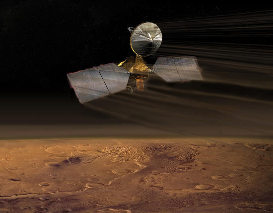
Artist concept of Mars Reconnaissance Orbiter
July 14, 2009
Credits
NASA/JPL-Caltech
ENLARGE
[51, 178]
Related
Wrinkle Ridge in Solis Planum
Wrinkle Ridge in Solis Planum
The Cerberus Fossae are a group of troughs in the Cerberus region of Mars that run roughly parallel to one another. They formed due to extension of the crust in the region. Some of the troughs, suc...
Vent in the Cerberus Region (3-D)
This global map of Mars was acquired on Aug. 2, 2012, by the Mars Color Imager instrument on NASA's Mars Reconnaissance Orbiter.
Mars Weather Map, Aug. 2 (Labeled)
Near the lower left corner of this view is the three-petal lander platform that NASA's Mars Exploration Rover Spirit drove off in January 2004.
Spirit Lander and Bonneville Crater in Color
NASA's Mars Exploration Rover Opportunity has been on the western rim of Endeavour Crater in Meridiani Planum for about two years.
Color View From Orbit Showing Opportunity in 'Botany Bay' (Unannotated)
A rippled dune front in Herschel Crater on Mars moved an average of about two meters (about two yards) between March 3, 2007 and December 1, 2010, as seen in these images from NASA's Mars Reconnais...
Rippling Dune Front in Herschel Crater on Mars
This map shows the frequency of carbon dioxide frost's presence at sunrise on Mars, as a percentage of days year-round. Carbon dioxide ice more often covers the ground at night in some mid-latitude...
Where on Mars Does Carbon Dioxide Frost Form Often?
The black speck circled in the lower left corner of this image is a cluster of recently formed craters spotted on Mars using a new machine-learning algorithm. This image was taken by the Context Ca...
Machine Learning Spots a Cluster of Mars Craters: Context Camera's View
The movie you're watching here is a sequence of 3 HiRISE images that were taken of an object that might be the Beagle 2 lander in the Isidis Planitia.
Found: Mars Reconnaissance Orbiter Locates Beagle 2 Lander
This image, taken with the High Resolution Imaging Science Experiment (HiRISE) camera, shows distinct bands of alternating tone and brightness within the "Murray Formation" on Mars.
Bands on the 'Murray Formation'
What is this enigmatic landform?
An Enigmatic Feature in Athabasca Lava Flows
Impact cratering and erosion combine to reveal the composition of the Martian underground by exposing materials from the subsurface.
Clay Minerals in Craters and Escarpments on Mars (Figure 4)
This HiRISE image shows erosional features formed by seasonal frost near the south pole of Mars.
Erosion Features near the South Pole of Mars
This view of a portion of the Eridania region of Mars shows blocks of deep-basin deposits that have been surrounded and partially buried by younger volcanic deposits. The image was taken by the Con...
Possible Floor of an Ancient Martian Sea
This map shows the route driven by NASA's Mars rover Curiosity through the 29th Martian day, or sol, of the rover's mission on Mars (Sept. 4, 2012).
Curiosity Traverse Map Through Sol 29
This meteoroid impact crater on Mars was discovered using the black-and-white Context Camera aboard NASA’s Mars Reconnaissance Orbiter. The Context Camera took this image of the impact, which occur...
Context Camera Views an Impact Crater in Amazonis Planitia
This May 2015 image from the HiRISE camera on NASA's Mars Reconnaissance Orbiter shows a location on Mars associated with the best-selling novel and Hollywood movie, "The Martian." It is in a regio...
The Ares 3 Landing Site: Where Science Fact Meets Fiction
These color-enhanced views of Deimos, the smaller of the two moons of Mars, were taken by the High Resolution Imaging Science Experiment (HiRISE) camera on NASA's Mars Reconnaissance Orbiter.
Martian Moon Deimos in High Resolution
This global map of Mars was acquired on Aug. 4, 2012, by the Mars Color Imager instrument on NASA's Mars Reconnaissance Orbiter.
Mars Weather Map, Aug. 4
The High Resolution Imaging Science Experiment (HiRISE) camera on NASA's Mars Reconnaissance Orbiter took two images of the larger of Mars' two moons, Phobos, within 10 minutes of each other on Mar...
Mars' Moon Phobos
In February 2015, NASA's Mars Exploration Rover Opportunity is approaching a cumulative driving distance on Mars equal to the length of a marathon race. This map shows the rover's position relative...
Opportunity Rover Nears Mars Marathon Feat (Unlabeled)
These images from the High Resolution Imaging Science Experiment (HiRISE) camera on NASA's Mars Reconnaissance Orbiter show how the appearance of dark markings on Martian slope changes with the sea...
Seasonal Changes in Dark Marks on an Equatorial Martian Slope
Artist's concept of Mars Reconnaissance Orbiter en route to Mars.
Artist's concept of Mars Reconnaissance Orbiter en route to Mars.
This comparison of before-and-after images shows two spots that likely appeared in connection with the Oct. 19, 2016, Mars arrival of the European Space Agency's Schiaparelli test lander. The image...
Signs of Schiaparelli Test Lander Seen From Orbit
This image acquired on December 13, 2020 by NASAs Mars Reconnaissance Orbiter, shows blobby features in the polar cap that are due to the sun sublimating away the carbon dioxide into these round pa...
Changes of a Happy Crater
You Might Also Like
The agency established the board in May 2023 to evaluate the technical, cost, and schedule plans prior to confirmation of the mission’s design.
NASA Releases Independent Review's Mars Sample Return Report
A pair of quakes in 2021 sent seismic waves deep into the Red Planet’s core, giving scientists the best data yet on its size and composition.
NASA InSight Study Provides Clearest Look Ever at Martian Core
Ten sample tubes, capturing an amazing variety of Martian geology, have been deposited on Mars’ surface so they could be studied on Earth in the future.
NASA's Perseverance Rover Completes Mars Sample Depot
Filled with rock, the sample tube will be one of 10 forming a depot of tubes that could be considered for a journey to Earth by the Mars Sample Return campaign.
NASA's Perseverance Rover Deposits First Sample on Mars Surface
The mission has concluded that the solar-powered lander has run out of energy after more than four years on the Red Planet.
NASA Retires InSight Mars Lander Mission After Years of Science
The 10 sample tubes being dropped on Mars’ surface so they can be studied on Earth in the future carry an amazing diversity of Red Planet geology.
NASA's Perseverance Rover to Begin Building Martian Sample Depot