NASA
NASA Science
Mars Exploration Program
Skip Navigation
menu
Images
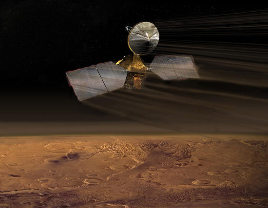
Artist concept of Mars Reconnaissance Orbiter
July 14, 2009
Credits
NASA/JPL-Caltech
ENLARGE
[51, 178]
Related
Dark, seasonal flows emanate from bedrock exposures at Palikir Crater on Mars in this image from the High Resolution Imaging Science Experiment (HiRISE) camera on NASA's Mars Reconnaissance Orbiter.
Warm-Season Flows on Martian Slope
A dust storm continues to envelop the Red Planet and Curiosity’s labs are back in action.
Mars Report: July 2018
A hill with a V-shaped collapse structure, two craters and a circular fracture pattern — possibly the remains of a buried impact crater — appear to form the face of a bear on the Mars surface. This...
A Bear Lookalike on Mars
With the Compact Reconnaissance Imaging Spectrometer for Mars (CRISM) instrument just above his head, a technician at NASA’s Kennedy Space Center works on the Mars Reconnaissance Orbiter spacecraft...
Spectrometer for Mars Reconnaissance Orbiter
NASA's Mars Reconnaissance Orbiter dips into the thin martian atmosphere to adjust its orbit in this artist's concept illustration.
Mars Reconnaissance Orbiter, Aerobraking
Shalbatana Vallis is a large channel with steep walls and a flat floor that may have formed by water draining from nearby Ganges Chasma. Here a section of the wall collapsed and produced a landslid...
Landslide in Shalbatana Vallis (3-D)
NASA's Mars rover Curiosity left the "Glenelg" area on July 4, 2013, on a "rapid transit route" to the entry point for the mission's next major destination, the lower layers of Mount Sharp.
Curiosity's Progress on Route from 'Glenelg' to Mount Sharp
This image acquired on January 27, 2019 by NASAs Mars Reconnaissance Orbiter, shows the extensive central peak complex of Hale Crater.
Bedrock in the Central Peaks of Hale Crater
This colorful image acquired on May 21, 2018 by NASA's Mars Reconnaissance Orbiter shows clays within the Eridania basin region. A large lake may have once existed here.
Clays in the Eridania Basin
This area of Mars is shaped by lava flows from volcanic eruptions.
Flow and Flow Features in Amazonis Planitia
This area at the base of Mount Sharp on Mars includes a pale outcrop, called "Pahrump Hills," that NASA's Curiosity Mars rover investigated from September 2014 to March 2015, and the "Artist's Driv...
Curiosity Heading Away from 'Pahrump Hills'
This comparison of before-and-after images shows two spots that likely appeared in connection with the Oct. 19, 2016, Mars arrival of the European Space Agency's Schiaparelli test lander. The image...
Signs of Schiaparelli Test Lander Seen From Orbit
A Martian dust devil roughly 12 miles (20 kilometers) high was captured winding its way along the Amazonis Planitia region of Northern Mars on March 14, 2012 by the High Resolution Imaging Science ...
Mars' Whirling Dust Devil
This image from the NASA Mars Reconnaissance Orbiter shows an impact scar on Mars made by pieces of the NASA Mars Science Laboratory spacecraft that the spacecraft shed just before entering the Mar...
Impact Scars from MSL Cruise Stage and Two Balance Weights (Figure 1)
This map shows the thickness of the north polar layered deposits on Mars as measured by the Shallow Radar instrument on NASA's Mars Reconnaissance Orbiter.
How Thick is the North Polar Ice Cap on Mars?
This picture of a heart-shaped feature in Arabia Terra on Mars was taken on May 23, 2010, by the Context Camera (CTX) on NASA's Mars Reconnaissance Orbiter.
Heart-shaped Feature in Arabia Terra
Sand dunes such as those seen in this image have been observed to creep slowly across the surface of Mars through the action of the wind.
Dunes on the Rim of the Hellas Impact Basin
A configuration interpreted as the United Kingdom's Beagle 2 Lander, with solar panels at least partially deployed, is indicated in this composite of two images from the High Resolution Imaging Sci...
Beagle 2 Lander on Mars, With Panels Deployed
This close-up image of a dust storm on Mars was acquired by the Mars Color Imager instrument on NASA's Mars Reconnaissance Orbiter on Nov. 7, 2007.
Martian Dust Storm
This view of layered rocks on the floor of McLaughlin Crater shows sedimentary rocks that contain spectroscopic evidence for minerals formed through interaction with water.
Layers with Carbonate Content Inside McLaughlin Crater on Mars
Sand dunes often accumulate in the floors of craters. In this region of Lyot Crater, NASA's Mars Reconnaissance Orbiter (MRO) shows a field of classic barchan dunes on Jan. 24, 2018.
Once in a Blue Dune
This oblique view with moderate vertical exaggeration shows the portion of the rim of Endeavour crater given the informal name "Spirit Point." This is the location where the team operating NASA's ...
Opportunity's First Goal at Endeavour Crater: 'Spirit Point'
This HiRISE image covers the southwest portion of the terraces and floor of Holden Crater situated in southwest Margaritifer Terra.
Holden Crater Megabreccia: A Telltale Sign of a Sudden and Violent Event
This image acquired on October 7, 2020 by NASAs Mars Reconnaissance Orbiter, shows a deposit draping the surface like a blanket.
A Slice of Ice
This image shows a portion of the central mound in the impact crater Gale that is of interest to scientists because it is composed of light-toned layered deposits.
Layers in a Central Mound in Gale Crater (3-D)
You Might Also Like
The agency established the board in May 2023 to evaluate the technical, cost, and schedule plans prior to confirmation of the mission’s design.
NASA Releases Independent Review's Mars Sample Return Report
A pair of quakes in 2021 sent seismic waves deep into the Red Planet’s core, giving scientists the best data yet on its size and composition.
NASA InSight Study Provides Clearest Look Ever at Martian Core
Ten sample tubes, capturing an amazing variety of Martian geology, have been deposited on Mars’ surface so they could be studied on Earth in the future.
NASA's Perseverance Rover Completes Mars Sample Depot
Filled with rock, the sample tube will be one of 10 forming a depot of tubes that could be considered for a journey to Earth by the Mars Sample Return campaign.
NASA's Perseverance Rover Deposits First Sample on Mars Surface
The mission has concluded that the solar-powered lander has run out of energy after more than four years on the Red Planet.
NASA Retires InSight Mars Lander Mission After Years of Science
The 10 sample tubes being dropped on Mars’ surface so they can be studied on Earth in the future carry an amazing diversity of Red Planet geology.
NASA's Perseverance Rover to Begin Building Martian Sample Depot