NASA
NASA Science
Mars Exploration Program
Skip Navigation
menu
Images
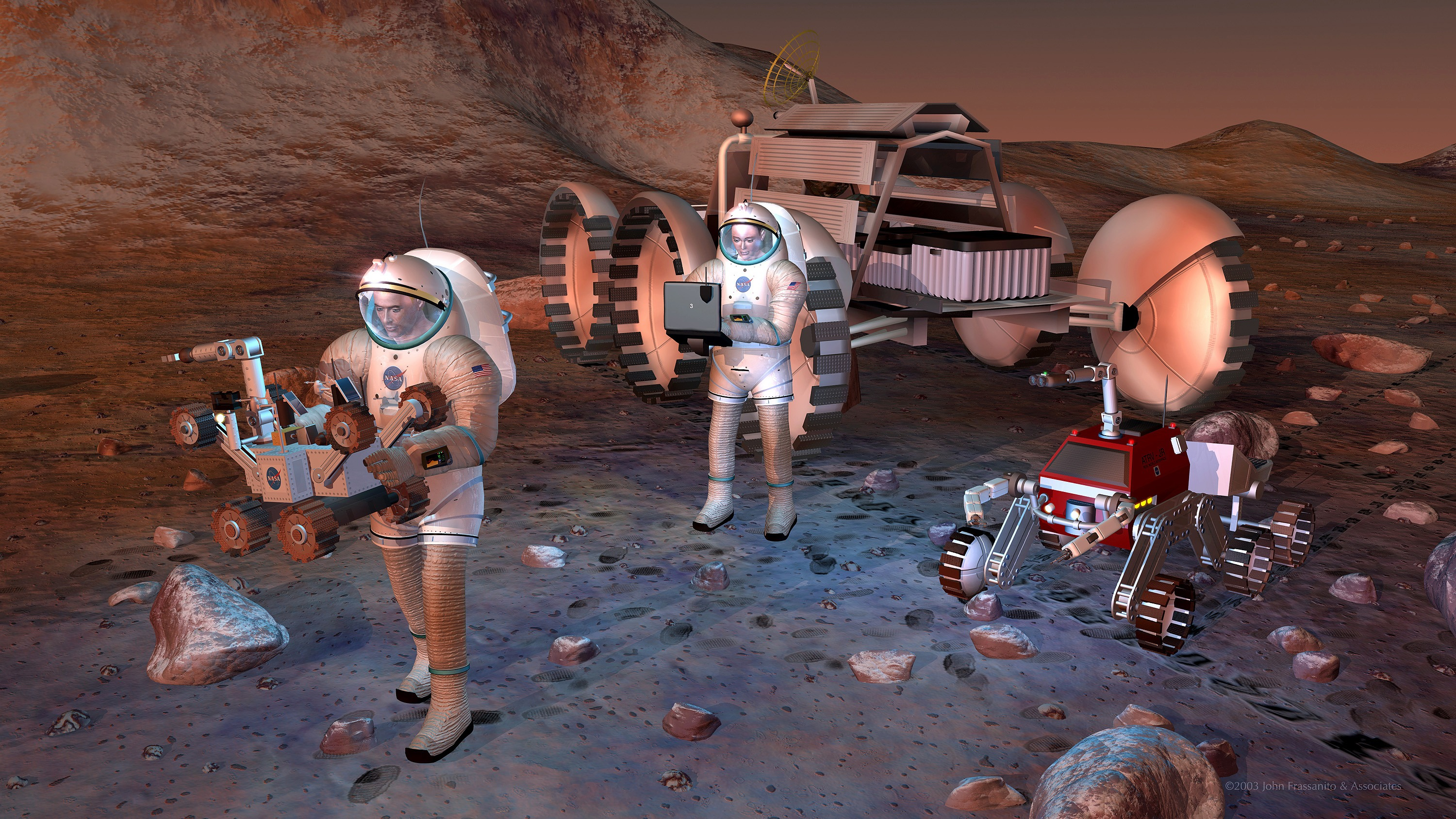
Artist's concept of future humans on Mars.
August 24, 2004
Credits
NASA/JPL-Caltech
ENLARGE
[51, 179]
Related
This image shows two small tributaries, just east of where they join Shalbatana Vallis.
Shalbatana Vallis
Re-analysis of 2002-2009 data from a hydrogen-finding instrument on NASA's Mars Odyssey orbiter increased the resolution of maps of hydrogen abundance.
Analysis Sharpens Mars Hydrogen Map, Hinting Equatorial Water Ice
Seasons change even on Mars and NASA's fleet of explorers are helping scientists learn more about the effects on the Red Planet.
Mars Report: How's the Weather on Mars?
Gale Crater, home to NASA's Curiosity Mars rover, shows a new face in this image made using data from the THEMIS camera on NASA's Mars Odyssey orbiter.
Gale Crater's Surface Materials
Five decades of successful NASA missions to the Red Planet, 1965-2015.
50 Years of Mars Exploration
NASA's NEOWISE mission detected comet C/2013 A1 Siding Spring on July 28, 2014, less than three months before this comet's close flyby of Mars on Oct. 19. This merging of multiple images presents t...
NEOWISE Spies Comet C/2013 A1 Siding Spring a Second Time
NASA's Mars Odyssey spacecraft passes above a portion of the planet that is rotating into the sunlight in this artist's concept illustration. The spacecraft has been orbiting Mars since October ...
Odyssey over Martian Sunrise, 3-D (Artist Concept)
On the southwest edge of the immense volcanic region of Tharsis, lava from its giant volcanoes flowed down to meet the old cratered landscape of Terra Sirenum.
Terra Sirenum
A "Grand Canyon of Mars" slices across the Red Planet near its equator.
Mars Canyon with Los Angeles for Scale
The artist's animation depicts how NASA's Curiosity rover will communicate with Earth during landing. As the rover descends to Mars, it will send out basic radio-frequency tones that go directly to...
Curiosity Speaks
The annotated area of Mars in this illustration holds near-surface water ice that would be easily accessible for astronauts to dig up. The water ice was identified as part of a map using data from ...
Water Ice Marked on Mars Globe
This region of Terra Sabaea contains areas with high densities of small craters.
Lot of Craters in Terra Sabaea
This map shows unprecedented detail of local variations in Mars' gravitational pull on orbiters. The gravitational mapping has been applied to map variations in the thickness of the planet's crust ...
Local Variations in the Gravitational Pull of Mars
At 11:02 a.m. EDT on April 7, 2001, crowds watch a Boeing Delta II rocket lift off from Cape Canaveral Air Force Station, Florida, carrying NASA's 2001 Mars Odyssey spacecraft into space on its sev...
Odyssey's Launch to Mars on April 7, 2001
This series of images was taken in visible-wavelength light as the THEMIS camera on NASA's Mars Odyssey scanned across the Martian moon Phobos on Sept. 29, 2017. The apparent motion is due to progr...
Series of Images from THEMIS Scanning Phobos
Just as on Earth, volcanism and tectonism are found together on Mars. Here is an example: the ridges and fractures of Claritas Fossae are affecting or perhaps hosting the volcanic flows of Solis Pl...
Volcanism & Tectonism
Bright blue marks a deposit of chloride (salt) minerals in the southern highlands of Mars in this false-color image, which highlights mineral composition differences.
Chloride Salt Deposit in Southern Highlands of Mars (Annotated)
This image shows the context for orbital observations of exposed rocks that had been buried an estimated 5 kilometers (3 miles) deep on Mars.
Nature's Drilling Exposes Deeply Buried Minerals
Chasma Boreale is a long, flat-floored valley that cuts deep into Mars' north polar icecap
Mars Odyssey All Stars: Chasma Boreale
Part of a multispectral THEMIS infrared image of Nili Patera caldera on Syrtis Major has been superimposed on a high-resolution THEMIS visual image.
Nili Patera and Dacite Lava Flow
Download a PDF of the 2001 Mars Odyssey Launch Press Kit.
2001 Mars Odyssey Launch Press Kit
This image shows a 90-mile-wide portion of the giant Valles Marineris canyon system. Landslide debris and gullies in the canyon walls on Mars can be seen at 100 meters (330 feet) per pixel.
Close View of Valles Marineris
This image from NASAs Mars Odyssey shows lava flows from Alba Mons, and a tectonic graben called Cyane Fossae.
Alba Mons
Morning clouds fill Coprates Chasma on Mars in this Nov. 25, 2015, image from the THEMIS camera on NASA's Mars Odyssey. No orbiter systematically observed Mars in morning sunlight before 2015. The ...
Mars Odyssey View of Morning Clouds in Canyon
Women working in science, technology, engineering and mathematics at NASA's Jet Propulsion Laboratory pose for a photo in mission control in honor of Women in Science Day.
Women in Science
You Might Also Like
The agency established the board in May 2023 to evaluate the technical, cost, and schedule plans prior to confirmation of the mission’s design.
NASA Releases Independent Review's Mars Sample Return Report
A pair of quakes in 2021 sent seismic waves deep into the Red Planet’s core, giving scientists the best data yet on its size and composition.
NASA InSight Study Provides Clearest Look Ever at Martian Core
Ten sample tubes, capturing an amazing variety of Martian geology, have been deposited on Mars’ surface so they could be studied on Earth in the future.
NASA's Perseverance Rover Completes Mars Sample Depot
Filled with rock, the sample tube will be one of 10 forming a depot of tubes that could be considered for a journey to Earth by the Mars Sample Return campaign.
NASA's Perseverance Rover Deposits First Sample on Mars Surface
The mission has concluded that the solar-powered lander has run out of energy after more than four years on the Red Planet.
NASA Retires InSight Mars Lander Mission After Years of Science
The 10 sample tubes being dropped on Mars’ surface so they can be studied on Earth in the future carry an amazing diversity of Red Planet geology.
NASA's Perseverance Rover to Begin Building Martian Sample Depot