September 27, 2017

Sol 1828: Bye Bye Bar Harbor

Written by Michelle Minitti, Planetary Geologist at Framework
Sol 1828: Bye Bye Bar Harbor

Before landing, Curiosity's landing ellipse and the foothills of Mt. Sharp were divided up into quadrangles - squares ~1.5 km on a side - to give science team members reasonable amounts of terrain to work with during pre-landing geological mapping, and provide the source of the target names within that quadrangle. Quadrangles get their names from towns that are nearby and share names with notable regions of geological interest on Earth, and since Sol 1500, Curiosity has been traversing the "Bar Harbor" quadrangle. If today's drive goes as planned, we will leave the Bar Harbor quadrangle behind, so today's blog will honor the Maine heritage of our long-time home.

Curiosity spent her last sol in the Bar Harbor quadrangle "going right out straight" (working very hard). With ChemCam, she zapped "Hawk Mountain," a rock with "savage" (great) layering, and a "whole 'notha" (another) target, "Bonney Woods," moving from a white vein into the surrounding bedrock. Mastcam acquired a small stereo mosaic over an area where the bedding geometry appeared particularly well-exposed. This area was dubbed "Erickson Fields," though not for MSL's "wicked good" (great) project manager, Jim Erickson. The Kuruman quadrangle is just out Curiosity's "dooryard" (front door), so with today's 32 m drive, we CAN get there from here!

September 27, 2017

Sol 1829: Hello Kuruman!

Written by Abigail Fraeman, Planetary Geologist at NASA's Jet Propulsion Laboratory
Sol 1829: Hello Kuruman!

As was predicted in yesterday's blog mars.nasa.gov/msl/mission/mars-rover-curiosity-mission-updates/?mu=sol-1828-bye-bye-bar-harbor, we have officially left the "Bar Harbor" quadrangle and are now into the "Kuruman" quadrangle. This quadrangle is named after a charming town situated on the edge of the Kalahari desert in South Africa. Notably, the town of Kuruman is the namesake for the Kuruman Iron Formation, an ~2.46 billion year sedimentary rock that is rich in hematite. Hematite is the same mineral we can see is distributed throughout the Vera Rubin Ridge from orbital data! The target names we will use while in this quadrangle are pulled from famous geological features from South Africa and nearby Botswana and Zimbabwe.

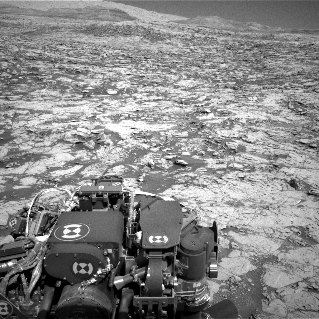
During our first full sol in the Kuruman quad, we will be doing a touch-and-go. We will investigate target "Enon" with APXS, MAHLI, ChemCam, and Mastcam. We are also currently sitting in front of an erosion-resistant outcrop, "Mt. Hamden," which is providing us with a nice vertical exposure that we will image with Mastcam left and right eyes. Finally, we will take another Mastcam image of target "Noisy" before driving off to the northeast. The day will end with some environmental science monitoring observations including a Mastcam tau measurement to assess the dust content of the atmosphere, and some Navcam images looking towards the sky and crater rim.

September 25, 2017

Sol 1827: It's déjà vu all over again

Written by Scott Guzewich, Atmospheric Scientist at NASA's Goddard Space Flight Center
Sol 1827: It's déjà vu all  over again

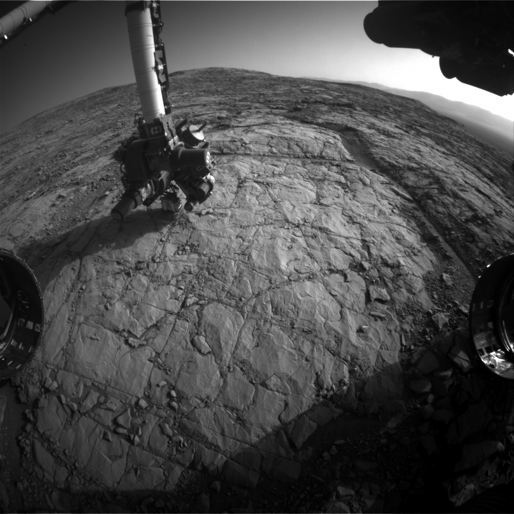
Just when we thought we were going to leave this spot on Mars, we found ourselves stuck here for yet another sol. This time, a fault during one of our arm activities caused us to lose our plans for the past two sols (which would have included a drive to our next waypoint in the Vera Rubin Ridge science campaign) and we were in recovery mode again today. This picture of the arm's shadow on the ground was taken just before the fault. So today, we make our third attempt to complete our science activities at this stop, including ChemCam and Mastcam targets of nearby bedrock: "Sherwood Forest", "Tableland", and "Troll Valley". We were also able to plan a Mastcam image of a target named "Elf Woods" that was originally intended for the weekend plan, but had to be removed for power considerations. Following these science activities, Curiosity will drive approximately 10 m closer to our third stop on Vera Rubin Ridge.

September 22, 2017

Sol 1824-1826: Reality and Fantasy Collide

Written by Scott Guzewich, Atmospheric Scientist at NASA's Goddard Space Flight Center
Sol 1824-1826:  Reality and Fantasy Collide

At times, it seems like fantasy that we have a nuclear-powered car exploring Mars and that I get to help that exploration, including today as the Science Operations Working Group Chair. But at other times, mundane reality creeps in to throw cold water on that. Such as happened yesterday when a network communications problem here on Earth resulted in yesterday's Sol 1823 plan not being uplinked to Curiosity. That resulted in Curiosity performing a "runout" sol when only basic activities are performed.

But we picked up right where we left off yesterday and created a packed list of science activities to keep Curiosity busy over the weekend. We recovered the lost science on targets "Sherwood_Forest" and "Tableland" (both of which are just above the first letters in "Curiosity" in this image: https://mars.nasa.gov/msl/multimedia/raw/?rawid=NLB_559245410EDR_F0660384NCAM00375M_&s=1822), which includes ChemCam and Mastcam examinations of both and contact science on "Sherwood_Forest". We added another fantasy-themed named target in "Troll_Valley" (just past the sandy spot above the Curiosity logo in that previous picture), which also will be examined by contact science with MAHLI and APXS and remotely by ChemCam and Mastcam. We also planned an extensive suite of environmental monitoring, including a ChemCam passive sky observation (where we use the ChemCam instrument without the laser to study atmospheric dust, ice, and gases) and Mastcam and Navcam images to determine the amount of dust in the atmosphere as well as search for clouds. We are entering the cloudy time of year on Mars and expect more clouds over the next several months.

Lastly, we scheduled the rover to drive to the third stop of our Vera Rubin Ridge science campaign. That stop is near the small, dark-toned ridge straight ahead in this image https://mars.nasa.gov/msl/multimedia/raw/?rawid=NLB_559245598EDR_F0660384NCAM00258M_&s=1822.

This image was taken by Navcam: Left B (NAV_LEFT_B) onboard NASA's Mars rover Curiosity on Sol 1822 (2017-09-21 06:27:32 UTC).

September 21, 2017

Sol 1823: "Will you come with me, sweet Reader?"

Written by Mark Salvatore, Planetary Geologist at University of Michigan
Sol 1823: "Will you come with me, sweet Reader?"

Curiosity continues her traverse across the lowermost portions of Vera Rubin Ridge, where she continues to investigate the interesting rock textures and colors ahead. Our current location is quite dusty, which motivated the science team to focus on a relatively quick characterization of the surrounding bedrock, which will allow the rover to drive away and continue making progress towards some of the other interesting locations within Vera Rubin Ridge. The upcoming plan involves a quick "touch-and-go" using the APXS and MAHLI instruments for the chemical and morphological investigation (respectively) of a flat piece of bedrock named "Sherwood Forest." After stowing her arm, Curiosity will then use Mastcam and ChemCam to analyze both "Sherwood Forest" and a dark-toned target named "Tableland." These targets are located just to the left of center in this front Hazcam image.

Before driving away, Curiosity will also create a high-resolution Mastcam mosaic of a region to the southwest of her current location. This region was identified from orbit as a potential region of interest, as it shows a relatively steep slope with some potentially interesting bedrock exposures. Ever since ascending onto Vera Rubin Ridge, Curiosity has been making progress towards this location to determine whether it is worth investigating from close-range. As it turns out, the region doesn't appear all that different from the parts of the ridge that Curiosity has already been exploring. So, instead of continuing the southwest drive towards this location, the team decided to blanket the area in high-resolution color imagery before turning to the east-southeast and towards another region of interest. Updating the rover's planned traverse path using both orbital and ground-based data is very common, and this decision by the science team highlights how collaborative discussions and the ability to adjust plans in real-time can both save time and maximize the scientific return of the mission.

The title of today's blog post is a quote from the beginning of the 1883 novel "The Merry Adventures of Robin Hood" by Howard Pyle. It's not every day that Curiosity roves around "Sherwood Forest!" The full quote reads "And now I lift the curtain that hangs between here and No-man's-land. Will you come with me, sweet Reader? I thank you. Give me your hand." I feel this quote is quite appropriate for us planetary scientists, who continually "lift the curtain" between our lives on Earth and our investigation of the Red Planet.

September 21, 2017

Sol 1822: Onward and upward!

Written by Lauren Edgar, Planetary Geologist at USGS Astrogeology Science Center
Sol 1822: Onward and upward!

This image was taken by Front Hazcam: Right B (FHAZ_RIGHT_B) onboard NASA's Mars rover Curiosity on Sol 1821 (2017-09-20 08:11:08 UTC).
On Sol 1821, Curiosity successfully completed contact science activities at "Pennessewassee" and "Passadumkeag". Perhaps in an effort to get to more easily pronounceable rock targets, today's tactical team planned a nice long drive towards our next waypoint on Vera Rubin Ridge.

The Sol 1822 plan begins with a Navcam movie to look for clouds above the northern rim of the crater. Then Curiosity will turn her attention towards the bedrock targets in front of her, using both Mastcam and ChemCam to assess the spectral character of yesterday's DRT target "Passadumkeag" and to assess the composition and sedimentary structures exposed at "Hypocrites Ledge." We'll also use Mastcam to monitor the movement of fines on the rover deck. Then Curiosity will gear up for a drive of ~40 m, as we work our way towards the next waypoint (located in the top center of the Mastcam image shown above). Downlink data volume was a challenge today, so the team had to think carefully about the priorities of post-drive imaging to prepare for possible touch-and-go contact science and other remote sensing in tomorrow's plan. The afternoon post-drive imaging block also contains some extended Navcam coverage for additional geologic context and targeting, as well as two Navcam observations to search for clouds and monitor the wind direction near the zenith. With drives like these, we're really reminded that we have a mountain-climbing robot on Mars!

September 19, 2017

Sol 1820: What lay beneath

Written by Michelle Minitti, Planetary Geologist at Framework
Sol 1820: What lay beneath

Curiosity's weekend "Brushfest" (link to Ken's weekend blog) paid off, revealing the stunning purple color of the rocks of this part of the Vera Rubin Ridge (VRR) hiding below the veneer of dust on their surfaces. As Curiosity arrived at her new bedrock-rich workspace after a weekend drive of ~18 m, the science team had to decide whether to quickly interrogate a contact science target with MAHLI and APXS using a touch and go, or stay and find out what lay beneath the dust. There were hints around the workspace that color variations were present, with surfaces visible in shades of tan, gray and purple, so the science team decided to push the drive off a day and stay to use the Dust Removal Tool (DRT) once again on the VRR rocks in the workspace.

The science team was not only in a cleaning mood, they were in a tongue twisting mood, as evidenced by the names of the two MAHLI and APXS targets, "Passadumkeag" (a small Maine town) and "Pennessewassee" (a lake near Norway, Maine). Passadumkeag, a tan-colored target, will benefit from the DRT's revelatory powers, while Pennessewassee, a more gray-colored target, will be interrogated as is. ChemCam will shoot Passadumkeag, adding to the chemical data from that target, as well as "Uncle Zeke Island" and "Mustards Island." The Uncle Zeke Island raster will cover an area of bedrock where its color changes from bluish to purplish. Mustards Island is a unique, non-bedrock target unto itself - a gray, lumpy disc of rock resting loose in the workspace. Mastcam will also acquire multispectral data from Mustards Island to help constrain its unique appearance.

Despite the focus on rocks today, the environment of Gale still got a bit of attention, with regular REMS and RAD measurements and a 360 degree Navcam panorama looking for dust devils. If only we could get those dust devils to do a little dust removing for us on our path ahead!

September 19, 2017

Sol 1821: Heading for Half a Million Laser Shots

Written by Roger Wiens, Geochemist at Los Alamos National Laboratory
Sol 1821: Heading for Half a Million Laser Shots

Communication ties our lives together. If phone or internet service goes out in our area, sometimes we have to put our lives on hold for a few minutes or a few hours. The same is true for Mars operations. Yestersol Curiosity missed its 'phone call' from Earth due to a small issue at one of NASA's Deep Space Network stations. We were aware of the issue yesterday, but we went ahead and completed the operation plan in case something would change at the last minute, but no dice. So today we plan to uplink exactly the same plan. Yestersol's plan is described in the blog for Sol 1820.

Of special note, ChemCam's observations will carry it past the half million mark for the number of laser firings on Mars. We receive a spectrum with each laser pulse, so these all represent a huge amount of critical data on Mars compositions. Fortunately, ChemCam's laser should last a while longer. Based on ground testing, we hope for at least another half million shots.

In some of my public talks, I joke about the initial media reaction to shooting the laser on Mars. We tell reporters that the ChemCam instrument 'zaps' rocks on Mars. However, sometimes the media edit this to sound a bit more engaging, writing that the rover 'blasts' rocks on Mars. The latter word can have much bigger connotations, like an explosion. In fact, at the time of the landing, we found a doctored picture on the internet showing ChemCam's laser beam eliciting a large explosion on Mars, with a fireball and debris cloud. In many of my talks I show this picture, which always brings a good laugh.

In reality, ChemCam makes only very small pits in the rock, well under a millimeter across. The RMI image shows the pits made in some of the softer rock we encountered a week ago on target "Sasanoa". This image is only 5 cm (2 inches) across. Several years ago we used MAHLI to make a short video of the LIBS plasma on Mars (see video link).

[[MODULE||videos.video||ParseModule=No&v=208&includevideojs=true&showinfo=false]]

When I think about these tiny traces that the rover leaves behind, I wonder if someday humans will follow the trail of this rover. Perhaps they will look for wheel marks, drill holes, and laser pits, a bit like we look for wagon-wheel ruts along the old Santa Fe Trail that brought 19th century settlers into the American West, or like we look for asphalt remnants of Route 66, the early- to mid-20th century highway from Chicago to Los Angeles.

September 16, 2017

Sol 1818-1819: Brushfest

Written by Kenneth Herkenhoff, Planetary Geologist at USGS Astrogeology Science Center
Sol 1818-1819: Brushfest

We are planning only 2 sols today because there will be a soliday on Sunday to get us back in sync with "Mars time" in Gale Crater. The focus of science planning this morning was on observations of the current workspace, including an experiment to acquire APXS and MAHLI data on a bedrock target before and after brushing. MAHLI images of three potential DRT targets were received and used to determine which of these small exposures could be brushed. One had small pebbles in the DRT ellipse, so could not be brushed, but both of the other targets ("Christmas Cove" and "Mitten Ledge") are brushable. So the APXS will measure the chemistry of Christmas Cove before it is brushed off, then will be placed on the brushed spot to measure chemical differences. MAHLI will image both targets before and after brushing, then acquire a full suite of images on a layered block dubbed "Whittum." Also on Sol 1818, ChemCam will shoot its laser at another layered bedrock block named "Medomak." Mastcam will also image Medomak, the Sun, and the crater rim to measure dust opacity in the atmosphere. That night, the APXS will be placed on Mitten Ledge for a long integration.

On Sol 1819, Navcam will search for dust devils before ChemCam acquires passive spectra of Christmas Cove and Mitten Ledge. Mastcam will then acquire multispectral observations of Christmas Cove and more distant "Jaquish Ledge" before the rover drives away. After the drive, in addition to the standard imaging, DAN will execute two active integrations. Because the Martian winter is approaching, we are planning more heating, which reduces the power available for other activities. Therefore, it was difficult to fit all of the above into the plan today, making for a challenging day for me as SOWG Chair. We had to shorten or delete some scientific observations, which was painful, but I'm happy with all of the science we were able to plan today!

September 14, 2017

Sol 1815 - 1816: Stopping to Smell the Rocks

Written by Abigail Fraeman, Planetary Geologist at NASA's Jet Propulsion Laboratory

Planning for Curiosity this morning was a bit like reading a great mystery novel. There were several twists and turns along the way, but we eventually reached an exciting ending that will reveal "Whodunnit?" - or more accurately -- what geologic forces had done to shape this landscape billions of years ago.

This image was taken by Navcam: Left B (NAV_LEFT_B) onboard NASA's Mars rover Curiosity on Sol 1814 (2017-09-13 00:53:16 UTC). Image
Credits: NASA/JPL-Caltech
The drive yestersol was successful, and placed us in front of one of many meter-scale factures that criss-cross this area. These fractures are visible in high-resolution orbital images, and on the ground are surrounded by raised broken rocks that appear to be slightly more resistant to erosion than their surroundings. We are interested in understanding how these fractures formed, if they were conduits for ancient water, and why the rocks on their edges are raised. We made a quick decision early in the planning day that these rocks were interesting enough to warrant staying here another couple of days to collect good contact science targets, rather than the single touch-and-go we had originally planned.

Once we decided to stay, the geology theme group had to work quickly to figure out what targets would be best to collect MAHLI and APXS data from. This entailed a lot of back and forth between the scientists and rover planners to understand which targets were reachable in the somewhat broken up workspace in front of us, and which were simply too far away or fragmented to access. After some work, we were able to find a great raised rock to examine with APXS and MAHLI, and we named the target "Schoppee." We'll also be taking 25 cm MAHLI standoff images of several other locations near the raised rim of the fracture to give us additional information about targets we could study in the weekend plan.

Forgoing the drive also allowed us to have time for some morning remote sensing before the contact science. During this time, we'll be taking ChemCam observations of targets "Elwell," "Bragdon," and "Graffam," as well as corresponding Mastcam documentation imaging. We have more remote sensing planned on the second sol, including a ChemCam RMI Z-stack observation (used to make a 3D model) of fine laminations in the target "Phoney Island," a corresponding Mastcam observation, and many environmental measurements in the afternoon and early morning.