September 19, 2018

Sols 2175-2176: Tell Us More, We Want to Help!

Written by Ashwin Vasavada, MSL Project Scientist at NASA's Jet Propulsion Laboratory
Sols 2175-2176: Tell Us More, We Want to Help!

Over the past few days, engineers here at JPL have been working to address an issue on Curiosity that is preventing it from sending much of the science and engineering data stored in its memory. The rover remains in its normal mode and is otherwise healthy and responsive.

The issue first appeared Saturday night while Curiosity was running through the weekend plan. Besides transmitting data recorded in its memory, the rover can transmit "real-time" data when it links to a relay orbiter or Deep Space Network antenna. These real-time data are transmitting normally, and include various details about the rover's status. Engineers are expanding the details the rover transmits in these real-time data to better diagnose the issue. Because the amount of data coming down is limited, it might take some time for the engineering team to diagnose the problem.

On Monday and Tuesday, engineers discussed which real-time details would be the most useful to have. They also commanded the rover to turn off science instruments that were still on, since their data are not being stored. They're also preparing to use the rover's backup computer in case they need to use it to diagnose the primary computer. That backup computer was the rover's primary one until Sol 200, when it experienced both a hardware failure and software issue that have since been addressed.

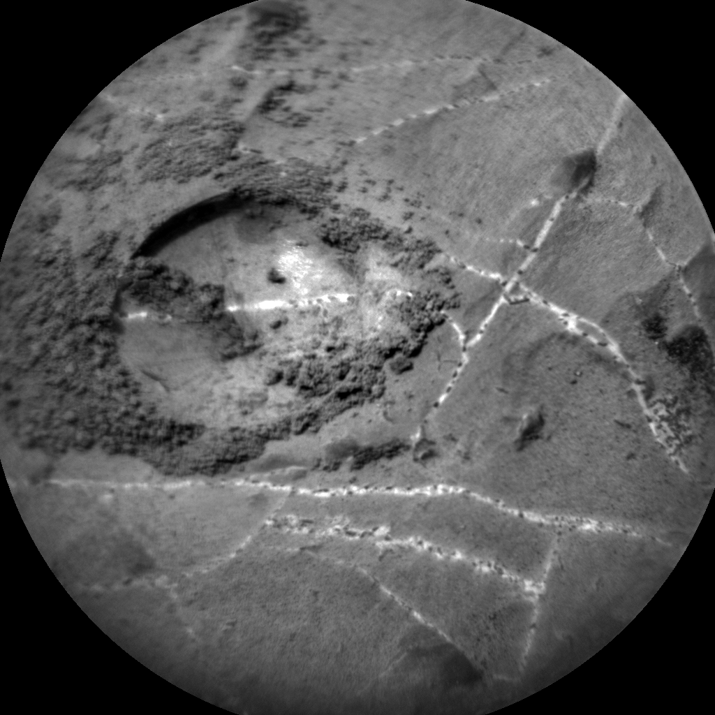
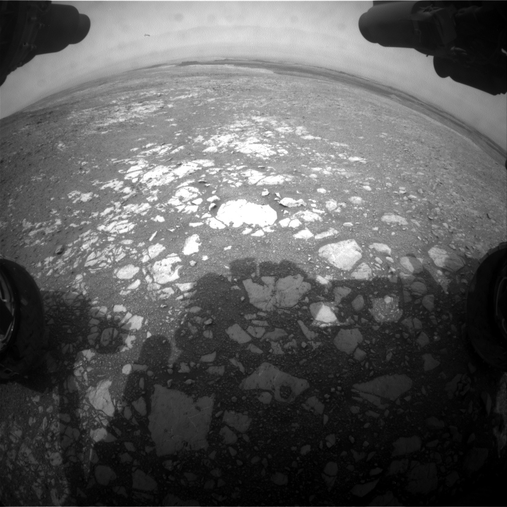
While the engineers work to understand the problem, Curiosity's science team is using the time to pore over data gathered on Vera Rubin Ridge and come up with the best location for another drilling attempt. We're looking at any clues that tell us the rocks are weaker and better for drilling. As the JPL-based project scientist, I really enjoy watching our scientists from all over the world take on these challenges. And, I also get to witness the brainpower that JPL brings to bear when the rover has a technical issue. We're rooting for the engineering team 100%!

This blog may be less frequent until science operations resume.

September 17, 2018

Sols 2172-2174: Who'd Have Thought That Ridge Rocks Could Be So Hard

Written by Vivian Sun, Planetary Geologist at NASA's Jet Propulsion Laboratory
Sols 2172-2174: Who'd Have Thought That Ridge Rocks Could Be So Hard

Last night we learned that our drill attempt on "Inverness" was not successful, reaching only 4 mm into the rock. Today's tactical team bounced back from this news and quickly assembled a plan to move on. This proved to be a busy day for the whole team, including me as the Geology Keeper of the Plan!

Our first order of business was discussing where to drive next. The grey Jura member is a top priority for sampling and understanding the geologic history of the Vera Rubin Ridge, so we felt it was imperative to try again. We ultimately decided to return to the "Lake Orcadie" region, where we previously attempted to drill on Sol 1977. In the past attempt, we were able to reach 10 mm depth using rotary only, so we are hopeful that this next attempt will reach sampling depths with the new percussion-enhanced drill capabilities.

Before driving off, we wrapped up at the Inverness site with APXS and ChemCam spectral measurements to characterize the composition of the drill tailings and the mini drill hole. We additionally targeted "Clune," a grey Jura bedrock, with ChemCam to continue our documentation of compositional heterogeneities in bedrock. Some science team members also identified two possible meteorite targets, so we obtained a ChemCam measurement of "Stoneyburn" and a Mastcam multispectral observation of "Rockend" to see if they have meteorite compositions. On Sol 2173, we planned a long 65 m drive to get Curiosity close to our next drill site in the Lake Orcadie region. We ended the plan on Sol 2174 with ChemCam calibration and sky observations, as well as our usual post-drive MARDI twilight image to document the terrain beneath the rover. If all goes well, we should be at our next drill site in no time!

September 13, 2018

Sols 2170-2171: Go for Drill at Inverness!

Written by Catherine O'Connell
Sols 2170-2171: Go for Drill at Inverness!

In our previous plan, we assessed the suitability of the Inverness target for drilling. We used APXS to determine if it fell within the required geochemical parameters, first brushing to remove excess dust and then using curium to irradiate the target and acquire whole-rock geochemical data. Curiosity also did a series of "stress tests" to test the integrity of the target, and check whether it would be strong enough to withstand our percussive drill technique without shattering. At the beginning of today's planning, we received data which confirmed that Inverness had passed our tests. Drilling begins tomorrow (sol 2170) on what will hopefully be our 18thsuccessful drill hole in Gale crater!

If successful, the resulting sample will be processed internally by CheMin (to assess mineralogical composition) and possibly SAM (to look for chemical signatures). The remaining collected drill sample will be dumped at a later date, so MAHLI will take imagery of potential dump locations on sol 2170 to help with later analysis. A pile of "tailings" will also be generated around the drill hole by the drilling activity. These tailings will be analyzed by ChemCam, APXS and MAHLI in the coming weeks - Mastcam will acquire images of the drill-hole and multispectral images on the tailings on sol 2171.

Today's 2-sol plan included three ChemCam LIBS targets on sol 2171 on an interesting network of veins and diagenetic features, revealed in the MAHLI image of the brushed Inverness target (shown above). "Pentland" (to the left of the image) consists of large veins. "Black Isle" is a grey, raised, nodular feature, in the right of the image, whilst "Grange" is a white patch, just below the brushed area. These targets will also help us look for variations across the Inverness block. All three targets will be imaged using Mastcam.

Although the plan is packed with drill related activities, we still fit in environmental monitoring activities, such as the Mastcam tau (to determine the amount of dust in the atmospheric column), standard DAN and REMS activities, and continuing Mastcam change detection of the targets Sandend and Skene (looking for evidence of grain movement, wind directions and strength).

Although drill campaigns can take up to two weeks to complete, we are starting to look ahead, thinking of our next potential drill site. Mastcam multispectral images taken on sol 2171 will be used to help us decide which direction to head in next!

September 11, 2018

Sols 2168-2169: Starting the drill campaign at "Inverness"

Written by Kristen Bennett, Planetary Geologist at USGS Astrogeology Science Center
Sols 2168-2169: Starting the drill campaign at "Inverness"

In the weekend plan Curiosity drove to an area that the team thought would be a good location for the next drill site on Vera Rubin Ridge. The drive was a success, and there is a block named "Inverness" in the center of the workspace that was selected to be the next drill target.

The 2-sol plan focuses on characterizing Inverness in preparation for the drill campaign. This includes removing dust from the surface of the rock with the DRT, as well as taking MAHLI images, APXS measurements, a ChemCam LIBS observation, and a Mastcam multispectral observation of Inverness.

In addition to all of the measurements of Inverness, Curiosity will begin taking change detection images. The rover will be sitting in one spot for some time during the drill campaign, so this is a good opportunity to see if any of the sand around Curiosity is being moved around by the wind. In the current plan this includes a MARDI twilight image and Mastcam images of "Sandend" and "Skene."

But wait! There's more! This plan also includes a Mastcam image of the target "Stoneyburn," a Navcam dust devil survey, and MAHLI night time images of the CheMin inlet.

This full 2-sol plan will set Curiosity up to start drilling into the next target on Vera Rubin Ridge later this week. Just another day planning to put holes in rocks on Mars!

September 10, 2018

Sol 2165 - 2167: It always looks grayer on the other side!

Written by Sean Czarnecki, Planetary Geologist at Arizona State University
Sol 2165 - 2167: It always looks grayer on the other side!

Curiosity's last plan didn't quite get our intrepid rover close enough to our next potential drill location in the gray bedrock that is visually distinct on this part of Vera Rubin Ridge. This weekend's plan was intended to be "Drill Sol 1," but since it would require at least another short drive to drill, the team decided to choose another target a little further away that will provide a better science return. So the weekend plan now includes a short drive to our new drill target.

Before we drive, ChemCam will measure the chemistry of the targets "Great Bernera," "Great Glen," and "Great Todday;" Mastcam will take images of these same targets including a multispectral observation of Great Todday; and APXS will measure the chemistry of targets "Trollochy," "Burn O Vat," and "Portobello." These observations are intended to document the compositional diversity of the gray and red bedrock at this location by documenting the transition from gray to red.

In addition, the DAN instrument will make a total of 60 minutes of active measurements before the drive. DAN active experiments emit neutrons that interact with the subsurface and then measure the time-of-flight and energy of neutrons that return to the rover. These data allow us to interpret compositional layering and abundances of water bound in minerals in the martian subsurface.

Following our drive, ChemCam has two more sets of chemical measurements on AEGIS targets, APXS will measure the argon abundance in the martian atmosphere, and DAN will take another standard active measurement. Also in the plan are standard DAN passive and environmental monitoring activities with the REMS, RAD, Mastcam, and Navcam instruments.

It's a weekend packed full of science to set up our next drill campaign!

September 5, 2018

Sols 2163-2164: Things that go Bump…

Written by Lucy Thompson, Planetary Geologist at University of New Brunswick
Sols 2163-2164: Things that go Bump…

In our case, the Curiosity rover! The main focus of our 2-sol (sol - martian day) plan today is to bump (drive ~15 m) the rover into place for an attempt at drilling an interesting grey coloured patch of bedrock, identified from orbit within the Jura member of the Murray formation on the Vera Rubin Ridge, referred to as "Loch Eriboll." We want to figure out how these patches of bedrock differ from the surrounding tan coloured rocks, more typical of what we see from orbit.

We had the potential to do a "touch and go" in the plan, whereby we would unstow the arm and use the APXS and MAHLI instruments to examine the chemistry and texture of a target close-up, before driving away. However, the workspace consists of a lot of broken up, smaller pieces of rock and we already have a lot of compositional and textural information of similar rocks. The ability to use the arm is instead being utilized to acquire MAHLI close-up imaging of the REMS UV sensor. This is requested periodically to check for dust and the general health of the sensor.

We decided to concentrate our efforts on the bump and some remote science observations using instruments situated on the rover's mast. We selected 4 bedrock targets for investigation with ChemCam ("The Law," "Eathie," "The Minch" and "Windy Hills"), to monitor compositional variation, accompanied by Mastcam documentation of those targets. Mastcam mosaics are being acquired of the "Laithach" area where we observe a potential contact between the grey and tan rocks, and the "Loch Eriboll" area, which will include multiple filters to look at the spectral properties of the different rocks. We then bump to our potential drill location followed by imaging of the new workspace and a 20 minute DAN Active measurement.

Post-drive, there are two untargeted ChemCam AEGIS activities to look at bedrock composition, standard REMS and DAN passive, Navcam imaging to monitor the atmosphere/environment, CheMin vibe and dump sample (after X-ray diffraction on the previously drilled "Stoer" material), MARDI (used to document the ground immediately beneath the rover wheels) and SAM Electrical Baseline Test (to periodically monitor SAM's electrical functions).

A busy 2-sol plan to hopefully set us up to drill in the weekend plan!

September 4, 2018

Sols 2157-2158: I'll Take the Quela To Go, Please!

Written by Brittney Cooper, Atmospheric Scientist at York University
Sols 2157-2158: I'll Take the Quela To Go, Please!

Today in Gale Crater, Curiosity begins with a short (but sweet) science block that utilizes ChemCam, Mastcam, and Navcam to observe the Martian surface and atmosphere. We start off with a ChemCam LIBS raster of the target "Cairntoul," and then Mastcam mosaics of the same target, as well as "Monar Dam."

The block is finished off with a Navcam line of sight (LOS) observation to continue monitoring dust in the crater as the optical depth slowly wanes. The Navcam LOS differs from the other dust-monitoring observation, the Mastcam tau, by looking at the amount of dust in Curiosity's line of sight to the crater rim. The Mastcam tau determines the amount of dust in the entire atmospheric column by looking at the Sun in a controlled and protected way.

The sol continues with a drive to the new workspace where contact science will be planned over the weekend, and ends with an over-night cleaning of the SAM "scrubbers" and "getters" in preparation for the SAM noble gas experiment in the early hours of sol 2159. Sol 2158 is spent sleeping and recharging, with only REMS environmental monitoring taking place.

After charging up the batteries, Curiosity will wake up in the wee hours of 2159 to run the noble gas experiment that will hopefully constrain the geochronology of the "Quela Doggie Bag" sample. Curiosity has actually been carrying these "Quela" leftovers from drilling that took place close to the Murray Buttes for almost two Earth years - appetizing, right? In fact, the sample is in a perfect state to be run through the noble gas experiment, which will help team members understand how recently the outcrop has been exposed from beneath eroding rocks. The Murray Buttes have been retreating due to erosion - but at what rate? Hopefully this experiment can help clue us in.

September 4, 2018

Sols 2159-2162: Lots of Bits!

Written by Dawn Sumner, Planetary Geologist at University of California Davis
Sols 2159-2162: Lots of Bits!

Curiosity's plan for the weekend is extra large - 4 sols and almost 3 gigabits of data! We planned 4 sols due to the Labor Day weekend, and the hefty data volume is courtesy of extra downlink from two special orbiters. Curiosity sends her data back to Earth through various orbiters around Mars. Usually, we use the Mars Reconnaissance Orbiter (MRO) and Mars Odyssey (ODY) to transmit our data, and we get an average of 500 megabits of data per sol. (Note that 8 bits = 1 byte, so our average bandwidth is about 60 megabytes of data per sol. In contrast, DSL bandwidths are ~10 megabytes per second, so we get about 6 seconds worth of internet per sol!)

Recently, we have been getting lots of extra downlink. NASA's InSight mission will land in November, and MRO will be dedicated to relaying InSight data for its prime mission. Curiosity will shift to downlinking data through NASA's Mars Atmosphere and Volatile Evolution (MAVEN) orbiter and the European Space Agency's Trace Gas Orbiter (TGO). In preparation, we have been downlinking extra data using MAVEN and TGO. This has allowed us to downlink a backlog of images. In today's plan, we were able to take some large multispectral mosaics to fill an extra ~2 gigabits of downlink we expect next week. That's an extra 4 sols worth of bits!

Our activities include recharging the batteries on sol 2159. On the next three sols, Mastcam will take multispectral mosaics of "Tayvallich," "Rosie," "Rhinns of Galloway," and "Ben Haint" plus an image of "Ben Vorlich." ChemCam will analyze "Ben Vorlich" with LIBS, and ChemCam, APXS, and MAHLI will analyze "Tayvallich." It's time to check our instrument calibrations, and APXS will integrate overnight on its calibration target to better constrain dust that settled during the recent dust storm. MAHLI will image both the MAHLI and APXS calibration targets on sol 2161. ChemCam then takes its turn for characterizing dust by observing the passive spectrum of the white part of the Mastcam calibration target with a magnet under it, followed by passively observing the sky. After all of this imaging, Curiosity will drive toward our next drill location, and we hope to end within 15 m of our next drill site. Mastcam will take multispectral images of that area to help us choose the exact spot. Sol 2162 focuses on collecting environmental data, including a sky survey and an image of the crater rim to compare dust levels in Gale Crater with those in the atmosphere as a whole.

It's an extra large plan! And we will enjoy the long weekend - planning doesn't resume again until Wednesday.

August 30, 2018

Sol 2156: The Story of Stoer

Written by Abigail Fraeman, Planetary Geologist at NASA's Jet Propulsion Laboratory
Sol 2156: The Story of Stoer

After an extremely productive couple of weeks, we are finishing up our work at Stoer! We'll take some quick ChemCam and Mastcam observations of the tailings dump pile tosols before packing up and starting our drive up the ridge towards our next drill location. As we leave Stoer, I'd like to take some time to share the story of how and why we came to drill this particular location.

We first attempted to drill Vera Rubin Ridge back on sol 2112 at the "Voyageurs" target. However, the drill made only a few millimeters of progress into that target before stopping because the rate of downward progress was so slow. The drill itself performed exactly as it was designed but the Voyageurs rock was simply too hard! It was pretty interesting from a science perspective to see this result, but it also meant we had to work quickly to figure out a plan B.

The science team agreed it was scientifically important enough to get a drill sample from the lower part of Vera Rubin Ridge that we should try again. But how could we improve our chances of finding a rock that would be softer and easier to drill than Voyageurs? It was time to think like geologists.

In the absence of direct data on rock mechanical properties, we came up with three criteria that we could use to try to find a softer rock. (1) Did the bristles of the DRT brush leave scratches on the rocks' surfaces? While not necessarily a direct indicator of what the rock strength would be when we drilled into it, we could at least say rocks that got scratched with the DRT had a softer surface than those that didn't. (2) How well exposed are the white calcium sulfate veins? On some rock targets, like Stoer, we clearly see veins. On other targets, like Voyageurs, the veins are recessed into the rock. Recessed veins erode much faster than the surrounding bedrock because the surrounding bedrock is harder. Non-recessed veins tells us the bedrock may be similar in strength to the veins, or, if the veins stick out, the bedrock may be lower in strength. (3) What does the large-scale topography tell us? Broadly, Vera Rubin Ridge is a ridge because it is composed of hard rocks that are more resistant to erosion than their surroundings. We realized we might use this same logic to find softer rocks within the ridge by trying to drill in local topographic lows or at bases of scarps where the bottom of the scarp is eroding more quickly than the hard rocks on top.

Fortunately, because we had already explored a lot of Vera Rubin Ridge, we already had lots of data in hand to search for our next drill targets. Several members of the science team put in impressive efforts to quickly go through all of the images we'd taken in the last 200 sols, and we found just a handful of candidates than fit our criteria. The area near "Ailsa Craig" was close to Voyageurs and looked different enough that we thought it was worth a go. We made more progress drilling into this target than Voyageurs, but still not enough.

"Stoer" was our final choice, and it was initially chosen because it was near the base of a scarp and had more prominently expressed veins. We all had a really good feeling about this target when we saw the DRT had scratched it, and were thrilled when we saw a successful drill hole. Apparently third time really was the charm for us!

Looking back on all the drills over the course of the mission, I think Stoer has got to be one of my favorites. Not only have I been personally wondering about the rocks on Vera Rubin Ridge for six years, but the fact that the science team worked so hard to find this not-so-hard rock makes this particular drill extra sweet.

August 29, 2018

Sol 2155: What a Dump

Written by Ryan Anderson, Planetary Geologist at USGS Astrogeology Science Center
Sol 2155: What a Dump

Our second attempt at a dump was successful! The plan for Sol 2155 starts with a whole slew of Mastcam images to check out various components of the arm turret, plus a MAHLI observation of the dump pile. After that, Navcam will look toward the crater rim to measure the amount of dust in the air, and ChemCam will analyze the targets "Ben Macdui" and "Tarskavaig," both of which appear to be interesting features where the bedrock chemistry and mineralogy may have been altered. Mastcam will take pictures of these two targets once ChemCam is done with them, and will also document the previous ChemCam targets "Laig Bay" and "Bealach na Ba." Mastcam will also take a high-resolution mosaic around the Stoer drill hole. In the late evening, MAHLI will take some pictures of the CheMin inlet funnel, and then we will place APXS over the tailings pile for an overnight analysis.

If all goes well, this will be the last full day at the Stoer location, and tomorrow Curiosity will start driving toward the south!