November 1, 2018

Sol 2218: No Candy, Just Science for Curiosity

Written by Sarah Lamm, Planetary Geologist at Los Alamos National Laboratory
Sol 2218: No Candy, Just Science for Curiosity

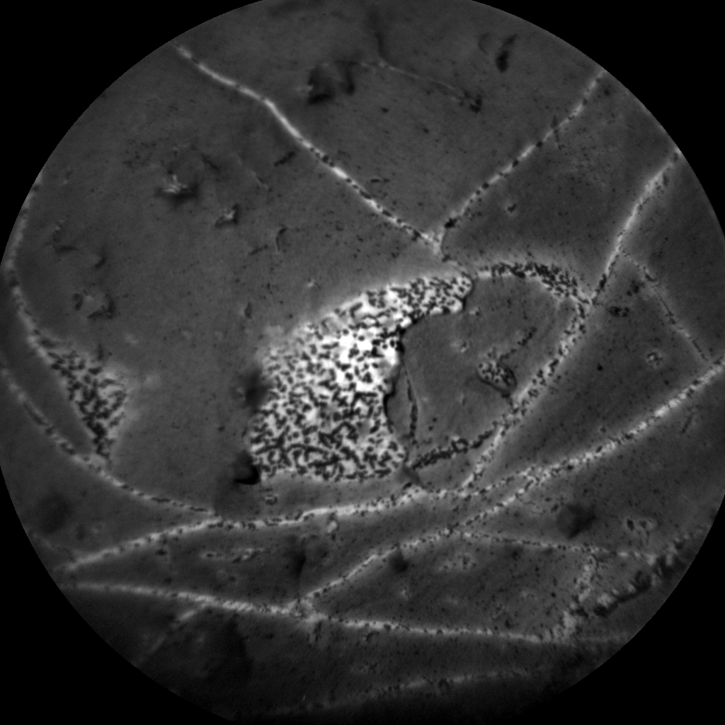
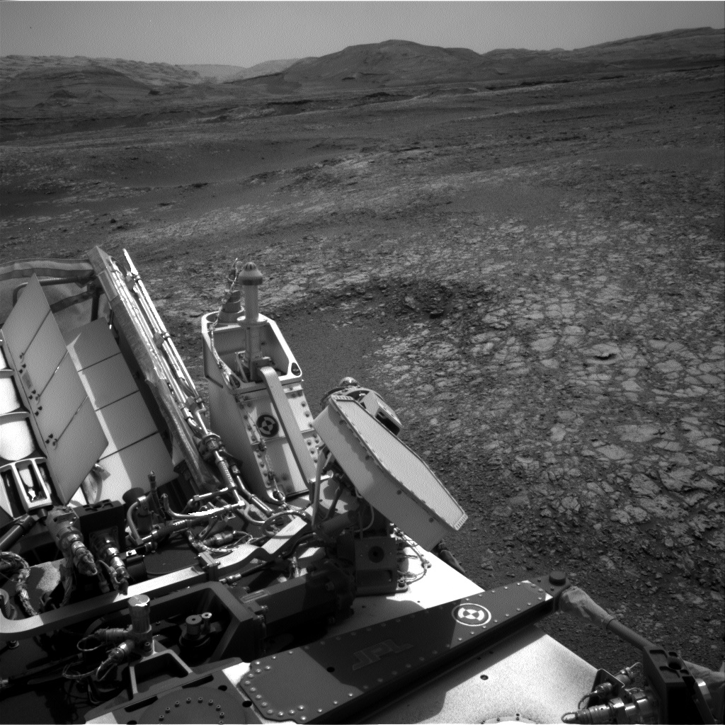
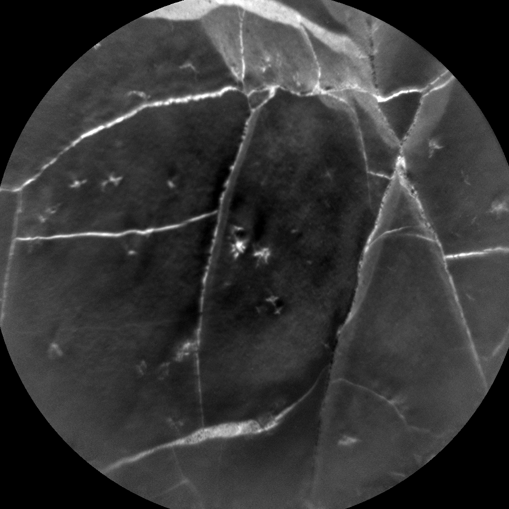
Curiosity had a good Halloween because it had resumed contact science. Today, Curiosity will have a targeted science block, drive, and then have an untargeted science block. MAHLI will take images of the "Lossiemouth" target before the drive. ChemCam has two planned targets before the drive: "Milton Ness" and "Grange 2218." Milton Ness is a target to capture more of the vein material and some bedrock, too. We are taking more measurements of Grange so we have more information on the dark inclusions. There is also scheduled Mastcam imagery for each ChemCam target.

After these science activities, we will be headed toward an area in the grey Jura member called "Lake Orcadie." This would be the first time that Curiosity has driven in six weeks. This will only be a test drive to ensure the software and mechanics are working properly. Curiosity was at Lake Orcadie before, back on sol 1977. We had tried to drill at Lake Orcadie before, using our new drilling method, but it was not successful. Then we planned to drive back to Lake Orcadie on sol 2173, but there was an anomaly on sol 2172.

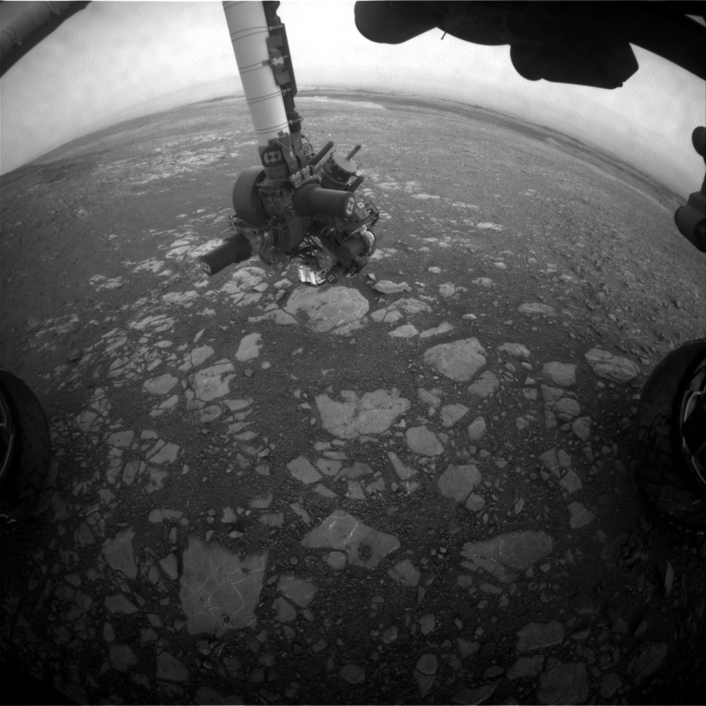
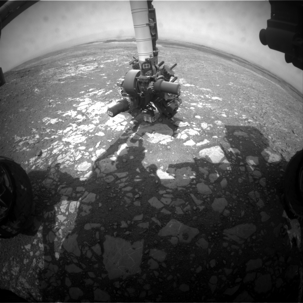
After the drive we have DAN (active), Mastcam imagery of the new location, and one more ChemCam target called "Aegis Post 2218." AEGIS is artificial intelligence software that we use after a drive. It can use Curiosity’s cameras to identify rocks, and then AEGIS uses ChemCam’s laser to shoot the rocks. This has increased the amount of data we can get from Gale Crater.

My operations role today was ChemCam science downlink lead. I got to process the most recent ChemCam data that had not been analyzed yet. I collect images, locations, and chemistry data and compile the data into preliminary reports. This role helps the uplink team decide if they want to retarget any rock or choose new targets.

October 29, 2018

Sol 2216: A Windswept Workspace

Written by Melissa Rice, Planetary Geologist at Western Washington University
Sol 2216: A Windswept Workspace

Today was the first day of planning with the full science team since Curiosity had an anomaly on sol 2172. It has been a over a month since we last looked at the "workspace," the region in front of the rover that the arm can reach, and there were some surprises in store for us! Before the anomaly, the rock was covered with gray-colored tailings from our failed attempt to drill the "Inverness" target, as seen in the Mastcam image from sol 2170. In the new image above, however, those tailings are now gone - and so is a lot of the dark brown soil and reddish dust. So while Curiosity has been sitting still, the winds have been moving, sweeping the workspace clean.

Later this week we plan to take advantage of this freshly-scrubbed surface by taking close-up MAHLI images of fine details in the rock, including the light-toned veins crisscrossing the outcrop that are peppered with interesting dark inclusions. Today we're easing back into science operations, taking MAHLI images with the cover open and closed to inspect how much dust is on the cover, a MAHLI image of the REMS UV sensor, a ChemCam observation of the vein target "Grange," and some Mastcam images of the nearby ripple field "Sandend" to look for more changes due to the wind.

In my role as a Long-Term Planner, I've got my eye on the road ahead, and I'm excited for Curiosity to drive to a new spot where we can successfully drill into the gray rock. Soon the wind won't be the only thing moving around here!

October 26, 2018

Sols 2213-2215: Eyes on the sky

Written by Lauren Edgar, Planetary Geologist at USGS Astrogeology Science Center
Sols 2213-2215: Eyes on the sky

The focus of today's three-sol plan is environmental monitoring. I'll be on duty as SOWG Chair on Monday, so I dialed in today to get up to speed. The first sol kicks off with Mastcam tau, Navcam line of sight, and Navcam dust devil observations, to monitor the dust content in the atmosphere and search for dust devils. Then CheMin will return the remaining raw data frames from the "Stoer" analysis from early September. In the afternoon, Curiosity will acquire a Mastcam sky survey, Navcam zenith movie, and Navcam suprahorizon movie, which will provide additional atmospheric monitoring data. Similar environmental observations will be acquired early the next morning, with an additional Mastcam crater rim extinction observation. The second sol also includes a redo of the pre-anomaly post-drive imaging, to look for changes and provide a terrain mesh prior to resuming full arm and mobility activities. And the third sol includes a final suite of Mastcam tau, Navcam dust devil and Navcam suprahorizon movies, in addition to the standard REMS and DAN passive observations throughout the plan.

But while the environmental theme group has their eyes on the sky, I've got mine on the ground, including the above Navcam view, looking south over the back of the rover, and the new terrain that we are tantalizingly close to reaching. Looking forward to resuming full science operations soon!

October 24, 2018

Sols 2211-2212: Getting Back into the Science Swing of Things!

Written by Ashley Stroupe, Mission Operations Engineer at NASA's Jet Propulsion Laboratory
Sols 2211-2212: Getting Back into the Science Swing of Things!

While we are working toward understanding and recovering from the anomaly, Curiosity is slowly ramping back up into normal science operations.

Earlier this week, we got our environmental instruments DAN, RAD, and REMS back online and we exercised the arm for the first time since the anomaly, retracting it from the surface and moving it above the deck. Today we are doing some environmental and atmospheric observations with REMS, RAD, and DAN. We're also using our Engineering cameras to do atmospheric science observations and some sky imaging to help in camera calibration. Mastcam is also being used for the first time to take several atmospheric tau measurements, as well as looking out at our workspace and the targets we were investigating. We're specifically doing change detection to see if the drill fines have moved around with the wind and if there is dust moving around on the targets and on the rover deck. We're looking forward to getting the rest of our instruments, the arm, and mobility all back to nominal operations soon.

An important milestone to note - on sol 2211 Curiosity will surpass the lifespan of the Spirit rover (we last heard from her on sol 2210) and become the second-longest lived rover on Mars, second to Opportunity!

October 22, 2018

Recap of the Bagnold Dune Investigation

Written by Catherine O'Connell-Cooper, Planetary Geologist at University of New Brunswick

As Curiosity continues on her journey up Mount Sharp (the mound in the centre of Gale crater), rocks we encounter contain evidence for changing environmental conditions. The fine-grained mudstones of the Murray formation show us that lakes were present in the past, whilst the sandstones of the Stimson formation are evidence for ancient dune fields.

During 2015-2017, we crossed the Bagnold dune field, a 35-km long by 1-2 km wide dune field that wraps around the northwest side of Mount Sharp. This was the first time that scientists have explored an active dune system on another planet. In the Martian fall/winter, we investigated two barchan dunes. Barchan dunes are crescent shaped and are formed by winds blowing in one direction, and when sediment supply is limited. Later on, during the Martian summer, we examined a linear dune. Linear dunes are formed by winds blowing in two directions, with more abundant sediment supply, and can be very long (on Earth, they can reach 160 miles in length e.g., Namib Sand Sea, Namibia).

Curiosity lived up to her official name "Mars Science Laboratory" for both parts of the campaign, utilizing almost every scientific instrument on board, plus the engineering cameras (Navcam and Hazcam) to collect observations and measurements. In a series of papers recently released, we present these results, looking at all aspects of the Bagnold dunes.

As we traversed the dune field and at each stop, we observed the physical properties of the sand dunes, such as grain size, rates of grain motion, and the overall bedform morphologies, using MAHLI, ChemCam, MARDI, Mastcam, Navcam, and REMS. We observed differences in wind activity levels, with lower wind and less movement of sand during the fall/winter than during the summer. Dust content (indicated by sulphur, chlorine and zinc levels, as measured by APXS; higher concentrations mean higher dust content) indicates that observed activity levels were higher in the linear dunes which were investigated during the summer (higher winds, less dust settling) and lower in the barchan dunes, which were investigated during the fall/winter.

We determined chemical composition, mineralogy and volatile content of sands using APXS, ChemCam, CheMin, DAN and SAM. My role as a member of the APXS operations team involved evaluating the composition of samples analyzed, comparing between the barchan and linear dunes, as well as sands previously analyzed by the Opportunity rover (at Meridiani Planum) and Spirit (at Gusev Crater). The basaltic Bagnold sands show subtle variations in mineralogy and chemistry, both between the barchan and linear dunes, but also depending on location within a dune. For example, ripple crests were often more coarse-grained and enriched in magnesium and nickel, whilst off-crest sands within the linear dunes were enriched in chromium. These variations may reflect sorting processes, or minor enrichments from local bedrock sources.

Our journey through the Bagnold Dunes has helped advanced our understanding of how winds shape modern Martian landscapes, and the properties of windblown materials, in the form of both the active Bagnold dunes and in ancient Martian dunes now preserved as rock in units such as the Stimson formation at Gale crater.

AGU Journals:
    - Investigations of the Bagnold Dune Field, Gale crater ›
    - Curiosity at the Bagnold Dunes, Gale Crater: Advances in Martian Eolian Processes ›

October 22, 2018

Recap of the Bagnold Dune Investigation

Written by Catherine O'Connell-Cooper, Planetary Geologist at University of New Brunswick

As Curiosity continues on her journey up Mount Sharp (the mound in the centre of Gale crater), rocks we encounter contain evidence for changing environmental conditions. The fine-grained mudstones of the Murray formation show us that lakes were present in the past, whilst the sandstones of the Stimson formation are evidence for ancient dune fields.

During 2015-2017, we crossed the Bagnold dune field, a 35-km long by 1-2 km wide dune field that wraps around the northwest side of Mount Sharp. This was the first time that scientists have explored an active dune system on another planet. In the Martian fall/winter, we investigated two barchan dunes. Barchan dunes are crescent shaped and are formed by winds blowing in one direction, and when sediment supply is limited. Later on, during the Martian summer, we examined a linear dune. Linear dunes are formed by winds blowing in two directions, with more abundant sediment supply, and can be very long (on Earth, they can reach 160 miles in length e.g., Namib Sand Sea, Namibia).

Curiosity lived up to her official name "Mars Science Laboratory" for both parts of the campaign, utilizing almost every scientific instrument on board, plus the engineering cameras (Navcam and Hazcam) to collect observations and measurements. In a series of papers recently released, we present these results, looking at all aspects of the Bagnold dunes.

As we traversed the dune field and at each stop, we observed the physical properties of the sand dunes, such as grain size, rates of grain motion, and the overall bedform morphologies, using MAHLI, ChemCam, MARDI, Mastcam, Navcam, and REMS. We observed differences in wind activity levels, with lower wind and less movement of sand during the fall/winter than during the summer. Dust content (indicated by sulphur, chlorine and zinc levels, as measured by APXS; higher concentrations mean higher dust content) indicates that observed activity levels were higher in the linear dunes which were investigated during the summer (higher winds, less dust settling) and lower in the barchan dunes, which were investigated during the fall/winter.

We determined chemical composition, mineralogy and volatile content of sands using APXS, ChemCam, CheMin, DAN and SAM. My role as a member of the APXS operations team involved evaluating the composition of samples analyzed, comparing between the barchan and linear dunes, as well as sands previously analyzed by the Opportunity rover (at Meridiani Planum) and Spirit (at Gusev Crater). The basaltic Bagnold sands show subtle variations in mineralogy and chemistry, both between the barchan and linear dunes, but also depending on location within a dune. For example, ripple crests were often more coarse-grained and enriched in magnesium and nickel, whilst off-crest sands within the linear dunes were enriched in chromium. These variations may reflect sorting processes, or minor enrichments from local bedrock sources.

Our journey through the Bagnold Dunes has helped advanced our understanding of how winds shape modern Martian landscapes, and the properties of windblown materials, in the form of both the active Bagnold dunes and in ancient Martian dunes now preserved as rock in units such as the Stimson formation at Gale crater.

AGU Journals:

    - Investigations of the Bagnold Dune Field, Gale crater ›

    - Curiosity at the Bagnold Dunes, Gale Crater: Advances in Martian Eolian Processes ›

October 19, 2018

Sol 2204: Curiosity science is baaaack!

Written by Sarah Lamm, Planetary Geologist at Los Alamos National Laboratory
Sol 2204: Curiosity science is baaaack!

Contrary to the "frightening" title, the Curiosity team is excited that science operations are starting to resume! The real fright was when Curiosity had an anomaly on Sol 2172 which affected its memory. Since then, the engineering team has continued to diagnose the anomaly and plan the recovery, including taking the first images with the A-side engineering cameras that haven't been used since 2013! Thanks to our hard-working engineers, Curiosity is ready for limited science operations while the anomaly work continues.

Curiosity has been at the (sadly) unsuccessful "Inverness" drill site since the anomaly. Curiosity is still exploring the gray Jura member on Vera Rubin Ridge. The uplink plan for Sol 2204 includes the use of RAD, REMS, and DAN (active and passive).

RAD detects high-energy radiation on the Martian surface. RAD's data will help shape future human mission to Mars by letting us know how much shielding from radiation future Mars astronauts will need to protect them. REMS (Rover Environmental Monitoring Station) is Curiosity's weather station. REMS can measure pressure, humidity, ultraviolet radiation, and temperature. DAN (Dynamic Albedo of Neutrons) detects neutrons that be used to measure the amount of hydrogen and other elements in the subsurface.

October 8, 2018

Crystal Balls May Show the Future, but Gypsum Crystals Tell Us About the Past

Written by Abigail Fraeman, Planetary Geologist at NASA's Jet Propulsion Laboratory
Crystal Balls May Show the Future, but Gypsum Crystals Tell Us About the Past

As Curiosity continues to mend, I've been looking forward to our next drill sample of gray rock. Some interesting features we've seen on Vera Rubin Ridge are small "swallowtail crystals" often associated with the boundary between gray and red rocks on the ridge top. In thinking about these features, I wanted to take the opportunity to reflect on past results from when Curiosity was just beginning to explore Mt. Sharp at the Pahrump Hills region. Readers of this blog may remember that back on sol 809, after we brushed away the dust on target "Mojave," the team was surprised and excited to discover hundreds of millimeter-sized, rice-shaped crystals on its face. These crystals are geologic clues to what happened in the past. What were these unique features made of? How and when did they form?

This image was taken by ChemCam: Remote Micro-Imager (CHEMCAM_RMI) onboard NASA's Mars rover Curiosity on Sol 2163 (2018-09-06 12:10:38 UTC). Image
Credits: NASA/JPL-Caltech/LANL
Curiosity scientist Linda Kah and colleagues address these questions in a new paper available in the journal Terra Nova titled "Syndepositional precipitation of calcium sulfate in Gale Crater, Mars." For this study, Kah and colleagues carefully studied the sizes, shapes, and orientations of the unusual crystals at Mojave and several nearby targets. They integrated these findings with the geologic setting, chemistry, and mineralogy of the Pahrump Hills area to infer the presence of shallow, salty, and sometimes ephemeral waters during this period in Gale's history.

Kah and co-authors explain that the crystal shapes are distinctive of gypsum salts that precipitate in lake, playa, and near-shore ocean environments. Interestingly, Curiosity did not detect any large differences in the composition of rocks containing crystals versus nearby, non-crystal-containing rocks. This result suggests the calcium sulfate that originally formed the crystals had either been dissolved at a later time and/or that the crystals had incorporated a lot of the original rocks around within them when they formed.

The shapes, sizes, and orientation of crystals give clues to how they grow. Kah and authors showed the crystals at Pahrump were randomly oriented and occurred between and within cemented layers. Combined with the crystals' elongated shapes, this suggests that they grew at the interface between loose, water-logged sediment and either shallow water or air. Interestingly, small amounts of organic (carbon-bearing) material can cause crystals to have shapes similar to those observed at Mojave, which is consistent with Curiosity findings of organic material in the Mojave drill sample.

The swallowtail crystals on Vera Rubin Ridge are also known shapes of gypsum crystals. Why are these crystals so different in form from what we saw back at Mojave? What does this all tell us about ancient environments at Gale Crater?

Related Mojave news story: Crystal-Rich Rock 'Mojave' is Next Mars Drill Target ››
Article: Syndepositional precipitation of calcium sulfate in Gale Crater, Mars ››

October 5, 2018

Geology - It's like Investigating a Crime Scene

Written by Susanne Schwenzer, Planetary Geologist at The Open University

Sometimes planetary geology is like forensics. We are presented with a crime scene: Something broke down the original igneous rock, and made all those clays, veins and hematite nodules. We know this something was a fluid, but in order to find out exactly what has happened, we need to examine all the evidence we have. That often starts with investigating the images, and in great detail. That's when we look at Mastcam images for the geologic context, then RMI and/or MAHLI for the close-up details. But what about the chemistry?

We are a small team here in the UK, specializing in what is called "thermochemical modelling." Thermochemical modelling uses mathematical equations that are based on known reactions of minerals with water. The models combine many thousands of such reactions into equations, which can be solved iteratively to arrive at a reaction path for a known rock composition. And once we determine what reacted and how, we can also infer which chemical elements remained in the water because they were not included in the reaction products. In other words, we can find out how the chemical elements are distributed between the fluid and the newly forming minerals. Some of our French and American colleagues use this method too, and we always have great discussions to advance our work. We take all the data that we have, images and chemistry from ChemCam and APXS, and where available also mineralogy from CheMin. That's the evidence at our crime scene. But who broke the rock and left all those clays and white veins?

We know it is "the fluid," and the modelling allows us to find out what temperature and composition this fluid might have had. For example, we have looked at the veins Curiosity found very early in the mission - at Yellowknife Bay. They were very pure calcium-sulfate, especially compared to what Curiosity measured later at Garden City and now at Vera Rubin Ridge. The purity of the calcium-sulfate at Yellowknife Bay gave us a clue: If we model a typical Yellowknife Bay rock with all chemical elements in the proportions available in this rock to react with water, then we will get veins that have more than just calcium-sulfate. We would therefore expect veins that have other minerals such as iron oxides and quartz. But the veins at Yellowknife Bay did not have any of those additional minerals. Therefore, we concluded that they must have come from water selectively dissolving a pre-existing mixed-mineralogy layer. The dissolution of this pre-existing layer would have left the less soluble minerals - quartz, iron oxides - behind while transporting the calcium and sulfate. This would have allowed the formation of a very pure calcium-sulfate, which is what was observed! But how does that help us at Vera Rubin Ridge?

The rover is currently exploring a very complex area, which has clearly seen the interaction of rocks with fluids. There are veins much more complex than the ones at Yellowknife Bay, and in addition there are iron nodules, crystal moulds and colour changes. We, the modellers, are working hard to understand how the fluid changed to produce all this new evidence… more later, as investigators rarely talk about ongoing investigations, right?

October 5, 2018

Geology - It's like Investigating a Crime Scene

Written by Susanne Schwenzer, Planetary Geologist at The Open University

Sometimes planetary geology is like forensics. We are presented with a crime scene: Something broke down the original igneous rock, and made all those clays, veins and hematite nodules. We know this something was a fluid, but in order to find out exactly what has happened, we need to examine all the evidence we have. That often starts with investigating the images, and in great detail. That's when we look at Mastcam images for the geologic context, then RMI and/or MAHLI for the close-up details. But what about the chemistry?


We are a small team here in the UK, specializing in what is called "thermochemical modelling." Thermochemical modelling uses mathematical equations that are based on known reactions of minerals with water. The models combine many thousands of such reactions into equations, which can be solved iteratively to arrive at a reaction path for a known rock composition. And once we determine what reacted and how, we can also infer which chemical elements remained in the water because they were not included in the reaction products. In other words, we can find out how the chemical elements are distributed between the fluid and the newly forming minerals. Some of our French and American colleagues use this method too, and we always have great discussions to advance our work. We take all the data that we have, images and chemistry from ChemCam and APXS, and where available also mineralogy from CheMin. That's the evidence at our crime scene. But who broke the rock and left all those clays and white veins?


We know it is "the fluid," and the modelling allows us to find out what temperature and composition this fluid might have had. For example, we have looked at the veins Curiosity found very early in the mission - at Yellowknife Bay. They were very pure calcium-sulfate, especially compared to what Curiosity measured later at Garden City and now at Vera Rubin Ridge. The purity of the calcium-sulfate at Yellowknife Bay gave us a clue: If we model a typical Yellowknife Bay rock with all chemical elements in the proportions available in this rock to react with water, then we will get veins that have more than just calcium-sulfate. We would therefore expect veins that have other minerals such as iron oxides and quartz. But the veins at Yellowknife Bay did not have any of those additional minerals. Therefore, we concluded that they must have come from water selectively dissolving a pre-existing mixed-mineralogy layer. The dissolution of this pre-existing layer would have left the less soluble minerals - quartz, iron oxides - behind while transporting the calcium and sulfate. This would have allowed the formation of a very pure calcium-sulfate, which is what was observed! But how does that help us at Vera Rubin Ridge?


The rover is currently exploring a very complex area, which has clearly seen the interaction of rocks with fluids. There are veins much more complex than the ones at Yellowknife Bay, and in addition there are iron nodules, crystal moulds and colour changes. We, the modellers, are working hard to understand how the fluid changed to produce all this new evidence… more later, as investigators rarely talk about ongoing investigations, right?