June 18, 2021

Sol 3153-3155: Not Driving off Into the Sunset

Written by Ashley Stroupe, Mission Operations Engineer at NASA's Jet Propulsion Laboratory
This black and white image of the mountain slope was taken by Right Navigation Camera onboard NASA's Mars rover Curiosity on Sol 3151.

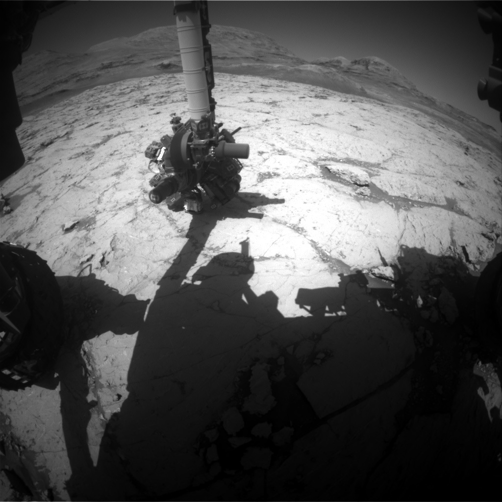
This image was taken by Right Navigation Camera onboard NASA's Mars rover Curiosity on Sol 3151. Credits: NASA/JPL-Caltech. Download image ›

In today’s 3-sol plan, we are doing a lot of pre-drive targeted science and a long drive. Today, I am a Rover Planner and helped to plan this long drive, which was an interesting challenge.

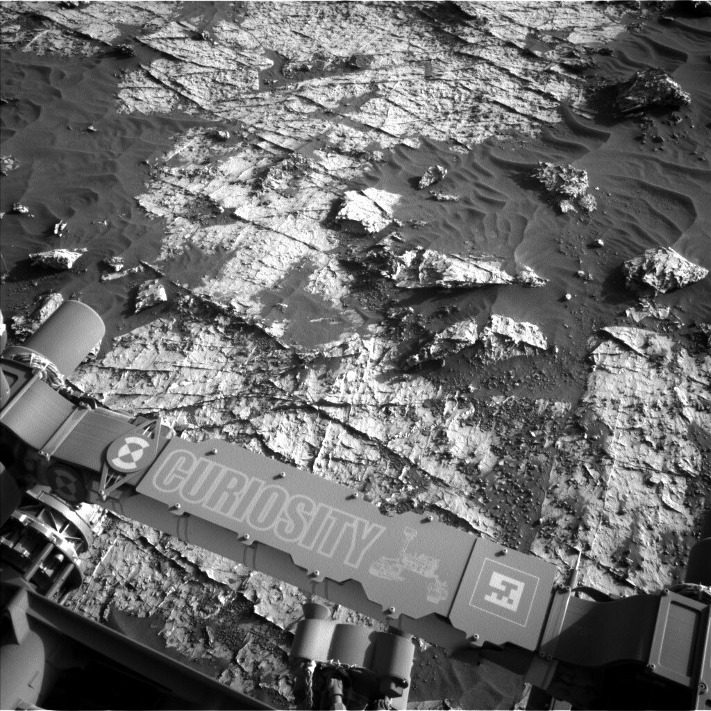
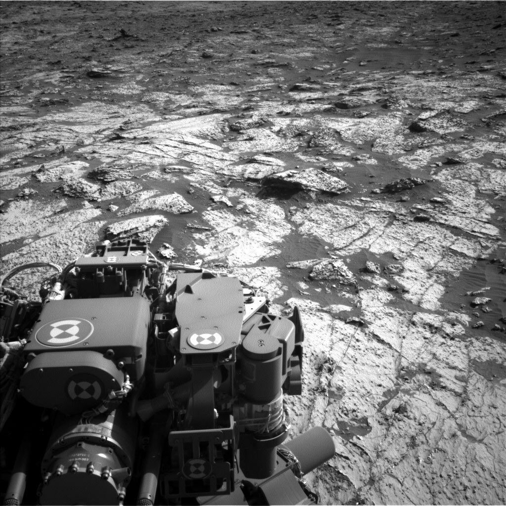
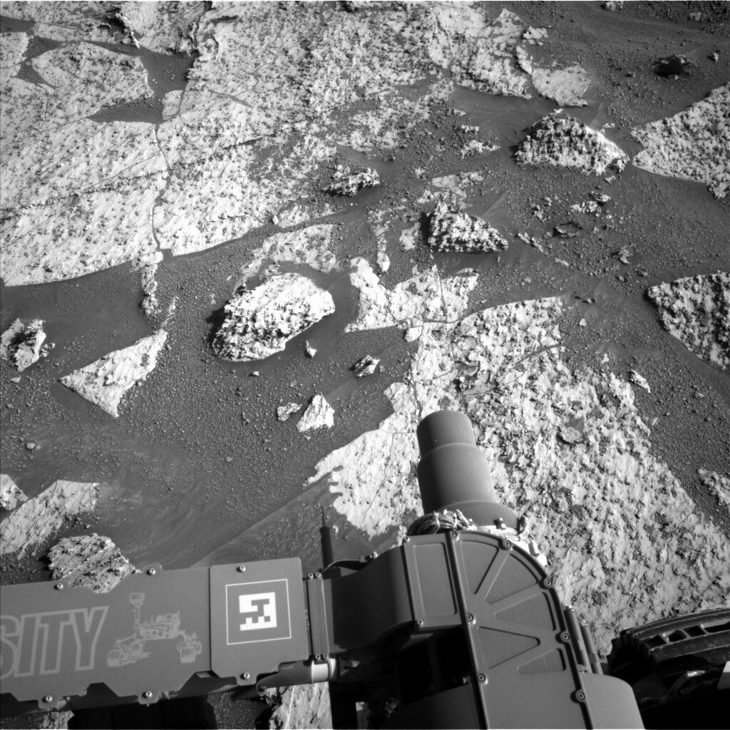
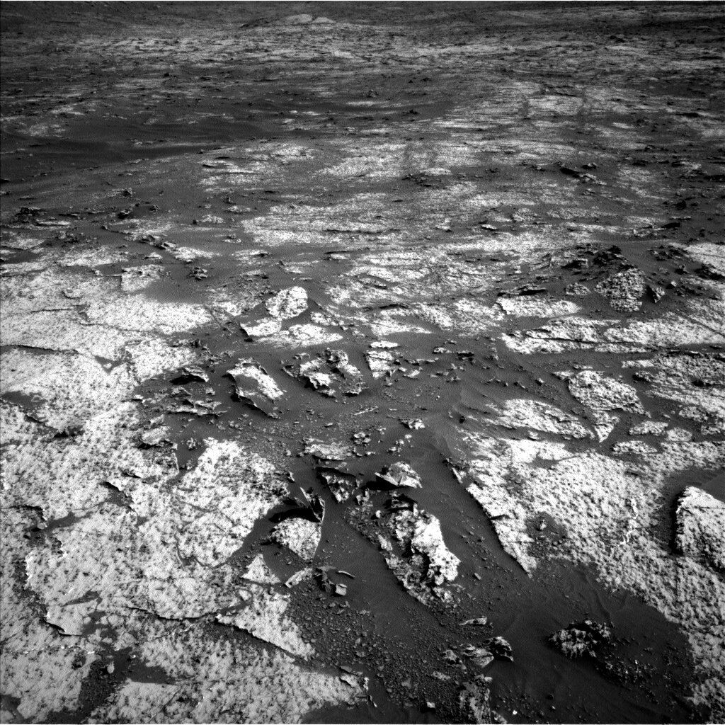
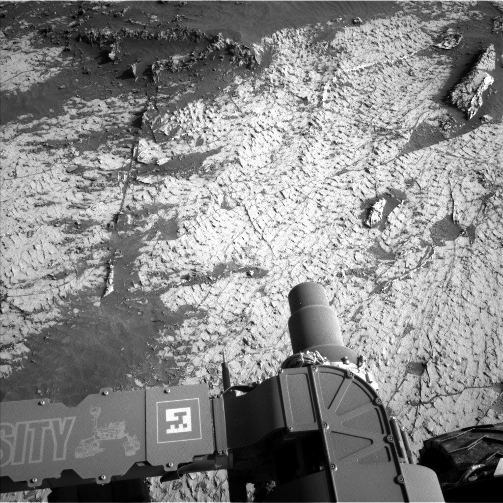
At the start of today’s planning, we came in to discover that our previous drive had stopped short due to higher tilts than expected. As a result, we did not have good imaging underneath the rover, and could not deploy the arm for contact science. This allowed us to significantly expand our first-sol targeted science block to a hefty three hours. In that block we are doing a lot of ChemCam and Mastcam observations. With ChemCam, we are looking at two bedrock targets, named “Beaussac” and “Biennac,” along with a lot of long distance RMIs looking south toward the sulfate unit. Mastcam, in addition to documenting the ChemCam targets, is also taking a multi-spectral set of images of target “Bernifal,” a bluish rock, to help understand its locally distinctive color. Mastcam is also taking a full 360-degree view of the rover’s location to help document our traverse. Along with all the science on this first sol of the plan, we are doing one of our periodic engineering activities to collect thermal data, which helps us keep our models up-to-date.

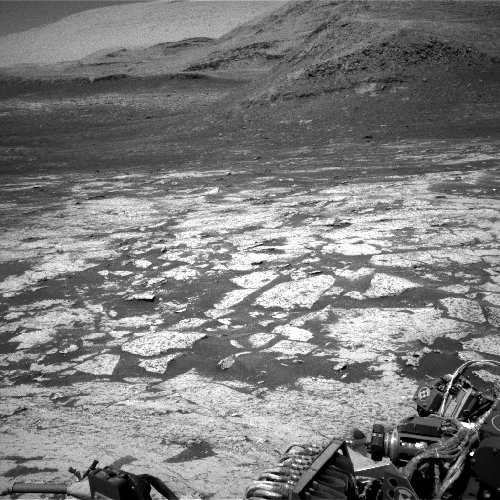
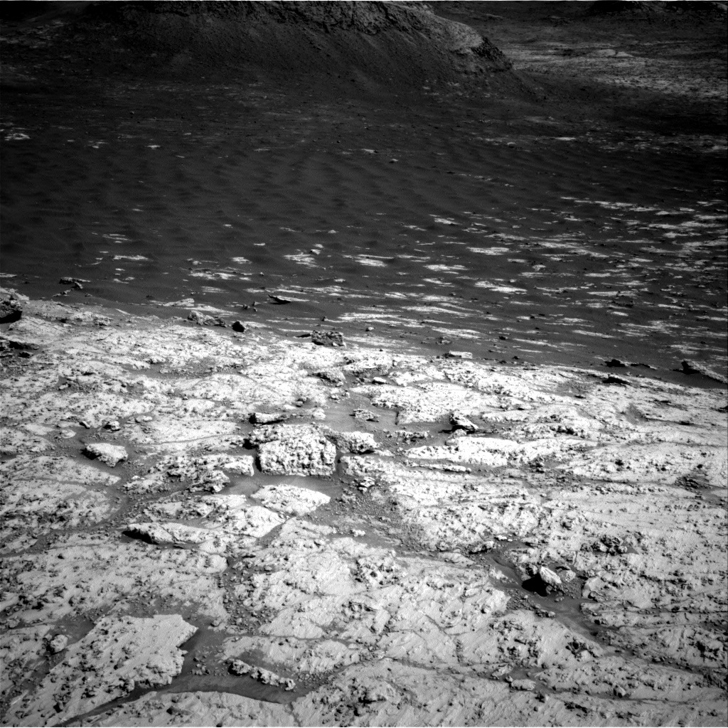
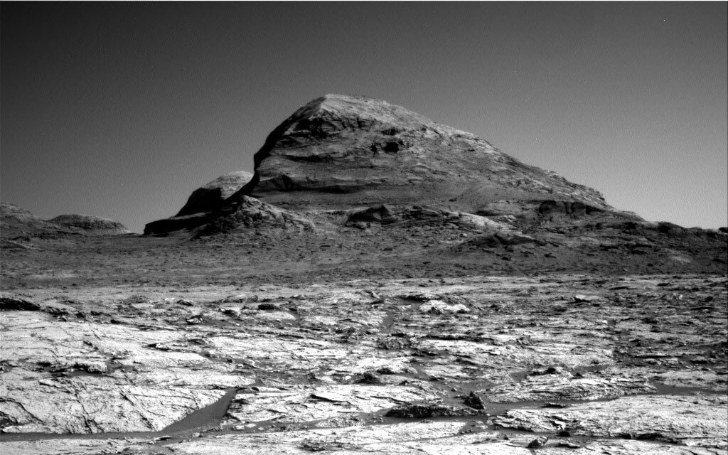
On the second sol of the plan, we are driving about 54m paralleling our strategic route. We are stopping at that point, even though we have more time, to make sure we can do our systematic contact science observations (especially since we couldn’t do them today). We are on challenging terrain – it is climbing upward, which limits how far we can see into the distance. You can see the upward slopes ahead in the attached image of our drive direction, toward Rafael Navarro Mountain (named for a former member of MSL’s SAM team - see our press release. Today we can only see about 25m, so we are using guarded driving, which uses the rover’s onboard hazard detection, so that we can drive further. Guarded driving faces challenges on steep slopes because it has a harder time estimating how big hazards are and predicting where it will drive due to higher expected slip. In order to prevent early termination of the drive precluding contact science on Monday (as it did today), we are taking some extra images along the path to try to ensure we have images under us to support our safety assessments. Another challenge we face with guarded driving is that we are driving west. We have to be careful how late in the day we try to take our map images – if the sun is in the field of view of the Front Hazcams, the stereo processing can be confused and hide hazards from the rover. This means we need to drive earlier in the day when we are facing west – and definitely NOT drive off into the sunset.

On the last sol of the plan, we are doing some untargeted science, which consists of atmospheric/environmental observations. We have Navcam imaging to look for clouds, to look through the atmosphere (zenith and suprahorizon movies) and Mastcam solar tau and crater rim extinction images.

June 16, 2021

Sol 3151-3152: Making Great Progress

Written by Abigail Fraeman, Planetary Geologist at NASA's Jet Propulsion Laboratory
This black and white image was taken by Left Navigation Camera onboard NASA's Mars rover Curiosity on Sol 3149.

This image was taken by Left Navigation Camera onboard NASA's Mars rover Curiosity on Sol 3149. Credits: NASA/JPL-Caltech. Download image ›

Curiosity drove another ~60 m in our last plan, so we were once again greeted with images from a brand-new location on Mars this morning. The workspace in front of Curiosity is crisscrossed by straight, high standing veins that are more resistant to erosion than the softer underlying bedrock. The veins and nodules in this region, both of which formed when groundwater moved through sediment as it became rock, continue to impress!

Today we planned two sols for Curiosity, the 3,151st and 3,152nd of the mission. On the first sol, we’ll start with a short APXS observation of a bedrock target named “Varennes.” Then we will collect a ChemCam LIBS observation of a nodular target named “Salignac Eyvigues” as well as some telescopic RMI mosaics of the terrain ahead. We’ll also snap Mastcam images of Salignan Eyvigues and additional mosaics of some of the impressive veins surrounding the rover. We then plan to drive further along our strategic route that climbs Mt. Sharp, followed by an evening APXS observation to measure argon in the atmosphere. The second sol of the plan is all about monitoring the environment at Gale crater. We’ll collect some ChemCam passive spectra of the sky above for atmospheric composition, as well as Mastcam and Navcam images to monitor the dust in atmosphere. The day rounds out with an early evening attempt to look for clouds, and we also have the usual cadence of RAD, REMs and DAN observations throughout the plan.

June 14, 2021

Sols 3149-3150: Recharged and Ready For Work

Written by Mariah Baker, Planetary Geologist at Center for Earth & Planetary Studies, Smithsonian National Air & Space Museum
This black and white image of the rocky surface of Mars was taken by Left Navigation Camera onboard NASA's Mars rover Curiosity on Sol 3147.

This image was taken by Left Navigation Camera onboard NASA's Mars rover Curiosity on Sol 3147. Credits: NASA/JPL-Caltech. Download image ›

Jumping back into work on Monday morning can be hard, and sometimes an extra cup of coffee is essential to kickstart the week. Luckily, the rover was particularly well-rested when she woke up this morning, so she didn’t need any extra caffeine. With her batteries restored to a full state of charge she was ready to get to work.

To kick the week off, the team scheduled two sols of activities for the rover to complete. And since she was so well-rested, we were able to skip her midday nap and replace it with even more science instead! On the first sol, the team planned a Mastcam stereo image of a steeply-dipping rock named “Anlhiac” (shown in the center of the Navcam image above) and a Mastcam multispectral observation of contact science target “Chenaud.” Prior to the multispectral, the rover will brush “Chenaud” with the Dust Removal Tool to expose the rock’s true color and will use the APXS instrument to collect data on its chemical composition. The team also scheduled a ChemCam LIBS measurement and Mastcam documentation image on target “Lusignac” as well as a long distance ChemCam RMI of an outcrop in Mount Sharp’s sulfate unit. Two large Mastcam mosaics will also provide additional coverage of buttes to the rover’s south and a ridge to her east.

After these activities have been completed, the rover will continue driving along her strategic route and will collect images of her next workspace to prepare for Wednesday’s planning. She will also acquire a Mastcam sky survey on the evening of the first sol before dozing off for the night. For the second sol, which is entirely dedicated to environmental monitoring, the team planned two Navcam dust devil movies and a Navcam dust devil survey. Additionally, a Navcam suprahorizon movie will be used to study clouds, and a Mastcam tau image will be used to quantify atmospheric dust levels. The rover will then go back to bed once more. After another good night’s sleep, she should wake up refreshed and ready for another exciting day of work on Mars.

June 11, 2021

Sols 3146-3148: Keep Your Shoes On

Written by Melissa Rice, Planetary Geologist at Western Washington University
This image was taken by Left Navigation Camera onboard NASA's Mars rover Curiosity on Sol 3145.

This image was taken by Left Navigation Camera onboard NASA's Mars rover Curiosity on Sol 3145. Credits: NASA/JPL-Caltech. Download image ›

“Not a place for the barefoot martians!” was the first thing Project Scientist Ashwin Vasavada said this morning when he saw today’s new images. Indeed, the rough textures in the outcrop would be tough going for all but the most calloused feet, martian or otherwise. (Aluminum wheels, however, seem to roll over them just fine!)

The Navcam image above shows the rocks that are currently under Curiosity’s right front wheel, which are chock full of lumpy concretions and bright, fracture-filling veins. These features are diagenetic, meaning they formed after the initial emplacement of the rock, when groundwater flowed through the bedrock and left mineral deposits behind. Because they are harder than their host rock, the diagenetic features are more resistant to erosion. Over many millennia, the wind abrades the rock around them, leaving the lumps, bumps, fins and ridges that you see protruding from the otherwise flat outcrops.

We have been closely tracking the occurrences of different diagenetic features recently as Curiosity continues to traverse uphill. That’s the theme of today’s plan for the weekend as well, with ChemCam observations of the nodule targets “Cantillac” and “Lacropte,” and MAHLI and APXS observations of the smooth spot “Monpazier” and the lumpy spot “Nabriat” (which you can see just above Curiosity’s “elbow” sticking out in the image above). Mastcam is going crazy for diagenesis as well, with multispectral observations of the nodules at targets “Eymet” and Nabriat, and a stereo mosaic covering nodules and veins around the target “Granat.”

Following these activities, Curiosity will continue driving uphill, and then will make several observations of the atmosphere. When the team returns to work on Monday morning, we’ll see where Curiosity wound up and how the diagenetic features have changed – and maybe it will be OK for the martians to kick their shoes off.

June 9, 2021

Sols 3144-3145: Fifty Meters at a Time

Written by Ryan Anderson, Planetary Geologist at USGS Astrogeology Science Center
Black and white photo of Mars surface from Mars rover Curiosity.

This image was taken by Left Navigation Camera onboard NASA's Mars rover Curiosity on Sol 3143. Credits: NASA/JPL-Caltech. Download image ›

Our 58 meter drive yesterday was successful, putting us in a new location with new targets to analyze! The plan for sols 3144 and 3145 is focused on contact science on two targets, a nodule named “Sarlande” and a patch of bedrock named “Plaisance.” But before the contact science, we have remote sensing, starting with a couple of Navcam dust devil movies and a Mastcam tau observation to measure dust in the atmosphere. That is followed by two ChemCam “passive” observations of the targets “Fonladier” and “Jaure” with accompanying Mastcam stereo. In the afternoon of Sol 3144, Mastcam has two mosaics: one of a group of parallel veins off to the side of the rover, and the other of Plaisance and surroundings in the workspace. MAHLI then will take a look at the REMS UV sensor, and then Plaisance and Sarlande. After MAHLI, APXS will do a quick measurement of the composition of Sarlande and an overnight measurement of Plaisance.

On Sol 3145, we will start off with another Navcam dust devil movie and an observation of the crater rim to measure dust in the atmosphere. ChemCam will then zap the target Sarlande and collect passive spectra of the target Plaisance. We’ll follow this up with a Mastcam documentation image of Sarlande, a multispectral observation of Plaisance, and a stereo mosaic of some interesting stratigraphy. We’ll wrap up Sol 3145 with another ~50 meter drive and our standard post-drive imaging.

June 7, 2021

Sols 3142-3143: Workspace of the Imagination

Written by Michelle Minitti, Planetary Geologist at Framework
This is a black and white image of Mars' surface.

This image was taken by Left Navigation Camera onboard NASA's Mars rover Curiosity on Sol 3140. Credits: NASA/JPL-Caltech Download image ›

Another successful long drive brought us to another wondrous workspace, filled with textures and structures the team could not wait to explore. The engineers made it possible to get the arm to two targets for MAHLI and APXS analyses. The first, “Minzac,” is a small area of bedrock relatively free of veins and nodules. The second, “Terrasson Lavilledieu,” which in France is home to “The Garden of the Imagination” (a contemporary public park designed to represent the history of gardens), is a patch of gray vein material opportunistically lying flat for easy arm access. This vein material was sufficiently interesting to the team that it will also be the subject of Mastcam multispectral and ChemCam passive observations at the target “Videix.” Videix and Terrasson Lavilledieu are in very close proximity on the vein target, unlike their counterparts in France.

ChemCam will shoot across a nodule and bedrock at the target “Vayres,” and Mastcam will get another multispectral observation at this same target. The mid- and farfield terrain was as interesting as our workspace, and garnered imaging attention from both Mastcam and ChemCam. Mastcam will acquire a small mosaic of “Larzac,” a three dimensional jumble of intersecting veins standing up above the bedrock, a ten-image mosaic of the foot of a ridge extending down from higher on Mount Sharp, and a larger mosaic stretching from the workspace along the starboard side of the rover. ChemCam will acquire a long distance RMI mosaic of a butte in the sulfate unit many kilometers up the road from our current position.

As we sit at our current workspace, as we drive to our next one, and after we arrive there, DAN will ping the ground beneath the back wheels of the rover, tracking the H signal within the subsurface. RAD and REMS run regularly throughout the plan, continuing to build their steady records of the radiation and weather conditions in Gale. Navcam will acquire dust devil and cloud movies on the first sol of the plan, and both Navcam and Mastcam will measure the amount of dust in the atmosphere with images on second sol of the plan.

June 4, 2021

Sols 3039-3141: Too Many Choices… A Good Problem to Have!

Written by Catherine O'Connell-Cooper, Planetary Geologist at University of New Brunswick
This image is a black and white image of our workspace taken by the Left Navigation Camera onboard NASA’s Mars rover Curiosity on Sol 3138.

This is an image of our workspace taken by Left Navigation Camera onboard NASA’s Mars rover Curiosity on Sol 3138. Credits: NASA/JPL-Caltech. Download image ›

We opened our planning program this morning to find a fantastic new workspace – we could spend a week here and still have amazing targets to choose from! We can see bedrock, with ridges and nodular features set in a very regular looking pattern, in addition to veins, veins and then more veins. So hard to choose! As the APXS planner today, I helped GEO with the difficult but always hoped for task of prioritizing and narrowing down a huge list of targets that were both reachable and interesting – they were all desirable!

In the end, APXS and MAHLI chose to analyze a nodular feature “Cladech” and a bedrock target “Beauronne” next to it. This paired sample helps us to determine the chemistry of the nodule, by allowing us to compare to “regular” bedrock and seeing what, if anything, is enriched or depleted. ChemCam will use active mode (LIBS) to analyze a second bedrock target “Lamourette” and passive mode to examine a dark vein “Petit Bersac.” The Mastcam team have their hands full with surveys of the intriguing textures in this workspace, in addition to their usual environmental monitoring activities which keep a beady eye on how much dust there is in the atmosphere above us.

Whilst it is hard leaving such an amazing workspace behind, we are moving on again, on the second sol of this plan. Our drive is planned to take us about 70 metres closer to our next drill site.

June 2, 2021

Sol 3137-3138: The Rover Finally Roved

Written by Scott Guzewich, Atmospheric Scientist at NASA's Goddard Space Flight Center
This image was taken by Right Navigation Camera onboard NASA's Mars rover Curiosity on Sol 3136.

This image was taken by Right Navigation Camera onboard NASA's Mars rover Curiosity on Sol 3136. Credits: NASA/JPL-Caltech. Download image ›

Curiosity is roving again! That gave us the first new view and workspace in just as many weeks, and we were able to have “regular” planning today. Due to the vagaries of the Mars-Earth communication pipeline, we had a “skinny” (i.e., very small) downlink from the rover overnight, which prevented us from having sufficient images of the nearby ground to safely conduct contact science with the arm. But we planned a full two days of remote sensing science including Mastcam images of the workspace and a large mosaic of our planned route up Mt. Sharp, ChemCam passive on the square-ish knobbly rock just left of center in foreground of this Navcam image (“Montaut”), ChemCam long-distance imaging of the buttes of the sulfate unit farther uphill, and a variety of ENV dust devil and cloud movies with Navcam.

Tomorrow after the science activities are complete, we’ll drive ahead, skirting to the right of the sandy regions seen in this Navcam image and continuing our press toward the sulfate unit.

June 1, 2021

Sols 3136: Roving Out of Dodge… Hopefully!

Written by Lucy Thompson, Planetary Geologist at University of New Brunswick
Hazcam image showing the APXS placed on the Fossemagne bedrock target on the morning of Sol 3134.

Hazcam image showing the APXS placed on the Fossemagne bedrock target on the morning of Sol 3134. Credits: NASA/JPL-Caltech Download image ›

Our recent attempts to drive have been stymied by problems related to MAHLI and the remote sensing mast (RSM). The planned RSM diagnostic and recovery activities in the previous plan resulted in us not driving away in the 4-sol holiday plan. The RSM activities planned today will hopefully be successful, and we will rove out of Dodge, with a planned drive distance of ~60 m. Prior to the drive we had time to plan a suite of short science observations using ChemCam LIBS to investigate the bedrock composition here (“Fossemagne”) and Mastcam to document the Fossemagne target (also a previous APXS target), as well as other recent APXS rock targets “Villars” and “Festalemps.” We have certainly acquired a lot of compositional data here on the edge of Mont Mercou with both APXS and ChemCam, taking advantage of the time. Navcam will also acquire a line of sight image to monitor the atmosphere.

The amount of data that we will downlink prior to the start of our next plan is relatively small. This resulted in a lot of effort to make sure that we have the necessary imaging down in order to facilitate science in our next workspace, and more importantly, continue driving onwards and upwards. After the drive, MARDI will also image the terrain immediately beneath the rover wheels. Standard RAD, REMS and DAN activities round out this plan.

We are all looking forward to a new view!

May 28, 2021

Sol 3132-3135: Momento Roveri

Written by Fred Calef, Planetary Geologist at NASA's Jet Propulsion Laboratory
The Marsdial on the Curiosity rover was a spare from several made for the Mars Exploration Rovers Spirit and Opportunity.

The Marsdial on the Curiosity rover was a spare from several made for the Mars Exploration Rovers Spirit and Opportunity. Credits: NASA/JPL-Caltech/MSSS Download image ›

"Momento" is an order, in Latin, to remember. For myself, as we are entering this four sol planning cycle over the US Memorial Day weekend, I remember my grandfather who fought in World War II, and who started my interest in geology at a young age by showing me pieces of granite (my home town, Quincy, Massachusetts, was renowned for its many granite quarries) and telling me their story. I also remember Curiosity bears mementos from both the Spirit and Opportunity rovers. For example, the Mastcam calibration target is in the form of a sun dial, or “Marsdial,” a modified flight spare from several made for the previous rovers, carrying inscriptions for future explorers to discovery. As the past week has been challenging with struggling lens covers and masts, I remember that every day we can get an image or science observation from Curiosity is a day to celebrate all its done and that every day is something special to remember what it's accomplished.

If the rover completes the next four sols with their numerous observations, it will be a very good set of days to remember indeed! We start with a whisper of environmental observations in the morning on sol 3132 with a ChemCam passive sky observation, Navcam large dust devil survey and line-of-sight observation (measuring dust opacity), and Mastcam color rim extinction (more dust observations within the crater). For the afternoon, a Mastcam tau observation, Navcam cloud movie, and other sky observations. On sol 3133, there even more Navcam dust devil and horizon movies before we start looking at rocks (my favorite part!) with Mastcam mosaics across the bedrock looking for potential lineations or scours across the undulating surface. Moving on to sol 3134, the rover investigates targets "Fossemagne" and "Festalemps" with ChemCam passive observations, though only after we give them a good scrubbing with the Dust Removal Tool (DRT) and APXS observations both before and after. The rover will take Mastcam multispectral documentation images of the area to further characterize their composition and better understand how these rocks look on the ground compared to what we see from orbit. Another Mastcam image will also be taken of a previous APXS target, "Villars." Finally, on sol 3135 before a 70 meters drive, a final ChemCam five shot horizontal observation on "Champsac" will help characterize the chemistry in front of the rover before we leave it. As the rover arrives at its new destination, it will take a Navcam view right before it parks, a Mastcam clast survey and solar tau, MARDI will take images beneath the rover, and a post drive Navcam mosaic for a view of the rocks there and ahead.

Enjoy your weekend and remember those who served, those who you are with, and what new events lie ahead in your future.