October 17, 2017

Sols 1848-1849: How far we've come

Written by Lauren Edgar, Planetary Geologist at USGS Astrogeology Science Center
Sols 1848-1849: How far we've come

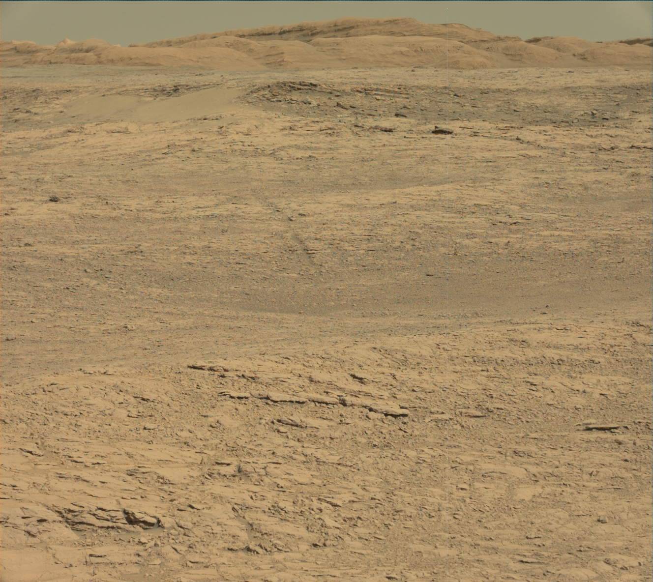
Today felt like any other planning day: a straightforward plan involving remote sensing, a drive, post-drive imaging, and some untargeted observations on the second sol. Just a typical day in the office. Maybe even an easy one. It wasn't until I sat down to write this blog that I fully processed how far we've come and just how awesome Curiosity's "office" is. I was looking through the drive imagery and came across this Navcam frame (posted above), which looks down on the Murray Buttes and Bagnold Dune Field, across Aeolis Palus and the northern rim of Gale crater. It's pretty spectacular to see just how much we've explored in 5 years. But that was just a quick glance over Curiosity's shoulder (or the RTG, which hangs off the back of the rover), because our sights were mostly set on the terrain ahead of us to choose where to go next.

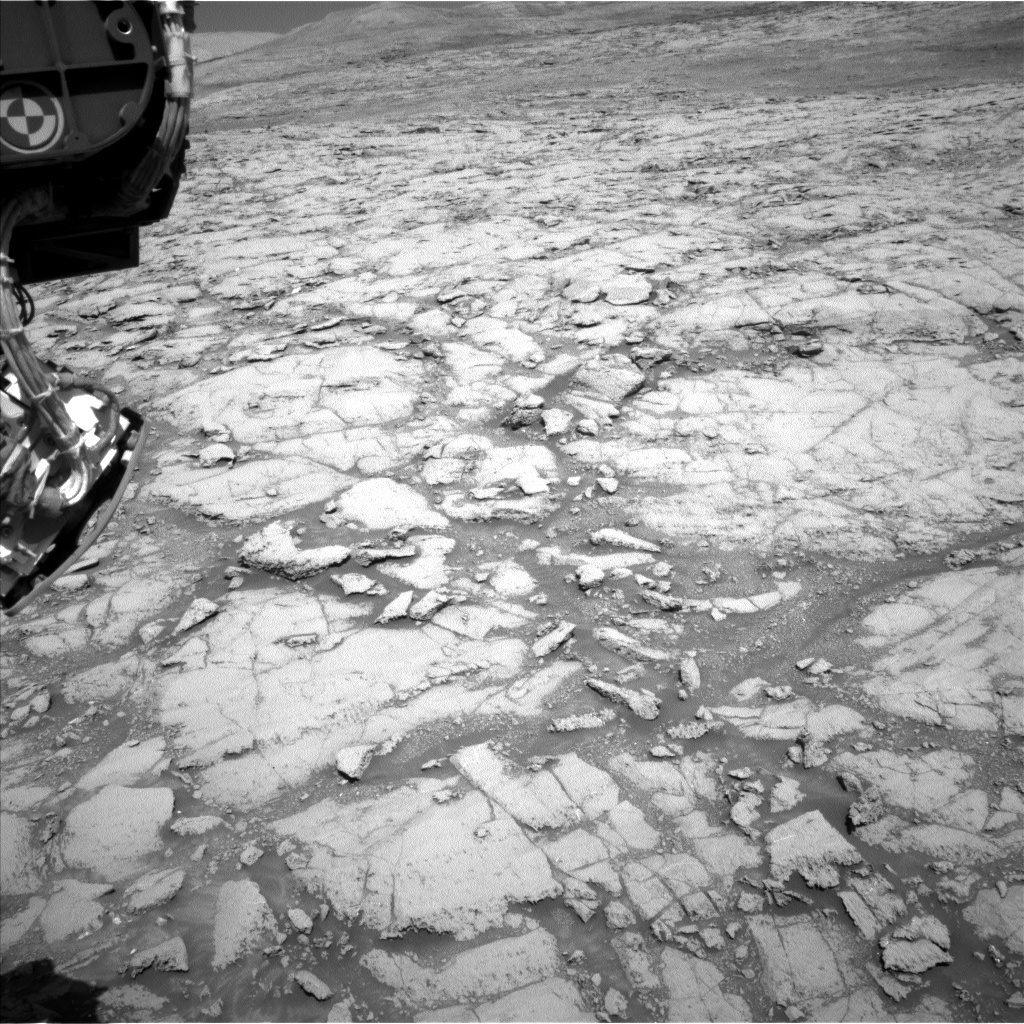
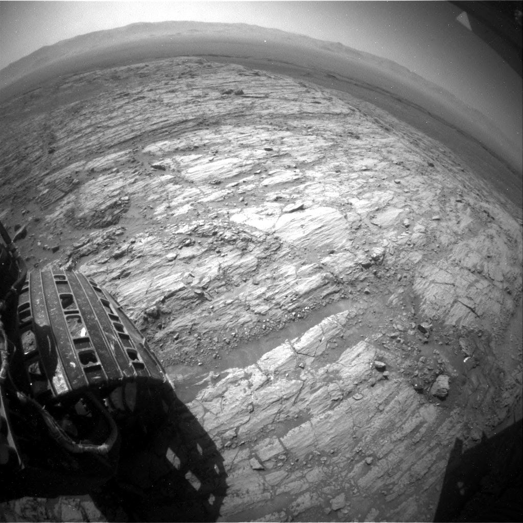
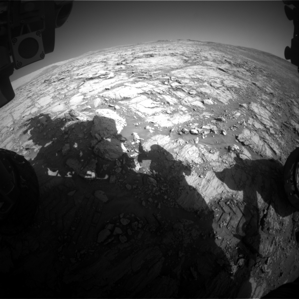
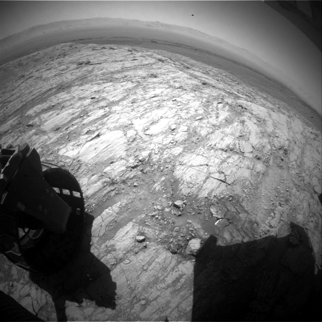
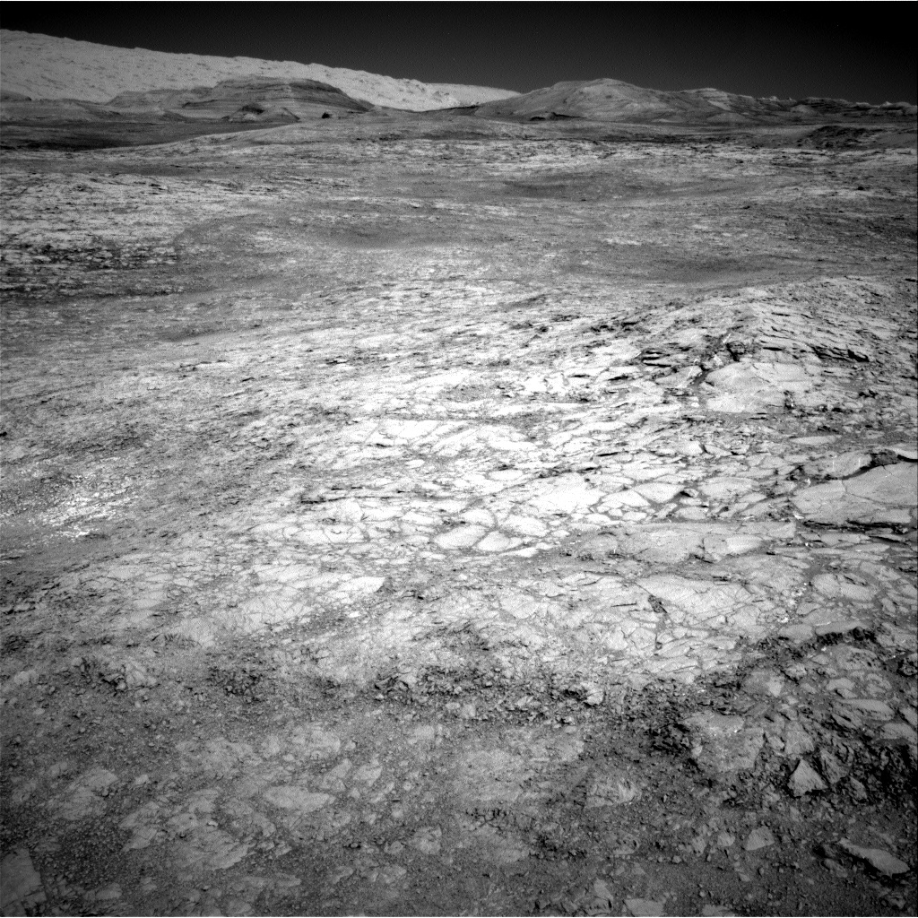
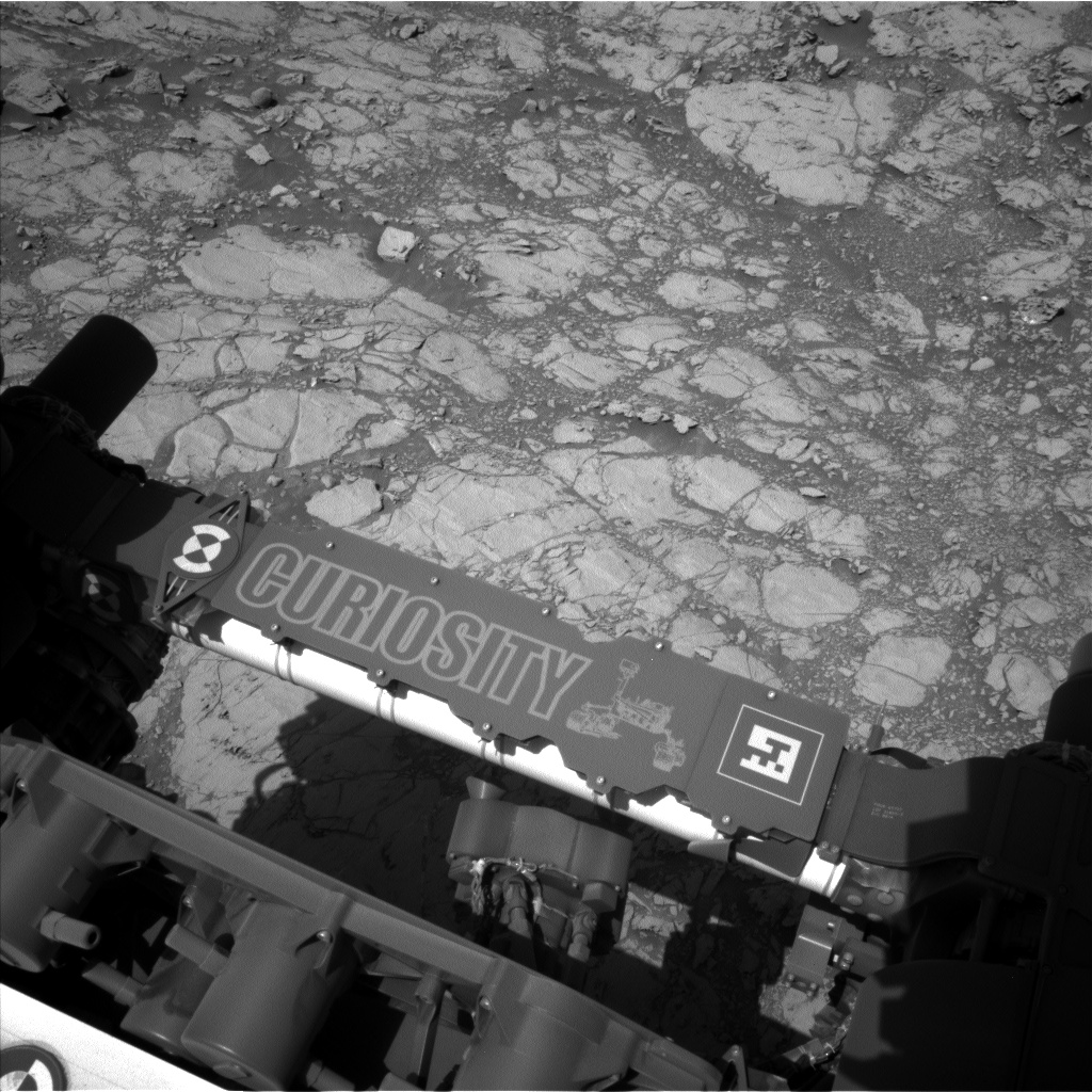
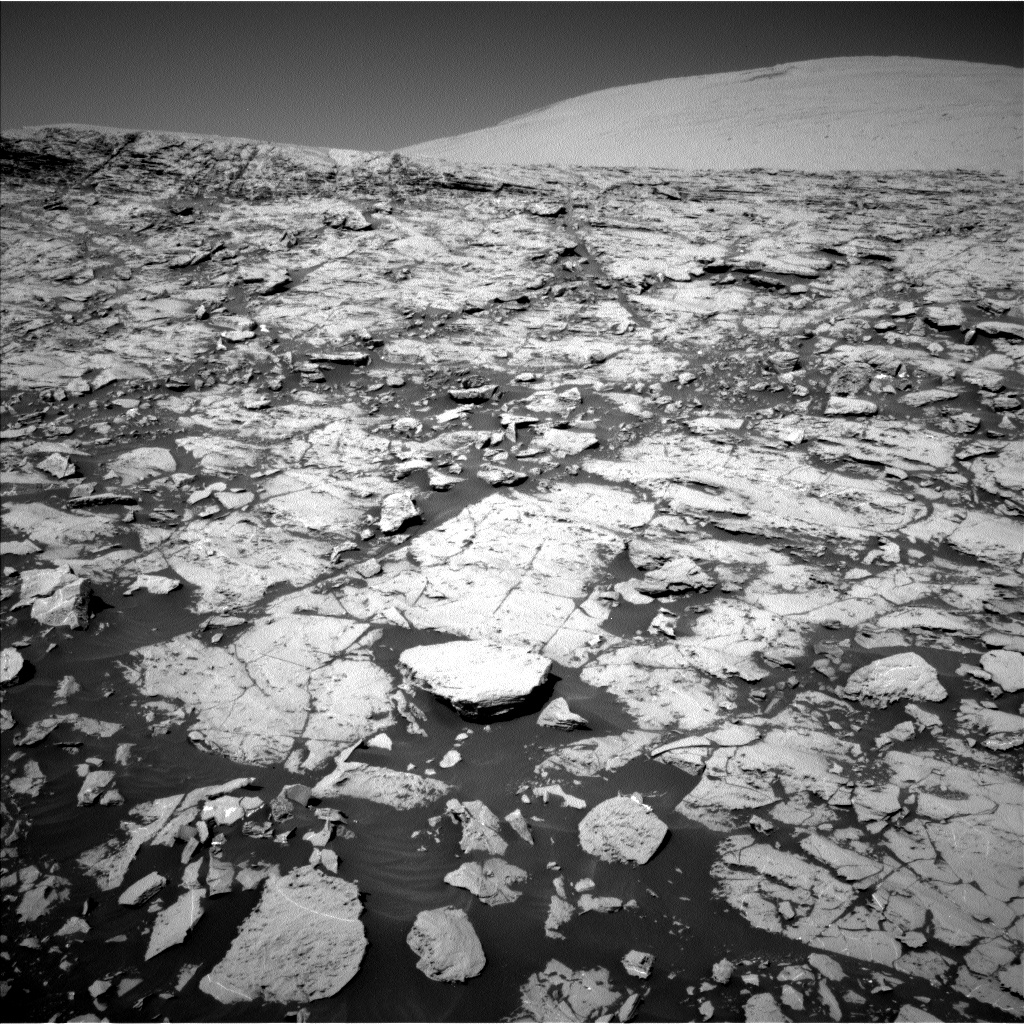
I was the Geology Science Theme Lead today, and it felt like any other planning day. We came in to assess how the weekend activities completed, what targets we had in front of us, and which route we wanted to take to get to the next interesting feature on Vera Rubin Ridge. The two-sol plan begins with a preload test of the rover's drill. Then Curiosity will acquire ChemCam and Mastcam observations of some nodular purple bedrock (target "Buck Reef"), and a unique gray-white vein or clast (target "Boomplaas"). We also planned some Mastcam imaging of sedimentary structures exposed in cross-section (target "Eccles") and to document the previously-acquired ChemCam AEGIS target. Then Curiosity will drive ~15-20 m further south to investigate some mottled outcrop that we first noticed from orbit. After the drive, we'll take Mastcam and Navcam images to prepare for contact science in the next plan. Data volume was a challenge today, so we had to think carefully about which images we need to have down in time to make decisions on Wednesday. On the second sol, Curiosity will wake up early to acquire a number of environmental monitoring observations to monitor clouds, dust, and wind. Later on the second sol we planned another ChemCam AEGIS observation to automatically target bedrock in our new location. Not bad for a typical day in the office!

October 16, 2017

Sol 1843-44: Winter is Coming

Written by Scott Guzewich, Atmospheric Scientist at NASA's Goddard Space Flight Center
Sol 1843-44:  Winter is Coming

The seasons on Mars are long, and even though Curiosity is near the equator, the change in weather between the seasons is noticeable and winter is coming to Gale Crater. Right now it's late fall in the southern hemisphere on Mars and the colder weather changes how we operate Curiosity. In colder weather, we need more power to heat the instruments and keep Curosity's electronics and mechanisms warm. This reduces the amount of electricity we have to conduct science, but we were still able to prepare a full plan for the next two sols.

We identified two new bedrock targets to analyze with ChemCam ("Woodlands" and "Montecristo", which are near the bottom portion of this image: https://mars.nasa.gov/msl/multimedia/raw/?rawid=NLB_560929716EDR_F0661332NCAM00279M_&s=1841). For Sol 1843, we also planned a series of Mastcam images of nearby bedrock targets that were analyzed with ChemCam as well as interesting spots in the distance, including a layered ledge on the Vera Rubin Ridge and a possibly hematite-rich patch called "Iron Mask" which we may drive near in the future. We also will drive approximately 22 m towards our next target on Sol 1843.

For Sol 1844, we planned an expansive series of environmental monitoring activities. As we approach winter, the martian atmosphere gets cloudier and we planned a series of Navcam movies to search for clouds as well as a triplet of Mastcam images to determine the amount of dust and ice in the atmosphere and how it varies over the day. We additionally planned two Navcam movies to search for dust devils.

October 13, 2017

Sol 1845-1847: Game of inches

Written by Michelle Minitti, Planetary Geologist at Framework
Sol 1845-1847: Game of inches

There's a line in the halftime scene of the movie "Any Given Sunday": "life's this game of inches…the margin for error is so small." The same is true on Mars. On Sol 1843, Curiosity started her drive with a turn to the right. Her right rear wheel encountered a small ridge (part of which is visible to the right of the wheel in the above image), a few inches of rock offering just enough resistance to cause Curiosity to stop the drive and wait for further instructions. The unexpected obstacle gave Curiosity a fourth planning sol at this location which the team used to add to their collection of bedrock measurements from the workspace. The "Bulawayo" target offered one of the least-dusty surfaces in the workspace, a gray, finely-layered and vertical rock face that made a tempting target for ChemCam. ChemCam also shot "Bushveld," a wind-sculpted expanse of bedrock dotted with small, resistant features. Not far from Bushveld, and adjacent to Sol 1838's "Duitschland" target, both MAHLI and APXS studied bedrock target "Stormberg." Having APXS analyses from both Stormberg and Duitschland in close proximity provides the opportunity to tease out small chemical differences between the targets.

After freeing herself from the obstacle by the right rear wheel, Curiosity will drive ~20 m farther up the "Vera Rubin Ridge." Post-drive, she'll acquire an automatically-targeted ChemCam analysis and a third CheMin integration of the "Ogunquit Beach" sand sample. Each CheMin integration brings the mineralogy of the Ogunquit Beach sample into sharper and sharper focus. The majority of the environmental monitoring observations also happen post-drive, including acquisition of mid-afternoon dust devil and cloud movies and a DAN active measurement.

Here's hoping the inches break our way this weekend!

October 9, 2017

Sols 1841-1842: Who ever said roving around Mars was easy?

Written by Dr. Mark Salvatore
Sols 1841-1842: Who ever said roving around Mars was easy?

When you take a step back and think about all of the things that must go right in order to perform scientific investigations on the surface of Mars, it's hard to believe that we EVER get things accomplished! It also means that seemingly minor issues can lead to significant delays and complications when it comes to developing science plans, commanding the rover, and gathering the collected data. Today was one of those instances when a seemingly minor issue here on Earth significantly influenced our abilities on Mars.

Earlier this morning, as the science team was assembling to select targets of interest and to populate our block of time dedicated to science with observations and analyses, our communications and ability to develop and send commands to the Jet Propulsion Laboratory was disrupted. Specifically, the communications and data transfer between JPL and the team that commands the majority of the high resolution cameras, including Mastcam, MAHLI, and MARDI, was disrupted. This often happens to me when I'm trying to watch my New York Mets play baseball, so I know just how frustrating it can be! Unfortunately, this also sometimes happens when critical data transfers and communications for rover planning must also take place. So, the science plan for the next two days must be adjusted to account for our inability to use Mastcam, MAHLI, and MARDI.

We are in our "restricted" planning mode this week, so today's science plan will cover two Mars days. Early tomorrow afternoon on Mars, Curiosity will analyze two targets in front of the rover, "Bokkeveld" and "Buffalo Spring," using the ChemCam active laser system to assess the chemistry of these two targets. Buffalo Spring has a nodular texture, not unlike some interesting targets observed on Vera Rubin Ridge over the last few weeks. Bokkeveld is a "typical" bedrock target, which will help us to understand just how different Buffalo Spring is relative to more typical basaltic targets. Later that afternoon, Curiosity will undergo some additional drill diagnostics to assess all of the great work that the engineers have been doing to get the drill capabilities back to the science team.

Early the following morning, the Navcam cameras will be used to identify and monitor local clouds. Around midday, ChemCam will make an automated measurement of a nearby rocky target as well as its titanium calibration target, and the Navcam cameras will image the surroundings and search for local dust devils. That evening, CheMin will be programmed to perform a second analysis on the Ogunquit Beach sediment sample and retrieve the data the following day.

As you can see, there is no drive scheduled during this two-day plan, so the science team will have the same view on Wednesday as they do today. Hopefully on Wednesday, we will be able to utilize all of the imaging capabilities of the rover, finish analyzing the local surroundings, and continue to make forward progress towards the top of Vera Rubin Ridge!

October 6, 2017

Sol 1838: Planning on Limited Data

Written by Christopher Edwards, Planetary Geologist at Northern Arizona University
Sol 1838: Planning on Limited Data

After a successful plan was carried out on the previous sols, in the decisional downlink we received limited imaging data with which to work today. Due to this not-yet received data, we developed our plan with the local workspace in mind and pushed some observations into the next plan. In the workspace, we planned for two ChemCam observations and associated Mastcam documentation images designed to continue the characterization of the chemical makeup of the "Vera Rubin Ridge" and the context of the hematite. Due to limited power for today's plan (thanks to some power-hungry SAM observations), that's just about all that made it in from a remote sensing perspective.

However, we did get a couple of MAHLI and APXS targets into the plan on the "Cheshire" and "Duitschland" targets to further augment the chemistry derived from the remote ChemCam observations. All of these observations are helping us to build up a detailed sedimentological and chemical stratigraphy for the Vera Rubin Ridge.

In this plan, SAM was the star of the show, though this activity didn't have anything to do with the Vera Rubin Ridge campaign. In this plan, Curiosity completed the sample drop-offs of the "Ogunquit Beach" sample back from the Bagnold Dunes campaign. As a part of this measurement suite, SAM will conduct an Evolved Gas Analysis (EGA) where the sample will be heated and some of the sample minerals will decompose or release their trapped water. This measurement allows us to effectively characterize the volatiles (e.g., SO2, CO2 and H2O) contained in the samples with the Gas Chromatograph Mass Spectrometer (GCMS). In the next plan, Curiosity will be at the same spot since the SAM measurements took so much power this weekend they prohibited a drive. In that plan, we'll be able to recapture some of the activities that were excluded from today's plan due to the limited imaging data that was downlinked. While Curiosity carries out these science measurements over the weekend, it'll have a pretty spectacular view as its parked right next to the edge of the Vera Rubin Ridge.

As it turns out, there's still plenty to do on Mars.

October 4, 2017

Sol 1836-1837: Frankenplan

Written by Abigail Fraeman, Planetary Geologist at NASA's Jet Propulsion Laboratory
Sol 1836-1837: Frankenplan

Unfortunately we weren't able to uplink yesterday's plan onto the rover because of a technical issue with the DSN, so we spent sol 1835 in run-out. Today we worked very hard to generate what we affectionately dubbed a "Frankenplan," which is defined as a plan in which one mashes elements that were already prepared (the contact science we had hoped to do on sol 1835) with new elements (a drive). We were able to pull this off because we were planning two sols today (1836-1837) instead of the one sol we planned yesterday.

This image was taken by Mastcam: Left onboard NASA's Mars rover Curiosity on Sol 1834.
We'll begin the plan on sol 1836 with a remote sensing block that has ChemCam LIBS observations of targets "Ecca" and "Lucknow." These are the same targets we had planned to do contact science on yesterday. We are also taking Mastcam mosaics of target "Limpopo" and a nice vertical exposure that we may visit in the future. We additionally managed to fit in a Mastcam tau observation and a Mastcam multispectral observation of an area named "Hotazel." We will use the multispectral observation to document the spectral properties of the terrain in front of us. After finishing the remote sensing science block, we will repeat that contact science we had planned yesterday, collecting MAHLI and APXS measurements on bedrock targets that we are going to DRT, Ecca and Lucknow. The purpose of these contact science measurements is to document the properties of the bedrock on this middle plateau on Vera Rubin Ridge. We will also squeeze in one more Mastcam tau measurement and a crater rim extinction image before the sun sets.

Our main activity on sol 1837 is a drive to the east to continue on our exploration of Vera Rubin Ridge. We will collect a Mastcam multispectral observation of the brushed targets Ecca and Lucknow before we drive away. Whew!

October 3, 2017

Sol 1835: Limpopo, Ecca, and Lucknow

Written by Roger Wiens, ChemCam PI
Sol 1835: Limpopo, Ecca, and Lucknow

Curiosity's 13.8 meter drive yestersol brought the rover a few meters higher on Vera Rubin Ridge (VRR) to a bit of a plateau. From here we can see over to the clay-rich unit beyond the ridge, and we can see more of the debris fan of the outflow channel that descends from Mt. Sharp, as seen in the accompanying Navcam image.

Today, for Sol 1835, we planned to remain stationary to allow a maximum of contact observations. This will include APXS, MAHLI, and ChemCam observations of two targets: a purplish "Ecca" and a tan-colored "Lucknow." The DRT will be used on both targets; "Ecca" will have the longer overnight observation by APXS. Mastcam will use its right-side imager to document these two targets and will obtain mosaics on "Limpopo" and a region of the next stop of VRR. Mastcam will also take left and right multispectral images of Katburg, a target that was observed by other instruments yestersol. The plan also includes DAN passive, and REMS and RAD get-data.

October 2, 2017

Sol 1834: Partial Success: Ogunquit Beach Sample Delivered to CheMin

Written by Roger Wiens, ChemCam PI
Sol 1834: Partial Success: Ogunquit Beach Sample Delivered to CheMin

NASA's Mars rover Curiosity acquired this image using its Mars Hand Lens Imager (MAHLI), located on the turret at the end of the rover's robotic arm, on March 28, 2017, Sol 1650 of the Mars Science Laboratory Mission, at 11:59:12 UTC.
Over the weekend Curiosity worked on a bold plan to drop off a sample in the inlet of the CheMin instrument. The sample, "Ogunquit Beach," is dune material that was collected at Stop 4 of the spring Bagnold Dune II campaign, collected starting on Sol 1651. The drop-off sequences included a vibration of CHIMRA, the sample processing hardware. These vibration activities were done to help move the loose sample material within CHIMRA, including into the portioning chamber. Because the use of vibration has been seen to affect the health of the drill, a test of the drill mechanisms also was performed. Vibration resulted in detectable changes to the mechanisms, so the rover automatically halted further use of the arm until further instructions from the ground were received. We see this drop-off as a good partial success, and a chance to learn more about the drill.

The team's operations today focused in part on returning the arm to normal operations. This includes approving the arm activities, doing some more drill diagnostics, performing some regular science activities, and then commanding a short drive. Following the results from Friday, we will be taking a second look at the float rock, "Normandien" (shown in the center of the Mastcam image), to be observed with ChemCam's spectrometers passively (no laser). Mastcam will be observing "Transvaal Extension" with a 3-image mosaic, and it will do some deck monitoring following the weekend sample drop-off. APXS and MAHLI will observe "Katberg," which was observed by ChemCam over the weekend. There will also be REMS and RAD activities, a DAN passive observation, and a Navcam dust devil movie.

After the drive, Navcam will do its usual imaging of the targetable region in front of the rover, Mastcam will continue a clast survey, MARDI will take an image of the region under the rover, and Navcam will take a 360 degree panorama.

September 30, 2017

Sol 1831: Quite a Diffracting Weekend!

Written by Mark Salvatore, Planetary Geologist at University of Michigan
Sol 1831: Quite a Diffracting Weekend!

The science team has been waiting quite a long time for this moment. Back in late March, nearly 180 Mars-days ago and when Curiosity was investigating the last stretches of the Bagnold Dunes before continuing towards Vera Rubin Ridge, Curiosity's scoop gathered a sample called "Ogunquit Beach." In order to quantitatively determine the mineral assemblage present in this sample of a sand dune, Curiosity would have to deliver the sample to the CheMin X-ray diffractometer instrument. However, because of the ongoing troubles with the arm's drill feed, Curiosity has been stuck with Ogunquit Beach in "storage" and unable to deliver the sample to CheMin - until this weekend! Tomorrow, at around 7:30am PDT, Curiosity will be given the "all clear" to deliver Ogunquit Beach to CheMin. Throughout the weekend, CheMin will analyze this sample, precisely measuring diffraction data for deriving its mineral assemblage, and will send the data back to Earth. The science team is very excited to be crossing this milestone, and we can't wait to compare Ogunquit Beach to the other measurements of the Bagnold Dunes acquired over the last few years.

In addition to this big achievement, Curiosity will also be investigating interesting science targets directly in front of her. The first task of the "weekend" on Mars will be to investigate three geologic targets of interest. First, the ChemCam laser system will be used to determine the chemistry of the targets "Katberg," "Normandien," and "Black Reef." Katberg is a relatively flat and benign piece of bedrock lying directly in front of the rover. Normandien is a bit further away from the rover, and is a darker rock sitting on top of the local bedrock, sand, and dust. Lastly, Black Reef is another darker rock (though slightly larger and more rounded than Normandien) that doesn't appear to be a piece of the local bedrock in the immediate rover surroundings. Following these measurements, Mastcam will document these three targets, as well as acquiring a few small mosaics of the local bedrock to the left and right of the rover and monitoring environmental conditions (e.g., atmospheric dust). The afternoon of this day is dedicated to delivering Ogunquit Beach to CheMin, with CheMin analyzing the sample overnight.

In the early Mars morning of the second day, Curiosity will make some additional atmospheric observations using Mastcam and Navcam. Later that afternoon, Curiosity's arm will swing into position, will brush away any dust or debris from the Katberg target, and will image Katberg with the high-resolution MAHLI camera. The APXS instrument will then be used to collect an overnight chemical analysis of Katberg. Midday on the third day, Curiosity will stow her arm and set off towards the east to continue making progress through Vera Rubin Ridge. After her drive, Curiosity will acquire some necessary post-drive images before returning them to Earth for the science team to analyze on Monday morning.

While most of this weekend's activities are fairly "normal" in the context of our recent scientific investigations, delivering Ogunquit Beach to CheMin marks an important milestone for utilizing this valuable rover asset. We hope that the results of these analyses will be just as valuable in our understanding of the mineral assemblages present in Martian sand dunes!

September 29, 2017

Sol 1830: We've got the power

Written by Michael Battalio, Planetary Climatologist at Yale University
Sol 1830:  We've got the power

With apologies to Montgomery Scott, "we do not have the power...," but we will, as today was about keeping our state of charge up in preparation for possible CheMin activities in a near-future plan. Fortunately, that absolutely did not preclude a lot of terrific science and a drive.

Today was a touch-and-go sol. Contact science was planned on a dark-toned target named "Collingham" in the hopes that the darker color indicated either a different chemistry or reduced surface dust. APXS, MAHLI, ChemCam, and Mastcam will all cooperate on observing this target. Mastcam will continue the Vera Rubin Ridge imaging campaign by capturing a 13x1 mosaic of a prominent outcrop, named "Tra Tra," which is the large outcrop at the top left of the above Navcam image. (Mt. Sharp is to the right.) A stereo image will be taken to ascertain the geometry of the bedding. Curiosity then will drive about 11 meters towards the top of a nearby ridge. Post-drive Navcam imaging will be taken as well as an automated AEGIS imaging activity with ChemCam.

ENV accommodated the power-saving requirements of the plan by not performing any imaging and only including REMS and DAN activities. The normal cadence of REMS observations was also scaled back in such a way as to not degrade the ability to perform good science. ENV can ensure this flexibility by shuffling the placement of REMS extended blocks (EBs) from one sol to the next or dropping very low-priority EBs. (Note that EBs should not be confused with the top-of-the-hour 5-minute blocks that are always scheduled.) Though the EB observations themselves are not power intensive, the additional wake-up time to retrieve these data from REMS memory into rover memory so that they may be relayed to Earth (an activity appropriately called a REMS Get Data) can use considerable power if required at night, especially during the winter season. The number of these Get Datas in any given plan can be reduced by simply cutting back on the number of EBs. (For a typical cadence in a 1-sol plan, about three or four Get Datas are required.) ENV can reduce the impact of dropped EBs on science goals by deferring the dropped blocks to future plans. This adaptability can be achieved because the highest-priority EB cadence is designed to capture a full sol of environmental measurements every six sols-that is, there are four evenly spaced 1-hr blocks every sol that get pushed backward by one hour in the following sol. (I.e., Sol 1830 has blocks at 0300, 0900, 1500, and 2100, while Sol 1831 will have blocks at 0200, 0800, 1400, and 2000. And so on.) Capturing a full sol of environmental monitoring at a regular frequency is important to ensure that any localized atmospheric phenomena are not missed as Curiosity explores Gale Crater. Additional high-priority observations support other MSL experiments (e.g., during expected SAM drop-off or atmospheric intake times or Mastcam change detection experiments) and concurrent monitoring when THEMIS (Thermal Emission Imaging System) onboard Mars Odyssey or MCS (Mars Climate Sounder) onboard the Mars Reconnaissance Orbiter is observing Curiosity's location. These are impossible to postpone but occur at specific, pre-planned times. At medium priority are periodic HRIM (High Resolution Interval Mode for humidity)-or morning-EBs and a noon EB every sol that looks for pressure drops from small-scale vortices (like dust devils). At low-priority are migrating two-hour EBs to detect any meteorological changes that might last longer than the usual hour-long blocks. All of these EB observations are usually easy to fit in the plan because they do not require the rover to be awake; however, the accompanying Get Datas must occur when the rover is awake. If the timing of awake periods due to other activities, like a communications pass, does not line up with the required Get Datas, then low-priority blocks can be dropped altogether and/or high-priority blocks can be pushed to the following sols to reduce the number of requisite Get Datas in a plan. For example, in the Sol 1831 plan, the 0300 and the 0200 blocks will be captured. In this way, the number of Get Datas and the ENV power requirements in a given plan are reduced, and a full sol of observations can still be taken within the six-sol goal.