April 23, 2018

Sol 2032-2033: The Rocks vs. Stone Cold Aluminum Wheels

Written by Abigail Fraeman, Planetary Geologist at NASA's Jet Propulsion Laboratory
Sol 2032-2033: The Rocks vs. Stone Cold Aluminum Wheels

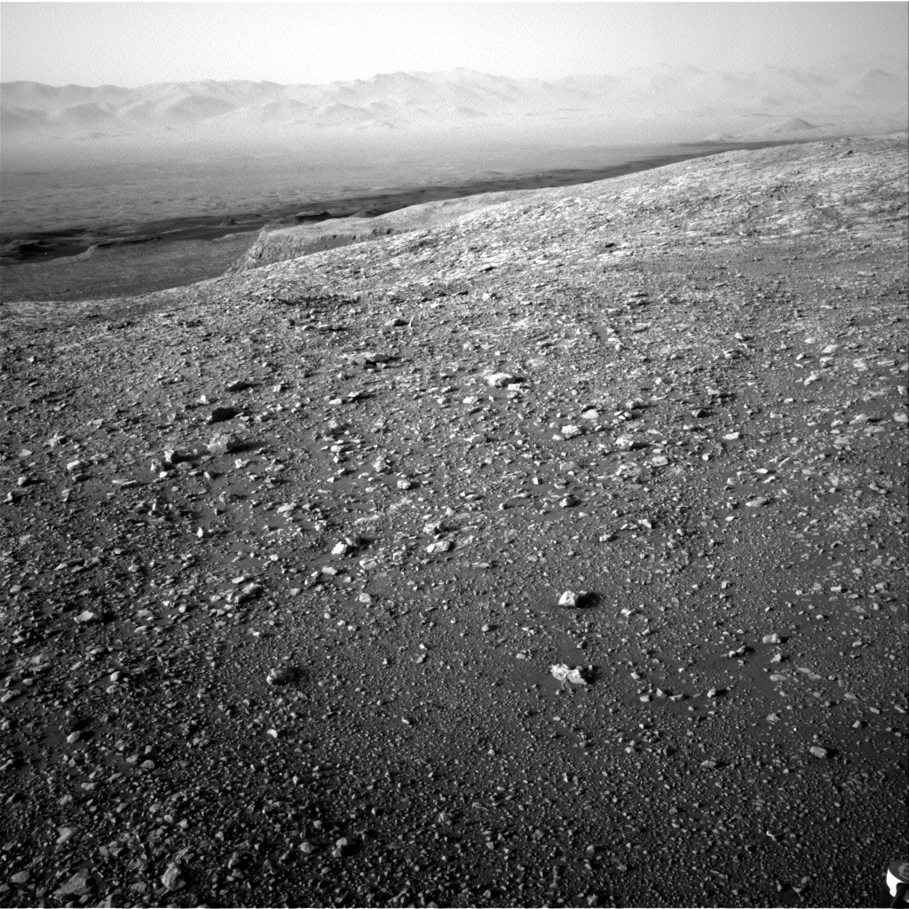
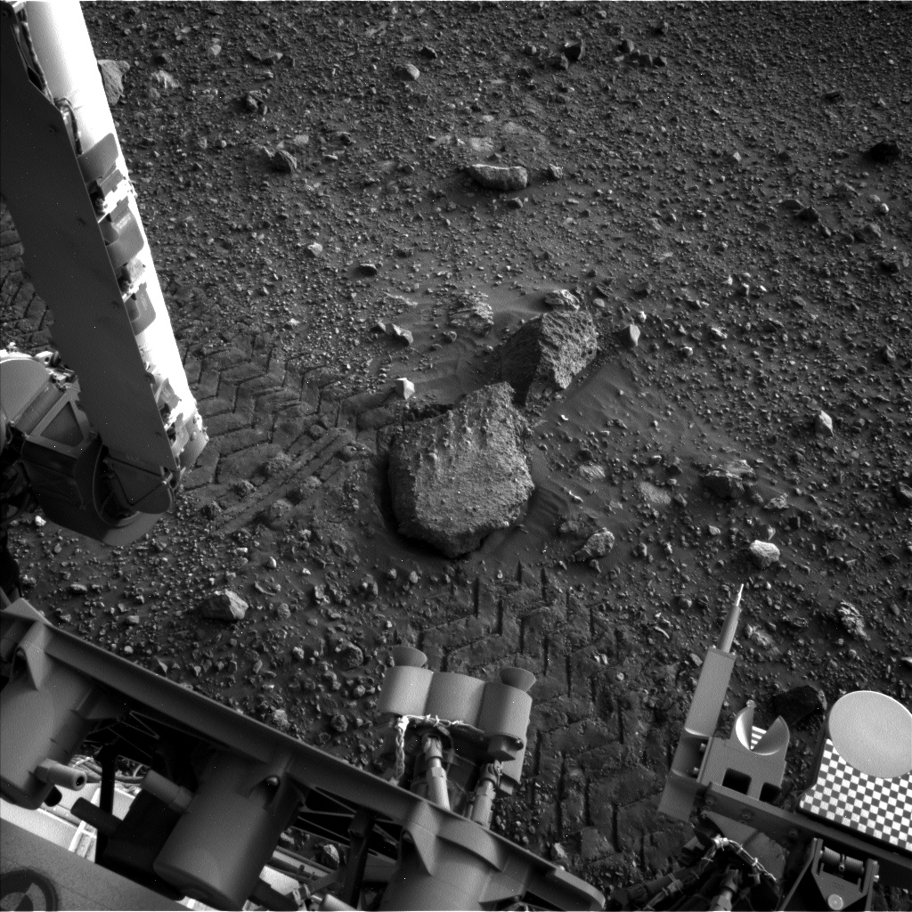
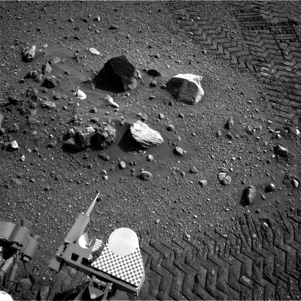
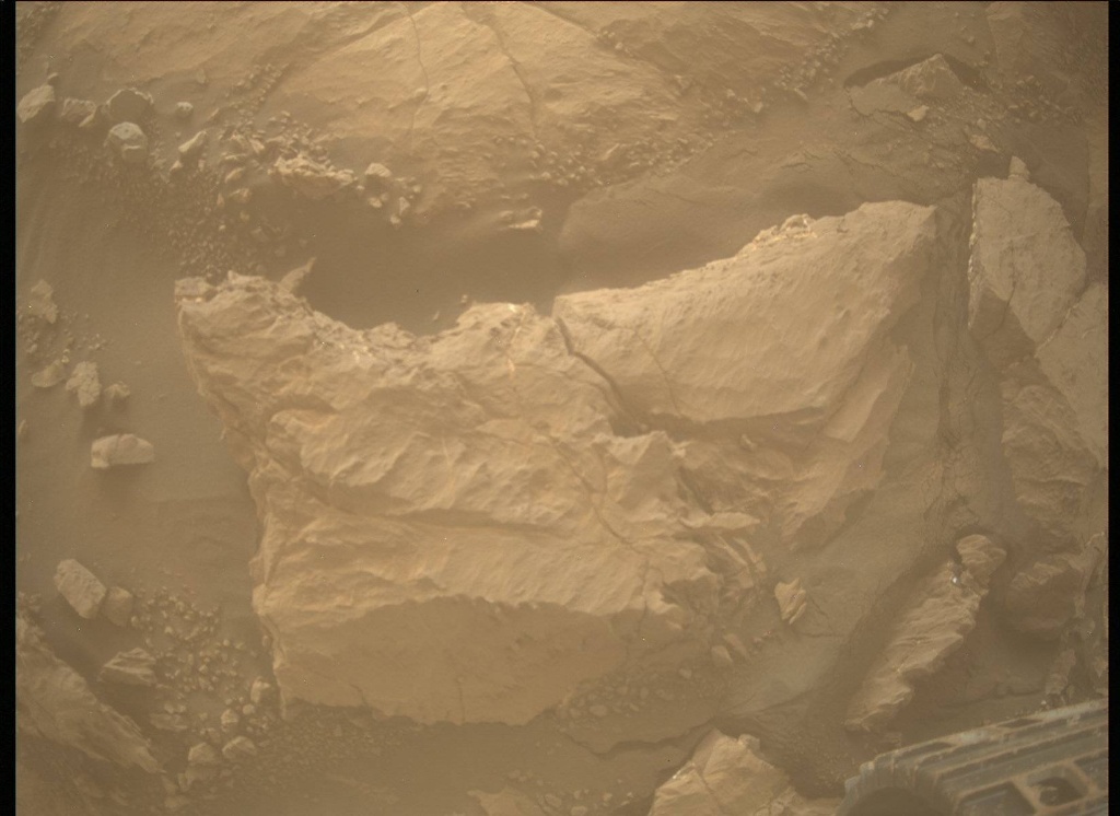
Curiosity drove a little over 16 m to the west this weekend. The rover is currently skirting around the southern edge of a small, blocky impact crater on its way north off the Vera Rubin Ridge. One of the activities we did this weekend was use MAHLI to take images of the rover wheels. We do this activity, dubbed Full MAHLI Wheel Imaging (or FMWI in NASA acronym speak), every few hundred meters to track damage to Curiosity's wheels caused by the terrain. It's important for us to take this observation in order to estimate how much farther the rover will be able to drive before the wheels become inoperable, and also to understand if the sharp edges of the broken wheels risk damaging the nearby cables. So far, we estimate we're in pretty great shape for our plans to drive a lot farther up Mt. Sharp!

This image was taken by Mars Descent Imager (MARDI) onboard NASA's Mars rover Curiosity on Sol 1869.
For the last few years, we've been actively working to mitigate wheel damage in several ways. JPL engineers developed some smart driving algorithms called "traction control" that reduce forces on Curiosity's wheels as the rover climb over rocks. Geologists like myself also help by planning drive paths over terrain that is safer for the wheels. We do this on a sol-to-sol basis in tactically staffed roles known as Surface Properties Scientist (SPS), which is what I did today. Strategically, we also work with the orbital datasets to predict what the terrain ahead will look like, and we use these predictions to choose long-term paths that will be easiest on the wheels without sacrificing science. If you look closely at the rover path from the last few sols in the orbital data, you may notice we've been driving along terrain that looks darker and bluer in this false color image compared to the nearby bright, tan rocks. This path corresponds to terrain that is filled with pebbles and hard-packed sand, and we think it's a little nicer for the wheels than the bright bedrock, which can sometimes have sharp edges. The geologic term for these sharp edged rocks is ventifacts, and they are formed by wind erosion over millions of years. While they probably won't hurt the wheels too much, we'd prefer to avoid them when possible.

Today we planned two sols. We'll start the first sol with MAHLI and APXS observations of a bedrock target named "Pokegama." The contact science is followed by some time for remote sensing, which includes a Mastcam mosaic of the nearby crater named "Taconite," and a single image of interesting looking rocks named "Winton," and "Cuyuna." We'll also have ChemCam LIBS and Mastcam documentation images of Pokegama and "Kenora." After the science block we'll have a short drive followed by post-drive imaging and a ChemCam AEGIS observation. In the second sol of the plan, we'll take a Navcam dust devil movie and second AEGIS observation.

April 20, 2018

Sol 2029-2031: Booking it Through Biwabik

Written by Abigail Fraeman, Planetary Geologist at NASA's Jet Propulsion Laboratory

Curiosity drove a whopping ~85 m to the northwest in the sol 2027 plan. Besides being long, this drive was remarkable because it marked a shift in Curiosity's strategic campaign: we have officially finished our initial reconnaissance of Vera Rubin Ridge, and we are beginning our journey down off the ridge, heading north into an area where we would like to test the rover's drill. The guidance from the team is now "drive, drive, drive!," while still doing as much opportunistic science as we can along the way of course.

With the sol 2027 drive, we have also officially entered the Biwabik Quad. You may recall we flirted with the boundary of this quad back on sol 2004-2007 and 2009-2012. Biwabik is a city in the United States in northern Minnesota that is connected with the Mesabi Range. This range contains a vast iron deposit, so we felt it was a perfect choice for the hematite-rich area we are currently exploring. (Hematite is an iron-rich mineral). Entering a new quad means we have a fresh set of target names to choose from, which added some fun to our morning planning. One of the names we chose, "Babbitt," is named after a city of ~1,500 residents about 30 miles away from Biwabik. Our Flagstaff-based team members also liked this name because it was reminiscent of the famous Babbitt Brothers who made a name for themselves as cattle ranchers in Flagstaff Arizona in the early 1900s.


We planned 3-sols today. In the first sol, we will have a morning remote sensing block with ChemCam observations of rock targets "Ely," Babbitt, and "Hibbing." These observations will be accompanied by Mastcam documentation images. We will also take a Mastcam mosaic and some multispectral frames of a nearby crater, and we have named this feature "Taconite." The remote sensing block will be followed by MAHLI and APXS observations of Babbitt. In the second sol of the plan, we will take a morning dust devil movie and use MAHLI to look at our wheels and document any punctures that may have formed over the last few hundred meters of driving. This will be followed by short drive along our strategic route with post-drive imaging activities that will set us up for a touch and go on Monday. The third sol of the plan is all about monitoring the Martian environment. We will take an overnight measurement with APXS to understand the Argon abundance in the atmosphere (it varies seasonally), and spend the morning taking a zenith movie, horizon movie, crater rim extinction imaging, and tau measurement. We will also use the ChemCam instrument in passive mode to take a spectrum on the atmosphere around noon. It will be a fun and busy weekend on Mars!

April 20, 2018

Sol 2029-2031: Booking it Through Biwabik

Written by Abigail Fraeman, Planetary Geologist at NASA's Jet Propulsion Laboratory

Curiosity drove a whopping ~85 m to the northwest in the sol 2027 plan. Besides being long, this drive was remarkable because it marked a shift in Curiosity's strategic campaign: we have officially finished our initial reconnaissance of Vera Rubin Ridge, and we are beginning our journey down off the ridge, heading north into an area where we would like to test the rover's drill. The guidance from the team is now "drive, drive, drive!," while still doing as much opportunistic science as we can along the way of course.

With the sol 2027 drive, we have also officially entered the Biwabik Quad. You may recall we flirted with the boundary of this quad back on sol 2004-2007 and 2009-2012. Biwabik is a city in the United States in northern Minnesota that is connected with the Mesabi Range. This range contains a vast iron deposit, so we felt it was a perfect choice for the hematite-rich area we are currently exploring. (Hematite is an iron-rich mineral). Entering a new quad means we have a fresh set of target names to choose from, which added some fun to our morning planning. One of the names we chose, "Babbitt," is named after a city of ~1,500 residents about 30 miles away from Biwabik. Our Flagstaff-based team members also liked this name because it was reminiscent of the famous Babbitt Brothers who made a name for themselves as cattle ranchers in Flagstaff Arizona in the early 1900s.

We planned 3-sols today. In the first sol, we will have a morning remote sensing block with ChemCam observations of rock targets "Ely," Babbitt, and "Hibbing." These observations will be accompanied by Mastcam documentation images. We will also take a Mastcam mosaic and some multispectral frames of a nearby crater, and we have named this feature "Taconite." The remote sensing block will be followed by MAHLI and APXS observations of Babbitt. In the second sol of the plan, we will take a morning dust devil movie and use MAHLI to look at our wheels and document any punctures that may have formed over the last few hundred meters of driving. This will be followed by short drive along our strategic route with post-drive imaging activities that will set us up for a touch and go on Monday. The third sol of the plan is all about monitoring the Martian environment. We will take an overnight measurement with APXS to understand the Argon abundance in the atmosphere (it varies seasonally), and spend the morning taking a zenith movie, horizon movie, crater rim extinction imaging, and tau measurement. We will also use the ChemCam instrument in passive mode to take a spectrum on the atmosphere around noon. It will be a fun and busy weekend on Mars!

April 20, 2018

Sol 2027-28: A Change of Season

Written by Scott Guzewich, Atmospheric Scientist at NASA's Goddard Space Flight Center
Sol 2027-28: A Change of Season

This was a week of transition for Curiosity's environmental science team. The cloudy season on Mars has ended as we've seen a marked decrease in water ice cloud activity in our Navcam sky movies over the last several weeks and we're moving quickly into the dusty season on Mars. We will now be drastically reducing the frequency in which we search for clouds and instead focus our attention on dust devils and storms. The atmosphere is beginning to get dustier, as seen by the hazy look of the northern rim in Gale Crater in this image. Indeed, we began preplanning our annual campaign to study a potential global dust storm, if and when such a storm develops this year. The dusty season on Mars, roughly the second half of the martian year, runs from the end of May until February next year, and we'll be monitoring closely for the signs that a global dust storm (the last of which occurred way back in 2008!) is developing.

But today on Mars, routine business continued as we performed a "touch-and-go" plan with MAHLI images of rock targets "Hawick", "Kemnay", and "Buchan", before driving toward our next destination. On the second sol of the plan, we planned two movies to look for dust devils and two more Mastcam image sequences to monitor the (increasing) amount of dust in the atmosphere as we move toward southern spring equinox.

April 16, 2018

Sols 2025-2026: From Float Rocks to Suilven Ripple

Written by Roger Wiens, ChemCam PI
Sols 2025-2026: From Float Rocks to Suilven Ripple

Over the weekend Curiosity completed a 13 meter drive from some interesting float rocks including some potential breccias (see accompanying MAHLI image) to "Suilven Ripple", a sand ripple where it will characterize the grain sizes and ripple morphology. Today is a 2-sol plan with no drive.

Planned science observations include APXS and MAHLI on "Kemnay," on the crest of the ripple, and on "Hawick" on the near side of the ripple, MAHLI on "Buchan" near the far edge of the ripple, ChemCam on "Arnstruther" on the near side of the ripple and "Ballachullish" on the crest. Mastcam will observe these targets plus a multispectral observation on "Cromarty" on the edge of a wheel track in the sand. Mastcam will also make a series of 10 change-detection observations periodically throughout both sols, targeting "Samson's Ribs" near the edge of the sand. Navcam will record a dust-devil movie, Mastcam will perform deck monitoring, and MARDI will take an image of the ground below the rover. There will be an APXS argon and SAM QMS run to study the atmospheric composition. RAD and REMS will take data.

April 14, 2018

Sols 2022-2024: Waternish extravaganza

Written by Ken Herkenhoff, Planetary Geologist at USGS Astrogeology Science Center
Sols 2022-2024: Waternish extravaganza

The Sol 2020 drive completed successfully, placing the vehicle in a good position for contact science on the Waternish conglomerate. To sample the diversity of clasts in Waternish, the Sol 2022 plan includes brushing two spots, a 5-point APXS raster, and lots of MAHLI imaging. But first, ChemCam will shoot its laser at Waternish and

the cobble behind it, named "Arrochar." After the DRT is finished brushing, MAHLI will acquire full suites of images of one of the brushed spots and of Arrochar, as well as a mosaic of images from 5 cm above the APXS raster spots and context images from 25 cm. Then APXS will go to work on Waternish, followed by placement on Arrochar for an overnight integration. This complex set of arm activities took longer than usual to plan, but should provide a rich dataset.

On Sol 2023, Mastcam will take a full multispectral set of images of Waternish and a 3x3 mosaic of both Waternish and Arrochar. ChemCam will observe two more spots on Waternish, and the Right Mastcam will take an image of the ChemCam target selected by AEGIS on Sol 2021. Then the rover will drive backwards to a nearby sandy ripple, un-stow its arm, and acquire the images needed to plan close-up observations of the ripple. Overnight, APXS will again measure the amount of argon in the atmosphere.

On Sol 2024, ChemCam will gather calibration data, Mastcam will measure the opacity of dust in the atmosphere, and Navcam will search for dust devils. Finally, APXS will perform a short thermal test and MARDI will take another twilight image. Another busy weekend for our intrepid explorer!

April 12, 2018

Sol 2020-2021: Leaving Bressay

Written by Ken Herkenhoff, Planetary Geologist at USGS Astrogeology Science Center
Sol 2020-2021: Leaving Bressay

The top science priority for this plan is to acquire all of the data needed to adequately characterize the rocks at the current location before driving away. So the GEO Science Theme Group discussed the priorities of various proposed observations, including a Right Mastcam mosaic of the arm workspace and surrounding area, ChemCam LIBS targets, and a mosaic of the mid-field terrain toward the south. Fortunately, power modeling indicated that the pre-drive science block could be lengthened to 2 hours, which made it much easier to fit all of the desired observations into the plan. First, ChemCam will measure the elemental chemistry of 4 nearby rock targets, called "Ledmore 2," "Minginish," "Askival 3," and "Tyndrum 3." Minginish has already been examined by MAHLI and APXS. Then the Right Mastcam will take images of Askival 3 and Ledmore 2, as well as a 9x1 mosaic of "Lorne Plateau" (the area to the south), a large mosaic to provide complete coverage of the area in front of the rover, named "Bressay," and a 3x3 mosaic of the "Jedburgh" area closer the rover toward the south. All these data will give the science team plenty to think about as we try to better understand the variety of rocks at Bressay.

We are transitioning into restricted planning again, so the drive away from Bressay is planned on Sol 2020. The drive target is a conglomerate rock named "Waternish." After the drive, early on Sol 2021, Mastcam will measure the amount of dust in the atmosphere and Navcam will search for clouds. Later that sol, Navcam will search for dust devils and Mastcam will measure dust opacity again. Then ChemCam will acquire calibration data and will use AEGIS to autonomously select and acquire LIBS data on a target in the new arm workspace. Finally, MARDI will take an image of the ground under the rover during twilight, to sample the terrain once again. Overall, it was a good day for me as SOWG Chair, and despite the late start we finished planning in time for me to take my wife out on her birthday this evening!

April 11, 2018

Sol 2019: The workspace that just keeps giving

Written by Lauren Edgar, Planetary Geologist at USGS Astrogeology Science Center
Sol 2019: The workspace that just keeps giving

For the past few sols Curiosity has been exploring a diverse assemblage of cobbles and boulders on Vera Rubin Ridge, trying to understand how this blocky deposit came to be, and what the variety of rock types can tell us about geologic processes in Gale crater. We've been really excited by the diversity of rock types, as seen in the above Mastcam image. The team decided to stay for one more full day of contact science before driving away in tomorrow's plan.

I was the SOWG Chair today, and we tried to pack as much science as possible into the plan, pushing the bounds of our power and data volume limits. We were able to plan 3 more contact science targets, and we'll acquire a full suite of MAHLI images and APXS data on each of them. The targets include a smooth gray rock named "Minginish," a well-cemented, finely-laminated rock named "Sanquhar," and a well-stratified rock named "Rousay." The Geology theme group also planned several ChemCam observations to assess the composition of different rock types, and three Mastcam mosaics to document a nearby light-toned outcrop, a view toward the sulfate-bearing unit, and the Greenheugh pediment in the distance. The Environmental theme group planned standard DAN and REMS observations, and a Navcam dust devil movie to find and characterize dust devils. It's been a lot of fun to see the diversity of rock types that Gale crater contains!

April 9, 2018

Sol 2018: Rock Garden

Written by Scott Guzewich, Atmospheric Scientist at NASA's Goddard Space Flight Center
Sol 2018: Rock Garden

An eclectic mix of rock targets has kept our team's attention for another sol today. The sheer number of possible science investigations led us to initially oversubscribing our science plan and thus needing to prioritize. After a brief discussion, GEO decided to set today as a full contact science sol, with APXS integrations and MAHLI images of targets "Hopeman" and "Askival", with additional MAHLI images of "Tyndrum2" and "Ledmore". What is especially unusual about today's plan is that we will use MAHLI's capability to shine a (UV) light on the situation and image "Askival" after sunset. In addition to that full contact science agenda, ChemCam will conduct LIBS rasters on "Ardgour" and "Rousay" and then conduct a depth profile at "Askival". A depth profile is where ChemCam shoots its laser at the same spot 150 times to measure how the composition changes with depth into the rock or soil. Last, but certainly not least to me as the environmental science theme lead today, is to conduct a dust devil survey around local solar noon. We are seeing a great deal of dust devil activity lately with a noticeable increase over the last few weeks as we move closer to the start of southern hemisphere spring.

April 6, 2018

Sols 2015-2017: Rover in a candy store

Written by Michelle Minitti, Planetary Geologist at Framework
Sols 2015-2017: Rover in a candy store

Like Harry Potter in Honeydukes or Charlie in the Chocolate Factory, Curiosity rolled up to the proverbial candy store today, wondering "where to begin?!" The variety of rock types in the workspace, the likes of which had not been seen for many hundreds of sols, made picking favorites a challenge. The job of surveying the variety was made easier by the opportunities to get four (4!) targets with a combination of MAHLI, APXS and ChemCam. MAHLI and APXS will image and analyze, respectively, the two large, gray blocks near the rover, "Staffa" (left) and "Tyndrum" (right). MAHLI and ChemCam will image and shoot, respectively, the targets "Askival," the bright white rock above Tyndrum, and "Hopeman," a lumpy rock which might be a conglomerate. Mastcam will cover much of the workspace with M100 images to get more detailed views of all the lithologies present, and will add multispectral observations over Hopeman, Askival and Tyndrum.

The atmosphere also got plenty of attention with mid- and late-day dust devil movies, early morning and late day cloud and dust observations, and an APXS Ar analysis.

Even with the embarrassment of riches in the weekend plan, the science team could not resist another shopping spree here. The weekend drive will pull us around the right side of the workspace to access some of the rocks that were not reachable from today's parking spot. Stay tuned for more fun next week!