May 10, 2018

Sol 2048: Successful Bump

Written by Kenneth Herkenhoff, Planetary Geologist at USGS Astrogeology Science Center
Sol 2048: Successful Bump

Today is the third and final day that I'm serving as SOWG Chair this week at JPL, and I was happy to see that the bump we originally planned for Sol 2046 completed successfully on Sol 2047, placing the rover in a good position for contact science on a couple of bright blocks in front of the rover. So we're planning to brush two targets on the larger block, named "Bilbert" and "Giants Range," before MAHLI images them and APXS measures their chemistry at night. Before the arm activities, ChemCam will shoot its laser at Giants Range and targets "Vermillion" and "Lac La Croix" on nearby blocks. Because the stowed arm partly blocks our view of the part of the arm workspace closest to the rover, we'll acquire a Navcam stereo pair and a single Left Mastcam color image of that area after the arm is deployed. These images will be useful in planning more contact science this weekend.

May 9, 2018

Sol 2047: Bump Take 2

Written by Scott Guzewich, Atmospheric Scientist at NASA's Goddard Space Flight Center
Sol 2047: Bump Take 2

In Curiosity-speak, a "bump" is a short drive the rover performs to better position itself for a particular science investigation (often contact science with the rover's arm). Yestersol's plan intended to include such a bump to reach a suitable target for contact science, but unfortunately the drive did not execute. Today's planning aimed to recover this drive and reach a target for contact science in the next plan. You can see from this Hazcam image that the ground is full of bedrock plates and tilted rocks, one of which Curiosity is standing on, which prevented contact science at the current location. The image also shows the northern edge of the Vera Rubin Ridge (from the upper left corner of the image extending horizontally across the upper portion of the frame). Curiosity will continue to head northward away from the ridge (toward the right side of the image) to find a target suitable for drilling.

Today's science plan was necessarily limited and will include post-drive imaging, a dust devil movie, and routine REMS and DAN environmental monitoring.

May 8, 2018

Sol 2046: The best laid plans...

Written by Mark Salvatore, Planetary Geologist at University of Michigan
Sol 2046: The best laid plans...

As Curiosity continues to descend the Vera Rubin Ridge, the science team is doing their best to characterize, for a second time, all of the structural, chemical, and spectral variations originally seen as we climbed up the ridge. Yesterday's drive brought Curiosity from the "Pettegrove Point" member of the VRR into the "Blunts Point" member, which is just below the ridge itself. So, the team was planning to spend a full day at this location to perform remote science investigations, to brush off a rock surface, to analyze the surface's chemistry with the APXS instrument, and to take some high-resolution oblique images to characterize the layering observed in the sides of the rocks. When the team woke up this morning and first saw the workspace in front of the rover, everyone was happy and eager to get to work!

However, a stroke of bad luck prevented the science team from performing most of these analyses. About half-way through planning this work, the science team got news that the rover was not only sitting at a rather steep angle (~17 degrees relative to horizontal), but that one of the wheels was also propped up on a loose rock. In order to play it safe and to minimize any risk that the rover would lose its balance when the arm was extended to perform many of these analyses, the rover planners and the science team decided to forego any arm activities and, instead, plan only a short science investigation and to "bump" to a nearby rock to try again tomorrow for a full surface characterization. While these decisions are momentarily disappointing, they are relatively frequent and necessary to ensure that Curiosity will be able to perform her job many years into the future. We certainly don't want to take any unnecessary risks!

So, instead of the plethora of science activities originally planned for the day, Curiosity will instead only make a handful of measurements before pivoting and driving a few meters away to the next location for tomorrow's attempt at surface science. Today, Curiosity will use the ChemCam instrument's laser-induced breakdown spectrometer to measure "Grand Lake," a block of the Blunts Point member that appears to have the typical properties seen earlier in the mission, as well as "Mud Lake," which is a piece of bedrock broken by Curiosity's wheels that revealed a bright brick-red color on its inside (the sunken rock in the middle of the following Hazcam image, wedged between the raised rocks: https://go.nasa.gov/2KLEawF). Mastcam will follow up with documentation images as well as a multispectral image of Mud Lake to see what sort of spectral and mineralogical variations are the cause of the bright red coloration. Curiosity will also perform several environmental monitoring measurements, including a search for dust devils and an atmospheric opacity observation. Following her short drive, Curiosity will then perform standard post-drive imaging in order to get ready for tomorrow's day of surface analyses.

May 7, 2018

Sol 2045: Purple Coleraine, Purple Coleraine

Written by Abigail Fraeman, Planetary Geologist at NASA's Jet Propulsion Laboratory
Sol 2045: Purple Coleraine, Purple Coleraine

The drive planned on sol 2045 will take Curiosity off of Vera Rubin Ridge and back into the broken-up rocks that comprise the Blunt's Point member of the Murray formation. But don't panic Vera Rubin Ridge fans, we plan to climb back onto the ridge and head to points beyond after we get a chance to test the drill down in Blunt's Point.

We are planning to start the sol 2045 plan with a remote sensing science block that has several ChemCam observations and associated Mastcam documentation images. The targets are "Blackhoof," a vein with potential darker inclusions, and "Bovey," a red-hued rock in the work area. Also, since we're currently using names from Prince's home state of Minnesota, why not two purple ones: "Coleraine", a purple-hued rock in the work area and "Soudan," a specular purple rock next to Coleraine.

May 3, 2018

Sol 2041: mmmmmm….science

Written by Michelle Minitti, Planetary Geologist at Framework
Sol 2041: mmmmmm….science

Curiosity continued her journey off of the "Vera Rubin Ridge," driving west along the ridge flank toward a passable route down to the bedrock north of the ridge. Her stop today may have been brief, but it was ehhhhhhxcellent. ChemCam will acquire ten spot rasters across "Homer Lake," a finely-layered bedrock block, and "Barto Lake," white sulfate vein material pasted to the side of the Homer Lake block. After ChemCam shoots Homer Lake and Barto Lake, Mastcam will collect multispectral data from both targets, giving Mastcam a view of the areas cleared of dust by the laser and providing complementary data to the ChemCam analyses. Mastcam will feel at home imaging "Terrace Point," a set of bedrock blocks with distinctive surface textures. Navcam will search for dust devils both before and after the drive.

The MAHLI and APXS teams did not have a cow about the lack of contact science in the plan, as the 25 m drive is aimed at a nice expanse of bedrock for the upcoming weekend plan. If the drive does not go as planned? D'oh!

May 3, 2018

Sol 2040: Go West, Young Rover

Written by Ryan Anderson, Planetary Geologist at USGS Astrogeology Science Center
Sol 2040: Go West, Young Rover

Our drive from Sol 2039 was successful, and the plan for sol 2040 is to continue driving to the west. Before we do that, ChemCam will analyze the bedrock target "Prairie Lake" and the loose rock "Gowan". Mastcam will take a single image to document both targets, as well as an image of the autonomously-selected target observed after the sol 2039 drive. Mastcam also has a 9-frame mosaic of an interesting crack in the soil near the rover. The targeted science block will wrap up with a Navcam movie to watch for clouds over Mt. Sharp.

After the drive, in addition to our normal post-drive imaging, Mastcam will observe the sun and the crater rim to measure the amount of dust in the atmosphere. ChemCam will do another autonomously-selected observation and we'll wrap up the day with a MARDI image of the ground under our wheels.

May 1, 2018

Sol 2039: All eyes on "Red Cliff"

Written by Rachel Kronyak, Planetary Geologist at NASA's Jet Propulsion Laboratory
Sol 2039: All eyes on "Red Cliff"

Following some fantastic preliminary imaging from yestersol, today's plan (Sol 2039) is dedicated to additional imaging of "Red Cliff" before continuing to drive toward a location where we think we are likely to drill. We have a short science block to start the day, during which we'll use Mastcam to take some context imaging of our surroundings and upcoming terrain. We'll then use the ChemCam RMI to extend our coverage of Red Cliff, similar to the black and white image above. These RMI images give us a really great opportunity to study small-scale stratigraphic details in rocks that are pretty far away from the rover.

Following our science block, we'll perform a drive and take our standard sequence of post-drive images to set us up for tomorrow. We'll take a dust devil movie with Navcam as well as a post-drive AEGIS observation to collect some preliminary geochemical information at our next location. We also have standard REMS and DAN activities to round out another great day on Mars!

April 30, 2018

Sol 2038: Enjoying the views

Written by Rachel Kronyak, Planetary Geologist at NASA's Jet Propulsion Laboratory
Sol 2038: Enjoying the views

A successful drive in the weekend plan set Curiosity up nicely for a full sol of contact and remote science. The main priority during planning today was to image the outcrop we've called "Red Cliff," a beautiful vertical cliff face seen in the mid-field of the Navcam image above.

We'll use both the ChemCam RMI and Mastcam to image Red Cliff, which will give us a really nice, well-rounded dataset in order to fully characterize the features and sedimentary structures present in the outcrop. Aside from imaging, we'll assess some local bedrock targets. With ChemCam LIBS, we'll analyze targets "Paulsen Lake," "Negaunee," and "Nashwauk." With MAHLI and APXS, we'll perform additional analyses on Nashwauk. Finally, we'll do some standard ENV activities, including REMS, DAN, and a tau measurement. During a tau observation, we use Mastcam to measure the optical depth of the atmosphere. This is particularly useful for understanding the scattering properties of the molecules and particles that are present in the martian atmosphere. Happy Mars Monday!

April 27, 2018

Sols 2036-2037: Down the ridge she comes

Written by Michelle Minitti, Planetary Geologist at Framework
Sols 2036-2037: Down the ridge she comes

Curiosity continues to pick her way downhill off the "Vera Rubin Ridge" and onto the Murray formation rocks below. This weekend's plan only covers two sols, to give Earth planning time and Mars time a chance to realign so that the science team is not up in the middle of the night commanding the rover. The two sols, however, are still chock full of activities. The rover is positioned on a rock-strewn sandy slope, and the science team thought the scattered rocks of the workspace would be better interrogated with Mastcam and ChemCam than MAHLI and APXS. ChemCam targeted "Virginia," a tan bedrock slab with small nodules, "Shannon Lake," a red bedrock slab, and "Eveleth," a block with distinctive layers. One of the advantages of driving backward is that rocks the rover has driven over end up in view of the remote sensing instruments. Mastcam acquired multispectral data from a rock broken by the rover wheels, the target "Britt," and an expanse of crossbedded ! outcrop, "Aurora," to the left of the rover. Mastcam completed imaging of the "Taconite" crater structure, which the rover has been skirting around the last several sols, with a large mosaic, and captured a single image of a well-preserved scarp in the sand amongst the rocks dubbed "Kinney."

While MAHLI did not see any action over rock targets today, she will image the REMS UV sensor, positioned on the rover deck. Such MAHLI images keep track of dust accumulation, supporting the observations of the sky made by the sensor. The sky itself will get attention from Mastcam and Navcam, with observations of dust in the atmosphere and dust devils at midday, and observations of dust in the atmosphere and clouds in the early morning.

After a ~50 m drive, Curiosity ought to be positioned within sight of two prominent vertical outcrop faces farther east along the Vera Rubin Ridge. These are high interest targets for imaging for next week, as the team hopes they provide further insight into the structure and formation of the ridge itself. After the drive, CheMin will conduct an empty cell analysis, a move in preparation for what the team hopes is acquisition and delivery of a new drilled sample in the not-too-distant future.

April 25, 2018

Sols 2034-2035: Descending Vera Rubin Ridge

Written by Mark Salvatore, Planetary Geologist at University of Michigan
Sols 2034-2035: Descending Vera Rubin Ridge

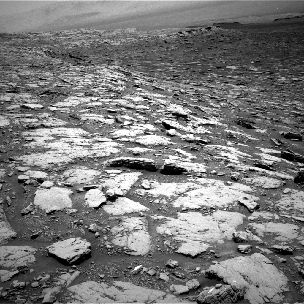
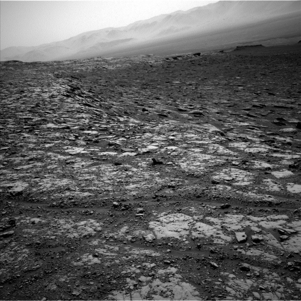
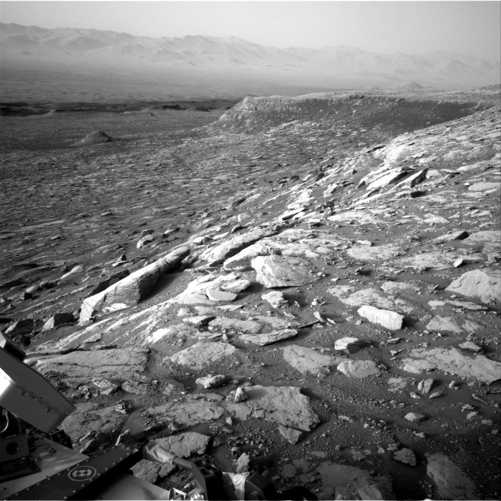
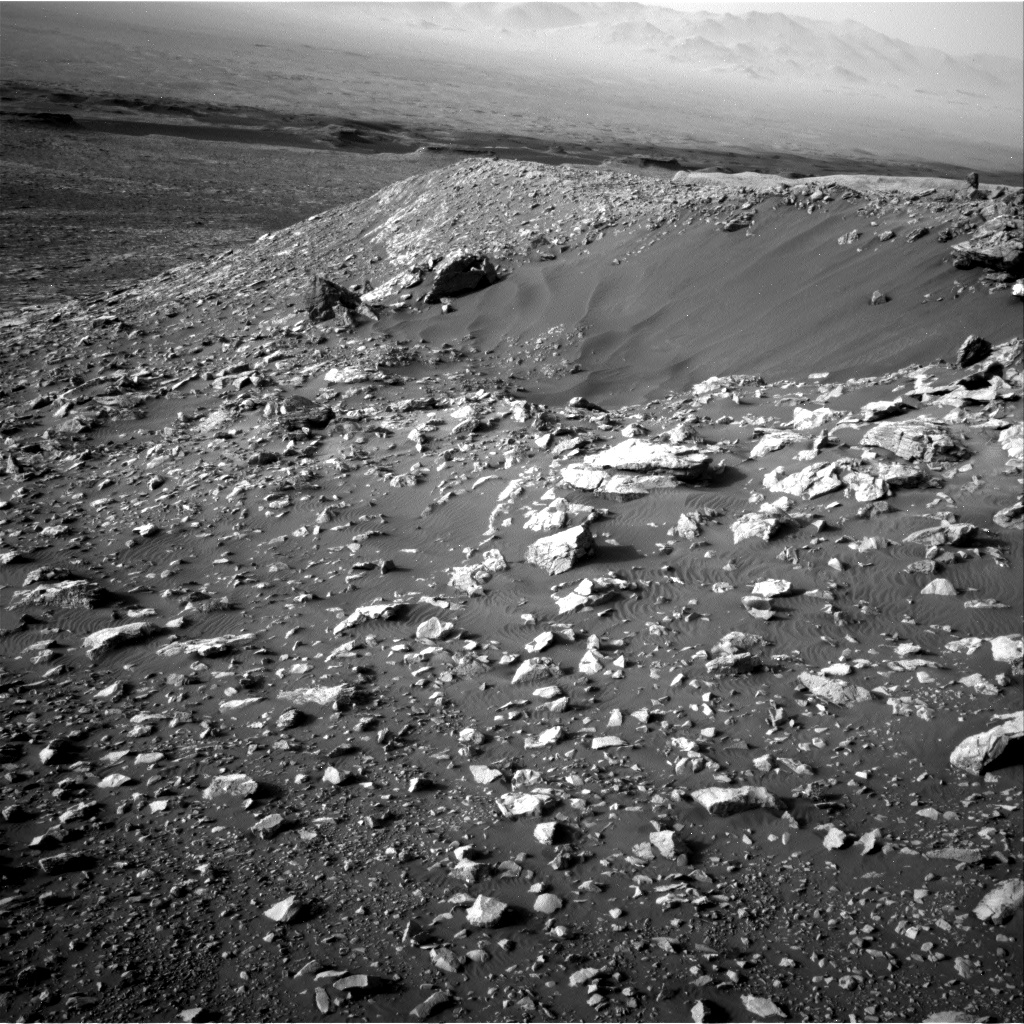
Curiosity is continuing her march to the north and west, descending through the stratigraphic layers exposed in Vera Rubin Ridge and working her way back towards the unit known as the Blunts Point member, just below the ridge. Curiosity will continue her investigation of each of these stratigraphic layers, filling in all of the details necessary to interpret the geologic history of this region.

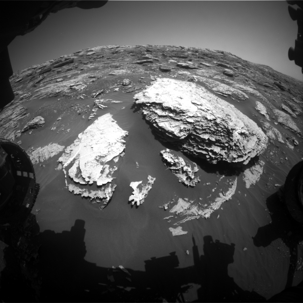
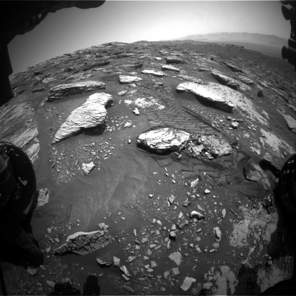
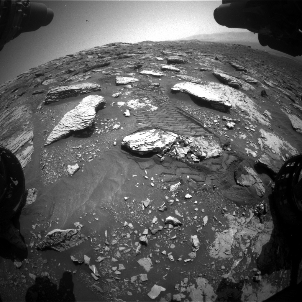
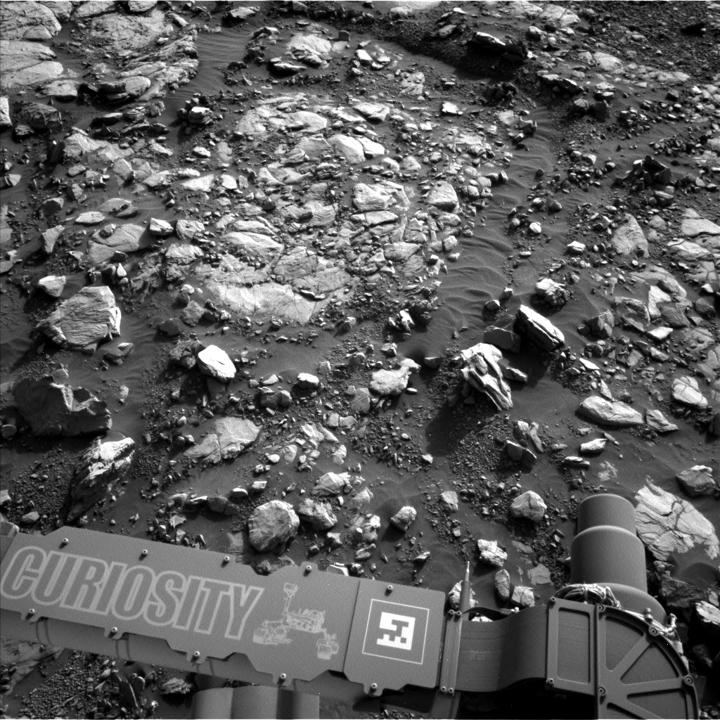
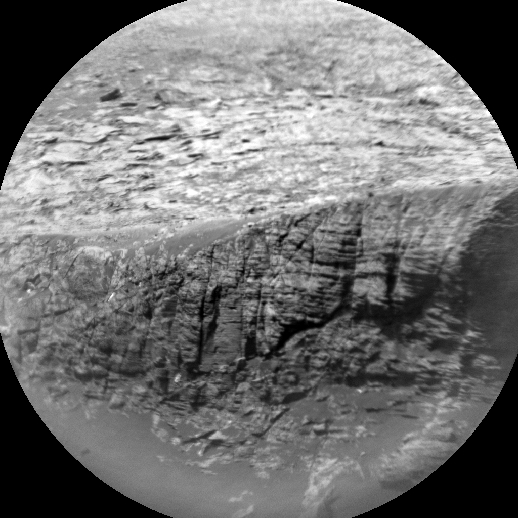
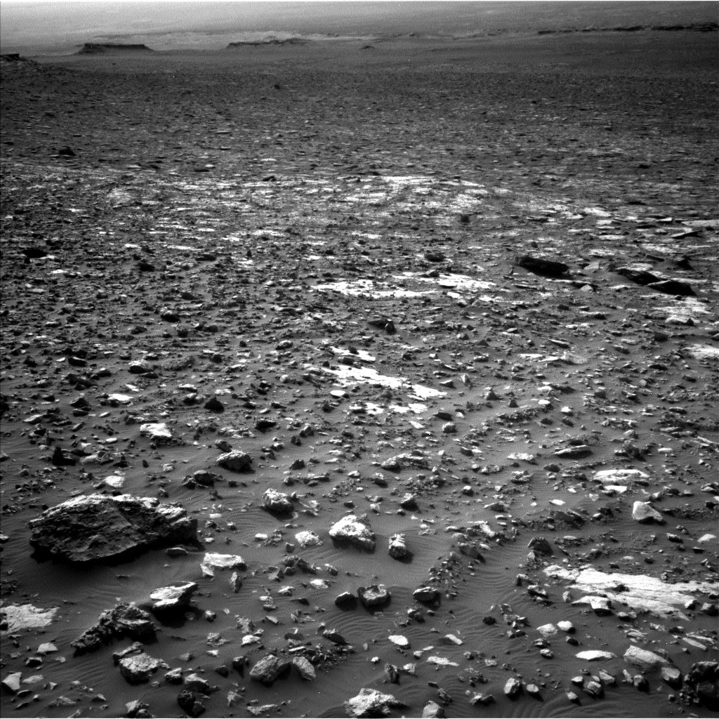
Until then, the science team is keeping Curiosity busy with additional measurements to better interpret the local and regional geology. In today's two-sol plan, Curiosity will begin with a 1 hour and 40 minute science block dedicated to studying the exposed rocky material in front of the rover. The science block kicks off with ChemCam measurements of surface chemistry using the onboard laser and spectrometers. The targets include "Mesabi," a textured rock towards the left-front wheel, then "Wakemup Bay," which appears to be in-place bedrock, and finally "Midway," a long and narrow rock in front of the rover that has potentially been broken apart by the small impact crater (named "Taconite crater"), to the north of Curiosity. ChemCam's high resolution camera will then be used to image a rock on the western rim of Taconite crater (named "Logan") at very high resolution to see if it shows any interesting features associated with the impact cratering process itself. Mastcam will then be used to image the surrounding area, including all of the ChemCam targets that were analyzed. In addition, a multispectral image suite will be obtained of Taconite crater's nearby ejecta field, as a way to determine whether the composition of the ejecta blocks are at all variable, which may indicate that the subsurface geologic units differ in composition from those closer to the surface. Stay tuned!

Following this science block, Curiosity has a ~48 meter drive planned to the northwest, which would result in another 10 meters or so of decreased elevation as we near the Blunts Point member. Standard post-drive imaging activities will then occur, obtaining images of the landscape surrounding the rover for both scientific and engineering purposes, as well as a MARDI image of the terrain immediately below the rover's belly.

The next sol, Curiosity will use her automated targeting capabilities to retrieve chemistry measurements of a nearby bedrock target. Following a nap and a quick chat with one of the Mars orbiters, Curiosity will then have one additional science block that is dedicated to environmental monitoring, including measuring the atmospheric dust concentration and searching for dust devils. This will then bring us to Friday, when the science team will plan for a weekend of activities and a drive that will have Curiosity once again head downhill.

At this location in Gale crater, the team is naming targets after locations in northeastern Minnesota. The names chosen today are perfect to use while we're still on Vera Rubin Ridge, as the Mesabi Range is part of Minnesota's Iron Range, a series of Precambrian (i.e., old!) sedimentary units that are enriched in iron. These areas were heavily mined in the early 1900s, and were an important part of Minnesota's economy at this time. Currently, this area is still being mined for low-grade iron ore known as "taconite" (hence Taconite crater!), a sedimentary rock with significant amounts of iron and other mineral phases. Kudos to today's science team for the relevant names!