May 30, 2018

Sol 2067: 'Tis the Season to be Dusty.

Written by Claire Newman, Atmospheric Scientist at Aeolis Research
Sol 2067: 'Tis the Season to be Dusty.

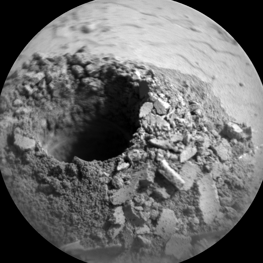
The previous plan included some tests of the sample delivery system, including delivery of a single portion to the closed cover of the SAM inlet. The imaging showed a small amount made it, but not as much as we'd hoped. So the team decided to postpone CheMin sample delivery until tomorrow's plan, leaving us even more time for science activities in today's single sol plan for Sol 2067.

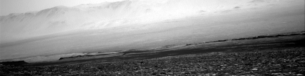
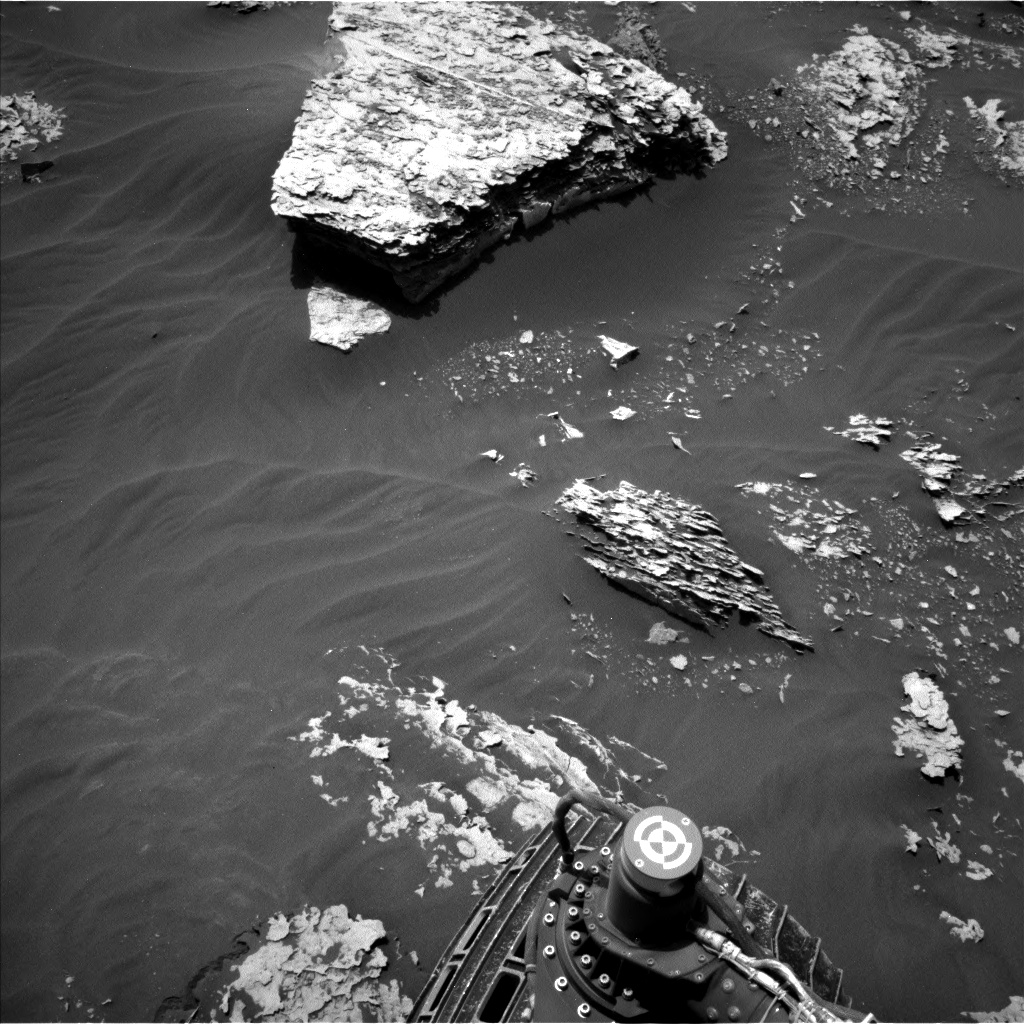
The environmental theme group seized the opportunity to take a long 'dust devil search' movie pointed roughly to the northwest, where we currently have a beautiful view back down the slope of Aeolis Mons toward the Bagnold Dunes, and all the way across Gale Crater's floor to the northwest rim (as shown in this Navcam image from Sol 2060). We've just moved past southern spring equinox, which means we're now in the half of the Mars year when global dust storms are observed to begin. However, the increased surface heating as we head for the warmest time of year should also produce a peak in convective activity and hence in dust-filled vortices known as dust devils. We've already seen a lot this Mars year in our location higher up the slope, so we're hoping for a bumper crop in spring and summer! The ENV theme group also added a long 360° dust devil survey and cloud movie as well as the usual REMS and DAN activities.

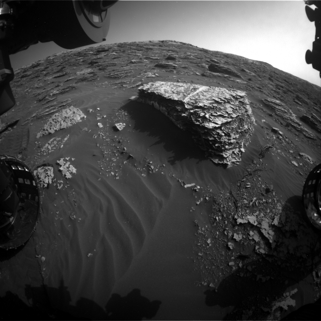
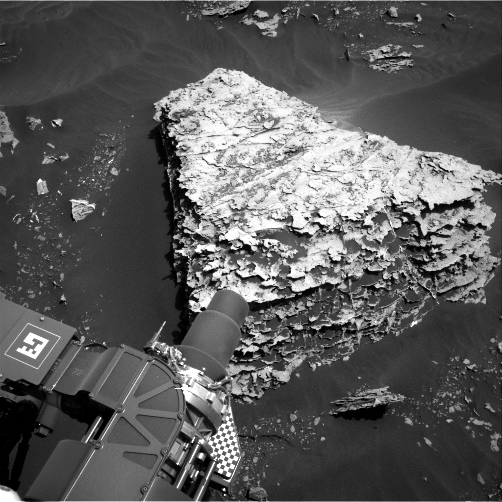
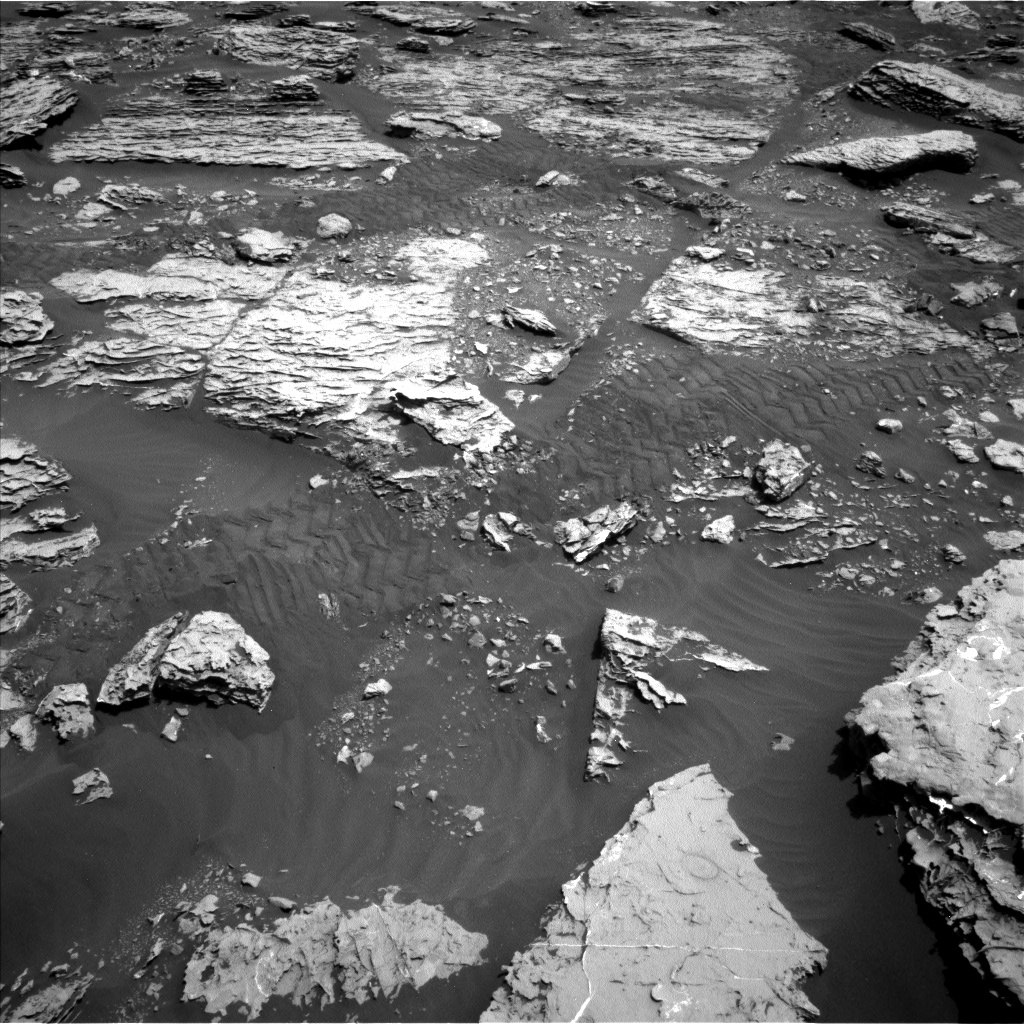
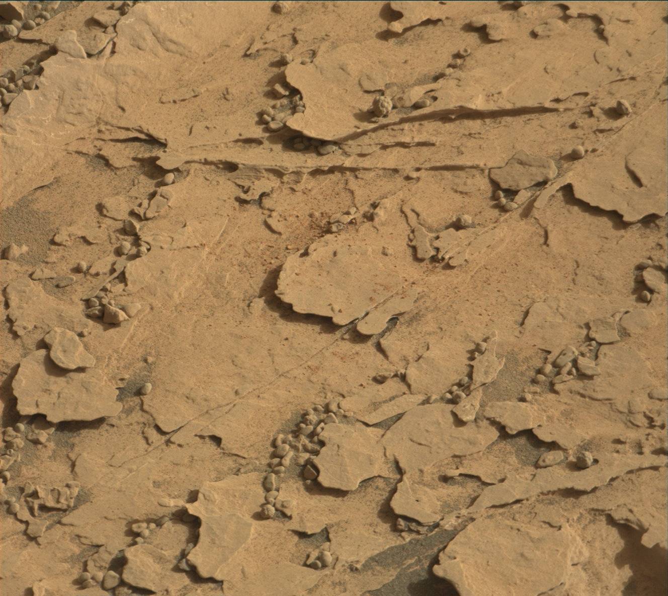
On the geology side, following our haul of change detection images over the weekend, we continued to look for surface changes on the Duluth drill tailings and on target "Noodle Lake" that has loose material sitting on the bedrock. The purpose of these experiments is to help us figure out the wind direction and its relative strength at this location, which may help to explain some of the sampling issues (e.g. if the sample is being blown away as it drops). ChemCam also made measurements on "Sawtooth Bluff," a gray, thin alteration layer raised above the bedrock surface, repeating measurements made previously on the nearby "Grand Marais" target, and on "Gary," a raised ridge feature, as well as taking two long-distance RMI images of the "Red Cliff" target as part of an engineering test.

May 25, 2018

Sol 2063-2066: Sample drop-off testing

Written by Kenneth Herkenhoff, Planetary Geologist at USGS Astrogeology Science Center
Sol 2063-2066: Sample drop-off testing

Some of the Duluth drill sample was dropped into CheMin on Sol 2061, but not enough for a proper mineralogical analysis. So the top priority for today's plan is to again test the new drop-off procedure. Since the drill feed mechanism became unreliable over a year ago, drill samples can no longer be sieved and processed in CHIMRA, as they were earlier in the mission. Instead, portions of the sample must be dropped from the tip of the drill directly into the analytical instruments. This new Feed-Extended Sample Transfer (FEST) procedure will be repeated on Sol 2064, over bedrock and over the closed SAM inlet cover. Mastcam images will be taken both before and after the drop-off in both locations, to allow the size of the sample portion to be estimated. The results of these tests will be used to inform future drop-off planning.

We're planning 4 sols today so that the tactical operations team can take a day off for the Memorial Day holiday. More change detection observations are scattered throughout the plan, with Right Mastcam images of dark sand ripples at "Noodle Lake" and the Duluth drill tailings on Sol 2063 at 11:00, 15:00 and 17:00, on Sol 2064 at 7:00 and noon, and on Sol 2065 at 7:00, ~11:00, noon, and 15:00. The goal of these observations is to constrain the frequency of wind gusts that are strong enough to move loose material. The Rover Planners also requested multiple Right Mastcam images of the sample drop-off location on nearby bedrock for the same purpose; these are scheduled in the afternoons of Sols 2063, 2065, and 2066. ChemCam will also be busy this weekend, measuring the chemistry of a bumpy bedrock target named "Brule Mountain" and layered bedrock targets "Devil Track" and "Devilfish Tower" on Sol 2063. The latter two targets will be captured in a single Right Mastcam image soon afterward. On Sol 2064, ChemCam will observe some pebbles dubbed "Paupores" and Right Mastcam will acquire a single image covering both Brule Mountain and Paupores. Early on Sol 2065, Mastcam and Navcam will measure the amount of dust in the atmosphere, and Navcam will search for clouds. Later that morning, Right Mastcam will take a picture of a nearby bedrock block dubbed "Deerwood." In the afternoon, Mastcam will image the Sun and sky to measure the scattering properties and size distribution of dust in the atmosphere over Gale Crater, with supporting Navcam imaging.

May 23, 2018

Sol 2059-2060: Characterizing a Successful Drill!

Written by Mark Salvatore, Planetary Geologist at University of Michigan
Sol 2059-2060: Characterizing a Successful Drill!

This past weekend, Curiosity successfully drilled into the "Duluth" rock target, generating a beautiful pile of drill tailings! This is a very exciting time for us on the rover team, who have been waiting for quite a while to successfully drill into a target and to ingest samples into the rover's analytical instruments. Before we are able to use all of our instruments, however, we must first characterize the nature of the materials that were collected during the drill activities. So, on Monday, the science team planned for the characterization of three small portions of the collected sample that were to be dropped onto the surface in front of us so that we could image these materials at high resolution. While these efforts were not primarily driven by science (the rover engineers were more interested in the nature of the sample and whether there would be any difficulties in delivering the sample to Curiosity's instruments), the science team didn't dare miss an opportunity to make some cool measurements of the new materials in front of us!

First up in Monday's plan was multispectral imaging of the drill target and some regular visible imaging of a small patch of sand ripples named "Esko." The drill target observation was requested to help determine how the interior of the Duluth target differs from its surface, while the imaging of Esko was used to see if there is any motion of the Esko ripples over time. ChemCam was then used to passively image the drill hole, and then to actively characterize the chemistry of the drill hole and drill tailings using its laser instrument. Mastcam and ChemCam imaging capabilities were also used to acquire high-resolution images of the small test portions throughout the plan. The next day's science plan had two Mastcam observations - one of the small portions and one of the Esko ripples - both of which were designed to identify whether the wind had modified these surfaces at all. Environmental measurements were also made on the second day to search for both cloud motion and dust devils.

We're all very excited to continue on with drill activities and to make some long awaited measurements. Stay tuned for more updates as the week progresses!

May 23, 2018

Sols 2061-2062: Time to feed CheMin

Written by Lauren Edgar, Planetary Geologist at USGS Astrogeology Science Center
Sols 2061-2062: Time to feed CheMin

After successfully drilling the "Duluth" target on Sol 2057 (as seen in the above Mastcam image), the science team is eager to find out what it's made of. As SOWG Chair today, it was exciting to plan the drop-off of material to CheMin and overnight CheMin analysis. Hopefully we'll get some good data about the mineralogy of this sample!

In addition to the CheMin activities, the team planned another ChemCam observation of the "Duluth" drill hole, and nearby bedrock and vein targets named "Prosit" and "Grand Marais." On Monday we delivered three portions of the drill material to a nearby rock surface, and in today's plan we're monitoring those piles to see if any of the fines are moving in the wind. We'll also check for changes in a sandy ripple named "Esko." Both change detection observations will be repeated on the second sol, along with a Mastcam mosaic to provide more context for this drill location. The environmental theme group also planned a couple of Navcam dust devil observations, a Mastcam tau, and a Mastcam crater rim extinction activity to monitor dust in the atmosphere.

Looking forward to finding out what this rock is made of!

May 21, 2018

Sols 2056-2058: Poised

Written by Michelle Minitti, Planetary Geologist at Framework
Sols 2056-2058:  Poised

This weekend, Curiosity will attempt to sink the drill into the complexly-layered "Duluth" block. Before that, she will gather more data from the "Blunts Point" member rocks in front of and around us. The Duluth target, neatly cleared of dust by the DRT in yesterday's plan, will be observed by ChemCam's passive mode and Mastcam's multispectral mode to gauge what iron mineralogy was hiding beneath the target's thin veneer of dust. ChemCam will shoot three targets to learn more about the chemistry of the layers within the Duluth block and similar blocks around it. Within the Duluth block, ChemCam will target "Chisholm," the delicate layer curling up above the top of the Duluth block, and "Aitkin," another layer jutting out from the side of the block. The "Buhl" target sits off to the rover's right and represents another example of the Blunts Point member for ChemCam to sample. Mastcam will then image two large blocks dubbed "Kabetogama" to learn more about the intricate layering of the Blunts Point member. Before drilling, Curiosity will also give the sky some attention. Images and movies acquired in the early morning will measure dust and look for clouds, while images and movies at mid-day will measure dust and look for dust devils. REMS and RAD will gather data regularly as the weekend progresses.

The second sol is the centerpiece of the plan, when we attempt to sink the drill into the Duluth block. Before drilling, MAHLI will capture "before" images of the drill target, and MAHLI and Mastcam will image the areas where different portions of a drill sample could be dumped both before and after sample delivery to SAM and CheMin. Then, drilling commences. Once the drill hole is created, ChemCam will image the hole with its RMI to set up for shooting the laser down the drill hole in subsequent sols, and Mastcam and Navcam will image the post-drill workspace.

The engineers have worked incredibly hard to invent a new way to use the drill, as highlighted in this recent story. Their ability to work around the problem from afar and give us another chance at drilling is very much in the spirit of NASA's engineers designing fixes to the systems of Apollo 13 as the spacecraft hurtled, crippled, to the Moon. Although the stakes are different for MSL, the ingenuity is the same. The science team has been wondering what minerals might be responsible for the layers, veins and nodules in the Blunts Point rocks. A successful drill will mark the first step in answering that mystery. Suffice it to say, the whole MSL team - scientists and engineers - will be waiting with bated breath for the data that reveal if the drilling was successful. Success will feel very much like *finally* getting to open that shiny birthday present after a long, enticing wait!

Good luck, Curiosity!

May 18, 2018

Sol 2055: Drill Site Perspectives from a Duluth Native

Written by Roger Wiens, ChemCam PI
Sol 2055: Drill Site Perspectives from a Duluth Native

I was excited to learn earlier this week that my native city was chosen as the name of the latest drill site on Mars! The name was selected by geologists on the mission to recognize the Duluth Complex, one of the largest intrusions of gabbro on Earth, along the north shore of Lake Superior. But, as the team likes one-word names, we are just calling the drill site "Duluth." The name was almost changed yesterday when it was realized that "Duluth" was already used for a ChemCam target on Sol 292. Normally we don't use names more than once, but the team decided an exception was warranted.

Duluth, my birth city, was at one time the busiest port in the United States in terms of gross tonnage, surpassing even New York for a while. It is still considered the largest freshwater port in the world even though it is one of the farthest inland, at 3770 km from the Atlantic Ocean. Duluth has one of the coolest climates in the US due to its proximity to the world's largest and one of the deepest freshwater lakes. The drill target "Duluth" on Mars was also once near the shore of a large freshwater lake. Its climate is also relatively cool, so the name is apropos.

The Curiosity rover is commencing its drill sequence with a full suite of contact science characterizations today. It will start with a touch of the target by the arm just off to the side of the planned drill site (documented by Hazcam and Navcam), then an APXS observation and then MAHLI observations of the "Duluth" target at 25 cm. After that there will be a pre-load drill test, which will be documented by the imagers. MAHLI will image the site at 35 cm along with imaging the location where the arm did its touch. The Dust Removal Tool (DRT) will brush the target, after which Mastcam will inspect the brush and the brushed surface, and MAHLI will document the brushed target at 25, 5, and 1-2 cm distances. The 5 cm distance will support a stereo pair of images. APXS will be placed for an overnight observation of the target. Navcam and Hazcam will document most of the arm instrument positions over the course of the day. Mastcam will take a Phobos transit video near sunset. RAD, REMS, and DAN will monitor the environment in the background. If all goes well, the uplink team will work on the drilling commands tomorrow.

May 16, 2018

Planning Sol 2054: Duluth at our feet... er, wheels

Written by Abigail Fraeman, Planetary Geologist at NASA's Jet Propulsion Laboratory
Planning Sol 2054: Duluth at our feet... er, wheels

Our sol 2054 plan was limited by a small morning downlink. Occasionally, the flight paths of the Mars orbiters over Gale Crater don't have favorable geometries for relays with Curiosity, and this means our data downlink passes are smaller than average. Today we received only 1.6 MB (Megabytes) of data at the start of our planning day. This was just enough to tell us the drive executed successfully and the rover was healthy, but not enough to include any new images from our current spot. We did get another (also small) downlink several hours into planning, which gave us the first view of our drill target smack in the middle of our workspace - a rock we are calling "Duluth."

Since we didn't have images available at the start of the planning day to choose science targets, we will spend most of sol 2054 completing "untargeted" activities. We will collect data from the ChemCam calibration target, take pictures of the sky with MAHLI (sky flats), snap a photo of the rover deck with Mastcam, and squeeze in one LIBS target that will be chosen autonomously by the rover using the AEGIS software. We will also make observations to characterize our environment and the dust in the atmosphere, including a Mastcam tau observation and images of the crater rim, and Navcam images of the sky and horizon.

We will also image Mars' moon Phobos passing in front of the sun around 8:30 in morning of sol 2055, before we handover to the new plan. We've taken Phobos transit images several times before (i.e. https://mars.nasa.gov/resources/4805/phobos-transit-viewed-by-opportunity-on-sol-3078/), and these data help us better constrain the orbit of this small, potato shaped moon.

May 15, 2018

Sol 2053: Bump to "Duluth"

Written by Rachel Kronyak, Planetary Geologist at NASA's Jet Propulsion Laboratory
Sol 2053: Bump to "Duluth"

A successful drive on Sol 2052 brought Curiosity within bumping distance of what will likely be our next intended drill target. The science team named this target "Duluth." Duluth is a beautifully exposed Murray formation block visible in the Navcam image above. From our current location, we have a really nice vantage point of both the top and sides of the Duluth block. Analyzing blocks that have this kind of 3-D expression gives us a great opportunity to assess the full architecture of the rock.

Today we planned Sol 2053, which includes a science block prior to our bump. In the science block, we'll acquire several ChemCam LIBS rasters on targets "Pine Mountain" and "Windigo," both of which are located on the Duluth block. We'll also take some Mastcam images of Duluth to document the ChemCam observations and to provide some additional context on the vertically exposed sides of the block.

ENV has a couple of observations in the plan as well, including DAN measurements and a dust devil survey with Navcam. After our bump, we'll take some post-drive images to set up for an exciting drilling campaign over the next several sols!

May 14, 2018

Sol 2052: We've Been Here Before

Written by Scott Guzewich, Atmospheric Scientist at NASA's Goddard Space Flight Center
Sol 2052: We've Been Here Before

We expected to start planning today examining a new location within arm's reach (or a very short drive's reach) of a possible location for our next drilling attempt, but instead found images like this. Rather than driving almost 11 meters, Curiosity only drove about 1/2 meter before stopping. So, we found ourselves looking at images of previous wheel tracks and contact science targets rather than a new location.

The priority for today was therefore to recover that drive, which left plenty of time for some additional targeted and untargeted science. This included ChemCam LIBS rasters of "Brownell" and "Mahtowa", additional Mastcam images of "Munger" and "Itasca", and a Navcam dust devil movie. Following the drive, Curiosity will conduct a ChemCam AEGIS activity and a longer version of a Navcam dust devil movie. We often schedule dust devil movies closer to midday, when dust devils are more common, but it's important to also observe at other times of day to understand their frequency and patterns.

May 11, 2018

Sols 2049-2051: Onward and northward

Written by Lauren Edgar, Planetary Geologist at USGS Astrogeology Science Center
Sols 2049-2051: Onward and northward

Curiosity is currently investigating the Blunts Point member of the Murray formation, and searching for a suitable location to drill in the near future. I was the SOWG Chair today, and we put together a busy weekend plan focused on wrapping up contact science at our current location and driving further north into the Blunts point member.

The plan starts with a ChemCam water adsorption experiment to look for seasonal variations in hydrogen in the soil at different times of day. On the first sol we also planned some juicy contact science: a MAHLI "dogs eye" image looking edge-on at the "Culver" target (seen in the above Mastcam image) to assess the relationship between veins and bedding, followed by DRT, MAHLI, and APXS on typical bedrock at the "Floodwood" target, and additional MAHLI and APXS on the "Carleton" target to look for variations in chemistry. Just as Curiosity wraps up the overnight APXS integration on "Floodwood," we'll put her back to work with another early morning ChemCam water adsorption observation. Around midday on the second sol we'll take several Mastcam multispectral images to document the Sols 2048-2049 DRT targets, along with a ChemCam passive sky observation and documentation images of the ChemCam targets. We'll also acquire ChemCam LIBS on the target "Mountain Iron" to assess the composition of dark nodules. The third sol is focused on a ~10 m drive to the north and post-drive imaging to prepare for contact science or bumping to a drill location next week. We were a bit tight on data volume in this plan due to some small downlink volumes lately, but hopefully by keeping our data appetite in check we'll be in good shape for the exciting activities coming up soon!