April 2, 2019

Sols 2365-2366: Edging closer and closer to a new drill target!

Written by Catherine O'Connell-Cooper, Planetary Geologist at University of New Brunswick
Sols 2365-2366: Edging closer and closer to a new drill target!

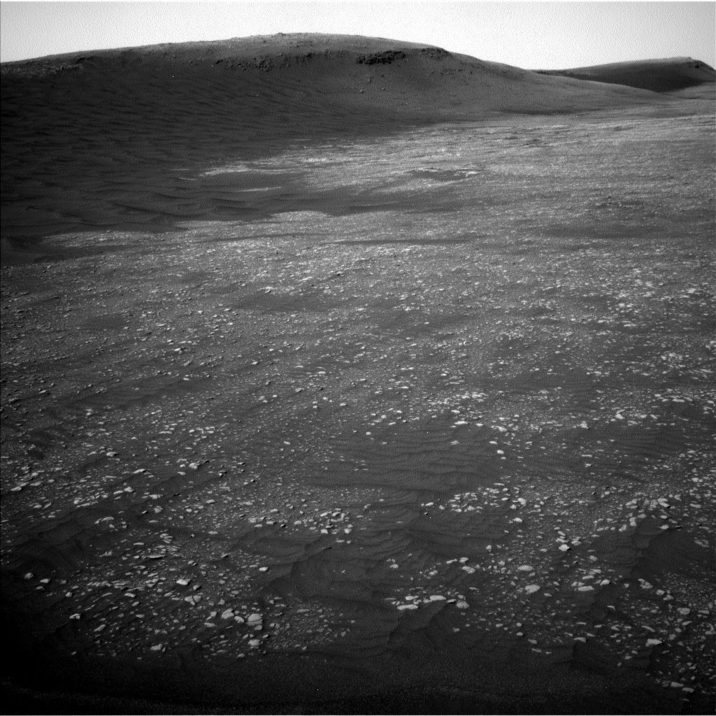
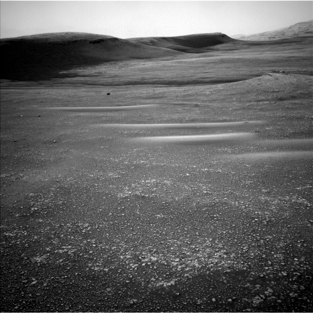
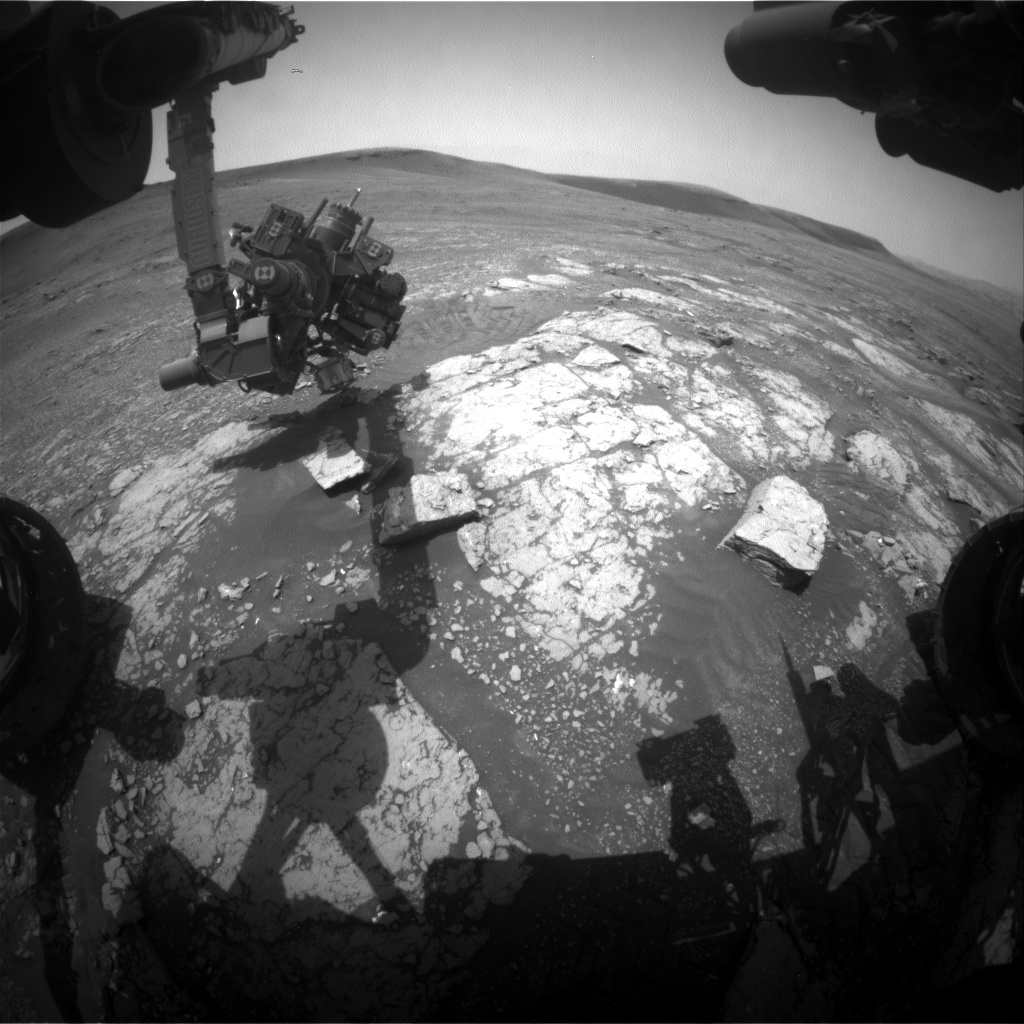
Navcam of the current workspace, with the potential drill site towards the back of the bedrock outcrop.

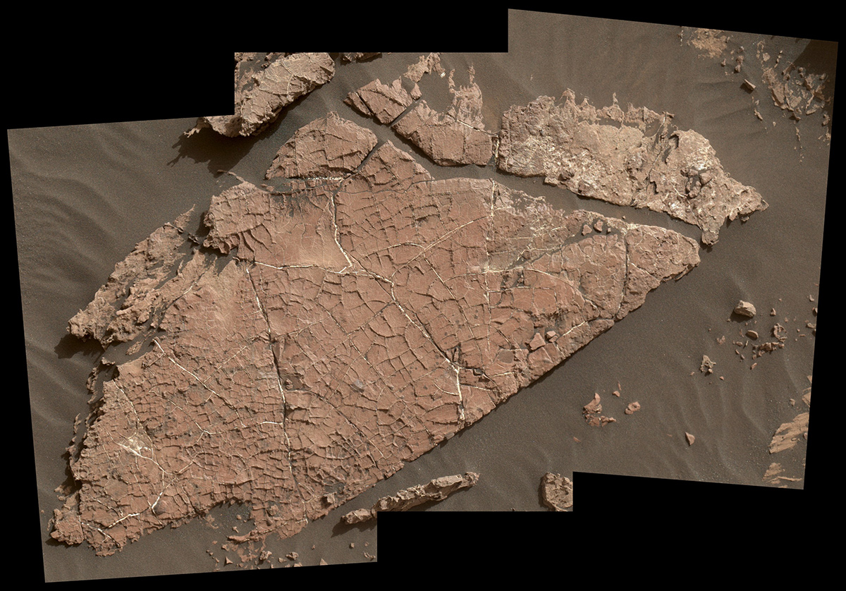
One of the primary goals of the Curiosity mission, to determine the composition of a region which appears to be rich in clays (informally known as "Glen Torridon") is getting closer to being achieved. Our weekend drive was designed to bring us to an area of flat-lying bedrock, which we had hoped might contain a drillable surface. At the start of planning, we were very excited to see a larger, flat slab of bedrock towards the back of this outcrop, so we decided to maneuver around to that end of the outcrop, so that we can assess the suitability of this rock as a drill target.

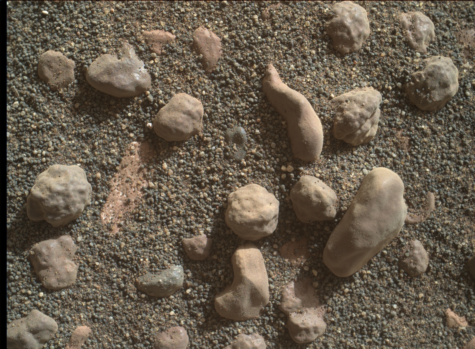
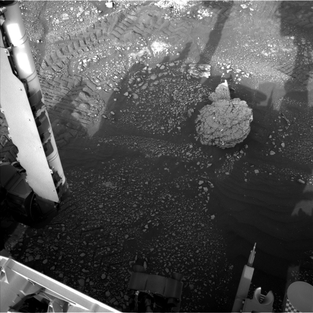
First, we will categorize the composition of the bedrock from the position that we are in. APXS will analyze "Longannet" to ensure that we are still within our desired compositional range, and MAHLI will image this target, for comparison to previous targets. ChemCam will analyze a comparable target called "Tartan." Mastcam will image Tartan and "Lumphanan," which may be a fragment of an iron meteorite.

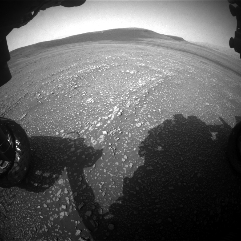
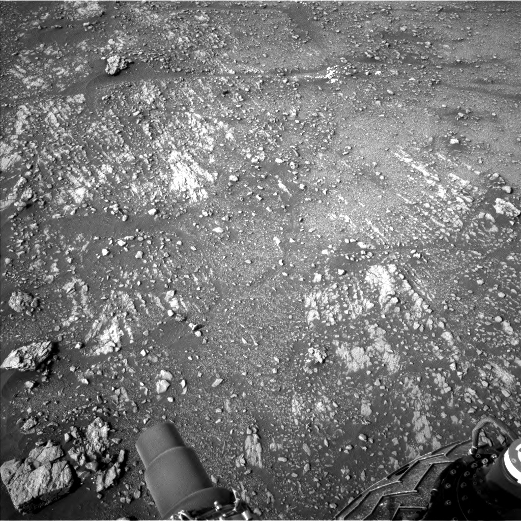
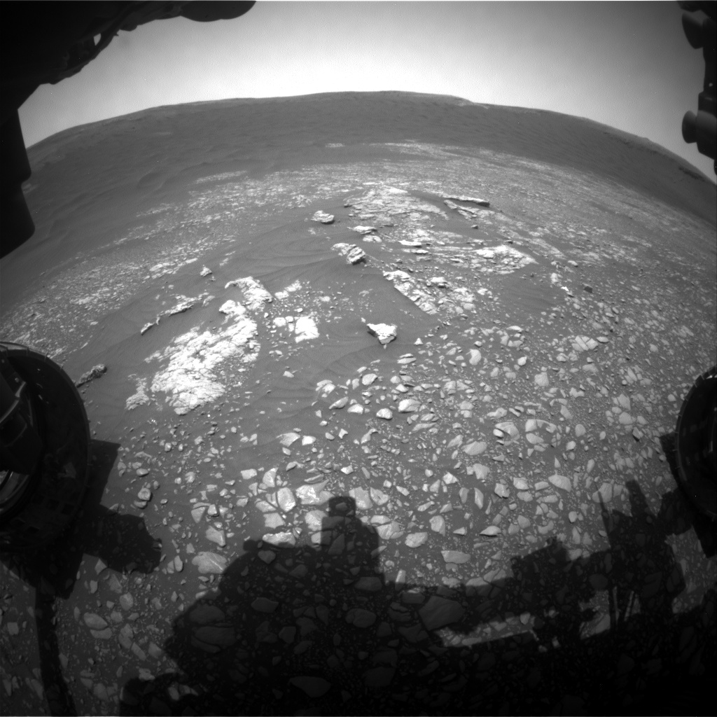
We then make a short drive (<15 meters) to the other side of this outcrop and take Mastcam imaging of the potential drill site. This will allow the engineers and rover planners at JPL to examine the bedrock in more detail and assess its suitability for drilling (for example, looking at rock coherency, presence of veins, homogeneity of the surface). These images will be downlinked ahead of the start of planning on Wednesday, so that we can make an informed decision. A key activity in this two-sol plan will be to clean the gas column in the "Sample Analysis at Mars" instrument (SAM), in advance of drilling and analyzing a new target.

The Environmental Theme group (ENV) planned activities to continue the monitoring of environmental conditions. The Navcam will take a suprahorizon movie, looking southward at clouds and variations in the atmosphere, and a dust devil survey, which gives information on winds and air currents near the surface of the planet. We will also have the usual complement of REMS, RAD and DAN actitivies, continuing their comprehensive monitoring of weather conditions and radiation levels in Gale crater.

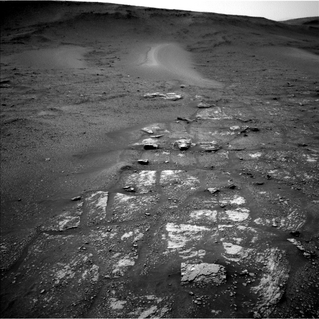
Although our focus right now is on finding a drill site, we are always looking into the future too, trying refine our future drive directions. As part of this process, Mastcam will take images to document the path forward, looking at an area where we can see some coherent blocks of bedrock eroding off a resistant clay unit ridge, known as "Teal." This will aid the planning groups to identify areas of higher scientific interest, and to determine our path once we leave this part of Glen Torridon.

April 1, 2019

Sols 2363-2364: Drilling on the horizon?

Written by Ashley Stroupe, Mission Operations Engineer at NASA's Jet Propulsion Laboratory
Sols 2363-2364: Drilling on the horizon?

Curiosity is getting close to the area in which we next want to drill. We are possibly as close as 2-3 drives (including today's) away from our next drill target! But before heading off, we are taking a lot of imaging with ChemCam and Mastcam of the local features - including some close-by small sand ripples and some of the pebbles in our workspace in order to help understand the relationship. We are also doing contact science with MAHLI and APXS on two small targets, Maud and Ardnamurchan; Maud will be partially "cleaned" by ChemCam so APXS might have a better view despite the target being too small to brush. We also continue our atmospheric studies, as we seem to be in a fairly windy period, including a dust devil movie and a tau measurement.

On the second sol of our plan, Curiosity will drive past a nearby patch of sand ripples, shown in the attached image, where she will stop for mid-drive imaging. We planned a dive of about 30m to a promising bedrock target on the other side of the sandy patch. Visual Odometry, to track our slip while driving, continues to be challenging due to the relatively featureless terrain, but the Rover Planners continue to improve their ability to find pointing that performs well. At the end of this drive, we hope to start being able to select candidate drill targets and start developing our path forward toward drilling.

March 28, 2019

Sol 2361 - 2362: Lots to explore in Glen Torridon

Written by Abigail Fraeman, Planetary Geologist at NASA's Jet Propulsion Laboratory
Sol 2361 - 2362: Lots to explore in Glen Torridon

We are continuing to find interesting new things in Glen Torridon. One of my favorite new images was taken this weekend (Mars sol 2356) on target "Stonebriggs" (pictured). We've seen round and smooth clasts before, but this area really stands out in how densely the clasts are packed together. Were these pebbles rounded by water during transport over a long distance?

NASA's Mars rover Curiosity acquired this image using its Mars Hand Lens Imager (MAHLI), located on the turret at the end of the rover's robotic arm, on September 4, 2017, Sol 1806 of the Mars Science Laboratory Mission.
Or are they wind polished concretions similar to what we saw back on sol 1806? Or something completely different? There is a lot to talk about within the science team!

Curiosity's workspace today looked more typical of what we've been seeing over the last few weeks. In today's plan, we will continue to drive towards an area we hope to drill. Before the drive on sol 2361, we will collect MAHLI and APXS data on a target named "Ardmillan," followed by ChemCam observations of Ardmillan, "Uyea," "Torry," and "Eorsa." We will also image nearby outcrops with apparent sedimentary structures named "Scolty Hill," "Midlothian," and "Dunans," as well as some sandy features named "Glamis." Finally, we take a full filter Mastcam observation of the nearby dark rock, "Eorsa," that we almost drove to last sol. On sol 2362, we will take a video of Phobos transiting the sun and a few ChemCam AEGIS observations.

This image was taken by Front Hazcam: Left B (FHAZ_LEFT_B) onboard NASA's Mars rover Curiosity on Sol 2359.

March 25, 2019

Sols 2359-2360: Hopping from outcrop to outcrop

Written by Vivian Sun, Planetary Geologist at NASA's Jet Propulsion Laboratory
Sols 2359-2360: Hopping from outcrop to outcrop

At the start of Sol 2359, Curiosity found herself parked in front of some layered bedrock outcrops (see above image), a rarity in the rubbly landscapes that we've explored so far in the clay-bearing unit. We were constrained by power in today's plan, but managed to make use of every available minute for science.

As part of our routine documentation of the chemical and textural variations in this region, APXS and MAHLI will be making observations of "Rutherglen" to measure composition and detailed texture. ChemCam will also measure the composition of "Woodland Bay," another bedrock exposure in the workspace. We will also take a couple of Mastcam mosaics - one of the entire workspace to get a better look at the outcrop layering and structure, and to bring color to the tonal variations in the Navcam images. Another Mastcam mosaic will be of "Goosander," an aeolian bedform that also shows tonal variations, visible at the top of the above image.

This image was taken by Navcam: Left B (NAV_LEFT_B) onboard NASA's Mars rover Curiosity on Sol 2357 (2019-03-24 23:24:07 UTC).

We also discussed where to drive next. One tempting option was to drive to a lone float rock (the dark rock near the middle of this image). We wondered what could this be - a meteorite, or a remnant of a higher, eroded unit? Another option was to drive to a nearby area that seems to contain subtle ridges (visible just to the left of the float rock in the same image). Given the prevalence of ridges and similar features in the clay-bearing unit, we decided that it was important to drive to the ridges and set ourselves up for contact science on these features. From our future location, we will also have the opportunity to image that float rock as well as a nearby butte (visible to the right of this image). To facilitate these future observations, we added a post-drive Mastcam workspace mosaic so that we will have color imagery to assist in targeting in the next plan.

Finally, after an approximately 30 meter drive to the small ridges, Curiosity will make observations of the Phobos transit and a Mastcam tau, followed by ChemCam AEGIS observations, which are designed to autonomously shoot ChemCam targets after driving to a new location.

March 23, 2019

Sol 2354-2358: Clay-bearing unit showing us its stripes?

Written by Michelle Minitti, Planetary Geologist at Framework
Sol 2354-2358: Clay-bearing unit showing us its stripes?

As Curiosity makes her way to the site where the science team would like to drill next, there is no shortage of observations to make of the many different lithologies of the clay-bearing unit. On Sol 2354, we were greeted with a pebble-dominated workspace, and had the opportunity for a quick contact science analysis with MAHLI and APXS before driving on. However, the rover wake up time was late enough in the morning that the temperature would have been a bit too warm for APXS to yield its best data. While it is ideal for MAHLI and APXS to work together, the team still thought it valuable to acquire MAHLI images of pebbles (the target "Gigha," a collection of red-and-gray rock fragments of various shapes ranging from ~1-4 cm in size) in the workspace to investigate their texture and grain size at the sub-millimeter scale. ChemCam also got in on the pebble act, targeting "Greenvoe." ChemCam also acquired a raster from a slightly larger target, "Greenock," a bedrock patch peeking through the pebbles. The "Vera Rubin Ridge," our exploration home for so many months, looms north above us on this part of our traverse, offering vertical faces of outcrop that make inviting imaging targets. We acquired a large stereo Mastcam mosaic and a ChemCam RMI mosaic of some prominent Vera Rubin Ridge outcrops, which help us document the structure that makes up the ridge and hopefully provide insight into how the ridge formed. To measure the bedding structure of outcrops in the clay-bearing unit itself, we acquired Mastcam stereo of closer, smaller bedrock outcrops called "Bellyford Burn."

After departing Gigha, Greenock and Greenvoe, Curiosity drove northeast in search of bedrock and to get slightly closer to the Vera Rubin Ridge. At our end-of-drive location, ahead of our weekend activities, we acquired three automatically-targeted ChemCam rasters, two in the workspace and one along the right side of the rover. Each will give us a great head start on assessing the chemistry of the materials around the rover. The Sol 2356 workspace indeed had more extensive bedrock patches than the Sol 2354 workspace, in addition to two types of pebbles. One pebble type was like those observed with Gigha, and the second was smaller, rounder and grayer - yet another variation observed within the clay-bearing unit! We put the payload to work on all the different lithologies facing us. MAHLI, APXS and ChemCam each took turns on the bedrock target "Snorre," which will surely be anything but boring. MAHLI and APXS will conduct their own variation of a raster - three overlapping analysis spots over a field of the smaller, grayer pebbles called "Stonebriggs." Such a raster helps APXS separate the chemistry of the pebbles from the background soil. ChemCam will get their own raster over both gray and Gigha-like pebbles at the target "Cairnwell." Outside the workspace, along the right side of the rover and extending for meters ahead of the rover we observed small, parallel, narrow ridges of bedrock (image above). Further from the rover, yet more bedrock was present, but which appeared in larger, flatter patches. These two contrasting bedrock manifestations drew the attention of the team, earning stereo Mastcam mosaics over "Flodigarry" (the ridges) and "Dumfries" (the flatter patches). Flodigarry was close enough that we could also target it with ChemCam, a chemistry measurement that can be compared and contrasted to the rest of the materials around the rover. The Vera Rubin Ridge still proved to be a target of interest as the science team targeted yet another ChemCam RMI mosaic on a vertical outcrop face near the one imaged on Sol 2354. Once all these activities are wrapped up, Curiosity will drive east and ever closer to our next drill target. Before and after drives, DAN will ping the subsurface over which the rover traverses, seeking signs of hydrogen.

Curiosity did not just stay focused on the clay-bearing unit and the Vera Rubin Ridge - the sky above also got a lot of attention! Mastcam and Navcam images and movies of atmospheric clarity, clouds and dust devils will be acquired at morning, late morning, afternoon and evening times so their behavior can be recorded at different times of day. Regular REMS and RAD measurements will faithfully record the weather and radiation environment of our small patch of the Martian surface. Even MAHLI and APXS will get in on the action! MAHLI will image the REMS UV sensor to record how much dust has settled on it, thereby affecting its measurements. APXS will measure the Ar content of the atmosphere. Finally, Navcam will attempt to capture Phobos, one of Mars's moons, transiting across the Sun in the Martian sky.

March 19, 2019

Sols 2352-2353: Why are we cracking up?

Written by Dawn Sumner, Planetary Geologist at University of California Davis
Sols 2352-2353: Why are we cracking up?

Possible Mud Cracks Preserved in Martian Rock
The network of cracks in this Martian rock slab called "Old Soaker" may have formed from the drying of a mud layer more than 3 billion years ago. The view spans about 3 feet (90 centimeters) left-to-right and combines three images taken by the MAHLI camera on the arm of NASA's Curiosity Mars rover.
Today was a fun, busy day to plan. Curiosity finally made the drive to a rock called "Muir of Ord," which has a cracked surface. The science team is particularly interested in imaging this rock up close because of the fracture patterns. Cracks like these can form from mud drying out when the original sediments were deposited or after exposure of the rock during weathering (see this rock from the Opportunity rover).
This three-dimensional view from the navigation camera on NASA's Mars Exploration Rover Opportunity shows an unusual, lumpy rock informally named "Wopmay" on the lower slopes of "Endurance Crater."
If the cracks on Muir of Ord formed when the sediment was first deposited, they tell us something about the depositional environment. If they formed during weathering, they tell us about processes on the slopes of Mount Sharp. Today, we planned observations to help determine which is more likely.

The science plan starts with contact science on the "Crieff" target, which is on the top surface of Muir of Ord. APXS will perform a short analysis to determine its elemental composition, and MAHLI will image it at progressively higher magnifications to allow us to study the crack shapes in detail. MAHLI will then image the side of Muir of Ord at a target called "Crossroads" to see how the cracks cross the layering in the rock. Once the contact science is complete, ChemCam will analyze Crieff with a 3x3 grid, and Mastcam will take a mosaic of Muir of Ord. ChemCam then analyzes the targets "James," "Kilmarnock," and "Crail" with Mastcam providing context images. Finally, we finish up the science at this spot with two more Mastcams of "Aldons Quarry" and "Small Isles."

But Curiosity is not done for the sol! The next activity is a ~30 meter drive with sequential MARDI images to document the large-scale fracture patterns in the outcrop. Once the drive is over, Curiosity will take typical post drive images, including both Navcam and Mastcam mosaics of the workspace and the future drive direction.

The second sol of our plan includes lots of environmental measurements. The morning activities consist of Mastcam imaging of the sun to characterize dust in the atmosphere, a Navcam movie above the horizon to study atmospheric dynamics, and a Navcam movie looking for dust devils. Afternoon activities include a zenith movie to image clouds and their motion, plus a second set of sun images. Geological activities include an AEGIS ChemCam analysis on a rover-selected target as well as a Mastcam 360° panorama. We are looking forward to interpreting all this great new data.

March 18, 2019

Sols 2349-2351: Capturing Deimos!

Written by Catherine O'Connell-Cooper, Planetary Geologist at University of New Brunswick

The Curiosity Operations team planned a 3-sol plan today, with lots of activities for both the Environmental (ENV) and Geology (GEO) theme groups. Top priority for ENV and Mastcam is to record a rare solar transit by Deimos (the smaller of the two martian moons) on sol 2350. This is similar to a lunar eclipse here on Earth; however, as Deimos is very small (radius of 6 km), it will not block out the Sun but appear as a dark spot on the solar disk. Although Curiosity has recorded 13 transits by Phobos (Mars' second moon) within the past six years, we have previously only captured one recording of Deimos crossing in front of the Sun, on sol 42.

GEO's main geological target today ("Caledonia") comprises three separate targets (1 cm apart) across a mixture of sand and pebbles, to help us determine the origin of the rubbly material found across this part of Gale crater. ChemCam will focus on a pebble here, APXS will analyze each of the three spots, and MAHLI will image each spot. Mastcam will take a multi-spectral image of the whole target to aid in interpreting the results. In addition, APXS will analyze a brushed bedrock target ("Arbuthnott") and ChemCam will examine some soil ("Buzzard") and an area of small pebbles ("Gardenstown"). Once we have finished investigating the geology of this location, we drive to a block of tilted rock, 12 metres away, called "Muir of Ord."

ENV also continues to measure the abundance and size of particles of water vapor, oxygen, water ice, and dust in the atmosphere (using ChemCam Passive Sky observations) and the optical depth of the atmosphere (Mastcam full tau observations). ENV also planned a "zenith" movie, which looks directly upwards to look at clouds and their direction of motion, and Navcam and Mastcam "dust devil" movies and surveys, to characterize these dust-filled convective vortices, which can give us information about surface heating, convection, and winds near the surface. There are also standard RAD, REMS and DAN activities. Finally, although APXS is normally used for geological observations, this weekend plan sees APXS used for environmental measurements too. As part of a long running experiment to measure argon fluctuations, APXS will analyze atmosphere while facing the sky overnight on sol 2350. Additionally, APXS will be recording mid-afternoon temperatures on sol 2351.

March 14, 2019

Sol 2347-2348: Ctrl+Alt+Del

Written by Scott Guzewich, Atmospheric Scientist at NASA's Goddard Space Flight Center
Sol 2347-2348:  Ctrl+Alt+Del

Curiosity is back to work after another hiatus due to a computer reset. These sorts of resets do happen from time to time for operating spacecraft and we're able to enjoy the benefit of two computers to operate the rover by switching to the other one when needed. As you'd expect, the view out of the front windshield hasn't changed much lately and the rover's arm is still poised over the bedrock target "Fife." We'll begin today's plan with an APXS integration on Fife before continuing to examine the nearby bedrock including a pebble called "Schiehallion." ChemCam and Mastcam will also both study some dune and ripple fields nearby called "Motherwell."

Our atmospheric monitoring is also behind schedule so today we'll try to make up for lost time with three measurements of atmospheric opacity in these next two sols, two searches for dust devils, and a Mastcam sky survey where we examine the properties of dust particles suspended in the air.

March 6, 2019

Sol 2340: And objects in the rear-view mirror may appear… interesting!

Written by Susanne Schwenzer, Planetary Geologist at The Open University
Sol 2340: And objects in the rear-view mirror may appear… interesting!

Image taken by the Left Rear Hazard Camera onboard NASA's Mars rover Curiosity on Sol 2338 (2019-03-05 10:16:29 UTC). This target has now been named "Muir of Ord."

In the current plan, we start with a dust devil survey to look for them while they are still in season. This is followed by a ChemCam investigation "Schiehallion" and an RMI mosaic on "Motherwell." Mastcam will finish off the investigation with multispectral images on the block in front of us, which contain the previous APXS targets "Fife" and "Arbuthnott." So far, so routine, but then there was the look in the rear-view mirror!

Finishing up at the "Midland Valley" outcrop also included the inspection of a wide range of new images. In those images the team discovered a block that allows a unique 3D view of the rocks in the area. As the rover stands at this moment, the rock of interest is just behind it, with the line of sight and ChemCam line of laser shot blocked by the rover itself. The question was, whether to proceed as planned and drive away from the site, or to turn the rover around and take the opportunity to observe this block from the top and the side. This way, we would gain a three-dimensional view of the layering as well as chemical information. This would be important information to investigate depositional conditions of those rocks, and thus help our understanding of the new environment of the clay-bearing unit, as part of which this rock was deposited. We decided to take the turn.

As a start, in today's plan, the rock was named "Muir of Ord" and - in an unusual manoeuvre only possible because of the very short and well understood drive to turn the rover around - Mastcam will be able to get multispectral imagery in the same sol. Chemical information and MAHLI will add to the investigations in the future. So, stay tuned!