January 13, 2021

Sols 3001-3002: Hold Up!

Written by Mark Salvatore, Planetary Geologist at University of Michigan
Black and white image of Mars

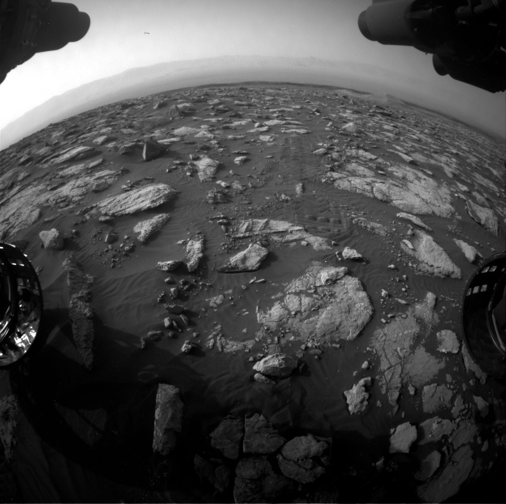
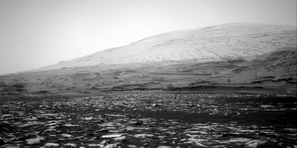
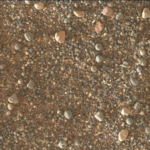
This image was taken by Front Hazard Avoidance Camera (Front Hazcam) onboard NASA's Mars rover Curiosity on Sol 2999. Credit: NASA/JPL-Caltech. Download image ›

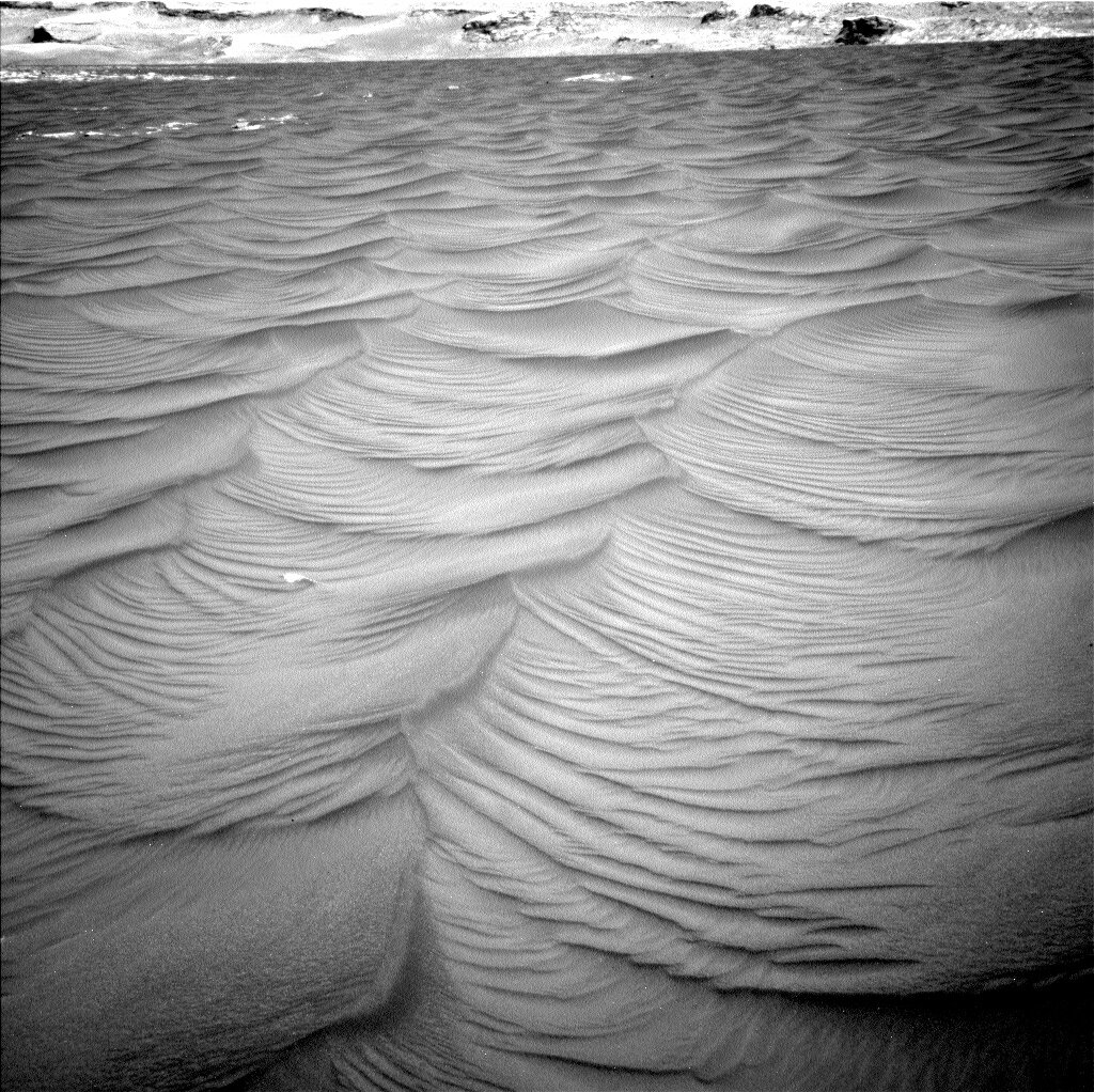
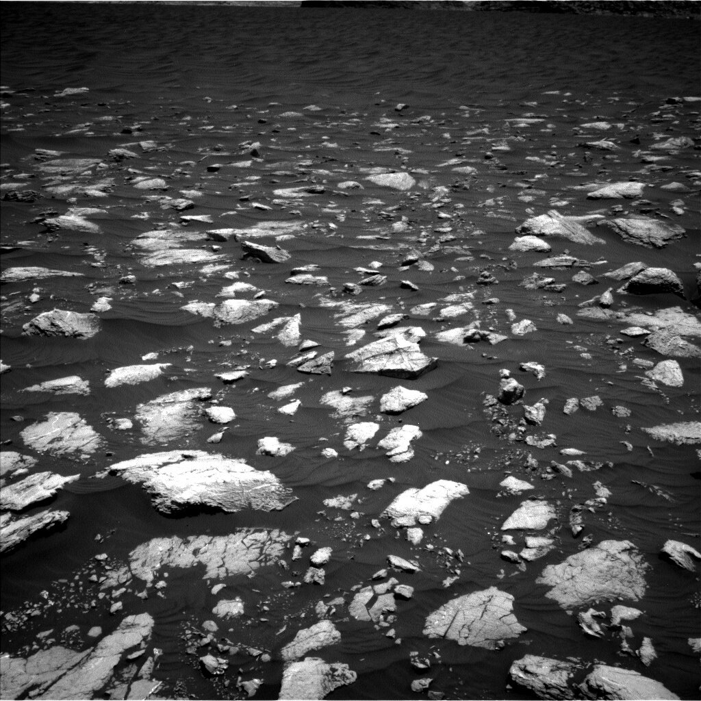
After each time Curiosity finishes a drive, the science team eagerly awaits the downlink of what is termed “post-drive imaging,” or PDI, to visualize our surroundings and to target areas of the surface for investigation. Sometimes, the expected PDI downlink is delayed, which can happen for a variety of fairly benign reasons related to hiccups in the communication pipeline (speaking with Mars can be challenging!). Today, unfortunately, was one of those days. The team didn’t get all the data down that they wanted, including imaging data that we need to plan our next drive. This means that the science team was tasked with planning several “untargeted” scientific investigations that do not rely on detailed positioning information and targeting data. Our next drive will wait until the next planning cycle.

Despite this “hiccup,” the science plan is full of some important activities. For example, we will be acquiring four sets of ChemCam LIBS chemistry observations of the surface using the Autonomous Exploration for Gathering Increased Science, or AEGIS, targeting system. This is a remarkable piece of software that allows for ChemCam to automatically identify targets of interest and acquire data without the need for human involvement. We will also be acquiring two sets of calibration observations for the ChemCam instrument - one “passive” set that only uses the instrument’s point spectrometer, and one “active” set, which uses the laser induced breakdown spectroscopy (LIBS) system to generate detailed chemical information. In addition to these calibration sequences, the environmental team will also be conducting a suite of atmospheric observations including the collection of a dust devil survey using Curiosity’s navigation cameras and observations to characterize the atmospheric dust content. Leave it to a bunch of really smart scientists to plan a packed two days of science observations without having imaging data to tell us exactly where the rover is located!

January 12, 2021

Sols 2999-3000: 3000 Sols of Exploration!

Written by Lauren Edgar, Planetary Geologist at USGS Astrogeology Science Center
A view of Mt. Sharp on Mars

This image was taken by Right Navigation Camera onboard NASA's Mars rover Curiosity on Sol 2997. Credit: NASA/JPL-Caltech. Download image ›

Three thousand sols and never a dull moment! Today we planned Sols 2999-3000 and it was a real reminder of how complex and rewarding this mission can be. Curiosity has recently completed an investigation of the “Sands of Forvie” ripple field and we are working our way back to the path that we plan to take to ascend Mt. Sharp, transitioning back into terrain with fewer broken blocks of bedrock. In the previous plan, Curiosity shifted slightly when we first unstowed the arm for the contact science activities. When the flight software detected this small but unexpected movement, the rover stopped moving the arm to await further instruction from Earth. This is exactly what we designed the software to do to make sure everything stays safe, and it means we didn’t carry out subsequent contact science or the drive over the weekend. This is a good safety check, and a reminder of how we’ve made it to Sol 3,000 with a healthy rover by making good decisions and making sure we’re on stable ground! All is well and it just means that today we have a familiar workspace and a chance to regain some of these observations before getting back on the road.

Today’s two-sol plan starts with ChemCam observation of the targets “Queyon” and “Longa Skerry” to characterize the various textures and diagenetic features present in the bedrock. Then Mastcam will acquire a multispectral observation of “St. Andrew Square” to assess some interesting color variations, and later in the afternoon MAHLI will take a closer look at targets named “Nugarth” and “Kleber.” The second sol includes a ChemCam observation of “Backagord” and a number of environmental monitoring observations to search for dust devils and monitor the dust content of the atmosphere. Then Curiosity will drive to the north to get back into smoother terrain, followed by imaging to prepare for targeting in the next plan. The next morning Curiosity will acquire a ChemCam passive sky survey to assess water vapor and dust in the atmosphere.

It’s been an exciting 3,000 sols so far, and I look forward to seeing what else we’ll discover as Curiosity continues to climb Mt. Sharp. Tonight I’ll be raising a glass to Curiosity and the science and engineering teams that have gotten us this far!

January 8, 2021

Sols 2996-2998: Retracing Our Steps

Written by Abigail Fraeman, Planetary Geologist at NASA's Jet Propulsion Laboratory
Mars terrain as seen by the Front Hazard Avoidance Camera

"Hazcam the scuff on top of a scuff," is an image taken by Front Hazard Avoidance Camera onboard NASA's Mars rover Curiosity on Sol 2995. Credit: NASA/JPL-Caltech. Download image ›

As we were finishing up our measurements at the “Sands of Forvie,” we decided to give the sand one last good kick – er, scuff – on our way out. We received images of the new scuff this morning, and it gives us an even closer look into the ripple’s interior, which will help us understand its structure. After the scuff, we planned to retrace our steps and get in position to study some rocks we’d seen from our previous sol 2977 parking location. This morning, we were happy to see the small rocks we had been targeting were indeed in our workspace. I think it’s really amazing that the rover drivers were able to place Curiosity in front of these centimeter sized objects completely autonomously AFTER scuffing the sand and then driving more than 20 m over Martian sand and rocks.

Today we planned MAHLI and APXS observations on two rocks in our workspace, and we named the spots we observed “Nugarth” and “Kleber.” We’re also going to study the rock with the Kleber target in two additional places using ChemCam, and we named these new spots “St. Andrew’s Square,” and “St. Vigeans.” We’ll finish up our characterization with some multispectral observations that will tell us about the color properties of the rocks, and in addition to more targeted Mastcam mosaics to observe other features in the area in color at high resolution. Finally, we’ll take some long distance RMI mosaics looking higher up Mt. Sharp and perform a variety of environmental science observations, including studying the composition of the atmosphere using SAM. After completing our observation, we’ll pack up and hit the road once more, driving more than 60 meters back to our strategic route and onwards to the sulfate unit!

January 6, 2021

Sols 2994-2995: Scuff the Scuff

Written by Fred Calef, Planetary Geologist at NASA's Jet Propulsion Laboratory
Close-up view of a ripple crest

A close-up MAHLI view of a ripple crest at the edge of the "Sands of Forvie." Credit: NASA/JPL-Caltech/MSSS. Full image and caption ›

The "Sands of Forvie" campaign continues on with further exploration of the ripples and sand disturbed by a previous wheel scuff. On sol 2994, ChemCam targets include "Tiroran" and "Trearne Quarry" looking at sand grain chemistry with respective Mastcam color documentation. A new MAHLI image of "Traquair" will provide another close-in view of sand grain color and morphology. Interestingly, on sol 2995, we'll turn the rover in place to re-scuff a ripple to provide a three dimensional view into how the sand grains built up over time. During the turn, we'll take a mid-drive Mastcam mosaic of the new scuff area. Afterwards, the rover will take Mastcam images for ripple change detection, a clast survey, a MARDI image, and a Navcam dust devil survey.

January 5, 2021

Sol 2993: Taken With a Grain of 'Sand'

Written by Lucy Thompson, Planetary Geologist at University of New Brunswick
surface of Mars

Front Hazcam image of the APXS on the “Ratharsair,” trough target after overnight analysis in the previous plan. The ripple crest, along which the “Airor” crest target is situated, to the left of the arm. The disturbed scuff can also be seen between the two front wheels. Credit: NASA/JPL-Caltech. Download image ›

We are in the midst of a mini-campaign to further examine eolian (wind erosion, transport and depositional) processes on Mars. Curiosity is parked on a dark sand sheet investigating the composition and texture of the sand grains from different regions of the sand sheet, as well as any current motion of sand grains. Yesterday, Curiosity imaged a coarser grained, darker ripple crest (“Airor”) and a finer grained, redder trough area (“Ratharsair”) with MAHLI, and investigated the composition of the trough target with APXS. In the plan today, those images will be utilized to take even closer-up, higher resolution images of the crest and trough targets with MAHLI. These will facilitate detailed analysis of grain size, shape and colour. The APXS will analyze the composition of the trough target in this plan, and differences in the chemistry between the trough and crest can then hopefully be linked to grain texture and eolian processes. We also planned ChemCam LIBS measurements and accompanying Mastcam documentation imaging of the “Kames Bay” sand target. In order to look for motion of sand grains, Mastcam and MARDI change detection images will be taken at approximately the same time of day as they have been in the previous few plans.

As the APXS strategic planner, not only was I involved in helping to oversee today’s APXS activities, but also in the pre-planning of upcoming APXS observations for the next plan. We will try to get APXS compositional data on an area disturbed and scuffed with the rover wheels before driving away. This should allow us to compare the composition of the surface of the sand sheet with the subsurface, perhaps providing further insights into eolian processes.

The environmental group planned standard observations to monitor the atmosphere including Navcam suprahorizon and dust devil movies. Standard REMS, RAD, DAN passive and active measurements will also be acquired.

January 4, 2021

Sol 2992: New Year's Resolution

Written by Mariah Baker, Planetary Geologist at Center for Earth & Planetary Studies, Smithsonian National Air & Space Museum
dust on mars

NASA's Mars rover Curiosity acquired this image using its Mars Hand Lens Imager (MAHLI), located on the turret at the end of the rover's robotic arm, on January 2, 2021, Sol 2989 of the Mars Science Laboratory Mission. Credit: NASA/JPL-Caltech/MSSS. Download image ›

Here on Earth, people often use the start of a new year as an opportunity to adopt new resolutions for themselves. In planetary exploration, we often talk about a different kind of resolution, namely the spatial resolution of the cameras carried by a spacecraft. The Curiosity rover has a large suite of cameras with a range of spatial resolutions, one of which is the Mars Hand Lens Imager (MAHLI) camera. Located at the end of the rover’s robotic arm, MAHLI can be placed in close proximity to the surface to acquire incredibly high-resolution images of the grains within loose soil and rocks. And in the rover’s first plan of 2021, MAHLI’s imaging capabilities took center stage.

Right before the holiday break, Curiosity had been making her way across rubbly terrain towards a set of large sand ripples located within the Sands of Forvie. One of our primary motivations for visiting these ripples was to acquire high-resolution MAHLI images of the sand comprising them. When wind blows sand around, it naturally sorts it based on properties such as particle size, so close-up images of sand grains on different parts of a ripple can provide a means to study natural sorting processes and the winds controlling them. As seen in the image above (acquired at our current location on Sol 2989), MAHLI is able to resolve the size, shape, and color of individual grains of sand that are no larger than those you would find at a beach here on Earth.

As today provided our first opportunity to study the Sands of Forvie ripples after our New Year’s scuff, a major focus of our planning was to obtain a preliminary set of MAHLI images of the crest and trough of a prominent ripple in our workspace. These images will allow the team to plan a second set of even higher-resolution MAHLI images tomorrow. Other scientific measurements planned today included an APXS measurement to accompany MAHLI images of the ripple trough, ChemCam observations on sand targets “Carsaig East” and “Carsaig Arches," and Mastcam “change detection” images for tracking sand motion. Special morning and evening change detection images were also scheduled to help us better constrain the timing and direction of the winds responsible for shaping the Sands of Forvie ripples. A Mastcam stereo mosaic and Mastcam multispectral observation will provide additional data on the ripples in our immediate workspace. DAN and REMS measurements, as well as a small set of Navcam and Mastcam observations will also allow us to probe the current environmental conditions. The team is excited to be ringing in the new year at this interesting – and sandy – spot, and we are looking forward to exploring many more new terrains in 2021 as we continue our traverse up Mount Sharp.

December 23, 2020

Sols 2989-2991: Wrapping up 2020 at the 'Sands of Forvie'

Written by Abigail Fraeman, Planetary Geologist at NASA's Jet Propulsion Laboratory
Dunes on Mars

This image was taken by Left Navigation Camera onboard NASA's Mars rover Curiosity on Sol 2979. Credit: NASA/JPL-Caltech. Download image ›

We made it. After a quick jaunt across the “rubbly” unit, Curiosity has reached the “Sands of Forvie” in time for the holidays. This sand sheet is approximately 400 meters across and a kilometer wide, and the views looking out over it are spectacularly scenic.

On Monday we made a mega, 10-sol plan to cover the holiday period, and the drive that took Curiosity to the edge of the sand sheet was in the first sol of that plan. Today, we planned 3 more sols that will happen at the end of that mega-plan. In other words, the activities we planned today won’t execute on Mars until next Earth calendar year!

The star of today’s 3-sol plan is a scuff where we will use the rover’s wheel to cut across one of the large ripples in the Sands of Forvie and allow us to observe its interior structure. We’ll also collect some ChemCam observations of two sand targets named “Corryhabbie Hill” and “Mill Loch,” and a small rock named “Fethaland.” We’ll additionally acquire MAHLI and APXS data on a ripple crest at a target named “Braewick Beach” and a different small rock in the workspace named “Ronas Hill.” These observations will be complemented by several Mastcam and RMI mosaics of the area, including a 360˚ Mastcam mosaic. Observations to monitor the environment and change detection images are also sprinkled throughout the plan.

As 2020 comes to a close, I’d like to take a moment to reflect on everything Curiosity has accomplished this (Earth) year. In March, we climbed the Greenheugh pediment, setting mission records for steepest contact science (26.9˚) and steepest climb (32˚) along the way. We also set a mission record for largest elevation change on our way back when we descended 11 meters in a single drive, which project scientist Ashwin Vasavada pointed out to me is the height of a three-story building! We drilled and analyzed six samples of Martian rock, ranking 2020 with 2016 as “Earth year where Curiosity drilled the most.” Over the summer, we performed special wet chemistry experiments on two of those drilled samples, including the first use of tetramethylammonium hydroxide (TMAH), to better understand their composition. Finally, we completed collection of our fourth full meteorological record of Mars when we celebrated our fourth Martian year on the surface. The science team has been working remotely for years, but Curiosity’s engineering team at JPL went fully remote starting in March. I am truly astonished by how much we’ve accomplished operating the rover from our dining room tables and makeshift home offices over the last 41 weeks, and I am so proud of this team.

Wishing health and happiness to everyone in this holiday season, and we’ll see you again in 2021!

December 22, 2020

Sols 2979-2988: Headed to the Beach!

Written by Michelle Minitti, Planetary Geologist at Framework
Image of bedrocks on Mars.

This image was taken by Left Navigation Camera onboard NASA's Mars rover Curiosity on Sol 2977. Credits: NASA/JPL-Caltech. Download image ›

Today’s plan covers the ten sols that span the holidays here on Earth, enabling Curiosity to keep exploring Gale crater while the scientists and engineers that guide her every move get a well-deserved break. Most of those sols contain only REMS weather and RAD radiation monitoring activities, as these regular measurements are easy to plan and relatively low risk to the rover operating for many sols without the team checking in regularly. Three of the sols of the holiday contain more extensive activities, including a drive to the edge of the “Sands of Forvie” sand sheet that Curiosity will study more extensively to start the new year. So while the sand and ripples that cap the Sands of Forvie evoke a beach vacation, the holiday will not be all relaxation for Curiosity. At least she will have a lovely view...

The first sol of the plan starts with surveying the bedrock and sand in the rover workspace with both ChemCam and Mastcam. ChemCam will shoot representative bedrock at “Buness,” bedrock and a prominent white vein at “Aithsting,” and a small sand ripple among the bedrock blocks at “Trodra.” These analyses will help us keep track of how rock and sand chemistry change as we approach the “Sands of Forvie” sand sheet that looms just off in the distance of the above image. Mastcam will acquire a large mosaic covering the blocks around the rover to get a detailed look at the structures and alteration features in the bedrock, in addition to imaging two other bedrock blocks, “Quothquan” and “Elishader,” that each exhibit interesting textures. ChemCam then turns its eyes upward to acquire a long distance RMI mosaic of sulfate-bearing layers found within the portion of Mount Sharp that makes up the next major phase of Curiosity’s exploration.

Next, Curiosity will drive toward the Sands of Forvie, where she will spend the majority of the holiday. ChemCam will acquire two autonomously-targeted rasters off to the starboard side of the rover. Mastcam and MARDI will watch for wind-induced changes in the sand around and under the rover, respectively. DAN will search for hydrogen in the subsurface under the rover in active mode right after the drive, and in passive mode later during our beach stay. The rest of the observations Curiosity acquires will be pointed skyward. Both early morning and near midday, Navcam and Mastcam will measure the amount of dust in the atmosphere, and Navcam will shoot dust devil movies. Early and mid-morning, Navcam will acquire movies to look for clouds overhead. ChemCam will collect a passive spectral observation of the atmosphere, and APXS will analyze atmospheric argon.

December 21, 2020

Curiosity's "Spyglass" Megamosaic of Mount Sharp

Stéphane Le Mouélic, Remote Sensing specialist at LPG/CNRS, Nantes, France

Housedon_Hill ChemCam/RMI mosaic, with selected zooms on areas of interest.
Housedon_Hill ChemCam/RMI mosaic, with selected zooms on areas of interest. Credit: NASA/JPL-Caltech/LANL/CNES/CNRS/ IRAP/IAS/LPG. Full image and caption ›

A quick introduction, since I'm not a regular author of Curiosity's blog: since the rover's landing, I’ve been involved in the processing of ChemCam’s images at France's University of Nantes. I'm always eager when new data come down, and the images we've collected here as a video are a real treat.

The recent “Housedon Hill” imaging campaign planned by the team during a two-month period while staying at the “Mary Anning” drill site broke a record, being the largest mosaic obtained so far with ChemCam’s Remote Micro-Imager (RMI). RMI was originally designed to document the tiny areas analyzed by ChemCam’s laser-induced breakdown spectroscopy (LIBS) technique on rocks only a few meters from the rover. During Curiosity’s first year on Mars, it was recognized that, thanks to its powerful optics, RMI could also go from a microscope to a telescope and play a significant role as a long-distance reconnaissance tool. It gives a typical circular “spyglass” black and white picture of a small region. So RMI complements other cameras quite nicely, thanks to its very long focal length. When stitched together, RMI mosaics reveal details of the landscape several kilometers from the rover, and provides pictures that are very complementary to orbital observations, giving a more human-like, ground-based perspective.

From July to October of 2020, Curiosity stayed parked at the same place to perform various rock sampling analyses. This rare opportunity of staying at the same location for a long time was used by the team to target very distant areas of interest, building an ever-growing RMI mosaic between September 9 and October 23 (sols 2878 and 2921) that eventually became 216 overlapping images. When stitched into a 46947x7260 pixel panorama, it covers over 50 degrees of azimuth along the horizon, from the bottom layers of “Mount Sharp” on the right to the edge of “Vera Rubin Ridge” on the left. The insets show how the high resolution achieved by RMI reveals various geologic landforms, such as a field of sand ripples near Vera Rubin Ridge, and an impressive variety of layered units. These features all highlight Gale crater’s complex geologic history. Mount Sharp has a prominent “marker bed," a distinct single layer that can be traced almost all along its base, extending over tens of kilometers. It appears in this mosaic as a dark layer that marks a key change in the formation of the mountain’s slopes.

By stretching the contrast of the image in the middle of the panorama above the foreground, one can even recognize features corresponding to blocky rocks that rolled partway down from Gale’s crater wall way off in the distance. When measured using imagery from the Mars Reconnaissance Orbiter’s Context Camera (CTX), these blocks are 59 kilometers from the rover – a record distance for a ChemCam/RMI observation. This is the equivalent of seeing Baltimore’s downtown buildings from Washington DC’s city center. This indicates that despite the dust in the atmosphere, which varies significantly across seasons, the sky at this time was clear enough to perform such very distant imaging.

Image taken with the CTX camera
View from Space and From the Ground: These two images compare images taken from space (by the Context Camera, or CTX, aboard NASA’s Mars Reconnaissance Orbiter) and the Martian surface (from the Remote Mico-Imager camera aboard ChemCam, an instrument aboard NASA’s Curiosity rover. Credits: NASA/JPL-Caltech/ LANL/CNES/CNRS/ IRAP/IAS/LPG/MSSS

December 18, 2020

Sols 2976-2978: Dun Dun Dun…

Written by Catherine O'Connell-Cooper, Planetary Geologist at University of New Brunswick
MAHLI image, taken from 25 cm standoff, showing the nodular target “An Dun” in the centre of the image.

This image was taken by Mars Hand Lens Imager (MAHLI) Camera onboard NASA's Mars rover Curiosity on Sol 2974. MAHLI image, taken from 25 cm standoff, showing the nodular target “An Dun” in the centre of the image. Credits: NASA/JPL-Caltech/MSSS. Download image ›

We have not moved since our last plan, to allow us to determine the geochemical composition of some small, resistant, nodular features (“An Dun”) in this workspace, shown in the image above. Although the nodules are not quite as large as the fort they were named after (Dun is Gaelic for “fort”), their height (7 mm) combined with morphology meant that we needed to do our due diligence and ensure that they did not pose a danger to the APXS instrument. Accordingly, MAHLI took some images in the last plan, which were used today to refine placement over the nodules. APXS will do a three-point raster (3 separate placements, separated by 1-2 cms) across An Dun, ensuring that we will have as much of the nodular material in our Field of View (FOV). MAHLI will take some further images of An Dun. To complete the compositional investigation, ChemCam will target An Dun the following day. This ordering, with APXS preceding ChemCam, was important today as it was not possible to use the DRT brush to remove the dust around these protruding features. The active ChemCam LIBS laser can move the dust around, so APXS needed to go first so that we did not inadvertently analyze some dust piled up around the main target! ChemCam is analyzing three bedrock targets in this workspace, “Corserine,” “Pundsar,” and “Tjorn,” all of which will also be documented by Mastcam images.

On the second sol (day) of the plan, we will drive further onto this rubbly material. This short drive (25 meters) will bring us closer to our next science goal – a mini-campaign on a large sand sheet called “Sands of Forvie.” We are eagerly looking forward to getting there, in time for the return to planning in the New Year.

In addition to contact science and driving, Curiosity will be busy monitoring environmental conditions, from dust in the atmosphere to capturing images of active dust devils. APXS will also take overnight measurements to monitor seasonal changes in argon levels, continuing work started with the Spirit and Opportunity rovers.