December 17, 2020

Sols 2974-2975: Double TRubble

Written by Mariah Baker, Planetary Geologist at Center for Earth & Planetary Studies, Smithsonian National Air & Space Museum
Black and white image of Mars

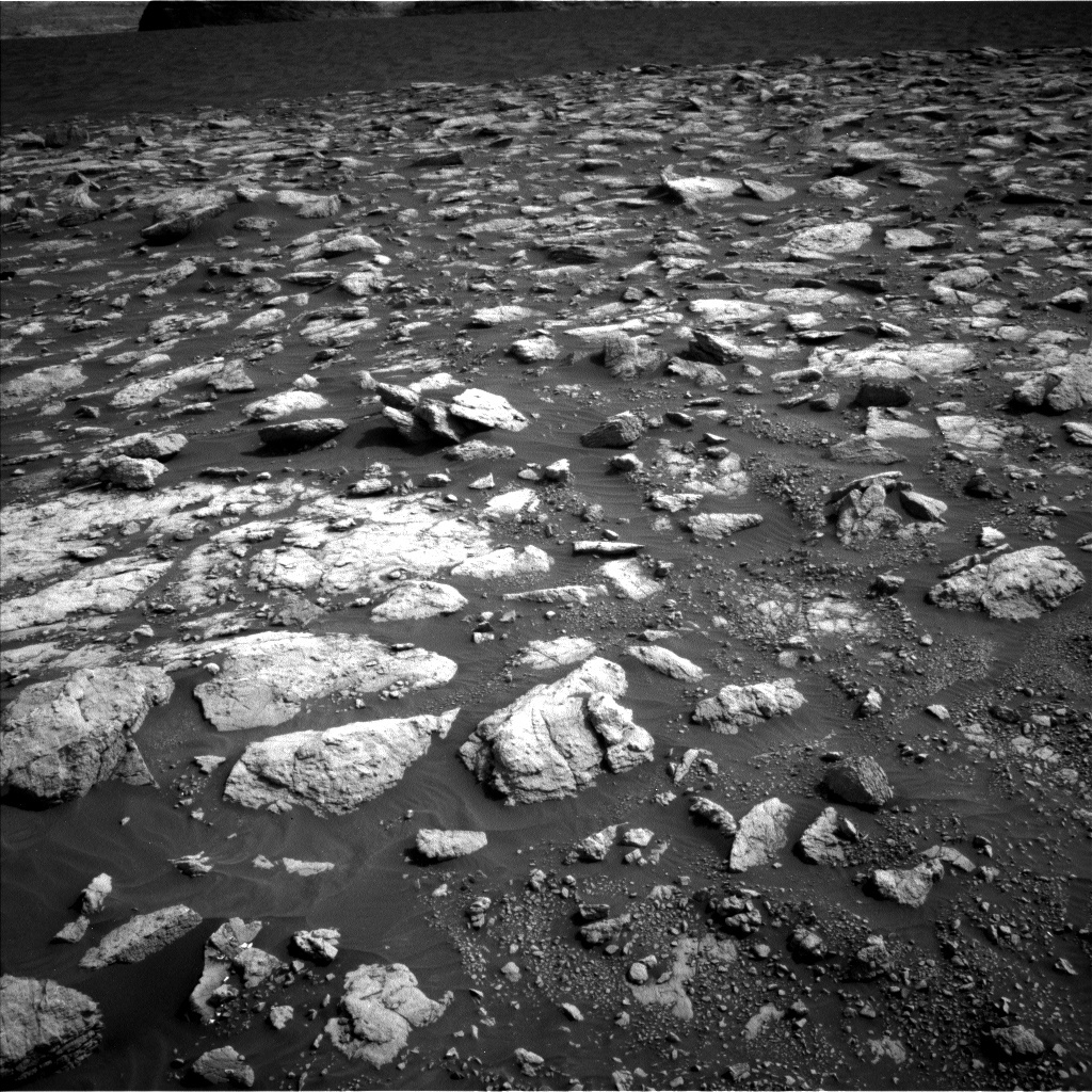
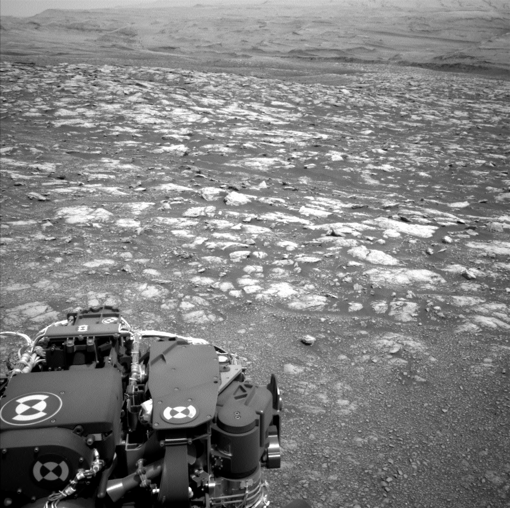
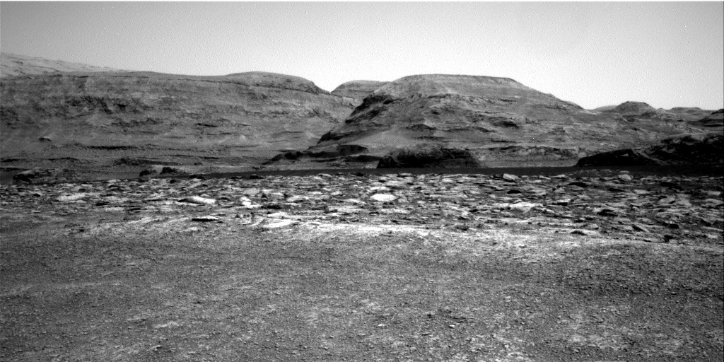
This image was taken by Left Navigation Camera onboard NASA's Mars rover Curiosity on Sol 2972. Credit: NASA/JPL-Caltech. Download image ›

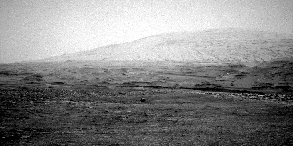
With the successful completion of Monday’s drive, Curiosity has entered a new geologic unit that is characterized by a particularly rubbly surface texture, as seen the Navcam image above. From orbit, this distinct geomorphology is also accompanied by a unique spectral signature, which piqued the team’s interest and motivated a short contact science stop within this unit. The ground truth data acquired during this stop will be crucial in determining why the rocks here look so different from others we have encountered along the traverse. Luckily, today's plan included two hefty 2-hour-long science blocks and no drive, which will allow us to collect double the data at this unusual stop before the rover drives away.

Full contact science with APXS and MAHLI was planned for a pair of targets, “Cod Baa” and “Carn Mor” (with a bonus MAHLI observation on “An Dun”), and the dual science blocks were filled to the brim with remote science activities. ChemCam LIBS measurements and Mastcam documentation images will be acquired on bedrock targets “Cod Baa,” “Northmavine,” and “St Abbs,” as well as soil target “Houster.” Four Mastcam mosaics will provide extended coverage of nearby rock surfaces and sand ripples, and two long distance ChemCam RMI observations will allow a closer look at distant rock outcrops. Two Mastcam multispectral observations will also provide additional data on the rubbly surface around the rover. Along with acquiring data on the local geology, the team also planned a large set of observations aimed at studying current environmental conditions. The first science block will include Navcam zenith and suprahorizon movies, a Mastcam tau image to measure atmospheric dust levels, and a Navcam image of the rover deck to monitor wind. The second science block will include two Navcam line-of-sight observations, a Navcam dust devil survey, and a Mastcam image of the crater rim, all of which will help assess ongoing dust activity. After two busy sols of science, the rover will continue to drive even further into the rubbly terrain on her way to a large sand sheet just south of our current location (seen in the background of the Navcam image above).

December 15, 2020

Sols 2972-2973: Rubble Bump

Written by Scott Guzewich, Atmospheric Scientist at NASA's Goddard Space Flight Center
Black and white image of Mars with part of Curiosity rover showing

This image was taken by Left Navigation Camera onboard NASA's Mars rover Curiosity on Sol 2970. Credit: NASA/JPL-Caltech. Download image ›

Curiosity currently is sitting at the edge of two geologic units, and today’s plan was focused on helping find that boundary and begin to determine the differences between them. As you can see in the Navcam image, the ground under our wheels now has small pebbles and is generally smooth. But right ahead of us is a different unit with much larger blocks of rock that has a distinct “rubbly” texture in images from orbit. After a quick touch-and-go in today’s plan on one of the pebbles nearby (“Torness”), Mastcam will take a large stereo mosaic of the boundary between these two geologic units and ChemCam will target three nearby rocks for LIBS analysis. Then we’ll perform a short drive (a “bump” in rover-speak) onto this rubbly unit where we’ll plan more contact science in Wednesday’s plan.

Meanwhile, farther ahead is a large sand sheet that we’ll investigate after the New Year. ENV is keeping an eye on dust devil activity over the sand sheet with two Navcam dust devil searches.

December 11, 2020

Sols 2969-2971: More Rubble, Toil and Trouble?

Written by Lucy Thompson, Planetary Geologist at University of New Brunswick
A part of the Curiosity rover is visible in this Mars image

The tosol’s rubbly workspace as seen by the Left Navigation Camera onboard NASA's Mars rover Curiosity on Sol 2967. Credit: NASA/JPL-Caltech. Download image ›

The last time I contributed to this blog (Sols 2933-2934), we were on rubbly terrain, and here we are again. Curiosity has had no trouble traversing rubbly Glen Torridon material, and our current terrain is no exception. We have made good progress since leaving the resistant bedrock benches and Curiosity is currently driving along the transition between what appears to be smoother material from orbital imagery and blockier, more resistant material to the south (see Where is Curiosity?). The workspace tosol is in the smoother material, ~25 m from the blocky terrain. The science team is interested in documenting any changes in chemistry and texture as we drive from the smoother material, up on to the blockier material and as we near the sulfate unit higher up on Mount Sharp, so this is an important pit stop along our traverse.

As the APXS Payload Uplink-Downlink Lead (PUDL) today, I was responsible for checking the APXS downlink from our previous plan, and then helping to plan and uplink the APXS measurements on two slightly different textured rock targets “Auchnafree Hill” and “Coupar Angus” in our current workspace. MAHLI will take close-up images of both targets and ChemCam will also investigate the Coupar Angus target. We will be able to compare the composition and texture with other rocks from previous rubbly terrains within Glen Torridon, as well as with the upcoming blockier terrain. We also planned ChemCam LIBS measurements and accompanying Mastcam documentation imaging of the “Ayre of Tonga” and “Ocraquoy” rock targets. The Ayre of Tonga target appears to be equivalent to the Auchnafree Hill APXS and MAHLI target, and the Ocraquoy has a similar dark, nodular texture to recent ChemCam/APXS targets “Ben Hee” and “Achnasheen.”

The science team also planned three Mastcam mosaics. The first is to document the transition between the smoother and blockier, more resistant terrains ahead of us. The second is to continue the investigation of periodic bedrock ridges that we have observed throughout the Glen Torridon region. The third is to document sedimentary textures in the near field of the rover. A Mastcam image will also be acquired of the rover deck.

The planned drive tosol should take us right to the contact between the smoother and blockier terrains, and the ramp that we are going to drive up in order to access the blocky material. To give us a hint at the chemistry of the rocks at the end of the drive, a post-drive ChemCam AEGIS observation will be acquired. A planned post-drive MARDI image will also give us a sense of what the ground beneath our wheels looks like.

The environmental group was also busy planning observations of the atmosphere. These include a Mastcam basic tau mosaic pointed towards the sun, Navcam suprahorizon and dust devil movies, and Navcam line of sight observation and dust devil survey images. Standard REMS, RAD, DAN passive and active measurements are also planned. A SAM atmospheric QMS-TLS run is also included, and CheMin are downlinking full frames from their analysis of the “Groken” drill fines, in order to refine their interpretation.

December 9, 2020

Sols 2967-2968: Curiosity Heading to the Sands for the Holidays

Written by Ashley Stroupe, Mission Operations Engineer at NASA's Jet Propulsion Laboratory
an image of Mars
This image was taken by Front Hazard Avoidance Camera (Front Hazcam) onboard NASA's Mars rover Curiosity on Sol 2965. Credit: NASA/JPL-Caltech. Download image ›

Curiosity is making her way to "Sands of Forvie,” the large sand field we’ve been seeing in the orbital images. Today, the rover planners are trying to drive as far as possible and expect to reach the 'rubbly unit' that is on the way to Sands of Forvie. The drive is extending beyond where we can see by making use of guarded driving, allowing the rover to look for hazards and stop if conditions are unsafe. The total distance is about 65 meters.

Prior to hitting the road, Curiosity will collect MAHLI and APXS data on a large clast, “Dun Eideann,” that is in an otherwise rubbly workspace, as visible in the Front Hazcam image. This is part of our regular tracking of compositional changes and will help us characterize the clasts in this area. We are also taking some Mastcam multispectral images of “Island Davaar,” and collecting both Mastcam multispectral and ChemCam passive spectral data of targets “Obar Dheathaian,” and “Eilean.” All three targets are some nearby interesting-looking rocks that potentially could be meteorites. We are also taking observations of Shillhope Law with Mastcam and ChemCam LIBS. Mastcam is doing stereo images of the pediment, to get a better sense of its morphology, and distant rocks in areas named “Nairnsire” and “Peerie Minn.”

After the drive, on the second sol of the plan, we’re doing a lot of untargeted science. We have a lot of environmental observations, predominantly looking for dust devils, and an atmospheric argon measurement by APXS. In addition, we’re letting Curiosity choose her own targets using AEGIS – it is always interesting to see what she finds!

December 7, 2020

Sols 2965-2966: Meteorite or Meteor-wrong?

Written by Melissa Rice, Planetary Geologist at Western Washington University
Mt. Sharp on Mars

In this image taken by Right Navigation Camera onboard NASA's Mars rover Curiosity on Sol 2963, a large, dark, shiny boulder called “Island Davaar” is visible in the distance. It does not look like any other rocks in the surrounding landscape. Credit: NASA/JPL-Caltech. Download image ›

Curiosity hits the road again today, heading towards the contact with a rubbly-looking geologic unit on the way up Mount Sharp. In the middle of today’s drive, Curiosity will make a pit stop to look at a large, dark, shiny boulder called “Island Davaar” with the Mastcam filter set. The boulder, which is visible in the distance from our current position (it’s in the center of the Navcam image above), does not look like any other rocks in the surrounding landscape. Previously along Curiosity's traverse, rocks that are distinctly dark and shiny (such those written about in the blog posts from sols 1985 and 2245-46) have turned out to be iron meteorites. Today’s mid-drive imaging will help us determine whether “Island Davaar” comes from a different geologic unit in Mount Sharp, or whether it is indeed a rock from space. The boulder’s spectrum in visible and near-infrared light, as seen from Mastcam’s fourteen different filters, will have a distinct shape if it is an iron meteorite.

Before driving, Curiosity will wrap up some science observations from her current location, including APXS and MAHLI observations of the bedrock target “Achnasheen,” ChemCam LIBS observations on two other rock targets (“Rattray” and “White Coomb”), and Mastcam imaging of regions in front of the rover and out towards the horizon.

December 4, 2020

Sols 2962-2964: Stop and Enjoy the Views

Written by Rachel Kronyak, Planetary Geologist at NASA's Jet Propulsion Laboratory
black and white photo of surface of Mars

This image was taken by Right Navigation Camera onboard NASA's Mars rover Curiosity on Sol 2959. Credit: NASA/JPL-Caltech. Download image ›

Curiosity is continuing to observe the local geology at the parking spot that we arrived at on Wednesday (see Wednesday’s blog post here) before continuing our trek up Mount Sharp. Today we planned three sols’ worth of activities to keep Curiosity nice and busy over the weekend.

On the first sol (Sol 2962) of our weekend plan, Curiosity will analyze several bedrock targets around the rover with ChemCam to assess the diversity of geologic materials that we’ve been encountering along our drive path. After that, we’ll spend the second and third sols (Sol 2963-2964) taking in all of the fantastic views that we have from this location. Closest to the rover, we’ll take a Mastcam multispectral observation on a nearby target “Ben Hee.” Looking further ahead, we’ll take a few larger Mastcam stereo mosaics to document the margin of the Greenheugh pediment and adjacent sulfate unit buttes. In addition, we’ll use the ChemCam Remote Micro Imager (RMI) to take a handful of long-distance mosaics to image a few interesting areas of the sulfate unit off in the distance. These areas are shown above in the Navcam image. Early next week we’ll wrap up our science observations at this location and hit the dusty trail!

December 3, 2020

Sols 2960-2961: Marching Forward!

Written by Mark Salvatore, Planetary Geologist at University of Michigan
black and white surface of Mars

This image was taken by Front Hazard Avoidance Camera (Front Hazcam) onboard NASA's Mars rover Curiosity on Sol 2959. Credit: NASA/JPL-Caltech. Download image ›

Curiosity continues to make swift progress on her climb up Mt. Sharp. After ascending a relatively steep portion over the last few weeks, Curiosity is now on “flatter” ground and covering lots of ground with each drive. At today’s location, Curiosity is stopped to investigate the local bedrock and to acquire some long-distance and high-resolution images of the interesting outcrops that lie ahead. The team selected four targets to analyze using the ChemCam LIBS instrument to better characterize the chemistry of the local bedrock. Three of these targets are designed to characterize color variations in relatively smooth bedrock, while the final target was selected to investigate a more nodular piece of bedrock observed in front of the rover. There are also two long-distance Mastcam color mosaics of some likely geologic transitions located ahead of the rover, as well as a Mastcam multispectral observation of two large boulders to the east. These multispectral observations will help the team to determine whether there are compositional differences between the boulders and the surrounding landscape, which could help to decipher the origin of the boulders and whether they represent more exotic geologic units than those currently being explored. In the coming days, Curiosity will stick around at this location as we gather more data and perform some routine rover maintenance before continuing her march to the east.

December 1, 2020

Sol 2959: A Late Slide and a Touch-and-Go at 'Edinburrie'

Written by Lauren Edgar, Planetary Geologist at USGS Astrogeology Science Center
a black and white view of Mars

This image was taken by Left Navigation Camera onboard NASA's Mars rover Curiosity on Sol 2958. Credit: NASA/JPL-Caltech. Download image ›

Planning today started 3 hours later than normal (known as a “late slide sol”) due to the late arrival of data relative to Earth time. We were all eagerly awaiting the results when they came down around 11am Pacific, confirming that yesterday’s ~51 m drive went well and we have some good outcrop in front of the rover to investigate. Today is also known as a “touch-and-go” – an opportunity to do short duration contact science before getting back on the road.

I was on shift as SOWG Chair today and the plan came together easily. First, Curiosity will acquire APXS and MAHLI observations of the target “Edinburrie” to systematically characterize bedrock as we transition between stratigraphic units. Then we’ll stow the arm and have a short science block which contains ChemCam and Mastcam observations of a nodular bedrock target named “Bruggs” and a Mastcam tau to monitor dust in the atmosphere. Then Curiosity will continue making progress to the southeast with a ~30 m drive, towards the bright blocky area seen on the horizon in the above Navcam image. After the drive we’ll acquire imaging to help with context and targeting in tomorrow’s plan. We also planned another autonomously selected ChemCam AEGIS target, and a ChemCam calibration activity. And last but not least, we’ll take a standard MARDI image to keep track of the changing terrain beneath the rover.

November 30, 2020

Sol 2958: Digesting a Long Weekend Full of Data

Written by Lauren Edgar, Planetary Geologist at USGS Astrogeology Science Center
Black and white view of Mars

This image was taken by Left Navigation Camera onboard NASA's Mars rover Curiosity on Sol 2956. Credit: NASA/JPL-Caltech. Download image ›

While many in the U.S. spent the long weekend resting and giving thanks, Curiosity was hard at work investigating rocky outcrops and driving back to the path that we’ve planned to ascend Mt. Sharp. The ~69 meters drive over the weekend put the rover in front of the patch of outcrop seen in the above Navcam image, but not quite close enough to plan contact science. So today’s one-sol plan is focused on remote sensing observations and a drive.

The plan begins with several Navcam observations to monitor dust in the atmosphere, search for dust devils, and monitor the movement of fines on the rover deck. Then ChemCam will investigate the bedrock target “Kergord,” followed by Mastcam imaging to characterize bedding orientations and troughs. There’s also an interesting small crater nearby named “Brogaig” that we can only see from this location, so the team planned a Mastcam mosaic for documentation. Then Curiosity will continue to drive to the southeast followed by more remote sensing. The afternoon science block includes an autonomously selected ChemCam AEGIS target, a Mastcam clast survey, Navcam context imaging, and additional monitoring of dust in the atmosphere and on the rover deck. I’ll be on shift as SOWG Chair tomorrow so I’m getting caught up, digesting all of the recent data, and asking for seconds.

November 24, 2020

Sols 2954-2957: Rest and Be Thankful

Written by Fred Calef, Planetary Geologist at NASA's Jet Propulsion Laboratory
The "Rest and Be Thankful" target is located up and to the left of the image center.

The "Rest and Be Thankful" target is located up and to the left of the image center. This image was taken by Left Navigation Camera onboard NASA's Mars rover Curiosity on Sol 2951. Credit: NASA/JPL-Caltech. Download image ›

We're planning four Martian days covering sols 2954 through 2957 ahead of the U.S. holiday break. Holidays, for me, are times to celebrate, reflect, or mourn. For some, it can be all three at once. In honor of Native American Heritage Month, I'd like to share a quote from Paula Peters of the Mashpee Wampanoag: "We are still here to acknowledge them, learn from them, talk about them, and give gratitude to the creator for them." While the "them" was in reference to the material objects from their culture that endures to this day, I think "them" can also mean our loved ones past and present.

Today, the science team reflected on the rocks on one of the many "benches" we're traversing over on our way to significant sulfate outcrops identified from orbit. Over the planning sols, we'll take five ChemCam observations named after the Scottish locations "Achnagarron" ("Field of the Geldings"), "Achnaha" ("Field by the Stable"), "Achnacarry" ("Field by the Wier"), "Achininver" ("Field by the River Mouth"), and "Achnasau" ("Field with the Barns") along with Mastcam documentation images of each. Additional observations include a Mastcam mosaic "along strike" (i.e. in the direction of the rock bedding plane) to the bench and a distant ChemCam RMI mosaic of the sulfates ahead. Before we drive off on sol 2956, the appropriate "Rest and Be Thankful" target, named after an actual location where hikers stopped in Scotland, will be cleaned by the Dust Removal Tool (DRT) and measured with APXS. Afterwards, we'll continue to drive ~75 meters towards the sulfates and take a Mastcam mosaic of the arm workspace in front of the rover, a Navcam cloud search movie, and a MARDI image looking at the rocks underneath the rover.

I recommend being like that target and "rest and be thankful" for the coming week.