August 23, 2021

Sols 3217-3218: Optimizing the Next Drive

Written by Ken Herkenhoff, Planetary Geologist at USGS Astrogeology Science Center
This is a black and white image of large white rocks with marks embedded into the flat, smooth and sandy surface fo Mars.

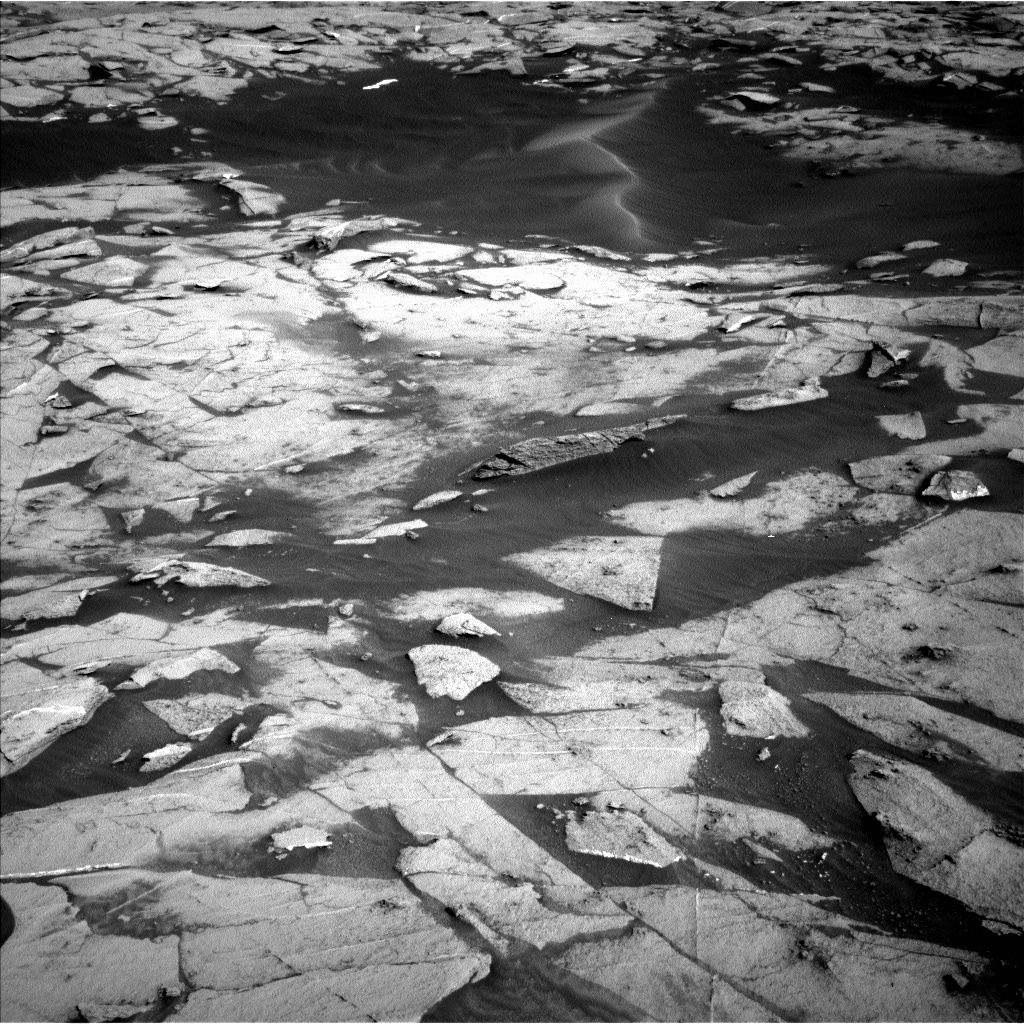
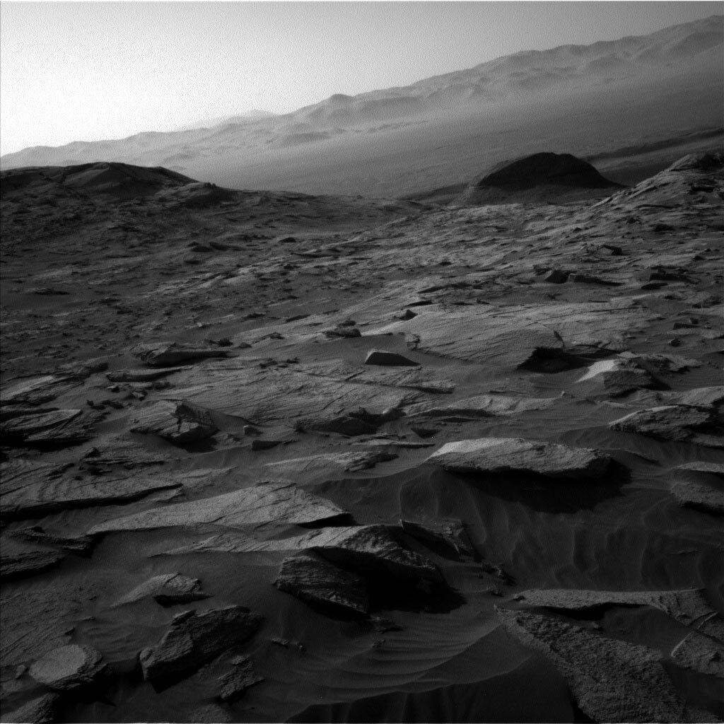
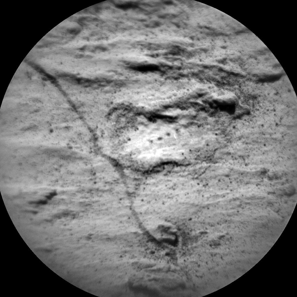
This image was taken by Left Navigation Camera onboard NASA's Mars rover Curiosity on Sol 3216. Credits: NASA/JPL-Caltech. Download image ›

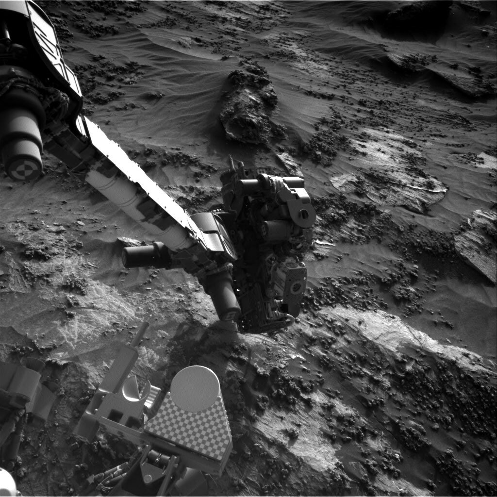
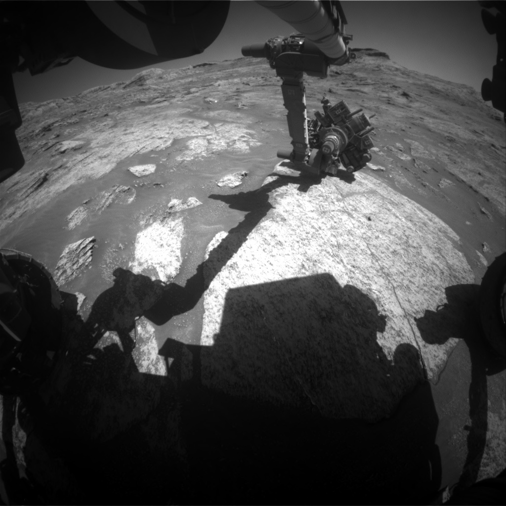
The Sol 3216 drive went well, placing the rover in an area of bright bedrock partly covered by dark sand. The top priority for today's plan is to continue making good progress toward the next potential drill target, so we worked to optimize the drive distance. The required drive duration didn't leave much time for other activities, so it was an interesting and challenging day for me as SOWG Chair. We had to make some difficult choices between various scientific observations, but ultimately were able to plan both contact science and some important remote sensing activities.

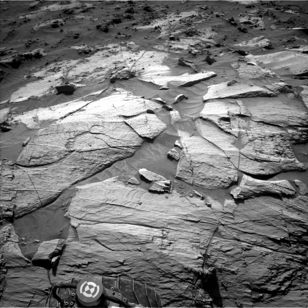
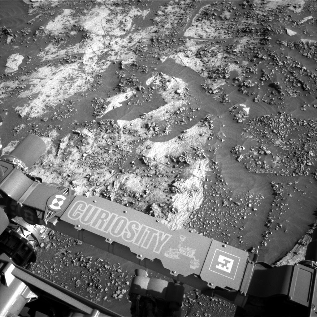
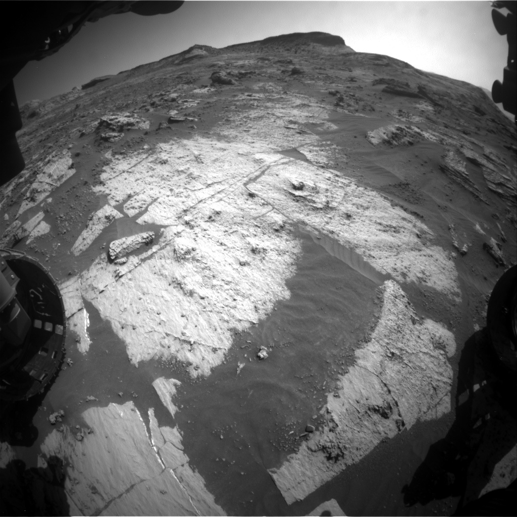
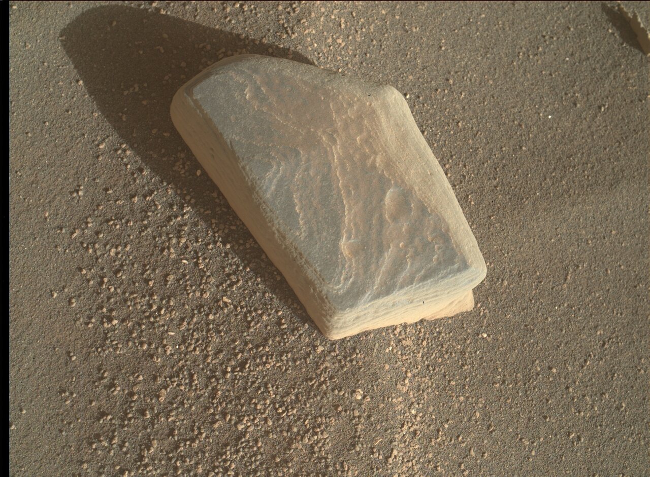
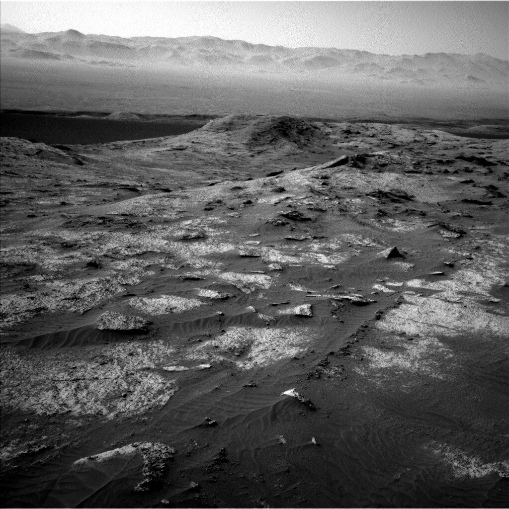
On the first sol of this 2-sol plan, the APXS will be placed on a bedrock target named "Spiggie" for a short integration. Then MAHLI will take images of Spiggie from 25 and 5 cm above the target before the arm is stowed. We were able to squeeze in a ChemCam LIBS observation of another bedrock target called "Dagon Stone" and a Right Mastcam image of the same target, plus an 18x4 Mastcam stereo mosaic of Rafael Navarro Mountain toward the southeast. This Mastcam mosaic had to be planned today because we expect to drive away from the mountain. After a ~57-meter drive and the standard post-drive imaging, MARDI will acquire another twilight image of the ground behind the left front wheel. Overnight, CheMin will vibrate its inlet funnel in an attempt to remove a speck of debris left on the inlet screen after the last drill sample was delivered to CheMin.

Planning the second sol was much less constrained, and it was easy to schedule Navcam dust devil survey and line-of-sight extinction observations, along with ChemCam untargeted activities. The AEGIS software will be used to autonomously select a ChemCam LIBS target and shoot the laser at 5 points across that target. ChemCam will also measure the spectral reflectance of several calibration targets to improve the calibration of ChemCam passive (no laser) observations. While we couldn't fit everything into this plan that we desired, it's still a good plan and I look forward to seeing the results!

August 21, 2021

Sols 3214-3216: Good Morning, Moonshine; Mars Says Hello

Written by Ashley Stroupe, Mission Operations Engineer at NASA's Jet Propulsion Laboratory
This is a black and white image of large boulders and hills in the horizon. The texture over the rocks is smooth sand.

The attached image shows the backdrop for the MAHLI experiment as well as our general drive direction. This image was taken by Left Navigation Camera onboard NASA's Mars rover Curiosity on Sol 3212. Credits: NASA/JPL-Caltech. Download image ›

This weekend, Curiosity will be very busy. Today I was part of the Rover Planner team and got to plan our drive.

Curiosity is in some very complex and beautiful terrain so there is a lot to look at. We are taking several Mastcam mosaics, including one of our contact science target, a bedrock target named “Newcraighall,” and another bedrock target named “Charlotte Square.” Additionally, we will image “North Dell,” which is a distant butte about 110 meters to the west. We are also taking ChemCam LIBS observations (with Mastcam documentation) of a third bedrock target, called “Manishmore,” which is on the same block as Newcraighall. Lastly, we are also taking ChemCam RMI observations of another distant outcrop target about 125 meters to the southeast

As Rover Planners, we definitely had our hands full today. In addition to standard systematic contact science on Newcraighall, we are doing something new. We will be pointing the MAHLI camera at the sky in an attempt to take an image of Mars’ moon Phobos at night. This is quite a challenge, as the field of view of MALHI is rather small, and it also requires very precise positioning of the arm based on our predictions of where Phobos will be at that time. We’ll also take a nighttime image of the RSM as a reference. This experiment will be used to help quantify the sensitivity of MAHLI at very low illumination. Phobos will be dark, but we may see a great moon-lit image of the RSM.

After all the complex arm activities, on the third sol of the plan, Curiosity will also be driving. The terrain in this area is very challenging, with rugged ground, lots of sharp rocks, and patches of rippling sand. The drive is planned to stay as much on bedrock as possible while avoiding the more dangerous rocks and deeper sand ripples. We are using tight safety checks to make sure we stay on track and avoid getting into any trouble. Curiosity will be driving about 35m to get to a good viewpoint in the direction of a newly identified potential drill target area that will be about 80 meters to the west at the end of the drive.

The plan also includes a suite of Navcam environmental and atmospheric measurements, including several images looking off into the distance and two dust devil surveys, as well as a Mastcam solar tau.

August 18, 2021

Sols 3212-3213: Marching Towards the Pediment

Written by Mark Salvatore, Planetary Geologist at University of Michigan
This image was taken by Left Navigation Camera onboard NASA's Mars rover Curiosity.

This image was taken by Left Navigation Camera onboard NASA's Mars rover Curiosity on Sol 3211. Credits: NASA/JPL-Caltech. Download image ›

Since navigating around the Sands of Forvie and changing our drive direction from east to the southwest, Curiosity has traversed more than one kilometer as she continues to head uphill and make her way towards the flat lithified Pediment unit. This climb continues through the transition between two different compositional units identified from orbit, moving from the lower clay-bearing materials and into the overlying sulfate-bearing materials. Curiosity is continuing to characterize this region to understand the physical and compositional nature of this transition.

In today’s plan, Curiosity will unstow her arm and will use the APXS instrument to measure the chemistry of a bedrock target named “Camster Cairn,” which shows fine-scale laminations and potentially some very small nodules or coarse grains. Following arm activities, Mastcam will collect two large mosaics, one of a nearby rock that has similar textures to the APXS target and another of the foothills of Rafael Navarro Mountain, taking advantage of the current viewing geometry. ChemCam will then use its LIBS capabilities to acquire chemistry data from the “Melby Fault” target, which is another laminated bedrock target just off the front-right side of the rover. Following a ~45 meter drive to the southwest, Curiosity will then acquire standard post-drive images, followed by an automated LIBS observation of the surrounding terrain and then wrapping up the plan with a handful of environmental activities.

August 17, 2021

Sol 3211: Popcorn Mars

Written by Scott Guzewich, Atmospheric Scientist at NASA's Goddard Space Flight Center
This black and white image of the rocky, sandy surface of Mars was taken by the Curiosity rover. A lot of small rocks are scattered on the smooth,sandy sandy  surface.

This image was taken by Left Navigation Camera onboard NASA's Mars rover Curiosity on Sol 3210. Credits: NASA/JPL-Caltech. Download image ›

Despite the similarities, Curiosity remains on Mars and not your neighborhood movie theater after the lights come on and you find spilled popcorn all over the floor. The terrain around our rover is littered with "diagenetic" rock features—rocks that have been chemically altered through likely interaction with water in the distant past. You can see these as the abundant nodules covering much of the surface on top of the unaltered (or less altered) flat bedrock in yesterday's Navcam image of today's arm workspace. Much of the discussion today centered on whether to target one of those popcorn-like diagenetic features or the bedrock beneath with contact science, and the choice was made to aim for the bedrock. One trick was finding a large enough spot free of the diagenetic features within reach of the arm! "Sanna Bay" was eventually the choice, just above the middle of Curiosity's nameplate in the Navcam image. GEO also planned some additional imagery and a ChemCam LIBS raster on one of those popcorn kernels, "Crag and Tail."

We are almost to the winter solstice in the southern hemisphere of Mars, and this is the coldest time of year in Gale Crater. It also is the "wettest" time of year, and we are preparing to search for very thin early morning frost on the surface in the next few weeks. We are keeping our eyes open for open dusty or sandy soil patches where conditions will be most suitable for this investigation in late August or early September.

August 16, 2021

Sol 3210: Finding the Balance!

Written by Catherine O'Connell-Cooper, Planetary Geologist at University of New Brunswick
This image is showing the typical terrain that we are driving over taken by Front Hazard Avoidance Camera (Front Hazcam) onboard NASA’s Mars rover Curiosity.

This image is showing the typical terrain that we are driving over taken by Front Hazard Avoidance Camera (Front Hazcam) onboard NASA’s Mars rover Curiosity. Credits: NASA/JPL-Caltech. Download image ›

We are continuing our traverse through an area of resistant buttes or mesas, and recent drives have been relatively short. Drives are planned using navigation images such as the one above. The area that is visible from your location is called the “viewshed.” Since we entered this area full of buttes and rough terrain, the viewsheds have been limited and the drives small. Driving in this area has been tough, and RPs have slowly picked their way with care, with drives of 20-30 metres the normal.

At the start of today’s planning, the rover planners (RPs) realised that the relatively benign topography just in front of us meant that they could potentially drive almost 90 metres. On the one hand, this was very tempting, after all the recent small drives, to finally get further down the road, and improve the viewshed. But… on the other hand… this area is so incredibly interesting. Every time we stop, we see something intriguing. Speeding through here could mean that we potentially miss important observations.

So, following a lively discussion of the pros and cons, we found a balance that allowed the best of both options: a moderate drive, leaving time for extra science activities from our current workspace, and a more leisurely pace through this area. A 50 metre drive will provide the RPs with better viewsheds and peeks at the road ahead, which will make planning drives a little easier for the coming week. We then added some bonus science at our current stop, in the form of brushing a bedrock target “Solway Lowlands” and interrogating that one with almost every tool we have – MAHLI imaging, APXS and ChemCam geochemical analysis, and Mastcam multispectral compositional analysis. We will also get more imaging of the lower slopes of “Rafael Navarro Mountain” and of a knoll (“Gogar”) crosscut by veins in our drive direction, before embarking on our sporty 50 metre drive. All this and environmental monitoring activities too – a busy one sol plan!

August 13, 2021

Sols 3207-3209: Martian Superstition

Written by Mariah Baker, Planetary Geologist at Center for Earth & Planetary Studies, Smithsonian National Air & Space Museum
MAHLI image of "Kilmaluag" acquired on sol 3208.

MAHLI image of "Kilmaluag" acquired on sol 3208. Credits: NASA/JPL-Caltech/MSSS. Download image ›

On Earth, there are superstitions that Friday the 13th is a day of bad luck. On Mars today, the Curiosity rover team got word that the rover’s drive had come up shorter than expected and that minor delays with software tools were complicating plans. So, to those who believe in the lore surrounding Friday the 13th, this may have seemed like an inevitable string of bad luck beyond our control. But to the rover team, this just looked like a regular day on Mars. Remote exploration of another planet is hard, and the team is often confronted with unforeseen challenges that require us to think on our feet and come up with innovative solutions. Today, the engineers and scientists on shift adapted quickly and succeeded in planning a full weekend of rover activities.

One the first sol of the plan the team scheduled a dedicated ChemCam Passive Sky observation that will be used to characterize local environmental conditions. The later sols in the plan will also include atmospheric activities including background DAN and REMS measurements and Mastcam images used to characterize dust opacity. The NCAM will also be used to acquire cloud movies, dust devil observations, a “line-of-sight” image, and a zenith movie.

The second and third sol of the plan will include a large set of remote science and contact science activities. A prominent vein feature called “White Caterthuns” will be targeted with ChemCam LIBS and documented with a Mastcam mosaic. A second Mastcam mosaic will be acquired on bedrock target “Balliol.” ChemCam will also target another piece of bedrock called “Brown Caterthuns.” Two small “blue” float rocks called “Inaccessible Pinnacle” and "Kilmaluag" (shown in the image above) will be investigated further with MAHLI, APXS, and Mastcam multispectral data. Lastly, the rover will acquire some additional imaging of our current location through a long distance RMI mosaic of a distant rock outcrop and a Mastcam 360° mosaic.

Barring any additional bouts of bad luck, the rover is geared up for a productive weekend on Mars. Fingers-crossed things will go smoothly but, as always, the team is prepared to handle any obstacles that await us.

August 12, 2021

Sols 3205-3206: Movin' on Up!

Written by Mark Salvatore, Planetary Geologist at University of Michigan
This is a black and white image of the sandy, rocky terrain on Mars. Very small smooth hills and some very rough textured rocks can be seen in the image.

This image was taken by Right Navigation Camera onboard NASA's Mars rover Curiosity on Sol 3205. Credits: NASA/JPL-Caltech. Download image ›

Curiosity continues her climb up Mt. Sharp, navigating her way towards the southwest. In the previous plan, Curiosity traveled approximately 40 meters through fairly rocky terrain that coincides with the transition region between the clay-bearing bedrock that we've been exploring for the past few years and the overlying sulfate-bearing materials. The science team is carefully characterizing this compositional transition both laterally and vertically, hoping to identify key evidence for environmental transitions along the way. The current transition zone was one of the main reasons why NASA and the scientific community selected Gale crater as the Curiosity landing site. Spectral evidence from the Compact Reconnaissance Imaging Spectrometer for Mars (CRISM) instrument showed a clear compositional transition here that might be indicative of significant environmental change recorded in the rock record. Curiosity is now in a position to begin understanding and unraveling this environmental history!

In the current plan, Curiosity will be acquiring a lot of local and long-distance imagery, as well as some compositional measurements of local bedrock and diagenetic features. The plan will end with a ~25 meter drive to the southwest as we continue our way through this transition zone.

August 10, 2021

Sol 3204: Tilleadh (Return) to Scottish Names

Written by Lucy Thompson, Planetary Geologist at University of New Brunswick
Front Hazcam image showing the APXS instrument on the Sol 3203 “Blis et Born” bedrock target.

Front Hazcam image showing the APXS instrument on the Sol 3203 “Blis et Born” bedrock target. Credits: NASA/JPL-Caltech. Download image ›

Our successful, ~30 m drive over this irregular terrain yesterday placed us back in the so-called “Torridon” quadrangle, so we get to practice our Gaelic again, having mastered our French while driving through the “Nontron” quadrangle (see yesterday’s blog for details of quadrangles). The terrain is a mixture of large blocks and more expansive exposures of bedrock and sand, with the occasional out of place cobble of distinct blue/grey-coloured rock. This is all set to the backdrop of the basal sulfate-bearing buttes and the Greenheugh pediment in the distance; a beautiful view out the front window.

The bedrock exhibits a range of interesting textures and colour variations that we are attempting to characterize with Curiosity’s instrument payload. They include ubiquitous resistant nodular features ranging from mm to cm scale, apparent laminations and layering, white veins, and darker grey vein/fracture coatings, many of which weather out as fins or plates.

As the APXS Payload Uplink and Download Lead, I firstly got to make sure that yesterday’s activities executed as planned before turning my attention to thinking about today’s plan. Yesterday we brushed and analyzed a relatively featureless bedrock area with APXS and MAHLI (“Blis et Born”), so today we decided to look at the fin-like material with APXS and MAHLI instead; the target “Rodel.” We will be able to compare the chemistry and texture of these two targets.

Because ChemCam targeted one of the out of place, blue-grey cobbles with LIBS yesterday we opted to analyze a relatively featureless, in place bedrock (“Arthur Holmes”) with LIBS today. A bright (possible vein) feature exposed on the side of a block (“Firth of Clyde”), ~16 m from the rover, was chosen for a ChemCam passive observation. Both targets will also be imaged with Mastcam. We will also image an interesting block with variable colours and textures (“South Dell”) with Mastcam.

Before and after the planned drive, a number of Navcam and Mastcam environmental observations are planned, as well as standard REMS, RAD and DAN activities. MARDI will image the terrain beneath Curiosity’s wheels after the drive.

After 9 years of roving on Mars, Curiosity is still managing to pack in the science observations and make important contributions to our understanding of Mars’ past and present. It has been a privilege to be along for the ride and to contribute to this amazing mission for the past 9 years as a member of the APXS team. Onward and upward!

August 9, 2021

Sol 3203: Leaving the Nontron Quad

Written by Lauren Edgar, Planetary Geologist at USGS Astrogeology Science Center
This is a black and white image of the rocky, sandy surface on Mars. In the front of the image rocks are seen embedded into the ground and are slightly poking out in places. Larger hills can be seen in the horizon with a clear sky.

This image was taken by Left Navigation Camera onboard NASA's Mars rover Curiosity on Sol 3202. Credits: NASA/JPL-Caltech. Download image ›

Curiosity is making good progress along the path to our next intended drill location, and making a lot of great observations along the way. All of this progress means we’re about to leave the "Nontron" quadrangle and return to the "Torridon" quadrangle. These quad names are how we keep track of observations on Mars - prior to landing, the expected landing zone and nearby areas were divided into square quadrangles (1.5 km on a side) and each quadrangle was assigned a name of a town on Earth with a population of less than 100,000 people. As we drive through the quads, we assign informal names to rock targets that correspond to geologic formations and features from that town on Earth. I was on duty as Long Term Planner today, and one of our jobs is to keep track of our location and target names, so I've been monitoring our progress towards this boundary. What this means is that after today's drive we'll stop using French names from "Nontron" and return to using names from "Torridon" in Scotland. We were previously in this quad, but now we’re much further to the south as we investigate the clay-sulfate transition.

Today's one sol plan is focused on contact science and continuing our drive. The team was able to add in a DRT to remove dust prior to the APXS and MAHLI observations on the target "Blis et Born," which will lead to better data about the bedrock here. The plan also includes two Mastcam mosaics to investigate vertical exposures of nearby stratification, as well as ChemCam LIBS on an interesting blue-gray float rock and a ChemCam RMI to investigate nodular bedrock. The team also planned some Navcam observations to assess the dust content of the atmosphere and search for dust devils. Onwards to Torridon!

August 6, 2021

Sols 3201-3203: We Are Safe on Mars!

Written by Susanne Schwenzer, Planetary Geologist at The Open University
This is a black and white circular lens image of the rough and rocky surface of Mars. The surrounding are to the roughness is smooth, flat and has little rock particles scattered on it.

In the middle of this image, you can spot a row of dark spots, which are actually imprints from the LIBS laser. This image was taken by Chemistry & Camera (ChemCam) onboard NASA's Mars rover Curiosity on Sol 3198. Credits: NASA/JPL-Caltech/LANL. Download image ›

"We are safe on Mars!" … I for my part cannot believe that Curiosity landed 9 years ago now, on the 5th of August 2012 late at night for most of my colleagues in the US, but actually today, on the 6th of August 2012, at 6.32 morning here in the UK. I woke up at 3 am, unable to get back to sleep, thinking about the hours, weeks, months, years ahead. When I heard the words "We are safe on Mars" it was a very special feeling. I can only compare it to the moment they told me that I passed my PhD exam. Relief, joy, but also the big question what the future would bring. I just relived the landing moment in the video that features the famous words quoted above.

If you want to do so, too, here it is. And what a ride it has been, starting at Yellowknife Bay all the way to where we are now, past spectacular active dunes, over ridges, and of course investigating all the lake-bed sediments that the crater has to offer. Everyone has their personal highlight list among our discoveries, of course. How else could it be? If you ask me, then one of my highlights is the noble gas data we received from Mars and within those especially the Xenon data. You might never before have heard of that, because it is quite a niche subject. So, why did I choose this as my personal highlight? Well, I studied Xenon in all the Martian meteorites that were available at the time (nine of them – now there are over 100), and so this topic is very close to my heart, and it actually won me the above mentioned PhD! If you are curious about all the science we've done, here is a list of the papers the science team has written, and it includes the paper we wrote about Xenon titled "In situ measurement of atmospheric krypton and xenon on Mars with Mars Science Laboratory." Now, with that little drive along my personal memory lane… let's get back tosol's planning! Planning #1 of year 10 on Mars.

Curiosity has a full weekend plan, but also gets one sol of soliday. This is to realign Mars and Earth timing, but I am sure it’s also going to be used for some celebrations. Observations in the plan include many observations of the rocks around us, which again are a mixture of smooth sedimentary rocks with a lot of nodules. APXS and MAHLI are looking at target 'Nadaillac,' which is one of the smooth sedimentary patches. ChemCam is also looking at this target with a passive observation and Mastcam is pointing at it with a multispectral observation. The nodular features are the target of two ChemCam LIBS observations on targets 'Pageas' and 'Paugnac.' Mastcam is documenting each of the ChemCam targets with a single image, and has one other single image on a very dark and blueish looking stone.

The terrain around us continues to give great vistas onto rock surfaces that allow us to understand the layering of the rocks and how different textures are stacked on top of each other. Mastcam is documenting those with an 18x2 mosaic, but because one of the outcrops is in shadow for most of the day, there is also a very early morning mosaic on that specific area. In addition, there is a dust devil survey in the plan. Lots to do on the first planning of the new year on Mars!