October 27, 2021

Sol 3279: So Long, Rafael Navarro Mountain!

Written by Mark Salvatore, Planetary Geologist at University of Michigan
This is a black and white image taken by the Left Navigation Camera of the Rafael Navarro Mountain. The surface of these low hills is very rocky and has cracks and there is a clear sky in the horizon of the image.

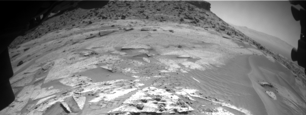
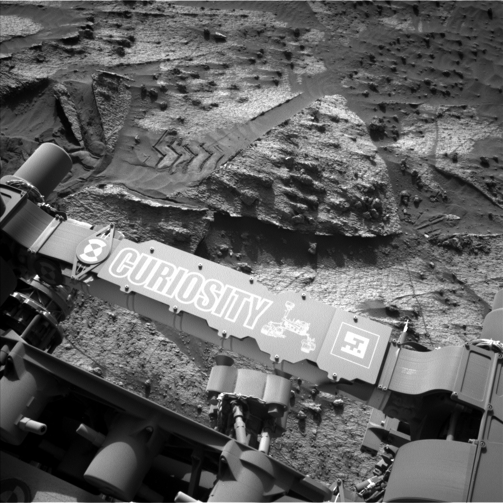
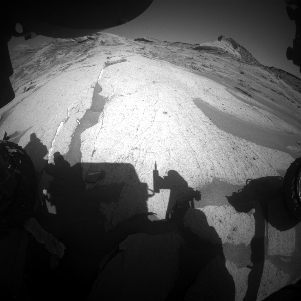
This image was taken by Left Navigation Camera onboard NASA's Mars rover Curiosity on Sol 3278. Credit: NASA/JPL-Caltech. Download image

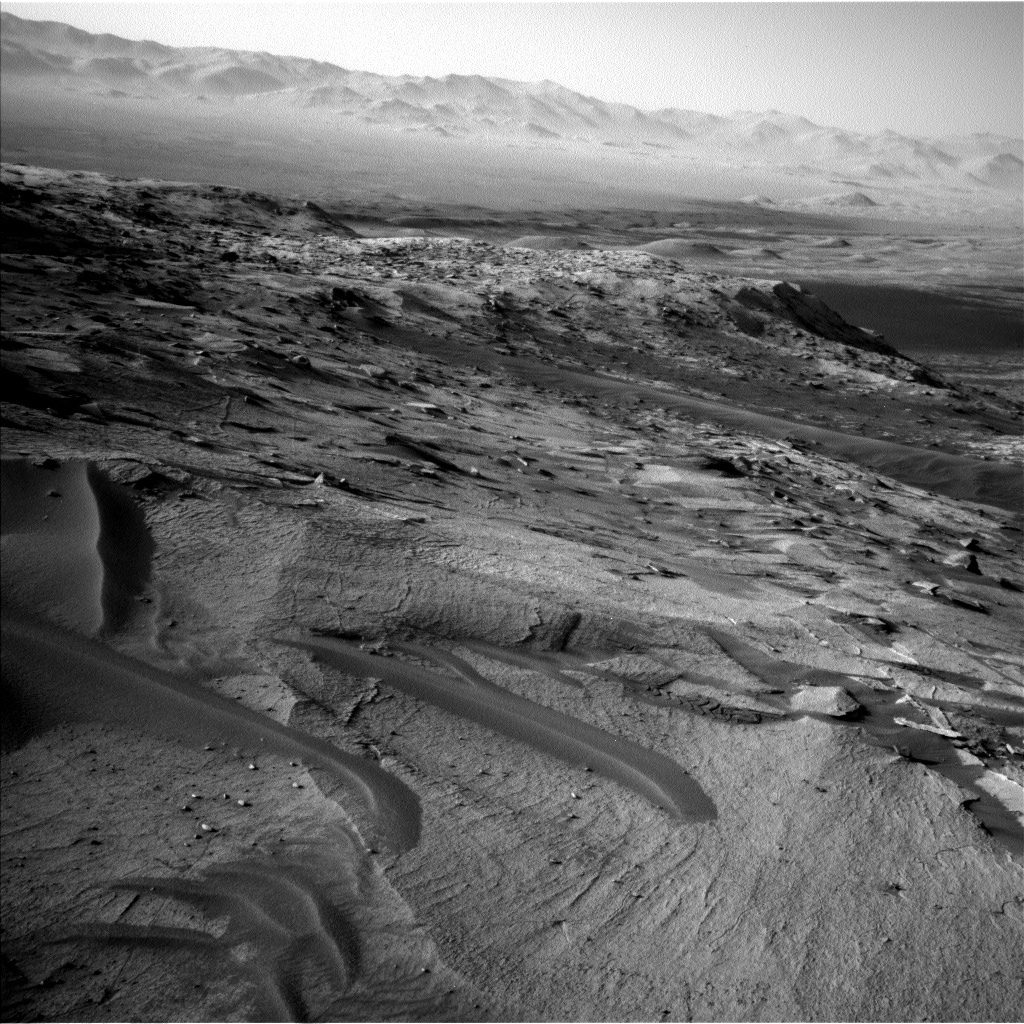
Since the early part of 2021, Curiosity has been continuing her drive up Mt. Sharp with the the ~140 m tall Rafael Navarro Mountain as a familiar reference point. Now that we have ascended a significant portion of Mt. Sharp and have started a southward drive to approach the Greenheugh Pediment, we are about to lose sight of parts of Rafael Navarro Mountain behind some other hills for the foreseeable future. Before we lose this view, however, Curiosity is prioritizing some long-distance imaging of Rafael Navarro Mountain to make sure that we don’t miss out on any interesting and valuable observations.

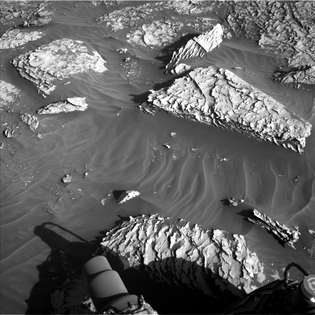
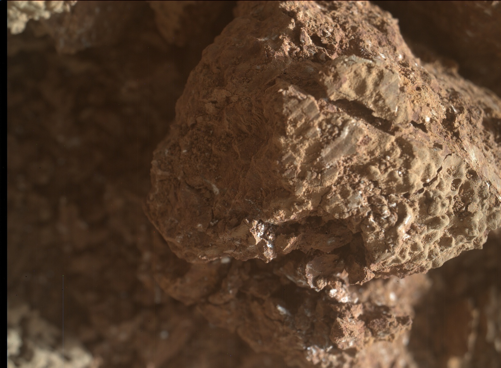
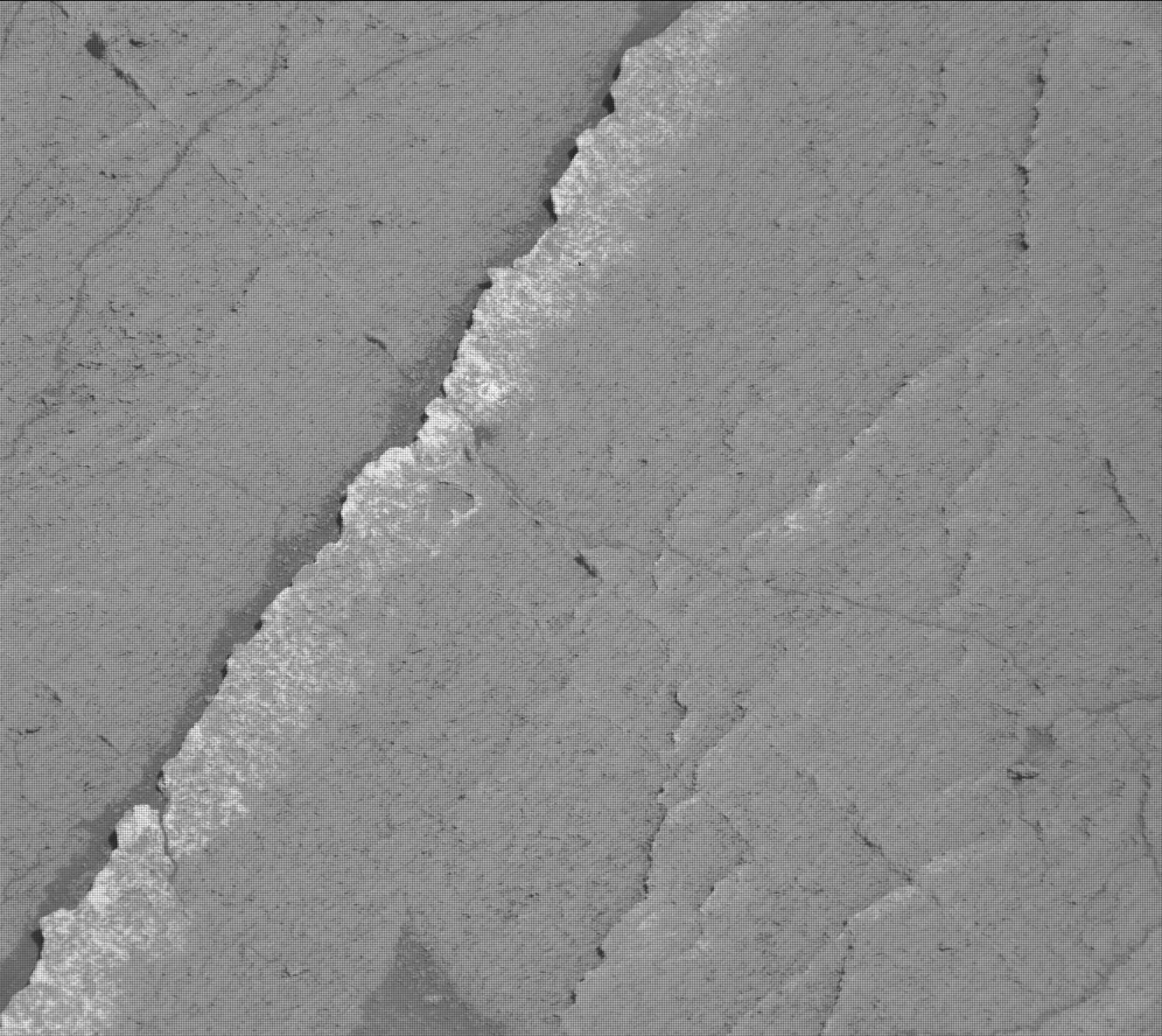
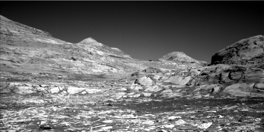
In today’s one-sol plan, Curiosity will start her science operations with some arm activities, including MAHLI imaging and APXS chemistry measurements of the "Ashlar" target, which is a finely laminated sedimentary rock that is heavily fractured with veins and potential nodules. Following arm activities, Curiosity will conduct a handful of remote sensing activities, including acquiring a multispectral image of the "Denburn" float rock target, a ChemCam LIBS measurement of the "Ashlar" bedrock target, and several Mastcam mosaics of targets including near-field layering, the Greenheugh Pediment, and Siccar Point. Lastly, ChemCam will be used to acquire a high-resolution imaging mosaic of Rafael Navarro Mountain from this fleeting vantage point (in the associated image, parts of Rafael Navarro Mountain can be seen to the left, while more local hills that will be blocking Curiosity’s view of Rafael Navarro Mountain in the near future are visible on the right).

After another drive to the south, Curiosity will acquire a standard suite of post-drive imaging before standing down for the evening and recharging before the next sol’s science activities.

October 25, 2021

Sol 3278: Nacho Everyday Workspace

Written by Scott Guzewich, Atmospheric Scientist at NASA's Goddard Space Flight Center
This is a black and white image of large surfaced rocks embedded in smooth sand. There are smaller rocks present as well. The surface of these rocks is rough with lots of cracks.

This image was taken by Left Navigation Camera onboard NASA's Mars rover Curiosity on Sol 3277. Credits: NASA/JPL-Caltech. Download image ›

Likely because mission operations start near lunch time on the East Coast, I’m often thinking about food when I begin my planning shift. Today I was Science Operations Working Group chair and my first thought looking at the rocks near our workspace was “those look like piles of tortilla chips!” To the geologists on the team though, these incredibly thin and fragile layers indicate that the rocks were laid down in a sedimentary environment. The tilted “tortilla chip” fins indicate later water flowed through fractures in the rocks. Both the thin layers and fins can be seen along the bottom edge of the nearby Siccar Point, and it’s likely that the dark overlying material that’s still present on Siccar Point was eroded away at the location we’re parked, leaving the “tortilla chip terrain” (my term, not an official MSL feature term) exposed on the surface.

Today was a standard touch-and-go plan, with contact science on a large block (tortilla chip pile) in the workspace termed “Wardie.” We’ll also use ChemCam LIBS on another such block off to the rover’s right and take a series of Mastcam images of the various surface textures around the rover. Farther afield, we’ll take a large Mastcam mosaic of Rafael Navarro mountain and search for dust devils with Navcam.

October 22, 2021

Sols 3276-3277: Closest Approach to Siccar Point

Written by Abigail Fraeman, Planetary Geologist at NASA's Jet Propulsion Laboratory
The Curiosity rover’s tires and shadow are in the forefront of the image. This is a black and white image showing the rocky, sandy surface of Mars. Low hills and a clear sky are in the horizon of the image.

This image was taken through the fisheye lens of Curiosity’s front Hazcam, which is mounted close to the ground. It shows the workspace in front of the rover and towering Siccar Point, visible in the upper right. This image was taken by Front Hazard Avoidance Camera (Front Hazcam) onboard NASA's Mars rover Curiosity on Sol 3274. Credits: NASA/JPL-Caltech. Download image ›

It’s another soliday weekend at Gale crater, which means we only planned two sols of activity today instead of the three we usually plan on weekends. Besides being a fun word to say, solidays are important because they help us realign our planning to match Earth and Mars’ constantly shifting time zone differences. Our two-sol plan today is relatively straightforward. We will brush the dust off of a vein running through the workspace we named “Joppa Salt,” and observe it with ChemCam, Mastcam, MAHLI, and APXS. We will also observe a second target, “Hope Park,” in our workspace with ChemCam, collect environmental science monitoring activities, and continue driving up Mt. Sharp.

Our parking location today marks the closest approach to a feature we’ve named “Siccar Point,” so we’re also making sure to take lots of images of this feature. (Here was our view of Siccar Point a couple sols ago.) The dark rocks that sit on top of Siccar Point are much younger than the tan rocks below, and the contact between the two rock types marks a large break in time in the rock record. This kind of contact is referred to as an “unconformity” by geologists. Earth’s Siccar Point is found in Scotland, and it’s famous for historians of geology because of the spectacular unconformity exposed there. When James Hutton observed the unconformity in Earth’s Siccar Point in 1788, he realized it demonstrated the longevity of geologic time, and this notion led him to develop one of the key principles of modern geology: uniformitarianism. Uniformitarianism states that changes in the Earth’s crust throughout history have resulted from the action of continuous and uniform processes. I am excited to see what sort of new information we learn from Gale crater’s Siccar Point in the images we take this weekend.

October 20, 2021

Sols 3274-3275: Rover Wheel Prints

Written by Susanne Schwenzer, Planetary Geologist at The Open University
This image shows the inside of some nodules Curiosity crushed and drove over. This colored image shows a brown rock with straight imprinted lines in the middle of flattened areas that appear slightly more grey. There are also visible cracks, especially clearly on the right of the nodule in the image.

There is evidence we drove over this nodule in the high resolution image taken by MAHLI, the hand lens imager onboard NASA's Mars rover Curiosity on Sol 3272. NASA's Mars rover Curiosity acquired this image using its Mars Hand Lens Imager (MAHLI), located on the turret at the end of the rover's robotic arm, on October 20, 2021, Sol 3272 of the Mars Science Laboratory Mission. Credits: NASA/JPL-Caltech/MSSS. Download image ›

In the blog preceding this one Lucy reported that we had successfully carried out our move to crush some nodules and get to see their insides. The image atop this blog shows evidence of our drive across a nodule – look closely for very straight imprinted lines in the middle of flattened areas that appear slightly more grey. You can also see cracks, especially clearly on the right of the nodule in the image, but if you look around, you’ll find there are more of them. Some of the scratched areas are looking white, too. All those features will allow us an insight into the nodules and an interpretation beyond what we can otherwise see on the surface. As much as the surface can tell us – here we are getting to the heart of those nodules!

In today’s plan, ChemCam is looking at the wheel-disturbed rocks with a LIBS observation on target ‘Picardy Stone’ and with a passive spectral observation on target ‘Pollock.’ Mastcam is joining the broken rock feast with a multispectral observation on an area named ‘Acadian,’ which is also investigated by APXS and MAHLI. Last but not least, a dune feature, now named ‘Longhill,’ receives some attention with a Mastcam mosaic to further study the dunes on Mars. While dunes can tell us a lot about both current and past wind and climate, there is also atmospheric monitoring in the plan to document the current conditions around the rover adding to our cadence of images to assess dust levels in the atmosphere – and our dust devil searches. And, of course, REMS is sending its daily weather report, and on top of all the atmospheric science possible with those long-term datasets, we can just enjoy knowing what temperature it is on Mars today, too. There is a drive in the plan that should set us up nicely for some more investigations of this interesting area. Images after the drive will give us first insights, and ChemCam gets a head start on the chemistry through an AEGIS observation.

October 18, 2021

Sols 3272-3273: Emerging From the Shadows...

Written by Lucy Thompson, Planetary Geologist at University of New Brunswick
The triangular shaped rock in the immediate foreground contains the crushed nodule targets “Helmsdale Boulder Beds” and the “Crovie” bedrock target. In the background, the slope is covered with grey float blocks similar to those being imaged by Mastcam. The pediment-capping rock is at the top of the image, just right of centre.

The triangular shaped rock in the immediate foreground contains the crushed nodule targets “Helmsdale Boulder Beds” and the “Crovie” bedrock target. In the background, the slope is covered with grey float blocks similar to those being imaged by Mastcam. The pediment-capping rock is at the top of the image, just right of centre. This image was taken by Front Hazard Avoidance Camera (Front Hazcam) onboard NASA's Mars rover Curiosity on Sol 3270. Credits: NASA/JPL-Caltech. Download image ›

Curiosity went into hibernation for a few weeks, executing only routine environmental and radiation monitoring activities, while the Sun was positioned between us and Mars (conjunction). Today is our first day planning since Mars has emerged from behind the sun. Curiosity is healthy after her rest, and we wasted no time planning a multitude of science activities.

Prior to conjunction, Curiosity drove away from the Maria Gordon drill site to an area nearby that contained large (~6-7 cm across) resistant nodules (“Helmsdale Boulder Beds”). We deliberately drove over the nodules to crush them and expose their fresh interiors for examination by a number of the science instruments. The team is interested in determining the chemistry of the nodules relative to the flat bedrock. Why are they resistant? How does their composition compare to other nodules previously encountered, and what might this tell us about fluids that were present in these rocks? The workspace imaging that came down confirmed that we had successfully broken some of the nodules, such that we were able to make several observations just before conjunction. But we were not able to use the arm mounted APXS and MAHLI instruments; we did not want the arm left out over conjunction.

Today, we took advantage of pre-planning prior to conjunction to acquire APXS chemistry and MAHLI images on the crushed “Helmsdale Boulder Beds.” MAHLI will also image another fresh-looking nodule, “Goose Stone.” These observations will be complemented with ChemCam LIBS measurements and Mastcam images on the same crushed “Helmsdale Boulder Beds” target and the “Crovie” bedrock target. Looking further afield, Curiosity will image resistant, pediment-capping rock in the distance with ChemCam RMI and Mastcam. The pediment is a gently sloping surface that appears to cut across the underlying rocks that we are currently driving over. Mastcam will also image some grey float rocks that may be derived from those pediment-capping rocks.

We will also uplink several environmental observations including Mastcam images to detect changes in the unconsolidated sediment and wind activity while Curiosity has been parked in the same location for the last few weeks. Atmospheric observations are also planned to look for dust devils and to measure the opacity of the atmosphere.

September 27, 2021

Sols 3251-3253: Celebrating Another Go Around

Written by Michelle Minitti, Planetary Geologist at Framework
This is a black and white image of low, sandy hills. There are higher hills in the horizon.

This image was taken by Left Navigation Camera onboard NASA's Mars rover Curiosity on Sol 3247. Credits: NASA/JPL-Caltech. Download image

Solar conjunction is once again upon us - the time when the Sun comes between Mars and Earth in their orbital dances and precludes reliable communication between us and our robotic friends. This is the fifth conjunction Curiosity has experienced, and such a regular, cosmic event like conjunction provides the perfect time to reflect - where were we the last time Mars, Earth and the Sun aligned like this? Looking back over what we were up to around each conjunction is very much like looking through a scrapbook of memories.

We headed into our first conjunction, starting on Sol 236 (April 2013), fresh off the excitement of finding evidence of a habitable environment in our first drill sample “John Klein,” and still feeling the relief of having survived a major fault with the A side computer. Curiosity runs on the B side computer to this day.

At our second conjunction, on Sol 1004 (May 2015), we had just passed the Sol 1000 milestone and had completed walkabout exploration (on our beat up wheels) of "Pahrump Hills,” the lowest exposed section of Mount Sharp. There we collected three samples of the mudstone-dominated Murray formation. We parked for conjunction at a contact between the Murray formation and another major formation, the Stimson, an aeolian sandstone deposit. Curiosity has continued to encounter variations of both formations throughout her exploration of Gale.

Conjunction #3 started on Sol 1756 (July 2017), and we found ourselves sitting on the Murray formation just north of "Vera Rubin Ridge," looking up at its enticing layering and color variations. Leading up to that point, we had sampled our way across the Stimson-capped "Naukluft Plateau," maneuvered through the Stimson-capped "Murray Buttes," and were systematically sampling the Murray formation when the drill fell out of commission. The loss of the ability to drill and deliver sample to CheMin and SAM was a blow, but the team, to borrow from our sister rover, persevered to continue building the story of the rocks of Gale with the rest of the payload.

By the next conjunction on Sol 2506 (August 2019), we had made it up and down Vera Rubin Ridge multiple times and into the clay-bearing "Glen Torridon” region. Our multiple traverses across the ridge were not just for exploration. Since the previous conjunction, the engineers invented a new way to use the drill to once again allow us to collect samples. We revisited terrain to gather samples where it was not previously possible, and gratefully sampled our way into Glen Torridon, We acquired sample #22, the clay-bearing “Glen Etive” sample, right before conjunction. In the midst of all the exploration and sampling, Curiosity also survived a near-global dust storm!

This time around, on Sol 3251, we sit just a few meters away from our 33rd drill hole, ”Maria Gordon,” in the shadow of the western side of the "Greenheugh Pediment.” We successfully summited the northern edge of the pediment since last conjunction, allowing us to cross over, sample, and analyze yet another (but higher!) Murray-Stimson contact. We hope to climb up onto the pediment again as we make our way from the clay-rich rocks of the Glen Torridon region toward the anticipated sulfate-rich layers of Mount Sharp above. But for the next few weeks, we will simply pause, look across the view above, and appreciate how much we have done and how far we have come.

September 24, 2021

Sols 3248-3250: Curiosity Crushed It!

Written by Ken Herkenhoff, Planetary Geologist at USGS Astrogeology Science Center
This is a black and white image of the Curiosity rover over the sandy, rocky surface of Mars. Curiosity's arm and tire marks can be seen imprinted in the smooth sand.

The Sol 3247 drive went as planned, crushing and breaking nodules as shown above and right of center in this Navcam image. This image was taken by Left Navigation Camera onboard NASA's Mars rover Curiosity on Sol 3247. Credits: NASA/JPL-Caltech. Download image ›

This is a black and white image of the rocky, sandy surface of Mars. The surface appears to be smooth and there are small chunks of rocks in places.
Compare the new Navcam image above with this Right Mastcam image of the same bedrock block taken on Sol 3238, before the rover drove up to this block. This image was taken by Mast Camera (Mastcam) onboard NASA's Mars rover Curiosity on Sol 3238. Credits: NASA/JPL-Caltech/MSSS. Download image ›

The fresh surfaces exposed by the rover wheels are high-priority contact science targets, but because solar conjunction is approaching, the arm will not be used in this 3-sol weekend plan to ensure that it is in a safe configuration before we stand down from tactical operations while Mars goes behind the Sun as seen from Earth. Even though Mars will not pass directly behind the Sun, radio communications between Mars and Earth will be unreliable due to interference from the Sun’s corona.

However, remote sensing observations can be planned for this weekend, so the rover will be busy! The Sol 3248 plan starts with a ChemCam LIBS observation of “Wolf Stone” to sample the chemical composition of a nodule that appears to have been scratched by the rover wheel. ChemCam and Mastcam will also measure the spectral reflectance of a cluster of disturbed nodules called “Helmsdale Boulder Beds” that is likely to be the target of contact science observations after solar conjunction. Mastcam will then acquire stereo images of 3 dark sandy targets named “Sandness Coast” that will be imaged again after solar conjunction to look for changes due to winds. Mastcam and Navcam will observe the sun and sky early and late in the afternoon, then early the next morning (Sol 3249) to look for clouds and measure changes in the amount of dust in the atmosphere. ChemCam RMI and Mastcam will also acquire mosaics of the cliff toward the west when it will be nicely illuminated early in the morning. Later that morning, Navcam will search for dust devils and ChemCam will fire its laser at “Clashach,” another nodule that appears to have been scratched by the wheels. Then ChemCam will measure the composition of the atmosphere and Mastcam will acquire a 7x2 stereo mosaic of the nearby nodular bedrock. Overnight, CheMin will analyze the cell that contained the most recent drill sample to confirm that the cell is now empty. Finally, on Sol 3250, Navcam will search for dust devils and image the rover deck to enable comparison with images taken after conjunction, to look for changes in the distribution of sand and dust on top of the rover.

September 22, 2021

Sols 3246-3247: Curiosity, the Nodule Crusher!

Written by Mark Salvatore, Planetary Geologist at University of Michigan
This is a close up image of a drill hole made by Curiosity. The sand surrounding and inside the drill site is crumbly and smooth.

NASA's Mars rover Curiosity acquired this image using its Mars Hand Lens Imager (MAHLI), located on the turret at the end of the rover's robotic arm, on September 22, 2021, Sol 3245 of the Mars Science Laboratory Mission. Credits: NASA/JPL-Caltech/MSSS. Download image ›

This two-sol plan will wrap up our drilling activities at the Maria Gordon drill location before continuing the drive up-section and towards the southwest. On the first sol of the plan, Curiosity will primarily be performing arm activities to further characterize the recently dumped drill sample and the drill hole. Daytime and evening imaging will occur using the MAHLI camera on the end of the arm. Overnight, the APXS instrument will be used to characterize the chemistry of the drill tailings. On the following sol, the team has planned a series of Mastcam mosaics and a long-distance ChemCam image mosaic, in addition to a Mastcam multispectral image on the drill dump pile.

Following this suite of science activities, Curiosity will drive away from this drill location and towards a region that contains a high abundance of nodules in the bedrock. Curiosity will use a driving technique designed to better prepare the nodular surface for additional investigations. Once Curiosity reaches her intended target at the end of the drive, she will perform a series of small maneuvers designed to crush any nodular targets on the surface before turning back around and putting herself in position to analyze the surface. If successful, we hope that this technique will result in better preparing the surface for additional imaging and compositional analyses, beyond what is commonly performed by Curiosity during normal imaging and surface analysis campaigns.

September 22, 2021

Sol 3245: Waste Not, Want Not

Written by Michelle Minitti, Planetary Geologist at Framework
This is a black and white zoomed in image of the rocky, sandy surface of Mars.

This image was taken by Mast Camera (Mastcam) onboard NASA's Mars rover Curiosity on Sol 3242. Credits: NASA/JPL-Caltech/MSSS. Download image ›

Over the last two weeks, Curiosity has thoroughly interrogated the “Maria Gordon” drill hole and sample. Mastcam multispectral and ChemCam passive observations probed the mineralogy of the drill cuttings, and ChemCam LIBS measured the chemistry of the bedrock in three dimensions. CheMin analyzed the sample mineralogy, and SAM investigated the volatile and organic content of the sample. To extract as much knowledge as possible from a resource as precious as a drill sample, tosol it was time for MAHLI and APXS to get in on the action. The sol started with Curiosity liberating (or, less elegantly, dumping) the remaining sample from the drill so that MAHLI and APXS could image and analyze it. MAHLI also imaged the drill cuttings, which have moved relatively little since they were formed on Sol 3229, to help plan APXS placement over the cuttings in a future plan to best effect. Adding data from the contact science instruments will help us build a more complete story of the rocks of this section of Mount Sharp.

Even with the focus on the drill hole and sample today, there was still time to acquire observations of our surroundings. ChemCam will acquire chemistry data from “Megaltih," one of the many parallel, linear ridges that cut across the bedrock of this area (and similar to the one in the image above, “Falls of Shin” from Sol 3242). ChemCam will also use RMI to image a new section of the spectacular layering within “Rafael Navarro Mountain.” REMS and RAD will keep their fingers on the pulse of the Gale environment, and DAN will execute both passive measurements and active soundings of the subsurface during the sol. Navcam will acquire its trifecta of atmospheric measurements: a dust devil survey, a cloud movie, and a line of sight observation to measure the dust in the atmosphere.

September 20, 2021

Sol 3244: Scone Today, Drill Tomorrow?

Written by Fred Calef, Planetary Geologist at NASA's Jet Propulsion Laboratory
This is a black and white image of the drill hole, "Maria Gordon", and the prominent hill, "Siccar Point".

A view of our latest drill hole, "Maria Gordon", and prominent hill, "Siccar Point". This image was taken by Front Hazard Avoidance Camera (Front Hazcam) onboard NASA's Mars rover Curiosity on Sol 3243. Credits: NASA/JPL-Caltech. Download image ›

After taking a second look at our "Maria Gordon" drill sample by SAM, we're still debating on whether to stay for a second drill attempt here or move along to look at some nodules in the bedrock before Conjunction (when we do not command Curiosity because Mars is on the other side of the Sun). While some targets may remind you (ok, maybe just me) of food, today's bedrock target "Scone Palace" (pronounced more like "schooner" than the tasty pastry) will give us another measurement of the nearby surface while we image "Siccar Point" for a third time from this location with Mastcam and ChemCam RMI to get different lighting angles to enhance the amazing textures and details we see there.