November 15, 2021

Sols 3299-3300: Still Lots To Do at the Zechstein Drill Locale

Written by Catherine O'Connell-Cooper, Planetary Geologist at University of New Brunswick
Image of the Zechstein drill hole wall and tailings around the drill hole.

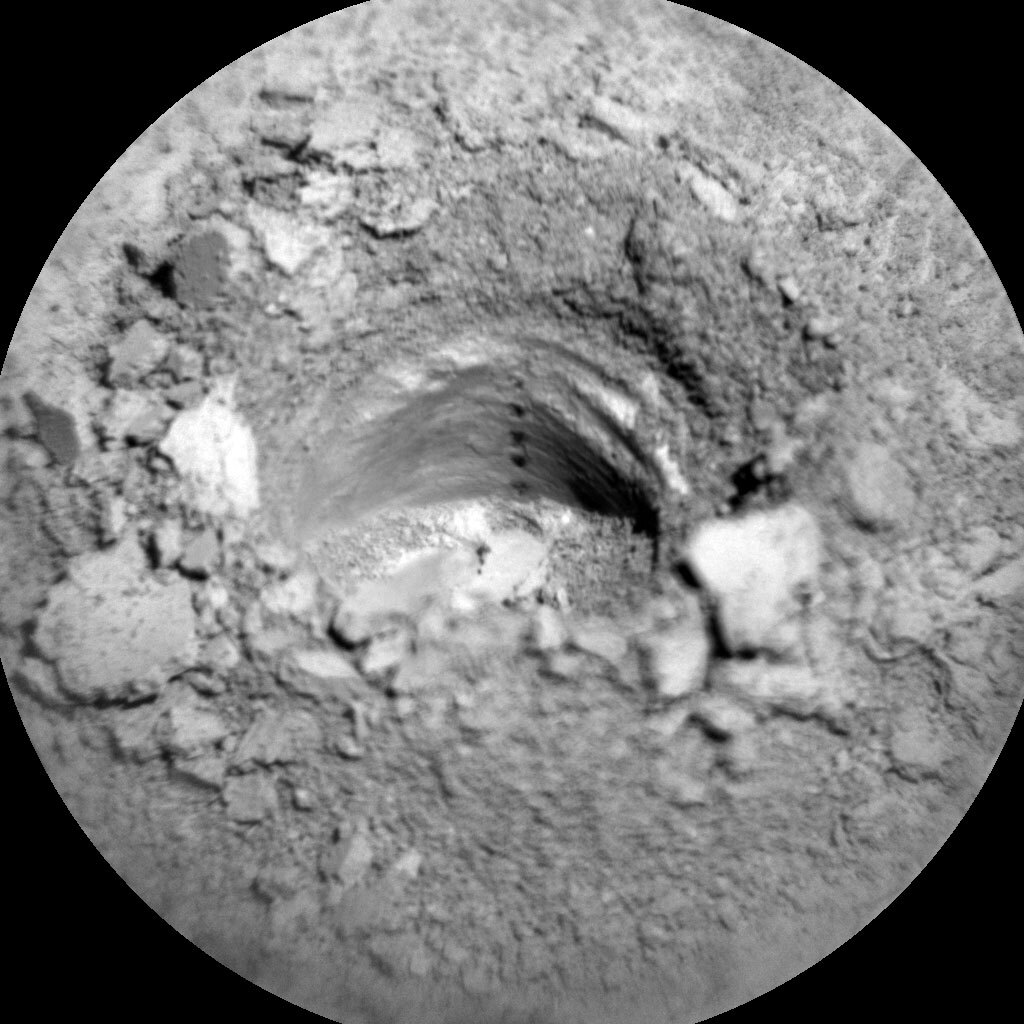
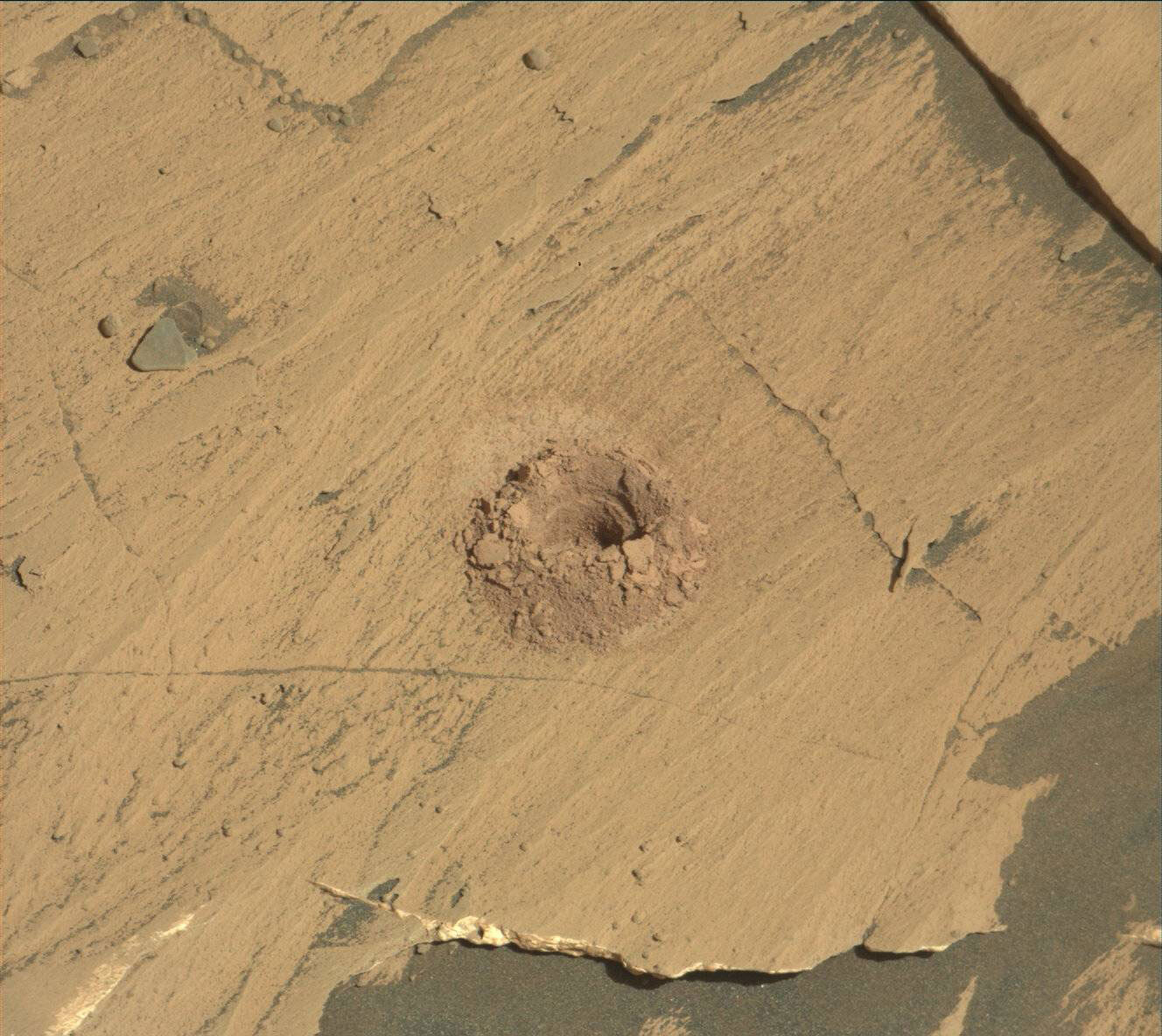
Image of the Zechstein drill hole wall and tailings around the drill hole taken by Chemistry & Camera (ChemCam) onboard NASA's Mars rover Curiosity on Sol 3292. Credits: NASA/JPL-Caltech/LANL. Download image ›

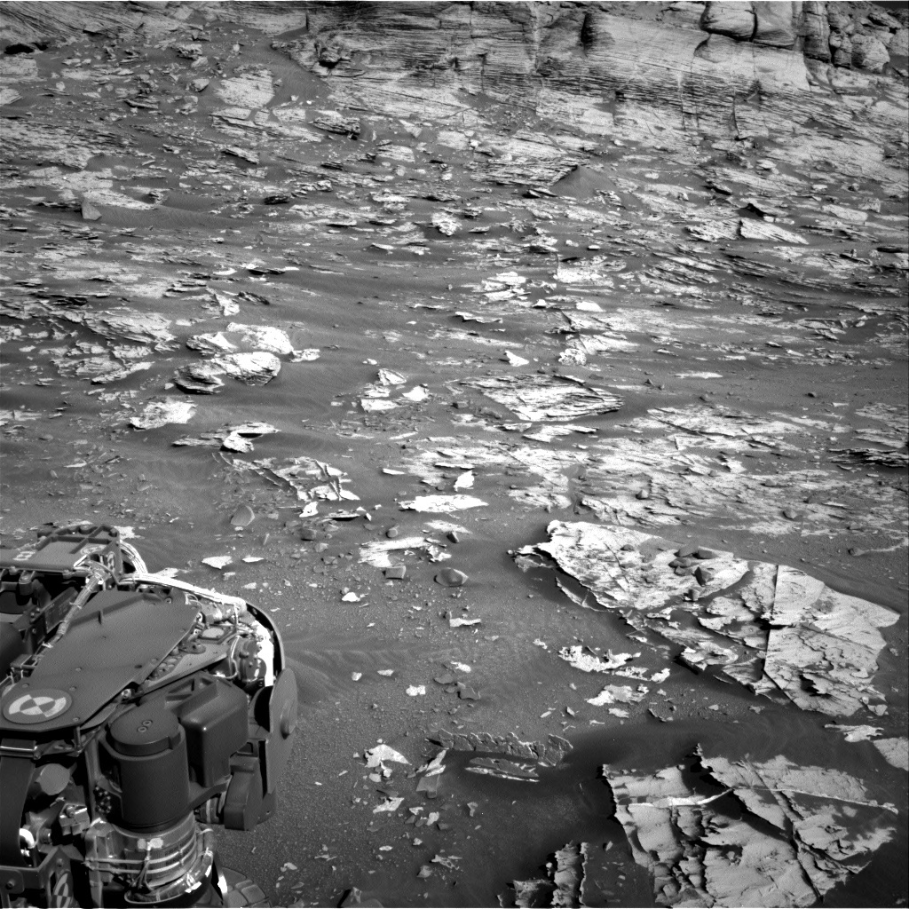
We are in the midst of the Zechstein drilling campaign. The SAM team are eagerly waiting for the results of their weekend EGA analysis on the drilled sample. Depending on the results, we might move onto characterizing the dumped sample with our contact science instruments and ChemCam in the next plan. Anticipating the return to contact science within the next few days, Mastcam will take an image of the tailings around the Zechstein drill hole in today’s plan. This change detection image will be used to determine the shape of the tailings, to see if they have been moved around by wind or by the ChemCam LIBS measurement of the drill hole wall on sol 3292 (shown in the above image). I was the APXS planner today, so it was a pretty quiet day for me, but APXS and the other contact science teams are looking forward to getting to work on these samples!

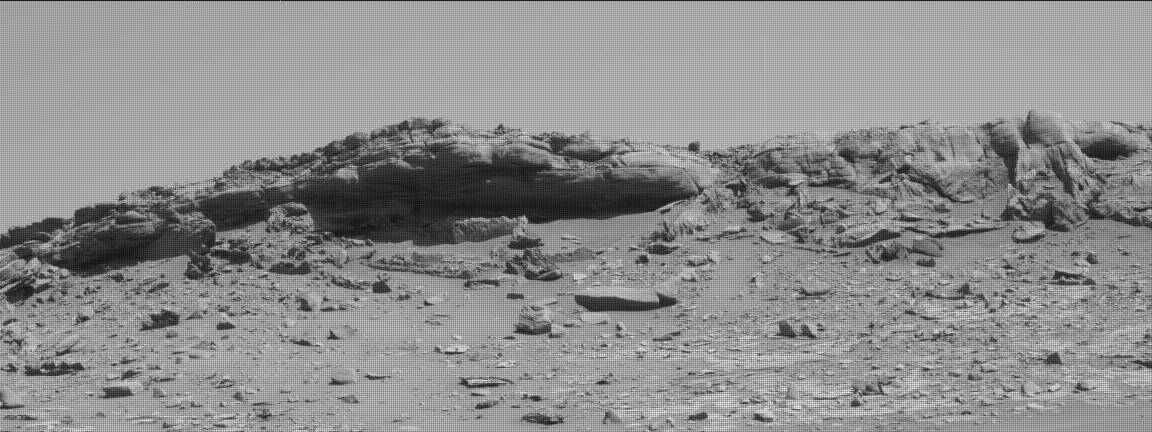
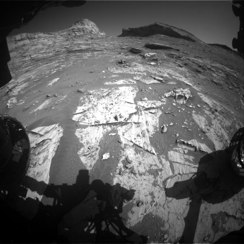
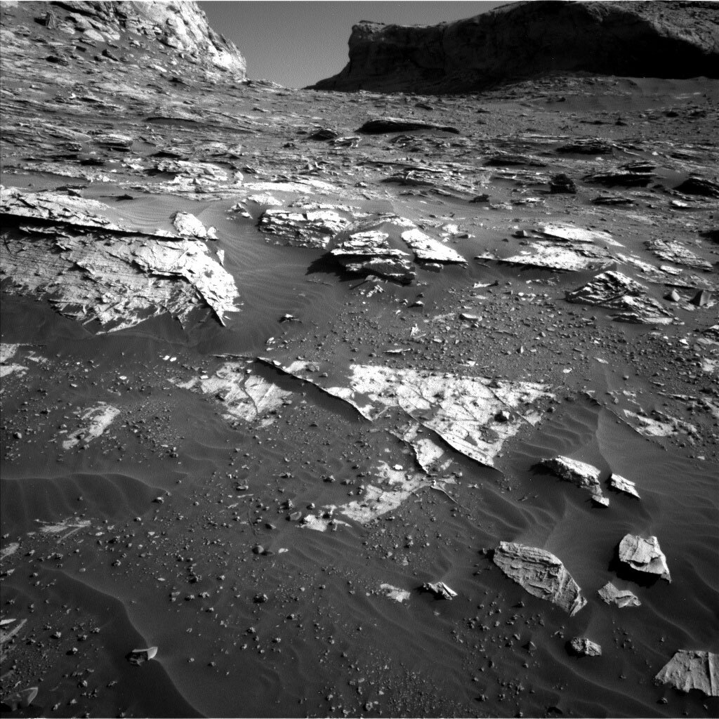
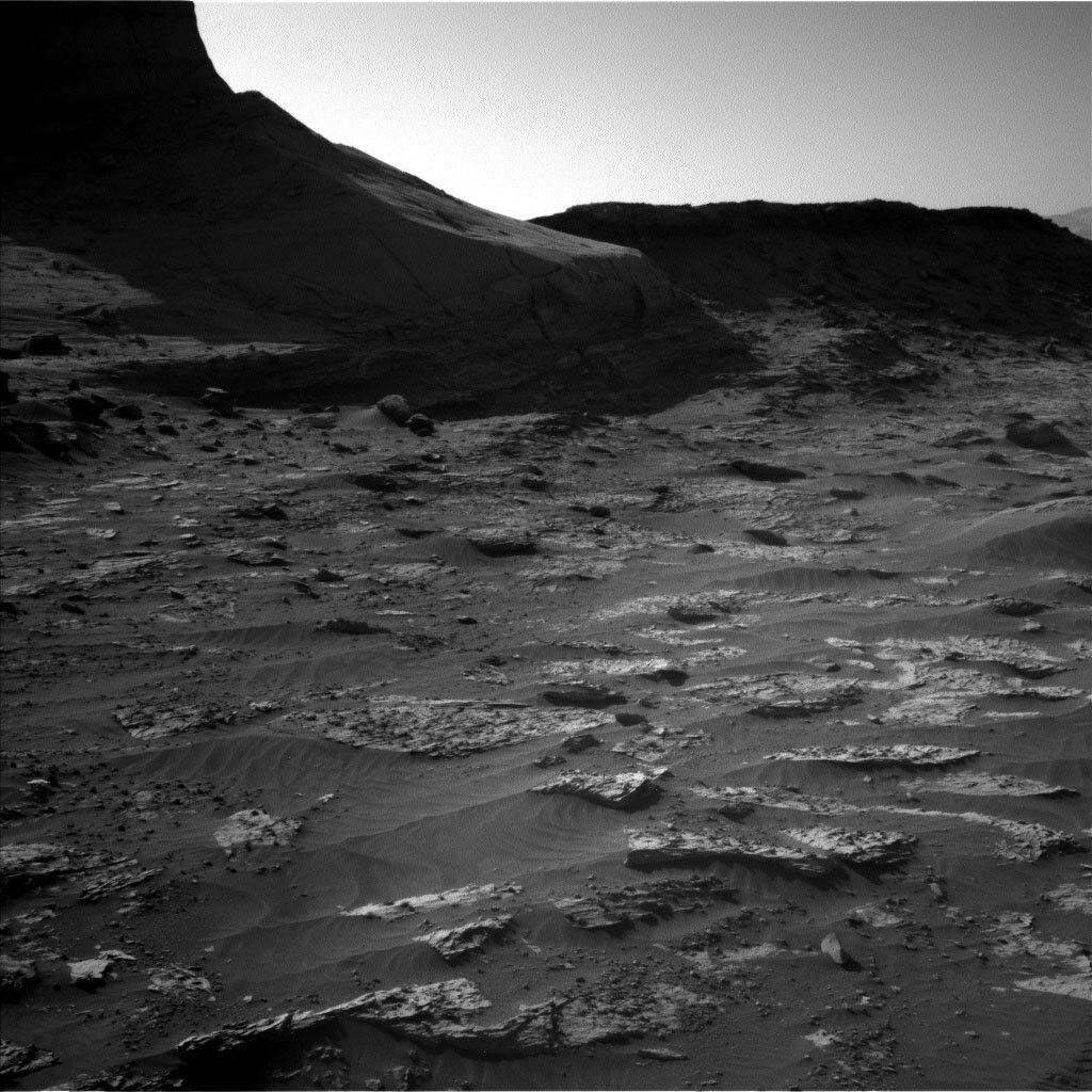
In the meantime, we continue to characterize the local bedrock with ChemCam and Mastcam. ChemCam is using the LIBS instrument to analyze two targets. One (“Aberlemmo”) is on some obviously layered bedrock, the second (”Caledonite”) is on a nearby fragment of bedrock but layering is less prominent. ChemCam will conduct a paired experiment, so that we can potentially determine if the layering has an associated compositional factor. Mastcam will image these targets and a third layered target (“Balmashanna”) in the same part of the workspace. Finally, the hardworking ChemCam and Mastcam instruments will do some long distance imaging of the overlying Greenheugh pediment, looking at the contact between the pediment and underlying rocks.

The environmental theme group continue their campaign to document environmental conditions in Gale crater, with tau observations (measuring dust in the atmosphere), cloud surveys and dust devil movies (hoping to catch one in action!)

November 12, 2021

Sols 3296-3299: It's Like Deja Vu All Over Again!

Written by Mark Salvatore, Planetary Geologist at University of Michigan
Image taken by NASA's Mars rover Curiosity with rock formations on Mars.

This image was taken by Mast Camera (Mastcam) onboard NASA's Mars rover Curiosity on Sol 3291. Credits: NASA/JPL-Caltech/MSSS. Download image ›

Another science-filled weekend is in store for Curiosity, who will be acquiring several large Mastcam mosaics, several ChemCam LIBS observations, some early morning images of a nearby outcrop, and some additional imaging of the Zechstein drill hole, not to mention a handful of ENV activities as well! Plus, in the middle sol of the plan, Curiosity will transfer drilled material to SAM for analysis using the evolved gas analyzer (EGA).

Now, for those of you blog enthusiasts who might feel that today’s science activities seem oddly similar to yesterday’s activities, you are not mistaken! Wednesday’s plan unfortunately did not uplink to the rover due to a DSN issue, and so the team planned to recover those lost activities in the weekend plan. Fortunately, the rover has been in good shape with regards to power, and so we are able to ensure that these important science observations can be recovered!

And for today’s image, I think it’s fitting that we repeat yesterday’s blog image as well. Not only is it consistent with our repeated plan, but it’s also just a really beautiful image from a great perspective!

November 11, 2021

Sols 3294-3295: Extra Energy for Extraterrestrial Science!

Written by Mariah Baker, Planetary Geologist at Center for Earth & Planetary Studies, Smithsonian National Air & Space Museum
This is an image of two sized large boulders that appear as low hills. The surface is sandy with lots of smaller rocks. There is a clear sky in the background.

This image was taken by Mast Camera (Mastcam) onboard NASA's Mars rover Curiosity on Sol 3291. Credits: NASA/JPL-Caltech/MSSS. Download image ›

When the operations team logged on today, we were prepared to pick up where Monday’s team had left off in Curiosity’s ongoing drill campaign at Zechstein. But then we received some news: even though the original plan already included two hefty science blocks, the rover still had extra energy to spare! In order to take advantage of this excess energy, the team added yet another science block to the plan and strategically positioned it to occur in the morning around 8 AM local Martian time. While science blocks typically occur during the middle of the day, this early morning time was desirable because it would provide better illumination for acquiring a ChemCam RMI image of a complex rock outcrop nearby (shown in the Mastcam image above). Plus, the additional heating needed to operate instruments during the cold morning hours would use up more of the rover’s spare energy. In other words, this new morning block was beneficial for both science and operations—a win win!

The other two science blocks in the plan were also filled to the brim with activities: two Mastcam mosaics were planned on local bedrock including target "Hare Stone," and a third Mastcam mosaic will provide stereo coverage of a curved sand ripple that can be seen from orbit. A ChemCam Passive observation will collect supplementary data on a pebble that was studied previously using ChemCam LIBS. Additional ChemCam LIBS measurements and associated Mastcam documentation images will be acquired on bedrock targets "Tong Saltings" and "Stack of Handa." A third Mastcam documentation image of the Zechstein drill hole will be used to monitor wind-driven changes in the drill tailings. The rover will also collect a set of environmental Navcam observations including dust devil, suprahorizon, and zenith movies, as well as a line-of-sight image for studying atmospheric dust levels. Even with all the activities planned over the next two sols, the rover is projected to have enough energy entering the plan on Friday for another full weekend of science!

November 8, 2021

Sols 3292-3293: Celebrating Zechstein with a Science Feast!

Written by Sean Czarnecki, Planetary Geologist at Arizona State University
This is an image of the sandy surface of Mars. There are several cracks in the surface and a quarter sized hole with grainy crushed sand surrounding the hole. Curiosity’s shadow is in the bottom right corner.

This image was taken by Mast Camera (Mastcam) onboard NASA's Mars rover Curiosity on Sol 3289. Credits: NASA/JPL-Caltech/MSSS. Download image ›

We did it! Yet another successful hole has been drilled in Mars! Welcome to the family, "Zechstein!"

Tosol, Curiosity is planning for a TON of cool science including a ChemCam vertical raster in our new drill hole (more about this below), CheMin analysis of the mineralogy of this drill sample, and several image mosaics! Mosaics are a common activity with our mission, and we have SO many cameras to plan them with! But this plan is pretty special because we have 7(!) image mosaics planned in addition to a dust devil survey.

Dust devil surveys are another common activity for our mission, but that doesn't mean they are unimportant. These surveys attempt to capture the formation of dust devils in Gale crater. These are some of the coolest products from our mission to look at because they are shots of Mars in action!

Tosol's mosaics include a Navcam sky flats observation and two ChemCam long distance mosaics of Rafael Navarro mountain and the pediment above us. We also have four mosaics from Mastcam, two large mosaics of the "Rafael Navarro Foothills" and "Maria Gordon Notch," and two smaller mosaics on targets "Loth" and "Reawick."

ChemCam is also taking LIBS chemistry measurements of two targets including "Comet Stone," which is a pebble thought to be from the Stimson formation above the rover, and a vertical raster inside our new drill hole, "Zechstein." I love these vertical ChemCam rasters in drill holes because they let us see the changing chemistry as a function of depth below the surface. A rare opportunity to better understand the unexposed subsurface rocks!

In addition to all of the great science activities above, we are delivering a sample of our newly drilled material to CheMin, which will provide us with detailed mineralogy of this site. And DAN, REMS, and RAD will also have their standard monitoring activities.

November 5, 2021

Sols 3289-3291: Go For Drilling on Zechstein!

Written by Ashley Stroupe, Mission Operations Engineer at NASA's Jet Propulsion Laboratory
Image taken by the Mars rover Curiosity of a close-up a brush of the rock surface around Zechstein.

NASA's Mars rover Curiosity acquired this image using its Mars Hand Lens Imager (MAHLI), located on the turret at the end of the rover's robotic arm, on November 4, 2021, Sol 3287 of the Mars Science Laboratory Mission. Credits: NASA/JPL-Caltech/MSSS. Download image ›

This weekend plan is an exciting one - we are "GO" for drilling! I worked as a Rover Planner today, helping to sequence our 34th drill hole on Mars on the target "Zechstein." This is also our 40th sample, including the six sand analyses we have done after scooping. In the last plan, we got a beautiful brush of the rock surface around Zechstein (shown in the image). We even think we can see a divot in the center resulting from our preload test, which is done to make sure the rock will not break when we try to drill.

Today, the first sol of the plan is all about the drill. First, we are using the APXS contact sensors to find the surface and then MAHLI to take imaging of all the targets we will need later in the campaign to dump out the sample. We have to do this because once we have sample we have to keep the drill pointed downward in order to avoid spilling the sample. We then start drilling in order to collect our sample. Other recent drilling activities have indicated the rocks are a little bit softer in this area, so we are hopeful that we will get a good sample for SAM and CheMin to analyze. After we drill, if there is enough time remaining, we will do some test sample portions on the SAM inlet cover to ensure that the sample is safe to give to the instruments – sticky samples or samples with lots of clumps may clog the inlets, so we always look at the samples before delivering. Overnight on the first sol, we will be doing an APXS measurement on the atmosphere. We are looking at the atmospheric composition, in particular Argon, which varies seasonally.

The second and third sols of the plan have targeted remote science observations. The drill tailings will be looked at closely with a Mastcam multispectral observation as well as a ChemCam RMI. We are looking at three spots around the target "Ardsheal" with Mastcam to look for recent changes in the sand and pebbles near the rover due to wind or temperature. We will follow up today’s observations with additional ones while we are parked during the drill campaign. There is also a large 28-frame mosaic of the Greenheugh pediment to help further characterize the capping layer, which is very distinctive, and to help plan the route ahead. For ChemCam, we are taking LIBS observations of a bedrock target "Causewayside" and a pebble target "Sannox" to get compositional comparisons of the two materials.

In addition to the targeted science, we have some additional environmental observations as well as some engineering maintenance activities. On the second sol we have a large dust devil movie, a 360-degree sky survey and a cloud observation with Navcam. On the third sol, in an early morning block a little more than hour after sunrise and just before the end of the plan, we have our standard AM Environmental suite: we take a Navcam zenith movie to look for clouds, a suprahorizon movie to look for clouds and dust devils, and some observations to measure the amount of dust in the atmosphere (a north-facing line of site toward the crater rim and a Mastcam solar tau sun image).

November 3, 2021

Sols 3287-3288: Assessing a New Potential Drill Target

Written by Abigail Fraeman, Planetary Geologist at NASA's Jet Propulsion Laboratory
This is a black and white image of the sandy, rocky surface of Mars.

This image was taken by Front Hazard Avoidance Camera (Front Hazcam) onboard NASA's Mars rover Curiosity on Sol 3286. Credit: NASA/JPL-Caltech. Download image ›

After our short bump on Tuesday, Curiosity has reached a new potential drill location. When we first arrived at the clay-sulfate transition, the science team decided on a strategy to drill every ~25 m in elevation gain. This allows us to systematically document any changes in the composition of the terrain while being reasonable with our limited rover resources. The terrain is beginning to steepen as Curiosity gets close to the end of this region, so even though we’re only a few drives away from our last drill site at Maria Gordon, we’ve already climbed 25 m higher!

The main activity in this two-sol plan will be characterizing the chemistry and textures of our planned drill target with APXS, MAHLI, Mastcam, and ChemCam. We will also place the drill bit on the rock to make sure the rock is stable enough to support the force of drilling. Additional environmental science monitoring observations will round out the plan. We named the planned drill target "Zechstein." On Earth, the Zechstein Group describes a succession of rocks that were deposited in an ancient ocean located east of the present location of the British Isles. The terrestrial sequence contains many salts that formed during periods when the waters became shallow, such as halite (sodium chloride, table salt) and gypsum (calcium sulfate), so we felt this was an appropriate name to use as we transition to rocks on Mars that could contain similar salty minerals.

November 2, 2021

Sol 3286: Drill Sol Zero!

Written by Ken Herkenhoff, Planetary Geologist at USGS Astrogeology Science Center
This is a black and white image of the sandy, rocky surface of Mars. There are many flat, low-lying rocks on the surface, and part of the Curiosity rover's arm is visible at lower left.

This image was taken by Right Navigation Camera onboard NASA's Mars rover Curiosity on Sol 3285. Credit: NASA/JPL-Caltech. Download image ›

The Sol 3285 drive went well and MSL has a good view of nearby outcrops, so the science team had a lot of potential drill and contact science targets to discuss. We sent a prioritized list of drive targets to the Rover Planners, and ultimately selected a low-lying outcrop seen right of center in this image. This target appears to be easily accessible, so today's plan represents the first sol of a new drill campaign! Although the time available before new data must be relayed to Earth was limited today, we were able to plan contact science on a nearby rock target called "Dumbuck" and some remote sensing observations as well. It was a busy and sometime hectic planning day for the team (including me as SOWG Chair), but the effort was worth it because the final plan is excellent.

After APXS and MAHLI examine Dumbuck, ChemCam will shoot its laser at a nearby nodule-rich bedrock target named "Fallen Stack" to look for compositional variations among the nodules and surrounding bedrock. After the Right Mastcam documents the laser spots, several Mastcam stereo mosaics are planned, of the drill site for context, of an outcrop to the west dubbed "Bellevue," and an outcrop uphill named "Cliffs of Hallaig." Mastcam stereo mosaics will also be acquired on a couple targets that had been imaged before, "Coylton Rocking Stone" and "Ciuff Hill," from our new viewpoint. After the drive to the new drill site, in addition to the standard post-drive imaging, Navcam and Mastcam will take mosaics of much of the terrain around us to enable detailed target selection tomorrow. Navcam will also search for clouds and MARDI will image the surface behind the left front wheel during twilight.

November 1, 2021

Sol 3285: Oh So Close

Written by Michelle Minitti, Planetary Geologist at Framework
This is a black and white image of the sandy, rocky surface of Mars. There are low hills in the background and small rocks are scattered on the smooth surface.

This image was taken by Left Navigation Camera onboard NASA's Mars rover Curiosity on Sol 3284. Credit: NASA/JPL-Caltech. Download image ›

The drive over the weekend was successful, gaining us more than 6 m in elevation - not bad for a weekend hike! Looking at this terrain, it is probably not surprising to you that looking uphill into the tilted bedrock slabs and thin resistant veins jutting up in all directions makes it hard to plan our next move. Indeed, today’s drive will take us close to the area where we want to drill next, but not necessarily the exact spot. We hope to be able to look around us after the next drive - looking left and right across the tops of these bedrock slabs and veins - and pick a sweet spot to drill. Given the variety of features around us right now, surely sweet spots will not be in short supply!

Before we drive, we had time to gather data from our surroundings. Today’s workspace was considerably less rocky than the last one, but the lovely sand ripples cutting through made an intriguing target. MAHLI and APXS will image and measure one ripple, “Dornoch Beach,” the first purely sand target we have studied in quite awhile. It is good to keep track of sand chemistry, as sand is a mixture of rock components near and far, and changes in sand chemistry can indicate changes how much local rocks are contributing to the sand. ChemCam will measure the chemistry of one of the ~cm-sized resistant nodules, “Aztec Tower," in bedrock out of reach of the arm instrument. Mastcam will acquire a mosaic of one of the spectacular slabs nearby, the one present on the left side of the image above, dubbed “Coylton Rocking Stone.”

Before and after the drive, Mastcam will support measurement of the amount of dust in the atmosphere with an image aimed at the sun, using a big filter keeping the camera safe while doing so. Navcam will look for dust devils and clouds. RAD and REMS run throughout the plan. DAN will run in passive mode for nearly 8 hours before, during, and after the drive while adding an active measurement after the drive is complete.

October 30, 2021

Sols 3282-3284: Layers and Veins in the Mist

Written by Michelle Minitti, Planetary Geologist at Framework
This is a black and white image of the smooth, sandy surface of Mars. There are large rough boulders embedded in the sand with smaller rocks scattered around.

This image was taken by Left Navigation Camera onboard NASA's Mars rover Curiosity on Sol 3280. Credit: NASA/JPL-Caltech. Download image ›

We were greeted with another artistic workspace on our trip toward the entry of “Maria Gordon Notch.” The bedrock exhibited millimeter-thick layers interrupted only by periodic thin white veins jutting out of the bedrock surface. The bedrock and surrounding sand ripples were littered with gray rock fragments, shed from the "Greenheugh Pediment" looming east of us. To keep building our systematic picture of the bedrock as we climb Mount Sharp, we used all our remote and contact science instruments on the bedrock target "Isle of Mists.” ChemCam will take first aim before we brush the target with the DRT. MAHLI and APXS will have the next crack at the dust-cleared target for closer looks at its texture and chemistry. Finally, Mastcam will acquire a multispectral observation of the cleared bedrock, and a stereo mosaic covering the workspace.

While the bedrock was the focus of our attention, the veins were not to be ignored. ChemCam will acquire a raster from the vein target “Draffen,” and the Mastcam mosaic of “Hill of Many Stanes” will cover bedrock exposures cut by veins and nodules.

Looking farther afield, Mastcam will capture mosaics of the area where we are headed for drilling, a long stretch of the eastern edge of the Greenheugh Pediment, and “Ciuff Hill,” a small cliff west of us where the stratigraphy of this area is exposed.

The environment will also get plenty of attention throughout the plan, with multiple measurements at different times of day to monitor changes across the sols. At midday, Mastcam and Navcam will measure the dust load in the atmosphere, and Navcam will look for clouds, cloud shadows, and dust devils. The Navcam dust load cloud movie observations will also occur in the early morning of Sol 3283. DAN will acquire long passive measurement of the subsurface on each sol of the plan, and RAD and REMS will keep their steady gaze fixed on the Gale environment.

With our observations complete, we will drive ~50 m drive toward the elevation at which we want to drill next. It is hard to believe it is it that time already! It does not seem like long ago that we are at the “Maria Gordon” drill site, even with our pause in planning for conjunction. The fact that it does not feel like it took us long to climb to our next drill target is a sign we are really mountain climbing, and reading the mountain as we go!

October 28, 2021

Sols 3280-3281: Veins, Sand Grains, and Tough Terrains

Written by Ashley Stroupe, Mission Operations Engineer at NASA's Jet Propulsion Laboratory
This is a black and white image of rocks embedded in sand on Martian ground. Low hills are present in the horizon of the image against a clear sky. In the forefront smooth sand and small scattered rock particles are present.

This image was taken by Left Navigation Camera onboard NASA's Mars rover Curiosity on Sol 3279. Credit: NASA/JPL-Caltech. Download image ›

Today is another busy day on Mars, with both arm and driving activities. I did Rover Planning today; my job was to combine and review the arm and drive sequences.

First up in the morning is our pre-drive contact science. Today’s target, "Rhue," is a bright white vein (one of the largest we’ve seen). We’ll do some short APXS integrations as well as MAHLI imaging of the vein. Unlike the really tiny veins that we normally see, this is one is so large enough that we should be able to target it well and accurately. Hopefully, the RPs will Rhue today, and not rue the day we missed the target.

After the arm activities, we have a series of targeted science observations. We are looking at the target "Bludgers Revelation," a typical bedrock target, with both the ChemCam RMI and Mastcam. We are also taking multispectral mosaics of some nearby features, including a regolith fracture, a laminated rock, and additional bedrock targets (both with and without veins). We are also taking a Navcam suprahorizon movie, looking off to the south.

Today’s drive is taking us back toward the planned strategic route, and gets us closer to the area we are targeting for our next drill campaign. This drive should leave us with bedrock in the workspace for additional contact science on the weekend. This terrain continues to be very challenging, with large boulders, sharp rocks that are wheel hazards, and sand ripples, like the terrain shown in the image. These drives take a while to plan to make sure we are avoiding all the hazards while getting to where science wants to go. Our paths end up looking a little “drunk” as we weave our way around obstacles.

The attached image is from our post-drive imaging on sol 3279. We took the imaging in the late afternoon, providing these dramatic and beautiful shadows. Today’s post-drive imaging is also late afternoon, so we will likely get some additional images like this for Friday.

On the second sol of the plan, we have another methane experiment with the SAM instrument. This is part of our periodic campaign to monitor atmospheric methane and understand seaasonal variations. We don’t have anything else on this sol of the plan to preserve power for the weekend plan.