March 20, 2020

Sol 2710-2712: Full Drill Ahead!

Written by Rachel Kronyak, Planetary Geologist at NASA's Jet Propulsion Laboratory
An image of the Edinburgh bedrock

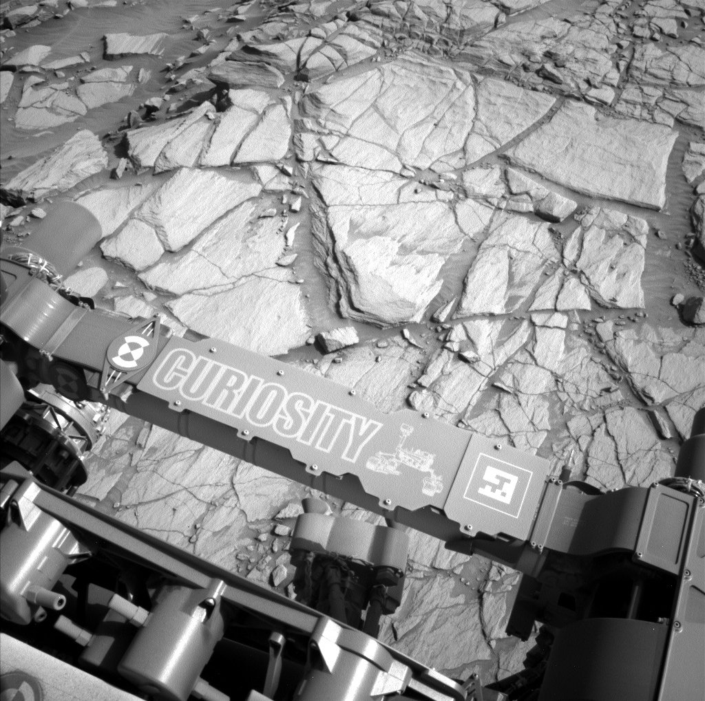
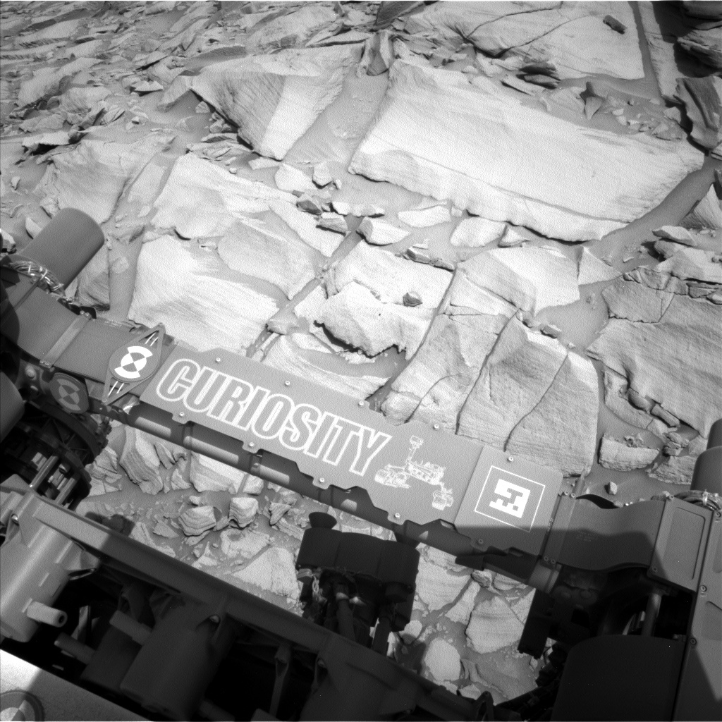
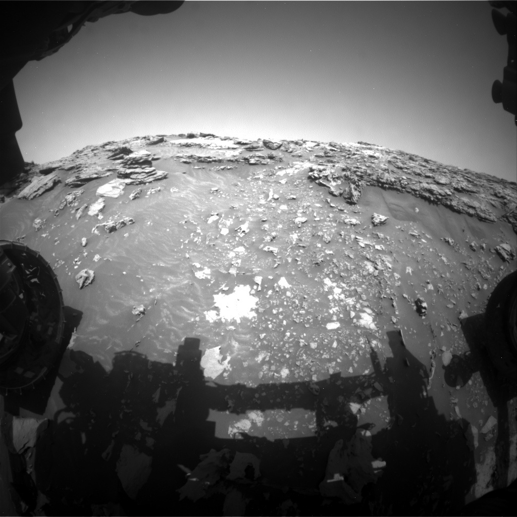
Curiosity will soon drill Edinburgh bedrock, seen in this image taken by MAHLI onboard NASA's Mars rover Curiosity on Sol 2703.Credits: NASA/JPL-Caltech/MSSS Download image ›

In light of recent events, NASA’s Jet Propulsion Laboratory has transitioned to teleworking for most employees. For the last few weeks, we have been making preparations so that our rover operations can be carried out with the JPL-based members of the team working remotely. Luckily, most of the science team has been working remotely for years! I’ve been serving as a Geo Keeper of the Plan (GKOP) for the last ~5 years, and most of that time was spent working remotely from the University of Tennessee. So, for most folks, it’s business as usual, which has helped smooth our transition to full teleworking.

Today we planned a 3-sol weekend plan. Despite today being our first day of fully remote operations, we made a jam-packed plan of activities centering around drilling target “Edinburgh!”

We’ll kick off the first sol of the weekend plan, Sol 2710, with a nice long science block full of both geological and environmental-focused observations. During the science block, we’ll perform a Mastcam multispectral observation of the “Eshaness” target (we had our first look at Eshaness on Monday using the DRT, MAHLI, and APXS instruments). We will also collect ChemCam LIBS data on two nearby targets including a soil target “Digg” and bedrock target “Eaglesham,” along with corresponding Mastcam documentation images. To wrap up our science block, we will make some of our standard atmospheric observations, including a Navcam dust devil survey, a Mastcam solar tau, and a Mastcam crater rim extinction image.

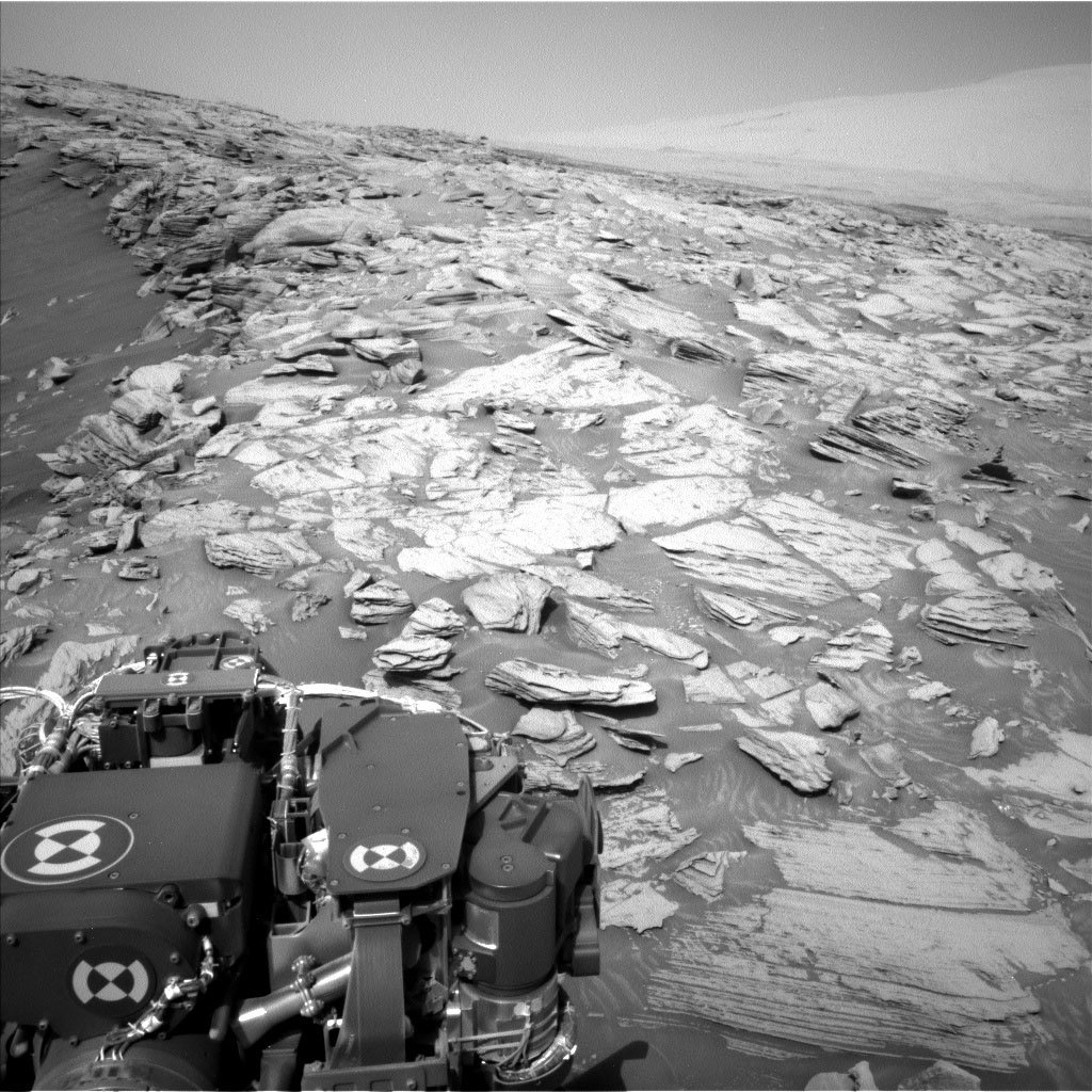
We have another science block in the early morning of Sol 2711, during which we’ll perform a similar suite of environmental observations as well as a Mastcam 360-degree mosaic. These hefty mosaics are especially useful during our drill campaigns, as they provide great context for our drilling operations and the broader geology around us. The rest of Sol 2711 will be dedicated to drilling the target “Edinburgh.”

Following a much-deserved night of sleep, Curiosity will wake up on Sol 2712 for the last science block of the weekend plan. During the science block, we’ll take dust devil survey and line-of-sight images with Navcam. Next, we’ll use ChemCam’s passive mode (no laser) to observe the Edinburgh drill tailings as well as use the RMI to take a long-distance mosaic of the target “Three Lochs,” an area further up the Greenheugh pediment. We’ll round out the plan by using Mastcam to take a multispectral observation of the Edinburgh drill tailings and take a stereo mosaic to expand our coverage of the “Hilltop” area, first imaged on Sol 2705.

We managed to plan a very full weekend plan for Curiosity, and had a very smooth day of planning for Curiosity’s operations team. It’s full steam (or rather, drill) ahead!

Stay safe, and continue to explore Mars with us!

March 17, 2020

Sol 2706: Science Team is Go for Drilling!

Written by Ken Herkenhoff, Planetary Geologist at USGS Astrogeology Science Center
This image of the Edinburgh bedrock was taken by MAHLI onboard NASA's Mars rover Curiosity on Sol 2703

This image of the Edinburgh bedrock was taken by MAHLI onboard NASA's Mars rover Curiosity on Sol 2703. Credits: NASA/JPL-Caltech/MSSS. Download image ›​

During the acquisition of the MAHLI images on Sol 2705, an arm hiccup prevented the sequence from completing. But enough images were successfully acquired that it's not necessary to repeat the MAHLI sequence, and the arm issue is well understood so that no special recovery activities were required.

We were therefore able to plan full contact science today, with DRT brushing of a bedrock target named "Eshaness."

Navcam will be used to search for dust devils and clouds, and Mastcam will take stereo image pairs to extend the mosaic of the hilltop. ChemCam planned a horizontal LIBS raster on a bedrock block dubbed "Corstorphine Hill" and another vertical raster on Glen Finglas using tighter point spacing. The Right Mastcam will take images of both ChemCam targets and of Glen Feshie, which was obscured by the arm when it was imaged on Sol 2705.

After an afternoon nap, MAHLI will acquire a full suite of images of the Eshaness brush spot and images from 25 and 5 cm of a soil patch named "Balliekine." APXS will then hover over Balliekine for an evening integration before the instrument is placed on Eshaness for an overnight integration.

Finally, early on the morning of Sol 2707, CheMin will perform funnel piezo and wheel move activities in preparation for the next drill target. During multiple discussions today, the science team concluded that we should go ahead and drill the Edinburgh bedrock target in our next plan.

So it was an interesting and exciting day for me as SOWG chair!

March 13, 2020

Sol 2703-2705: Assessing a possible drill target at 'Edinburgh'

Written by Abigail Fraeman, Planetary Geologist at NASA's Jet Propulsion Laboratory
The "Edinburgh" target (trapezoid shaped block, upper left) as viewed from our sol 2700 location.

The "Edinburgh" target (trapezoid shaped block, upper left) as viewed from our sol 2700 location. Credits: NASA/JPL-Caltech/MSSS. Download image ›​

Our small bump in Wednesday’s plan left Curiosity in a good position to examine a potential drill target that we have named “Edinburgh.” This weekend, we will DRT Edinburgh and observe it with ChemCam, APXS, MAHLI, and Mastcam’s multispectral filters. We will analyze these observations to help make a decision on Monday about whether we want to continue with a full drill in this area or move on.

The other geology-focused activities in the weekend plan include ChemCam observations of targets named “Tentsmuir,” “Glen Finglas,” and “Glen Feshie,” along with a 19x2 Mastcam mosaic of our surroundings. We will also conduct a series of environmental science investigations that include a measure of the amount of argon in the atmosphere using APXS, a dust devil survey, and several Navcam observations of far-away targets to characterize the amount of dust in the atmosphere. Finally, we will take a bunch of MAHLI images of the surface in front of us at different angles in order to understand how reflected light behaves with different viewing geometries.

March 12, 2020

Sols 2701-2702: Approaching a Possible Drill Target

Written by Ken Herkenhoff, Planetary Geologist at USGS Astrogeology Science Center
Image of Curiosity on the surface of Mars

Curiosity took this image on on March 11, 2020 (Sol 2700). The slab on the upper right of the image is a potential drill target. Credits: NASA/JPL-Caltech. Download image ›

The Sol 2700 drive went well, setting the rover up for contact and remote science on exposures of the pediment-capping bedrock. Before the arm is deployed on Sol 2701, ChemCam will measure the elemental chemistry of the sides of a couple bedrock slabs dubbed "Strath Halladale" and "Glen Tanar."

The Right Mastcam will image both of the ChemCam targets, then the DRT will be used to brush off the top of another slab of bedrock at "Assynt Window." MAHLI will take seven images of the brushed spot and another three images of a nearby slab named "Glen Feshie." The APXS will be placed on Glen Feshie for an evening integration, then moved over to Assynt Window for an overnight integration.

The next morning (Sol 2702), the arm will be stowed to allow ChemCam to observe a different bedrock slab named "Beinn Fhada" and the side of a rock called "Shieldaig." After the Right Mastcam takes images of those targets, the rover will perform a short drive to get Beinn Fhada in the arm workspace, allowing detailed investigation of this slab (upper right) as a potential drill target. After the drive, the arm will be unstowed to allow unobstructed imaging of the arm workspace to support targeting for the weekend plan.

Finally, Navcam will search for clouds and MARDI will take a standard twilight image of a new patch of Mars' surface. If all goes well and pending analysis of these new data, the team may decide to acquire a new drill sample!

March 10, 2020

Sol 2700: Photo Shoot

Written by Scott Guzewich, Atmospheric Scientist at NASA's Goddard Space Flight Center
This image was taken by Left Navigation Camera onboard NASA's Mars rover Curiosity on Sol 2698.

This image was taken by Left Navigation Camera onboard NASA's Mars rover Curiosity on Sol 2698. Credits: NASA/JPL-Caltech. Download image ›

Today’s plan focused on completing a major task of our science campaign investigating the Greenheugh Pediment: taking a large Mastcam stereo mosaic of the pediment capping unit and the distant Gediz Vallis ridge. Much of the mosaic’s field-of-view is covered in this Navcam image. This large mosaic will help link the patterns seen from orbit with what we see on the ground and help us understand how the pediment and Gediz Vallis formed and what their relative ages are compared to the rest of the features we’ve explored.

After taking that mosaic and a Navcam dust devil survey (the Greenheugh Pediment also appears to be particularly prone to dust devils), we’ll make a short drive to the west to reach our 3rd stop on this science campaign. After evaluating that location later this week, we’ll decide which spot we’ll want to drill.

March 9, 2020

Sol 2699: What to Do After Climbing a Pile of Rocks (On Any Planet)

Written by Sean Czarnecki, Planetary Geologist at Arizona State University
This image was taken by Left Navigation Camera onboard NASA's Mars rover Curiosity on Sol 2698.

This image was taken by Left Navigation Camera onboard NASA's Mars rover Curiosity on Sol 2698. Credits: NASA/JPL-Caltech. Download image

​I got to spend some time this weekend climbing around on rocks here in Arizona, and I'm happy to report that our favorite Mars Science Laboratory is doing the same (except ... you know ... on Mars)! After Curiosity's strenuous climb onto the pediment-capping unit last week, she will do what I did: look at rocks, gaze into the distance, take pictures of everything, and shoot lasers. Ok, I didn't shoot any lasers, but ChemCam will!

We will start with the rocks (and lasers). ChemCam will take rasters of "Machir Bay," "New Aberdour," and "An Carnach" to assess the chemical variability of the bedrock here. We will then take pre-DRT MAHLI images of Machir Bay and "Forsinard Flows," break out the DRT to dust off these targets, take post-DRT MAHLI images, and measure the bulk chemistry of these targets with APXS. Whew! Mastcam will also take images of this bedrock (a portion of which is in the Navcam image above) to study the fine-scale details.

This image was taken by Left Navigation Camera onboard NASA's Mars rover Curiosity on Sol 2698.
This image was taken by Left Navigation Camera onboard NASA's Mars rover Curiosity on Sol 2698. Credits: NASA/JPL-Caltech. Download image ›
In addition to interrogating the rocks under our wheels (so to speak), we will spend some time gazing into the distance. What a view we have from all the way up here on the pediment-capping unit! Mastcam will take advantage of our location to image nearby "Tower Butte" (in the top left corner of this Navcam image) in order to examine surface textures. Then Navcam will look to the horizon for dust devils and to the sky for clouds. It's sounding more and more like Arizona!

In the background, DAN will be measuring the neutron flux from the subsurface to assess the pediment-capping unit's hydration and RAD and REMS will continue to measure the radiation and atmospheric environments, respectively, at yet another record elevation for Curiosity!

March 6, 2020

Sols 2696-2698: Made it!

Written by Michelle Minitti, Planetary Geologist at Framework
This image was taken by Left Navigation Camera onboard NASA's Mars rover Curiosity on Sol 2695.

This image was taken by Left Navigation Camera onboard NASA's Mars rover Curiosity on Sol 2695. Credits: NASA/JPL-Caltech. Download image ›

Kudos to our rover drivers for making it up the steep, sandy slope below the “Greenheugh pediment” (visible in the left side of the above image) and delivering us to a stretch of geology we had our eyes on even before we landed in Gale crater! The geology planning group honored the achievement of making it here by getting our cameras and laser on every little bit of rock we could manage.

MAHLI and APXS will analyze “Galloway Hills,” cleared of dust beforehand by the DRT, and “Ardwell Bay.” The former is on a smoother, flatter part of the sandstone we are parked on, and the latter is an example of the resistant features that dot the sandstone in this part of the pediment. MAHLI will also acquire a mosaic looking edge on at a package of sandstone layers at the bedrock target “Chinglebraes.”

ChemCam will sweep across the terrain in front and to the left of us to gather data that will help us understand the chemical variability of the pediment here. "Machrie Moor” and "Templars Park” are comparable to Galloway Hills in that they are flatter, smoother patches of bedrock. "Lowther Hills” is comparable to Ardwell Bay, as it is a collection of resistant features within the bedrock. "Cheviot Hills” appears to be a bit more of an oddball - it’s a dark, smooth block like those we have seen on “Western Butte” and “Tower Butte.” ChemCam will tell us if it is linked to the rocks we have seen before, or if it is just a particularly dust-free example of the pediment rocks.

Mastcam has plenty to look at from our high perch. It will acquire a stereo mosaic looking across the scene, dubbed "Enard Bay," captured in the above Navcam image to get higher resolution and color views of the beds exposed there. Another large mosaic will cover the terrain into which we will drive over the weekend. The mosaic includes the drive target “East Lothian” and will give us an idea of the distribution of textures and structures of the bedrock we will be exploring for the near term. At the opposite end of the spectrum from a large mosaic, Mastcam will also take a single image of "Gars Bheinn,” one of the few blocks in the workspace that is relatively free of dust. The hope is that the image will give us a clearer view of the sandstone’s grain size and texture.

Now that we do not have a steep cliff in our front windshield, the skies stretch largely unencumbered above and around us. Navcam will take a 360 degree look around for dust devils on two different sols, and will acquire movies looking for clouds both in the afternoon and early morning. Mastcam and Navcam will assess the dustiness of the atmosphere by gazing across Gale crater from our great viewpoint.

March 5, 2020

Sols 2694-2695: Close to the Top!

Written by Kristen Bennett, Planetary Geologist at USGS Astrogeology Science Center
This image was taken by Mast Camera (Mastcam) onboard NASA's Mars rover Curiosity on Sol 2693. Credits: NASA/JPL-Caltech. Download image ›

This image was taken by Mast Camera (Mastcam) onboard NASA's Mars rover Curiosity on Sol 2693. Credits: NASA/JPL-Caltech. Download image ›

A short drive was planned in the previous sol to place Curiosity just below the top of the pediment. The drive went extremely well, and the workspace available for tosol’s plan is beautiful and full of tantalizing outcrops. The goal of this two-sol plan is to characterize the area just below the pediment capping unit to understand whether these rocks have a different chemistry than the rocks further away.

Curiosity is currently sitting on a 26 degree slope, but we were still able to plan for contact science! The team selected two locations that are thought to be just below the pediment capping unit to investigate with MAHLI and APXS: “Huttons Section” and “Clach Glas.” Huttons Section was targeted by ChemCam in the previous plan and we added a Mastcam multispectral image of this target to this plan.

The plan also includes four different ChemCam targets to help characterize the variations in chemistry in this area. “Muir of Dinnett” and “Findhorn Bay” are ChemCam targets in different locations on the pediment capping unit. Gleann Beag” was selected to be near the MAHLI and APXS target, Clach Glas. “Collieston” is targeting an area full of round nodules near the rover. Mastcam images of all the ChemCam targets are included in the plan. The Mastcam observation that includes Gleann Beag is a 7x5 mosaic that will cover the contact between the Murray Formation and the pediment capping unit. Additionally, Mastcam is taking a stereo mosaic called “Ochil Hills,” which will cover a vertical outcrop of the edge of the pediment that we have previously imaged from a different angle.

In the second sol the plan is for Curiosity to finish the climb to the top of the pediment. The rover's current location is just below the top, so Curiosity only has a short way to go before she finishes her climb and we can start exploring the pediment capping unit. A MARDI video is planned during the drive, in which MARDI will take 12 pictures per minute looking down at the ground as Curiosity drives over the contact and onto the top of the pediment. We should have a great view awaiting us up there!

March 3, 2020

Sol 2693: Have We Broken a Record? Not so Fast, Says Opportunity!

Written by Susanne Schwenzer, Planetary Geologist at The Open University
Comparing this image to the one in yesterday’s blog shows the progress on Curiosity’s impressive ascent.

Comparing this image to the one in yesterday’s blog shows the progress on Curiosity’s impressive ascent. This image was taken by Front Hazard Avoidance Camera onboard NASA's Mars rover Curiosity on Sol 2692. Download image ›

The planning started with intense discussions on the question of what to do, and for a very good reason. The sedimentology experts in the team had determined that we can see very interesting structures related to a possible contact between the Murray and the overlying pediment. We therefore had to decide early in planning if we wanted to try to collect contact science near the contact, or if we should continue with our climb to the top. In my role as Geo Science Team Lead I had to keep the planning on track – not an easy feat and I think I have to send out some chocolates to all who helped keep planning moving along! Orbital mechanics won’t stop for us and make Mars wait in position until we are ready to uplink our plan.

Changing the plan from ‘keep moving’ to ‘stay’ is never taken lightly, and the discussions reflected this as we were weighing options. The reason for the discussion was that we found a site close to the contact that looked much more accessible, detail rich and valuable up close than it had originally looked from the bottom of the hill. This justified not driving all the way onto the top of the pediment today, and instead doing a small adjustment to allow us to do contact science at these interesting targets tomorrow.

The data we will be acquiring here is getting the team excited! In today’s plan we have two ChemCam targets on bedrock: target “Ariundle” is in front of the rover, in fact, it is among the smaller rocks above the white patch in the image that accompanies this blog post. The ChemCam target “Hutton’s Section” is higher up on the slope and thus closer to the pediment. We are expecting to see some differences in chemistry between the two. Mastcam has a mosaic in this plan, which covers the two targets and documents the sedimentary structures around them.

We will then slightly adjust the rover to prepare for an APXS measurement in the area of the Hutton’s Section target. The adjustment should get us into a position to where we can reach the target with our arm. But if we indeed will be able to use the arm tomorrow is yet to be seen, because we are driving through very challenging terrain. On the last drive the tilt of the rover exceeded 30°. And, of course, that sparked the question if we are now holding the martian rover tilt record. Well, the colleagues who also did operations on the MER rovers reminded us that the MER rover Opportunity still holds the record by a fraction of a degree.​

In addition to these observations, the plan includes further imaging and a ChemCam AEGIS observation after the drive. This will set us up nicely for the next planning, hopefully with some contact science if it can be done safely – and then to continue the climb onto the pediment. Will we break the martian tilt record? The jury is still out – and a big shout of ‘awesome, thank you’ goes to the engineers, who make Curiosity climb as never before!

March 2, 2020

Sol 2692: Any Impediment to Climbing the Pediment? None so Far!

Written by Lucy Thompson, Planetary Geologist at University of New Brunswick
Front Hazcam image of our workspace as we get closer and closer to the pediment.

Almost there! Front Hazcam image of our workspace as we get closer and closer to the pediment. Credits: NASA/JPL-Caltech. Download image ›

Curiosity successfully completed the first drive of the ascent path onto the Greenheugh pediment, and ended up at a 26.7 degree tilt and at the highest elevation so far on Mount Sharp! Kudos to the rover planning engineers at JPL who executed the ambitious drive perfectly!

The focus of planning today was to characterize the bedrock immediately underlying the pediment capping rock with ChemCam and Mastcam and to continue the ascent. ChemCam will shoot two bedrock targets (“Corriecravie” and “Shannochie”) to document any compositional changes as we near the contact. This will help the team test hypotheses we have about water-rock interactions along the contact. Mastcam will be used to document the texture of these targets and to look more closely at the contact. There was not enough time in this plan to unstow the arm and do contact science as well as drive, and the priority is to ascend the pediment, so we chose the option of driving over contact science. We hope to do contact science later in the week, possibly at the contact tomorrow, and/or once we are on top of the pediment cap rock.

After what we hope will be another successful drive, there is a Mastcam clast survey, Navcam complete the 360, ChemCam AEGIS and MARDI planned. Standard REMS, DAN and RAD activities round out the plan.