March 22, 2018

Sol 2000: Roving for 2000 Martian Days

Written by Christopher Edwards, Planetary Geologist at Northern Arizona University
Sol 2000: Roving for 2000 Martian Days

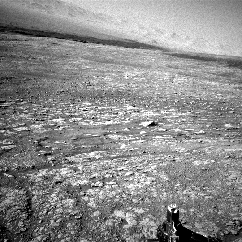
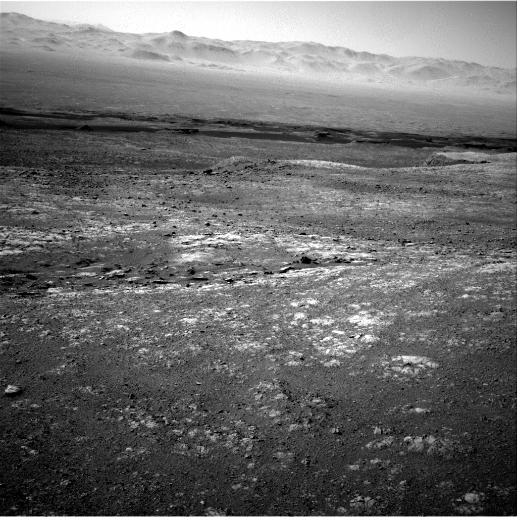
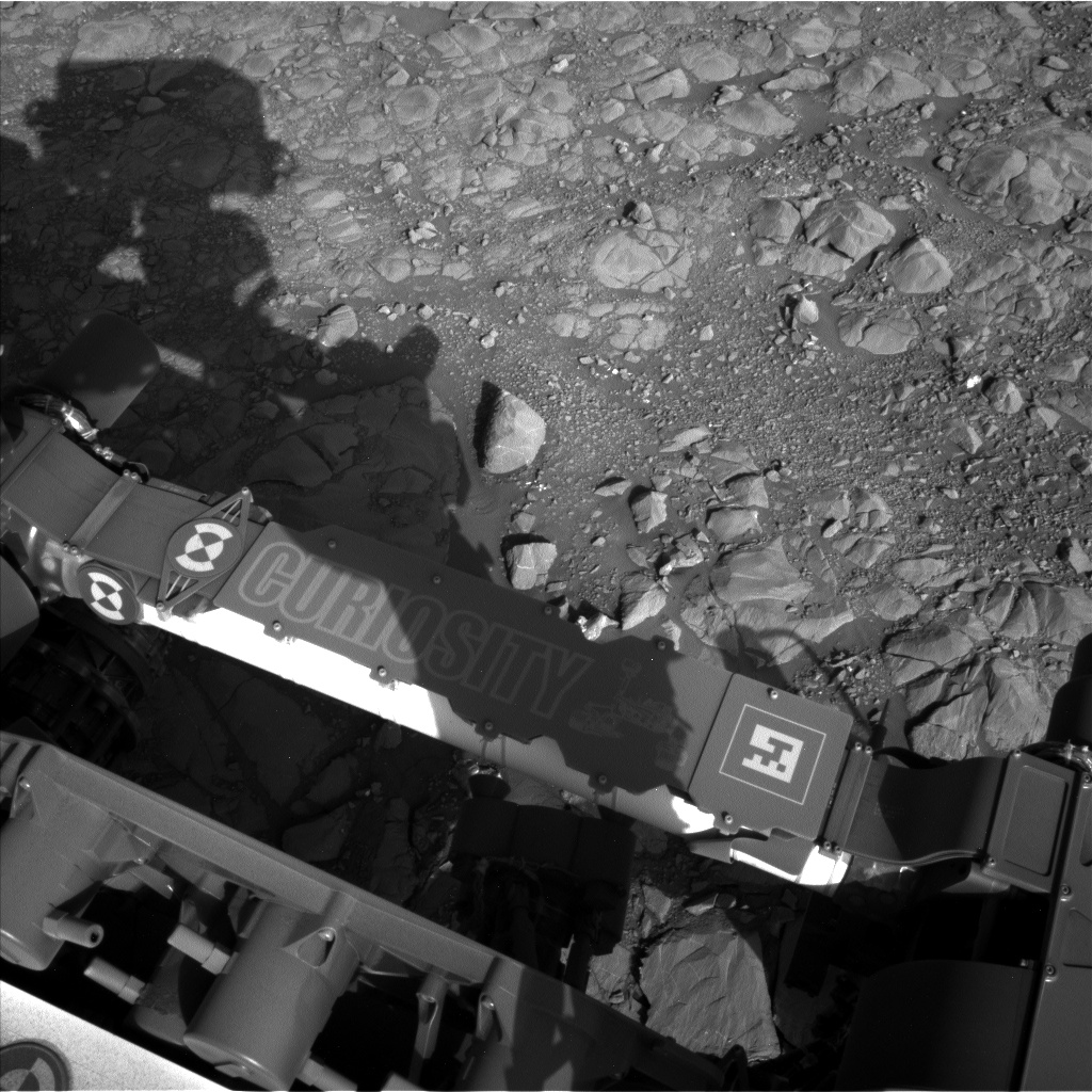
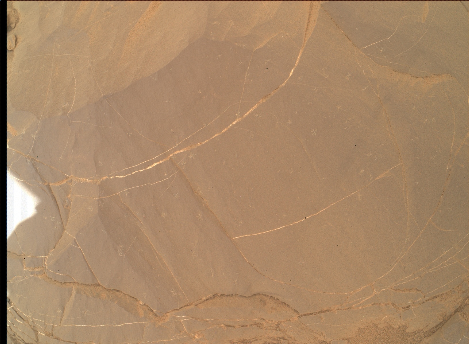
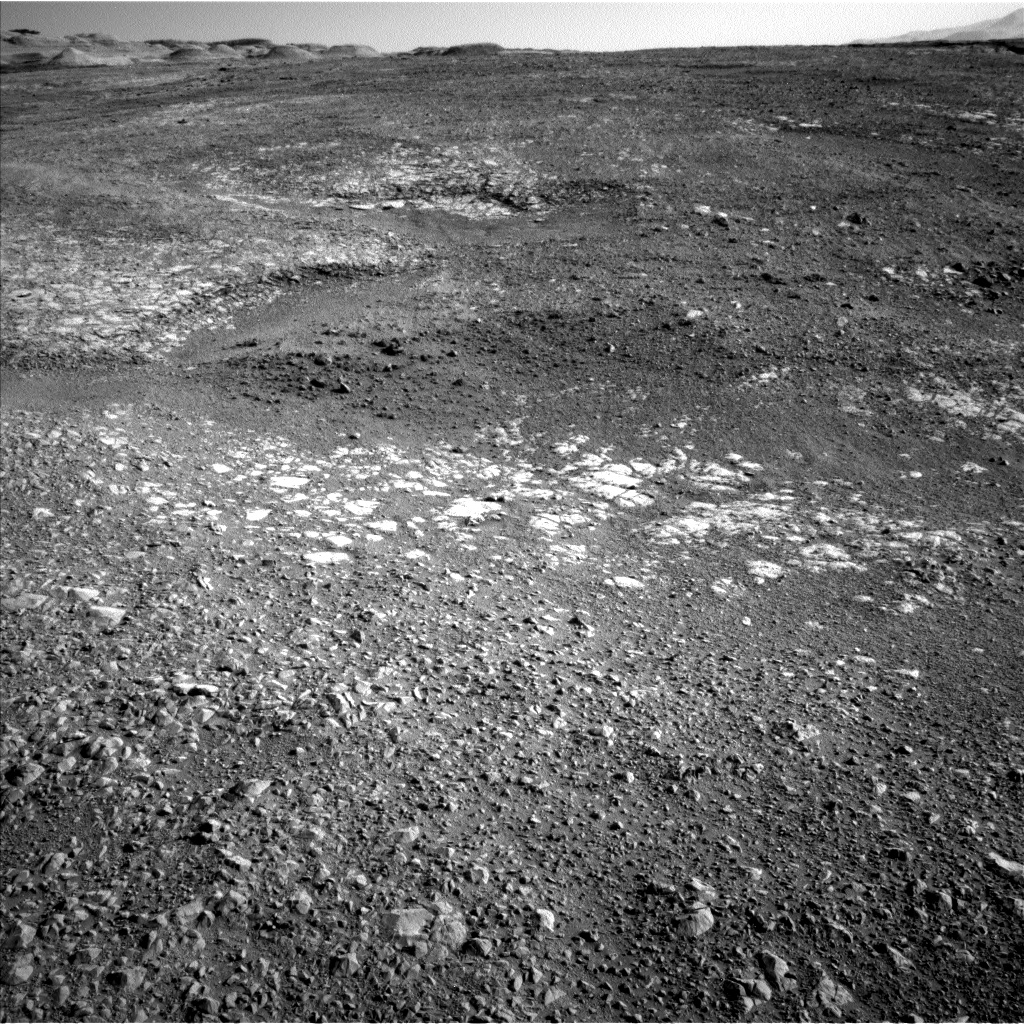
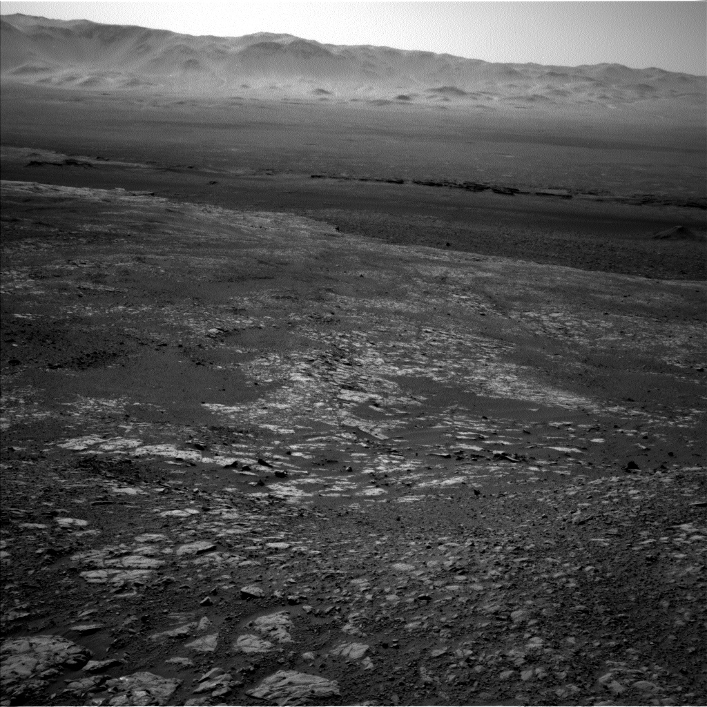
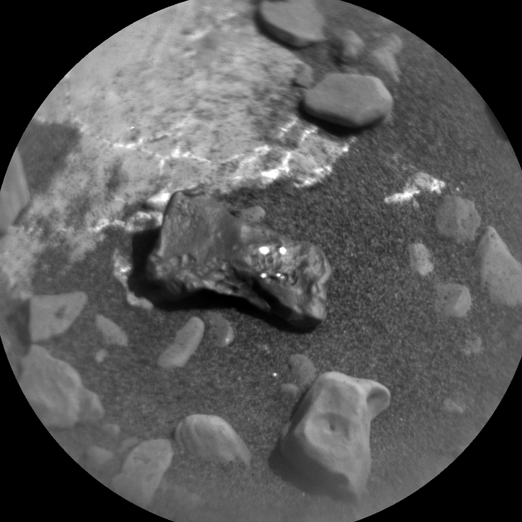
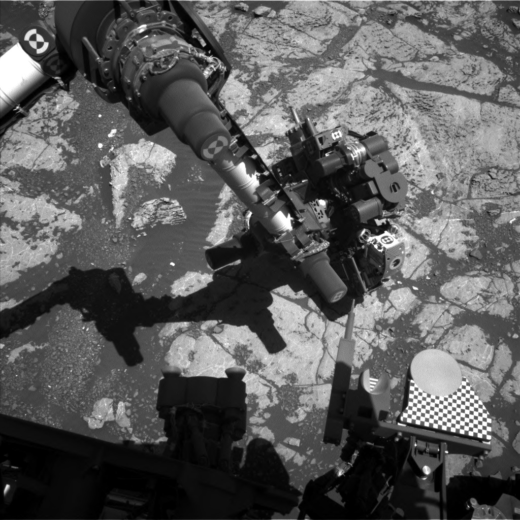
Today marks a milestone for Curiosity. Our trusty Martian rover has spent 2000 sols exploring Gale Crater helping to unravel the geologic history preserved in the rocks. We've observed a huge variety of past environments ranging from conglomerate rocks that indicate flowing surface water to mudstones that document a time when Gale crater contained an ancient lake. In today's plan, Curiosity is continuing its exploration of past environments preserved within Gale crater, further examining the Vera Rubin Ridge. Curiosity is continuing to make its way to the location where the strongest orbital signature of hematite is observed. In today's plan, we're carrying out remote sensing activities to examine layering in the rocks, as well as contact science on the target dubbed "Sgurr of Eigg" (just off the bottom of this image) to characterize the unit's chemistry and fine-scale morphology. We'll continue these types of activities over the weekend plan to refine our understanding of this workspace.

While some of us on the science team were busy planning activities for Curiosity's plan, many of the MSL science team members were busy attending the Lunar and Planetary Science Conference (LPSC). Today coincides with the majority of the MSL presentations discussing the new science being carried out by the team. In fact, I'm also attending LPSC but am taking a break to help plan Curiosity's activities from my hotel room at the conference center. It just goes to show, you can help drive a rover from almost anywhere!

March 21, 2018

Sol 1999: Party like it's (Sol) 1999

Written by Scott Guzewich, Atmospheric Scientist at NASA's Goddard Space Flight Center
Sol 1999: Party like it's (Sol) 1999

Curiosity is but 1 sol away from a major mission milestone, but work always comes before celebrations. Today our major decision was whether to perform contact science at the current location and conduct a short drive, or make a longer drive toward stop #12 on the Vera Rubin Ridge campaign (in the middle distance on the right side of the image). Today's team decided quickly to choose the latter option. But prior to the drive, we had room for a short science block that included ChemCam and Mastcam analysis of a bedrock target termed "Mangersta", measurements of dust in the atmosphere, and a search for dust devils. Then Curiosity will boogie toward stop #12, and after getting there, conduct a ChemCam AEGIS activity.

March 19, 2018

Sol 1998: Checking out the scenery

Written by Rachel Kronyak, Planetary Geologist at NASA's Jet Propulsion Laboratory
Sol 1998: Checking out the scenery

Today was a fairly quiet day of planning on Mars, the reason being that most of the MSL science team is currently attending the Lunar and Planetary Science Conference (LPSC) in Houston, Texas. LPSC kicks off today and is a really exciting time to hear all about the planetary-focused research being conducted all over the world. It's also a great time to make connections and collaborate with fellow scientists!

Today we planned for Sol 1998, which was mostly devoted to remote science observations as we drive along the VRR to our next area of interest. We have a hefty, 2-hour science block, which starts off with a couple of Mastcam multispectral observations on the "Red Hill" and "Red Cuillin" areas. These observations are intended to investigate the spectral properties of the terrain just ahead of the rover. We'll then take a stereo mosaic of the "Sgurr Alasdair" target to document the stratigraphic relationships of nearby rocks. After Mastcam, we'll take a suite of ChemCam observations. First, we'll take LIBS measurements on bedrock targets "Ochil" and "Orval," followed by RMI mosaics of yardang and fan features off in the distance.

Following our science block, the rover will perform a drive and take some standard post-drive images. We also have a post-drive science block, during which we intend to carry out a few ENV observations to monitor atmospheric and cloud properties.

Today I served as Mastcam PUL-1 and am working my shift remotely from the conference center at LPSC. I will be presenting some of my PhD research later this week, focused on fractures and veins that we've observed using the Curiosity rover and HiRISE orbital camera.

March 16, 2018

Sols 1995-1997: Under Durness

Written by Michelle Minitti, Planetary Geologist at Framework
Sols 1995-1997: Under Durness

The science team gave Curiosity a workout in this plan, using just about every watt of power available to carry out a full slate of activities. Sol 1995 starts off with a bang - three ChemCam rasters and a Mastcam 360 mosaic! ChemCam will first shoot "Durness," a flat, gray, apparently wind sculpted slab of bedrock in the workspace. Next up for ChemCam is "Paisley," a faceted cobble of bedrock cut by sulfate veins, and last is "Fingals Cave," a bright white exposure of sulfate vein.

The arm instruments get to work next. MAHLI will image Durness, which will show the ChemCam shots across the target, followed by DRT brushing of the target. APXS will analyze Durness and Paisley overnight, and then early in the morning of Sol 1996, MAHLI will return to Durness for more imaging on its now dust-cleared surface. MAHLI imaging of Paisley ends the arm work, and will capture the ChemCam raster spots and the areas cleared of dust by the ChemCam laser.

Before we drive on Sol 1996, the rover will acquire Mastcam multispectral observations of the DRT spot on Durness and across the "Vera Rubin Ridge" in the direction of a particularly strong hematite signal seen from orbit that we are driving toward. After the drive, Curiosity will acquire two ChemCam observations using the AEGIS automated targeting algorithm, and spend time observing the atmosphere. Mastcam and Navcam images and movies measuring dust in the atmosphere and looking for dust devils and clouds will take place both early in the morning and in the afternoon of Sol 1997. APXS will acquire another Ar atmospheric measurement overnight on Sol 1997. Regular DAN, RAD and REMS measurements keep the rover working in those small windows where nothing else is going on!

March 15, 2018

Sols 1993-1994: Castle in the Sand

Written by Michelle Minitti, Planetary Geologist at Framework
Sols 1993-1994: Castle in the Sand

NASA's Mars rover Curiosity acquired this image using its Mars Hand Lens Imager (MAHLI), located on the turret at the end of the rover's robotic arm, on March 13, 2018, Sol 1991 of the Mars Science Laboratory Mission, at 19:14:19 UTC.
As we drive east across the top of "Vera Rubin Ridge" - backwards no less! - we encountered another nice patch of bedrock in Curiosity's workspace today, motivating multiple observations before we hit the road once again. The bedrock in front of us resembled that which we studied on Sol 1991, where we imaged the target "Seaforth Head" . Seaforth Head exhibits small crystals like the ones we found at the "Jura" outcrop, and we hoped that today's workspace might turn up more crystals. To look for them, we planned a Mastcam M100 mosaic over a wide swath of the workspace. Our more detailed assessment of the bedrock will include coordinated observations of the gray bedrock target "Stirling Castle" with MAHLI, APXS and ChemCam. This target's name also gave us a chance to honor one of the rover planners operating the rover today, Stirling Algermissen! ChemCam will acquire a second raster on "Dunottar," bedrock which is rough and reddish at its base and smooth and gray at its top.

ChemCam will be kept very busy imaging far away targets and the sky in this plan. Nine overlapping RMI images of Peace Vallis will be acquired in an effort to combine them into a single image of higher resolution. As we did on Sols 1986-1987(link to the Sol 1986-87 blog), we will image the yardang unit on the flank of Mt. Sharp with two long distance RMI mosaics. These mosaics will help us increase our understanding of the internal structure of this unit. Just as we often use ChemCam in passive mode to look at the spectroscopic signature of rocks around us, in this plan we will use that same mode to look at the sky. ChemCam passive observations of the sky allow us to estimate concentrations of aerosols and trace gases in the atmosphere. To ensure the passive sky observation is well-calibrated, ChemCam will acquire passive spectra from the ChemCam calibration targets both before and after the sky observation.

The atmosphere will get more attention after our ~35 m drive, with images to measure the amount of dust in the atmosphere and movies that seek out clouds. APXS will also get its turn, measuring the amount of atmospheric Ar as the turret remains stowed on the night of Sol 1994.

March 12, 2018

Sol 1991-1992: Taking our time for science

Written by Ryan Anderson, Planetary Geologist at USGS Astrogeology Science Center
Sol 1991-1992: Taking our time for science

After a successful weekend plan, the team decided that for the sol 1991-1992 plan, we would trade a longer-distance drive in favor of some "touch and go" contact science. This ensures that we have a good record of the variations in chemistry and rock texture as we drive along the Vera Rubin Ridge. The plan starts with a short APXS observation of the target "Seaforth Head" along with MAHLI images of the same target. ChemCam and Mastcam also join in the fun, analyzing Seaforth Head as well as the target "Canisp". After those observations are finished, Curiosity will drive about 15 meters and collect the usual post-drive images.

On Sol 1992, we have an untargeted science block full of ChemCam activities. ChemCam will use autonomous targeting to analyze a patch of bedrock, and then will observe the titanium calibration target. After that, ChemCam will take advantage of the clear skies and nice vantage point here on the top of the Vera Rubin Ridge to do a big 10x2 RMI mosaic of part of the Peace Vallis fan. Mastcam will observe the same area with its right eye to provide color and context for the RMI. The plan wraps up with a Navcam movie to watch for clouds.

March 12, 2018

Sol 1988-1990: Stop and Smell the Argon

Written by Ryan Anderson, Planetary Geologist at USGS Astrogeology Science Center
Sol 1988-1990: Stop and Smell the Argon

We found out this morning that in the Sol 1986 plan, ChemCam was marked as "sick" and did not run its sequences. But on the bright side, it's a repeat of a minor issue that we've seen before, and so ChemCam will be back in action in today's 3-sol plan.

The plan begins on Sol 1988 with a bunch of Mastcam observations. We have stereo mosaics of an area near the target "Golspie" and an area called "Loch Eriboll" that we are scoping out as a potential drill site, as well as a broader context mosaic that covers both areas. Mastcam will also make a multispectral observation in the drive direction. After that, with ChemCam back online, it will analyze the target "North Harris" and Mastcam will take a documentation image. Later in the day, MAHLI will take some pictures of the targets "Barkeval" and "North Harris" and then APXS will do a quick analysis of "Barkeval" and an overnight measurement of "North Harris".

On Sol 1989, MAHLI will inspect our battered wheels, and then we will drive for about 45 meters, followed by the usual post-drive imaging. APXS will pull another all-nighter, this time in the stowed position. By collecting data while not touching a rock, APXS can measure the amount of argon in the martian atmosphere, which is useful since unlike carbon dioxide and water vapor, argon doesn't freeze out of the atmosphere at the poles every winter!

Speaking of the atmosphere, Sol 1990 was dedicated to lots of atmospheric observations. Mastcam has some observations of dust in the atmosphere in the early morning and early afternoon, and Navcam will watch for clouds at those times as well. Navcam also has some early morning observations of the atmospheric "phase function": basically, how bright the sky is at different angles from the sun. Navcam will also watch for dust devils in the afternoon.

March 8, 2018

Sol 1986-1987: Clear Vistas on Mars

Written by Roger Wiens, ChemCam PI
Sol 1986-1987: Clear Vistas on Mars

Seasons make a big difference for Mars vistas. Tosol Mars is at solar longitude 139, meaning that it is halfway between winter solstice and spring equinox in the southern hemisphere where Curiosity resides. The atmosphere around the globe is the clearest in southern winter. Once spring starts, turbulence increases and dust storms begin. The rover team is taking advantage of the clear skies to take long-distance ChemCam RMI mosaics of the terrain on Mt. Sharp and on the crater rim. We are especially interested in a Mt. Sharp unit characterized by features that look like yardangs, which are typically wind-sculpted elongated features in a landscape that is experiencing erosion. We're also very interested in the apparent fluvial channels seen descending from the crater rim. The accompanying Navcam image shows at least two channels (you may have to zoom in to see them). The one at the far right is named Peace Vallis and has already been the subject of some studies. We are curious - when was the last time that water flowed down these channels? Was it steady flow, or catastrophic? Is there evidence of snow and ice, or was the water more likely delivered as rain?

Under clear skies, Curiosity drove ~30 meters yestersol and is now stationed on a gravelly patch of ground. The rover is heading northeast along the top of Vera Rubin Ridge. With only gravel underfoot, the arm instrument teams decided to forgo contact science at this location. ChemCam and Mastcam will observe small bedrock targets "Sgurr nan Gilean" and "Braemar." Mastcam will use optical filters to observe the latter target. After a planned long northerly and slightly downhill drive aiming for 82 meters with visual odometry, imaging of the surroundings will be done by Hazcam, Navcam, and Mastcam. It will include a Mastcam clast survey. AEGIS software will use the Navcam images to pick a target for ChemCam to shoot. On the second sol of this plan ChemCam will take long-distance images of the yardang unit on Mt. Sharp and of the Peace Vallis area as noted above. Navcam will take several movies to look for dust devils and thin clouds. DAN, RAD, MARDI, and REMS will also take data.

March 6, 2018

Sol 1985: How Hard is a Rock?

Written by Roger Wiens, Geochemist at Los Alamos National Laboratory
Sol 1985: How Hard is a Rock?

Last week when the first Vera Rubin Ridge drill-hole attempts turned out to be too shallow at "Lake Orcadie", discussion in the team turned to the question of, "How hard is that rock? Is there a way to know before starting the drill hole how hard the rock will be, so we can anticipate whether Curiosity's new drill technique will be successful?" It turns out that the rover team has several indicators of rock hardness: a) retention of natural features such as craters, b) the imprints of wheel marks on the rocks, when we see them, c) scratch marks from the DRT brush, and d) laser pits from ChemCam. This turns out to be a lot of data, especially from ChemCam and MAHLI. However, no one has yet made a quantitative study of rock hardness vs. apparent laser pit depth or brush scratches. The problem is that other factors can affect how deep the pit or scratches look in our images, especially including lighting angle and rock texture and color, but also, for the laser, the distance from the rover and the focus quality. Even so, a study to determine apparent laser pit depth or scratch depth vs. hardness may be useful.

The classic Mohs mineral hardness scale was developed over 200 years ago, based on ten readily available minerals ranging from talc (hardness of 1) to diamond (hardness of 10). It is still used because of its simplicity-you can buy a kit with each of the representative minerals and try using them to scratch the mineral that you want to test. However, for quantitative measurements, most studies use the Vickers scale, which was defined 100 years ago and is reported in kg per square mm. It is traditionally measured by the size of the indentation left from a diamond tip with a given force applied.

Meanwhile, back on Mars, Curiosity will be driving away from this hard-rock location, with the first drive since Sol 1962, planned to go backwards for 30 meters in a northeasterly direction. Prior to leaving this site, ChemCam and Mastcam will make one more observation each of a meteorite, "Ben Nevis_2." The accompanying image shows the small iron clast with four bright glints, which are sunlight reflections off the metal made bare by previous ChemCam laser shots. Mastcam will also make crater rim extinction and basic tau (atmospheric visibility) observations. After the drive Mastcam, Hazcam, and Navcam will document the new rover surroundings. Navcam will take a zenith movie and a 360 degree observation. Mastcam will also take a clast survey image, ChemCam will take an RMI mosaic of the Yardang portion of Mt. Sharp, and will use AEGIS software to select an outcrop target near the rover for chemical analysis. DAN, MARDI, RAD, and REMS will also take data.

March 5, 2018

Sol 1984: Searching for Softer Pastures

Written by Scott Guzewich, Atmospheric Scientist at NASA's Goddard Space Flight Center
Sol 1984:  Searching for Softer Pastures

Vera Rubin Ridge is as hard as a rock! After two drilling attempts, Curiosity's drill was not able to dig into the bedrock sufficiently to collect a sample of rock at this location. Curiosity's engineers are continuing to refine the new drilling method. In the future, this might include adding percussion, which could enable drilling into harder rock. After learning this, the science team planned a series of Mastcam and ChemCam "passive" and LIBS observations of the attempted drill hole at "Lake Orcadie 2" (covered up by the turret in this image) in addition to contact science on the drill "tailings" (the powdered bits of rock ground up by the drill) with MAHLI and APXS. A ChemCam passive observation uses the instrument's ability to detect different wavelengths of light to get a sense of a rock's composition without using the laser to vaporize tiny bits of the rock surface. The team also planned another trick with ChemCam: long-distance image sequences of Peace Vallis on the far side of Gale Crater and a portion of the clay unit that represents part of Curiosity's future agenda.