April 5, 2018

Sol 2014: Something new and different

Written by Lauren Edgar, Planetary Geologist at USGS Astrogeology Science Center
Sol 2014: Something new and different

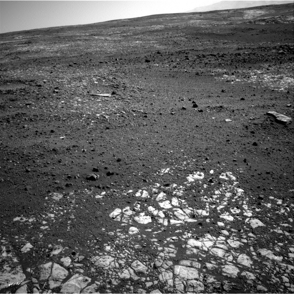
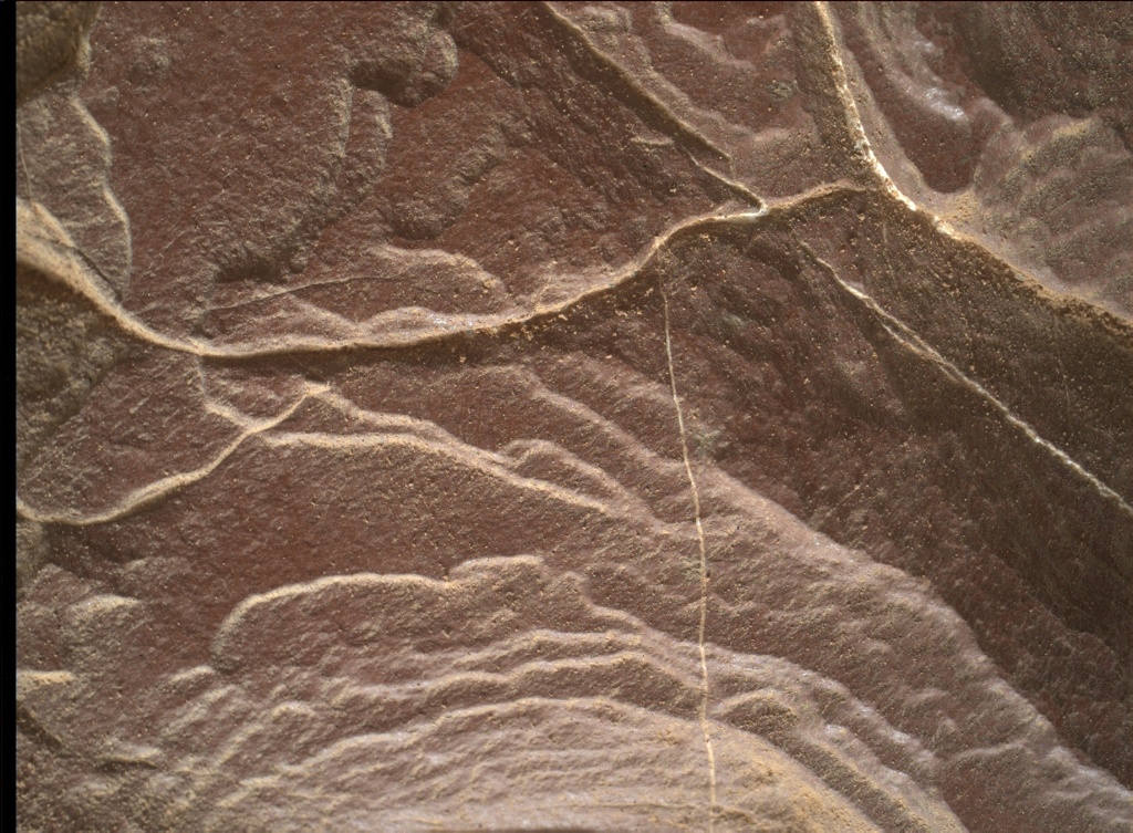
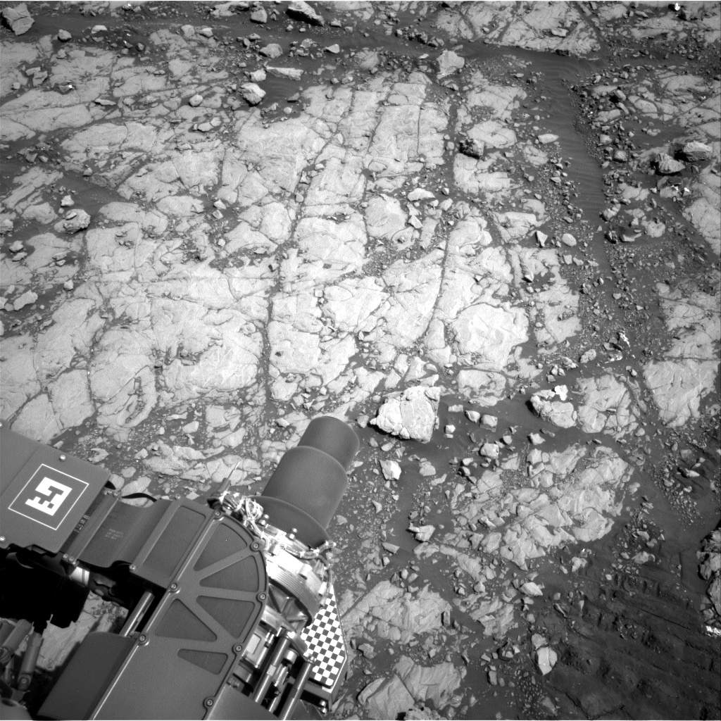
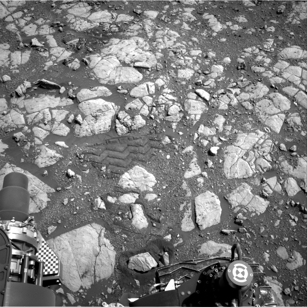
For much of the last year, Curiosity has been exploring fine-grained rocks along Vera Rubin Ridge, and investigating red and gray color variations. Recently, something else caught our eye: dark cobbles and boulders exposed in patches, as seen in the above Mastcam image. We've seen some similar blocky deposits earlier in the mission, but it's definitely been a while. These interesting rocks led the science team to decide to spend the weekend at a patch of these dark blocky deposits.

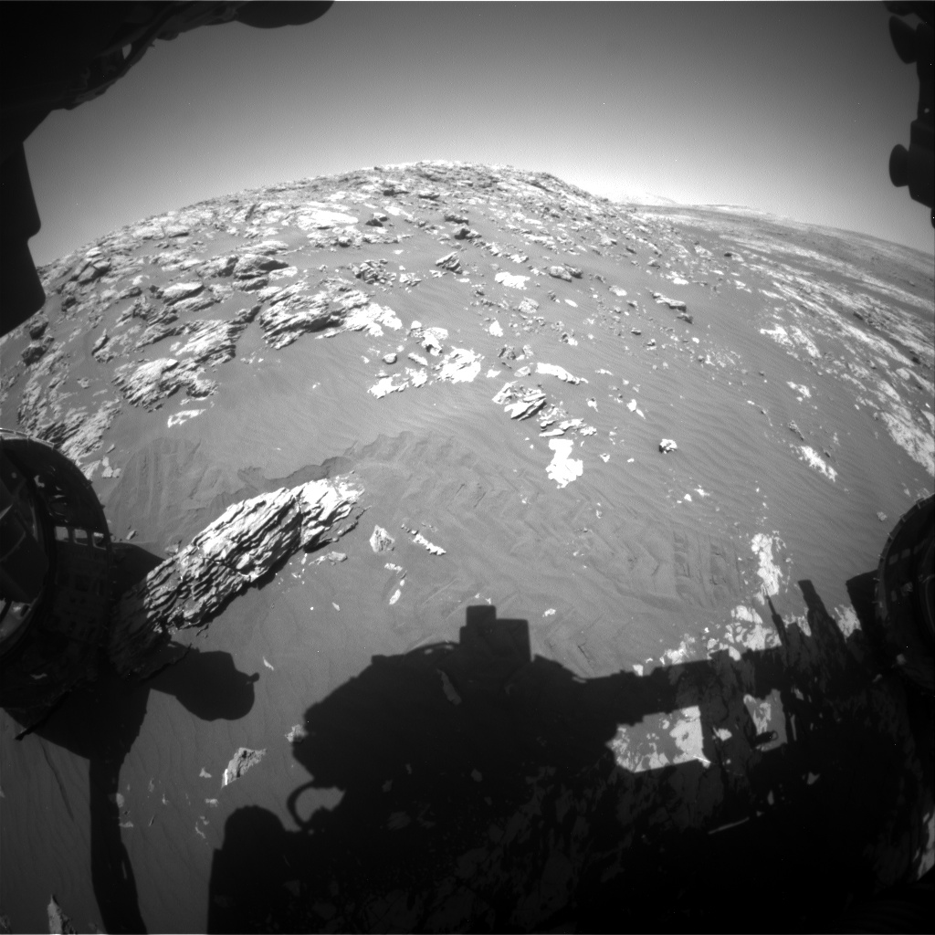
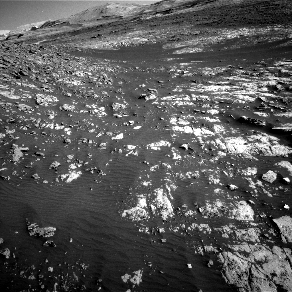
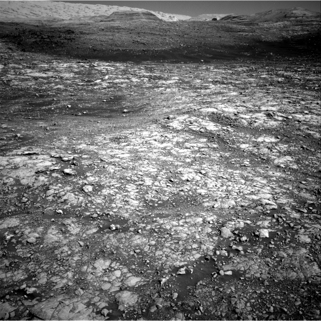
I was the SOWG Chair today, and it was a fairly straightforward planning day once we settled on that end of drive location. The plan starts with MAHLI and APXS observations of the target "Corsehill" to characterize some potential concretions in the bedrock at our present location. Then we'll acquire Mastcam multispectral imaging of yesterday's DRT target "Lingarabay" and some additional Mastcam mosaics to document diagenetic features and nearby blocky deposits at "Sidlaw," "Edzell," and "Waternish." Unfortunately we were pressed for time today so we weren't able to fit in any ChemCam observations, but we look forward to collecting more ChemCam data in the weekend plan. We also planned a Navcam dust devil movie, along with standard REMS and DAN measurements. After Curiosity's ~18 m drive, we'll take post-drive imaging to prepare for contact science in the weekend plan, and we'll acquire an overnight APXS atmospheric observation. I'm looking forward to learning more about these blocky deposits and how they relate to the depositional and erosional history preserved at Vera Rubin Ridge!

April 4, 2018

Sol 2013: From Biwabik Back to Torridon

Written by Roger Wiens, Geochemist at Los Alamos National Laboratory
Sol 2013: From Biwabik Back to Torridon

Factoids: Mars is the only known planet inhabited exclusively by active robots. It has been this way for over fourteen Earth years, with a cumulative total of twenty-six Earth years of roving by four vehicles. Together these rovers have logged over 70 km of distance, well over half of that by the Opportunity rover. (Curiosity will likely hit the 20 km mark later this year).

After a 38 meter drive Curiosity reached the location that the team has called Region 13 of Vera Rubin Ridge. It has been subdivided into separate nearby sites, with the current one as B1, still near the edge of the hematite "hotspot" identified from orbit by CRISM. Curiosity is flirting with the boundary of the mapped "Biwabik" quadrangle; pretty soon we will drive into it for a while and start using target names from northern Minnesota. The Biwabik name was selected because of the city's connection with the Mesabi Range, which contains large deposits of Precambrian iron ore. For tosol, the rover is back into the "Torridon" quad with Scottish names, a quad that Curiosity has been exploring most of the sols in the last several weeks. The team is intrigued to see some fields of dark, blocky float rocks nearby, as seen in the background in the accompanying image.

Tosol Curiosity's science includes ChemCam, Mastcam, MAHLI, and APXS observations on "Lingarabay" and "Kinloch". The Dust Removal Tool will be used on the first of the two targets, which will be an overnight APXS target. MAHLI's observation distances will be 25 and 5 cm. Mastcam's right-side camera will stay busy, with a 5x1 mosaic on the "hematite hotspot", a 2x1 on "Galloway", a 5x1 on "Foula", a 5x1 on "Suilven" (targeting grain sizes along a ripple crest) and a single image on "Arrochar." Additional measurements include DAN passive, REMS and RAD acquisitions, Mastcam sun tau measurement, crater rim extinction, and calibration target observations as well as a drive direction 4x1 observation.

April 4, 2018

Sol 2012: Moving On

Written by Christopher Edwards, Planetary Geologist at Northern Arizona University
Sol 2012: Moving On

After failing to pass SRAP (the process that makes sure the rover is safe to use its arm) on the previous sol (see Sol 2011 for details), we finished up the set of observations possible at this location. Since Curiosity didn't move from its parking spot on Sol 2011, that also means there were no opportunities to conduct contact science in today's plan.

While somewhat disappointing to the science team members on shift, Curiosity's health is everyone's priority. We always maximize every minute on Mars, so we planned to complete some needed activities before driving away. These activities included long-distance imaging using the ChemCam instrument to look clear across the crater to the far rim. This long-distance imaging needed to happen before there's too much dust in the atmosphere to obtain clear pictures. Some additional imaging and ChemCam observations of nearby targets were planned before Curiosity left, headed for a new location ~40 meters away. It's likely that the goals planned at the Sol 2011 location to characterize the differences between two geologic units in the Vera Rubin Ridge will carry over to the next location, as the same exposures appear to be present just down the way.

April 2, 2018

Sol 2011: Take Only Pictures, Leave Only Wheel Tracks

Written by Ryan Anderson, Planetary Geologist at USGS Astrogeology Science Center
Sol 2011: Take Only Pictures, Leave Only Wheel Tracks

After the weekend drive, the rover ended up in a spot that was a little too unstable to pass the Slip Risk Assessment Process (SRAP). That means that there is a slight chance that the rover's footing might shift if the robotic arm is extended, which is not ideal for the safety of our contact science instruments, so for the Sol 2011 plan we chose not to use the arm and instead focused on remote sensing.

The rover will start off with two ChemCam RMI mosaics of the Peace Vallis alluvial fan on the crater floor. The air is clear right now, but is expected to get dusty later this season, so it is important to get these very long distance images while we can. Next, ChemCam will measure the chemistry of the targets "Morven", "Insch", and "Pabay". Mastcam then will take four mosaics: two that cover the three ChemCam targets, and two more looking for changes in the bedrock at other locations. Navcam will then finish up, watching for dust devils and clouds around midday and in the late afternoon.

The plan is to wrap up observations at this location in the Sol 2012 plan and then drive to the southeast.

March 30, 2018

Sols 2008-2010: Exploring variations in composition, texture, and color

Written by Lauren Edgar, Planetary Geologist at USGS Astrogeology Science Center
Sols 2008-2010: Exploring variations in composition, texture, and color

NASA's Mars rover Curiosity acquired this image using its Mars Hand Lens Imager (MAHLI), located on the turret at the end of the rover's robotic arm, on March 28, 2018, Sol 2005 of the Mars Science Laboratory Mission, at 09:59:48 UTC.

Yesterday Curiosity drove 35 m to the southeast, which set us up for some great contact science on the rim of a small impact crater. We're working our way toward Region 13 on Vera Rubin Ridge and exploring changes in bedrock composition, texture, and color, as shown in the Navcam and MAHLI images.

I was the SOWG Chair today, and we developed a 3-sol plan with a lot of great science for the weekend. The first sol kicks off with ChemCam observations of "Beinn Dearg Mhor," "Dun Caan," and "Dalbeattie" to look for changes in chemistry within the red bedrock in our workspace. Sometimes I'm convinced that the geology theme group intentionally picks names that are hard for me to pronounce during the SOWG meeting! Then we'll acquire Mastcam documentation of those targets as well as a mosaic to characterize a sandy trough on the floor of the small crater at "Saxa Vord." In the afternoon, we planned contact science (including DRT, MAHLI, and APXS) on the targets "Lanark" and "Dun Caan" and some overnight APXS integrations. These observations will help to compare orbital observations to surface characteristics, particularly as we move through an area with a high hematite signature in orbital spectroscopic data. On the second sol Curiosity will acquire Mastcam multispectral observations of the DRT target "Lanark," and the stratigraphy exposed in the wall of the small crater at the target "Stac Fada." After completing science activities at this location, Curiosity will drive to the southeast to investigate variations in color and sedimentary structures. On the third sol, we planned an early science block for environmental monitoring activities. Later in the afternoon Curiosity will acquire a long distance RMI to characterize the yardangs and stratigraphy exposed higher on the slope of Mt Sharp. We'll also acquire several additional Navcam and Mastcam images to monitor atmospheric opacity, clouds, and scattering properties. It's going to be a busy weekend on Mars!

March 29, 2018

Sol 2007: "Today is a Shetland Day!"

Written by Mark Salvatore, Planetary Geologist at University of Michigan
Sol 2007: "Today is a Shetland Day!"

The science team today had a few tough decisions to make to balance time and power. The three activities that must be balanced were arm activities (including high-resolution imaging and chemistry measurements), remote activities (including multispectral imaging and remote chemistry analyses), and driving to our next location along the Vera Rubin Ridge. The team obviously doesn't want to drive away from interesting locations that haven't been fully investigated, so there was a lot of discussion regarding whether we've fully characterized this extremely interesting region. At the end of the discussion, the team decided to forego any arm activities, which would allow Curiosity to obtain several more remote measurements before hitting the road towards the next location. The plan is for Curiosity to begin her drive eastward in the early afternoon, towards another well-exposed outcrop on top of the Vera Rubin Ridge.

Curiosity will begin her science investigations around 10:45am local time, when she will acquire Mastcam multispectral data for three science targets investigated over the previous two days ("Stranraer," "Burghead," and "Walls Peninsula"), in addition to a multispectral image of the calibration target. Curiosity will then switch to ChemCam chemistry observations of the red nodular rock target "Sullom Voe." These chemistry observations will include five times more laser pulses than typical ChemCam measurements, as the team is hoping to investigate whether we can see compositional variations as the laser pulses bore deeper and deeper into the rock surface. A more typical ChemCam chemistry measurement will then be made on the target "Papa Stour," a fractured and potentially vein-rich piece of outcrop in front of the rover. Following these chemistry measurements, Mastcam will again be put to use to acquire high-resolution color images of the targets "Muckle Roe" and "Mousa Broch," two high-standing rocks with interesting erosion patterns, as well as a context image of "Sullom Voe" for ChemCam context imaging. Curiosity will then finish her scientific activities with black-and-white Navcam images to search for dust devils in Gale crater. After Curiosity's drive, she will acquire standard post-drive imaging in preparation for the science team to interpret all of the data and the rover's workspace tomorrow morning!

With the exception of the targets "Stranraer" and "Burghead," which were both selected in previous sols, all of today's targets are named after features or locations in the Shetland Islands located northeast of Great Britain. As exclaimed by our geology science theme lead John Bridges (himself in the United Kingdom at the University of Leicester) after selecting target names, "today is a Shetland day!" It's only appropriate that we're investigating Shetland-named targets here up on the Vera Rubin Ridge, where red rock targets are distributed throughout the workspace. The Shetland Islands host numerous outcrops of the Devonian-aged Old Red Sandstone, which are fossil-bearing red-hued sedimentary rocks. Here's to hoping to someday explore fossil-bearing sedimentary rocks on Mars!

March 28, 2018

Sol 2005: Squarely in the Red

Written by Christopher Edwards, Planetary Geologist at Northern Arizona University
Sol 2005: Squarely in the Red

After completing a nearly 55m drive, Curiosity found itself sitting right in the middle of the strongest spectral detection of hematite identified along its path up Mt. Sharp. This strong spectral signature is viewed both from orbit, where it was originally identified in Compact Reconnaissance Imaging Spectrometer data, and from the ground in Mastcam multispectral data. While Curiosity has definitely visited some areas that have the spectral fingerprint of hematite in previous sols, this is by far the best example we've seen over the mission. The MSL science team is still trying to figure out how this mineral formed and why we're finding it where we are. Today's parking spot will likely prove key to unraveling the geologic history of the Vera Rubin Ridge, when combined with other data acquired in Gale Crater.

It was a busy day for Curiosity and the science team had a fabulous workspace to examine. Two contact science targets ("Stranraer" and "Murchison") were chosen to help examine the variability in chemistry related to different targets identified in color Mastcam data. For example, the Murchison target appears to be darker red than some of the other rocks like the Stranraer target. A unique experiment with Mastcam was designed to characterize the light scattering properties of the unit by taking 7 different observations over the course of the day. Mastcam will observe how the same spot on the surface changes its reflectivity properties with changing illumination, with the goal of providing insights into the nature of the hematite itself.

March 28, 2018

Sol 2006: Three (Martian) Years on the Surface!

Written by Mark Salvatore, Planetary Geologist at University of Michigan
Sol 2006: Three (Martian) Years on the Surface!

As of ~9:00pm Pacific Daylight Time this evening, Curiosity will have made three revolutions around the Sun while exploring Gale crater. Quite a feat, considering Curiosity's primary mission was designed to last just one Mars year. Yet another reason why the engineers and rover and science planners are invaluable to our exploration of the Red Planet!

Because of some power-intensive measurements that will take place later in the evening (see below), today's surface investigations will be fairly lean and will last just over one hour. Curiosity did not drive either yesterday or today, so we are still in the same location where we are hoping to identify the sources and nature of the strong iron oxide signatures observed from orbit. To start our investigation, we will be imaging the nearby surface to investigate how the observed iron oxide signatures change as a function of changes in solar illumination. This type of experiment and material behavior is known as "photometry," and spectroscopists can learn quite a bit about surface properties based on these types of measurements. We will then acquire Mastcam multispectral images of the landscape in front of the rover where we will be investigating over the subsequent week to determine how the mineral signatures vary over the landscape. After these imaging efforts, we will use the ChemCam instrument to investigate the chemistry of local rock targets in front of the rover. The first target (named "Burntisland") is a red piece of rock that was disturbed by one of Curiosity's wheels whose color suggests the presence of the iron oxides that we're looking to investigate. The second target (named "Burghead") is a more purple piece of bedrock in front of the rover that was also disturbed by a rover wheel. This measurement will help us to determine the full range of compositional variations observed throughout the workspace.

After these science investigations, Curiosity will use two different instruments (Sample Analysis at Mars, or SAM, and the Alpha Particle X-Ray Spectrometer, or APXS) to measure the concentration of argon in the martian atmosphere. Argon is the third most abundant gas in the martian atmosphere, accounting for nearly 2% by volume. Previous studies have shown that the concentration of argon is able to change seasonally in the martian atmosphere, and so the SAM and APXS instruments will be monitoring its current abundance to understand if/how the concentration of argon has been variable over time. These measurements utilize a fair amount of energy, which is why the scientific observations in today's plan are relatively short.

We will continue to investigate the variations in iron oxide signatures across the Vera Rubin Ridge over the next few weeks, but the activities over the past and subsequent few days are of critical importance due to the strong signatures observed from orbit. Hopefully the data that we acquire today will help us to understand the source and nature of the hematite that is present throughout the Vera Rubin Ridge!

March 26, 2018

Sol 2004: Let's try that one more time

Written by Abigail Fraeman, Planetary Geologist at NASA's Jet Propulsion Laboratory
Sol 2004: Let's try that one more time

For Sol 2004, Curiosity threw it back to the 2004's sleeper hit Mean Girls when the rover said, "Stop trying to make 'drive' happen." The weekend drive stopped after just a few meters due to a high current warning from the right middle wheel. We were able to assess all of the drive data this morning and decided there wasn't any real risk to the vehicle. Instead, we just got unlucky because the combination of a small rock and the rover orientation made the middle wheel work a little harder than normal, and this tripped the limit warning. These things happen occasionally when you are autonomously driving a MINI-cooper sized rover on an entirely different planet!

The star of today's plan will be the drive that was planned for the weekend. We will start by backing up from the area where the weekend drive faulted out, and then continue along our original planned path from the weekend. We do have a very short science block before today's drive. During that time, we will investigate a brick-red rock, "Mousa," that was turned up by the rover's wheel using ChemCam and Mastcam multispectral data. We will also take a high resolution Mastcam image of a rock with an interesting texture named "Duncansby Head." After our drive, we will take a lot of post-drive images and an AEGIS ChemCam observation. As I mentioned on Friday's blog post, we are headed to the area on the ridge where we see the clearest orbital signature of hematite. I wonder if the bright red rocks at our feet are an indicator of things to come?

March 23, 2018

2001: A Mars Odyssey

Written by Abigail Fraeman, Planetary Geologist at NASA's Jet Propulsion Laboratory
2001: A Mars Odyssey

View of our workspace

Geology Science Theme Group Leader Prof. Chris House kicked off our planning today by playing a rousing rendition of "Also sprach Zarathustra" over the phone line. Hearing the theme song to the famous movie 2001: A Space Odyssey was the perfect start to sol 2001 planning and inspired us to chose two new target names that were as close to A Space Odyssey as we could get: "Boddam" ((David) Bowman) and "Kirkcudbright" ((Stanley) Kubrick).

Curiosity is currently sitting in front of a steep outcrop that shows some interesting geologic relationships between rocks in the Vera Rubin Ridge. We acquired some great images of these rocks in yestersol's plan, so today we were focused on understanding the properties of the rocks at our feet. In the first sol of the plan, sol 2001, we will be collecting MAHLI images of a target named "Apin," and doing DRT, MAHLI, and APXS on a target named "Brora."

The second sol, sol 2002, will focus on remote sensing, with ChemCam observations on targets named Boddam, "Sgurr of Eigg," and Kirkcudbright. The ChemCam observations will be accompanied by Mastcam documentation images. We will also be taking a multispectral observation of the DRT targets from tosol (Brora) and yestersol (Sgurr of Eigg), some multispectral images of the landscape in front of us, and some additional color images of the vertical rocks in front of the rover to complement the data we collected yestersol. We'll top off the science block with a dust devil movie and dust devil survey. We'll stay up after dark on sol 2002 to collect additional nighttime MAHLI images of Appin and Brora.

On sol 2003 we will have a bunch of dedicated environmental science measurements, including a tau to measure the dust in the atmosphere, a Navcam 360 sky survey, a Navcam zenith and suprahorizon movies, and a crater rim extinction image. We'll squeeze in another ChemCam RMI mosaic of some distant features in Mt. Sharp. Sol 2003 will finish with an ~50 m drive towards an area where we see some of the strongest spectral signatures of hematite on the ridge in orbital data. We'll take a standard set of post-drive images over the weekend to set us up to characterize this location in the sol 2004 plan. It will be very exciting to see the exact rocks that are the source of the orbital signature which helped us realize the importance of Vera Rubin Ridge over five years ago!