June 14, 2019

Sol 2436: So many choices, so little time

Written by Michelle Minitti, Planetary Geologist at Framework
Sol 2436: So many choices, so little time

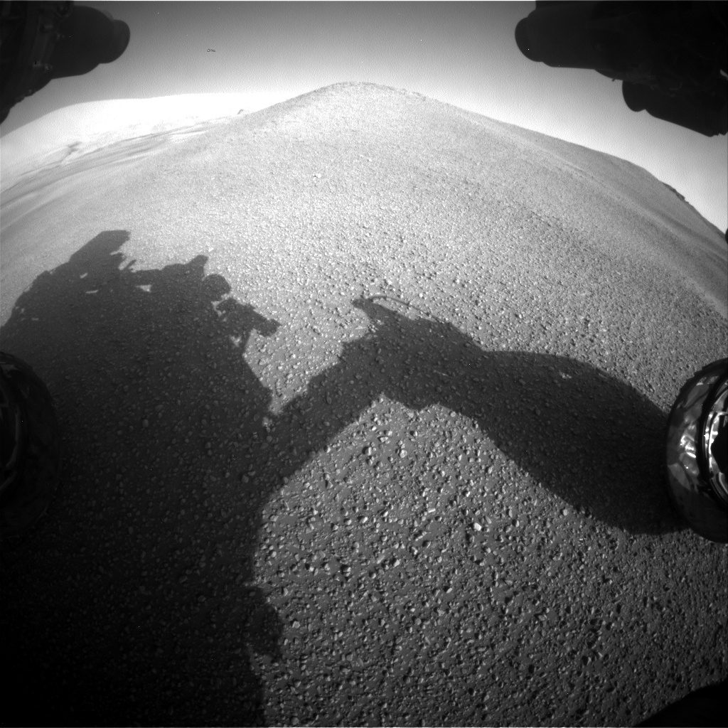
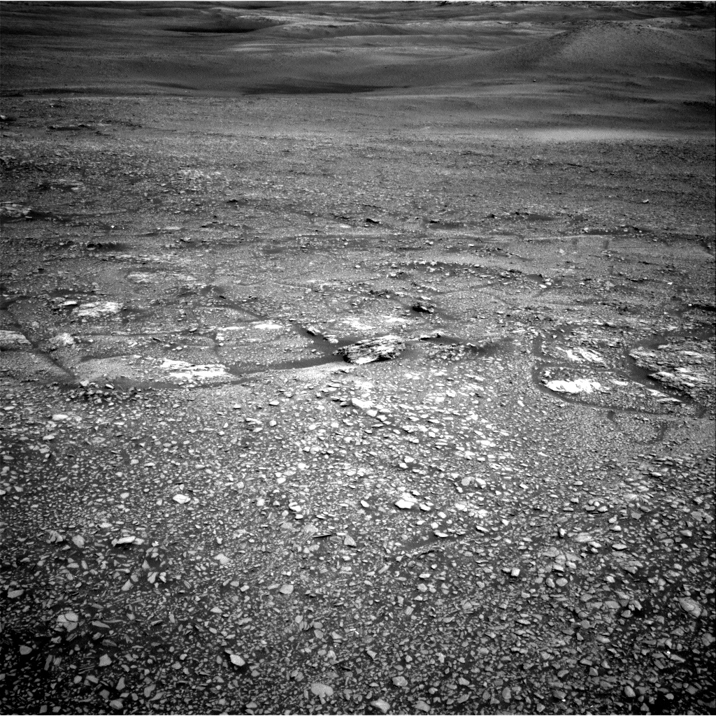
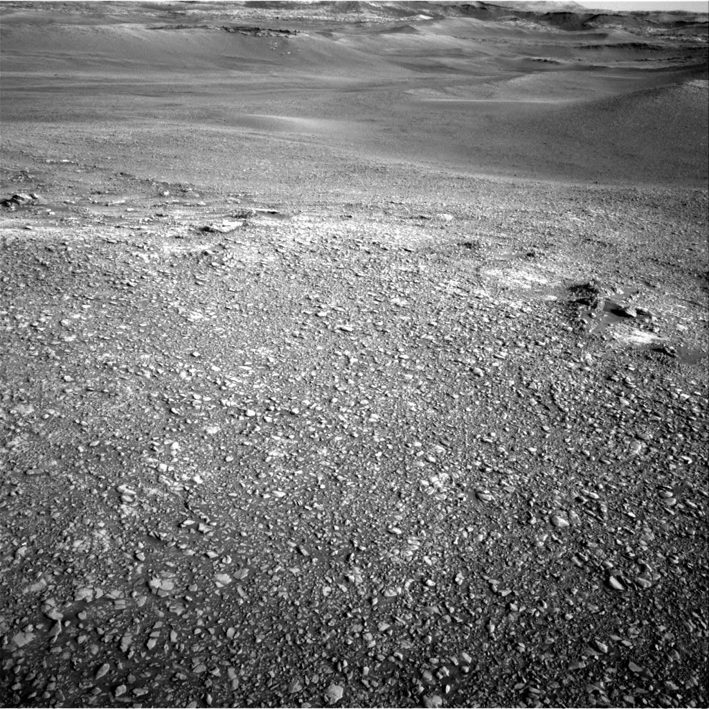
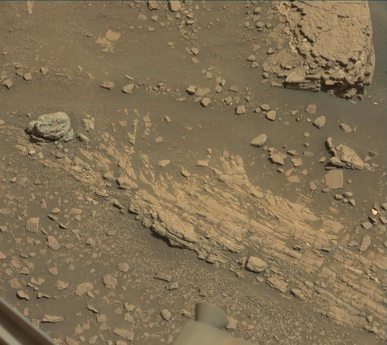
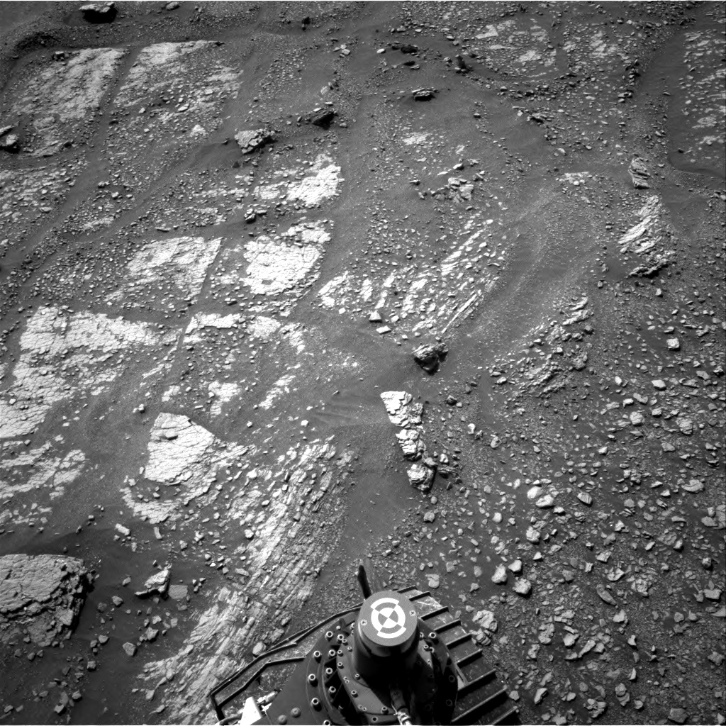
The planning day started with a change of plans. Due to a late-breaking change in relay pass scheduling, the decisional pass (the communication pass carrying the latest information about Curiosity's location and state to arrive before the start of planning on Earth the next day) in today's plan was much earlier in the plan than we expected. That meant that Curiosity had to wrap up her activities earlier in the sol than we initially thought. The science team had to rapidly decide how to use the limited time available for rover activities. We could choose to stay at our current position, parked along the side of a pebble-covered clay-bearing unit ridge (pictured above), for activities today and over the weekend. Or we could choose to drive off to another location for the weekend. There were many drive targets to choose from, from interesting rocks at the top of the ridge (also visible in the image above) to bedrock exposures along the base of the ridge. The science team spent a lot of time weighing the pros and cons of each target in the wider context of our study of the ridge and the clay-bearing unit. We eventually decided to drive to a small outcrop patch about 30 m away, where we will be able to invest time studying the outcrop while also gazing up along the ridge to look for other bedrock exposures and clues about its structure.

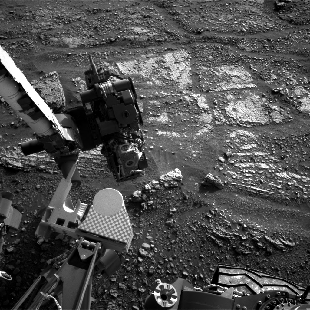
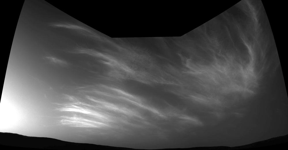
We did manage to squeeze in a bit of science before the drive, however. We will acquire a ten-image ChemCam RMI mosaic across the aforementioned interesting rocks at the top of the ridge, and Navcam and Mastcam images to measure the amount of dust in the atmosphere. After the drive, and thus after the decisional pass, we had more time for science - just because we will not get the data back before planning tomorrow does not mean the science is not worthwhile! We will acquire a ChemCam raster from an autonomously-selected target in our workspace and another Mastcam observation of the sky. Near twilight, we will acquire a Navcam cloud movie. At the same time, InSight will also be looking for clouds. The coordinated observations could constrain the height at which clouds occur, giving us a lofty end to a busy day!

June 13, 2019

Sol 2435: Forecast: It's pebbly out there

Written by Susanne Schwenzer, Planetary Geologist at The Open University
Sol 2435: Forecast: It's pebbly out there

Image taken by Curiosity's front hazard camera, on Sol 2434, Earth time 2019-06-12 at 04:21:30 UTC. It shows the ridge in front of the rover in sol 2435 planning.

After yesterday's soliday for the rover operations team on Earth, we went back to work planning activities for Curiosity to complete on sol 2435 in the Glen Torridon area. One feature standing high above the ground in this area are ridges, displaying a mixture of pebbles and sand. Their surface appears to be compacted enough to drive over, but finding a target suitable for our chemistry investigations is a challenge - unless we want soil, of course. It is nevertheless important to understand the chemistry of the pebbles since they do originate from a rock that makes up the stratigraphy of the Gale sediment column. Thus, understanding their composition is as important as understanding outcrops and bigger float rocks.

The team planned a series of investigations of the pebbles and the soil in between. We are also looking into the distance, but more about that later. The investigations at the current parking location are two ChemCam investigations. The target "Little Minch" is a pebble of about 2 to 3 cm size. The ChemCam team managed to fit a five-spot raster on it. Next to the pebble, a second ChemCam investigation targets the soil, with a target name "Strathspey." Mastcam looks at the same area with a multispectral investigation, which will allow us to compare the spectral information with the chemical information, but also to look at undisturbed soil and soil just disturbed by ChemCam in the same frame.

Looking into the distance, Mastcam investigates the ridge acquiring two mosaics, which will allow us to assess pebble size and distribution as well as the relationship to the outcrop at the top of the ridge. The target name for this investigation is "Marwick Head." Even further in the distance is the sulfate-bearing unit. This is a unit that was detected before landing and shows hydrous sulfates in orbital images. ChemCam takes an image of this unit from Curiosity's current parking spot, which will reveal further details of the rock structures in that area. Another look forward is, of course, in the direction of the next drive, which should take Curiosity down off the ridge and into the trough between the ridges. Downwards and onwards, but don't forget to look back occasionally.

June 10, 2019

Sol 2434: Ridge Rage

Written by Mariah Baker, Planetary Geologist at Center for Earth & Planetary Studies, Smithsonian National Air & Space Museum
Sol 2434: Ridge Rage

This Navcam image acquired on sol 2432 shows some of the rubbly terrain in front of us, as well as the "Waypoint 4" ridge we are driving towards (upper right corner).

It's a good thing that Curiosity doesn't have any competition on the road as she drives fervently across undulating terrain towards a large geologic ridge of unknown origin (informally named "Waypoint 4"). The weekend plan included a long 44-meter drive to put her in her current location (on a similar, but smaller ridge), and two more 25-meter drives were planned for this week to put her at a good vantage point for imaging the side of the ridge. But the team decided to put the pedal to the metal and try to make it to this ridgeline in just one drive. Ridge features are common throughout the Glen Torridon unit, so characterizing the morphology and chemical composition of these ridges can place important constraints on their formation and on the overarching geologic history of this region. This will be the goal of our investigation at Waypoint 4.

Although her current priority is getting to the large ridge as quickly as possible, Curiosity will still conduct science along the way; today we planned various contact science and remote sensing observations, including ChemCam LIBS on the target "Portessie," and APXS and MAHLI on target "Smoogro." Mastcam stereo images will also be acquired on "Portessie" and "Lossie." Once these activities have concluded, the rover will start her lengthy drive over to Waypoint 4. Post-drive imaging, including standard Navcam, Hazcam, and Mastcam mosaics as well as an extended Navcam upper tier mosaic, will help us assess our end-of-drive location and will provide the first up-close look at the ridge in question. Tomorrow is a designated "Soliday," but hopefully Curiosity will have made it to her destination by the time normal operations resume on Wednesday… assuming she doesn't get stuck in any traffic along the way!

June 8, 2019

Sols 2431-2433: Punctuated Sleep for Curiosity

Written by Mark Salvatore, Planetary Geologist at University of Michigan
Sols 2431-2433: Punctuated Sleep for Curiosity

After yesterday's 47 meter drive, Curiosity awoke to a much different landscape than she had been analyzing over the past week. Instead of the beautifully exposed sedimentary bedrock that had been extensively analyzed since late May, Curiosity now finds herself among a pile of small pebbles and cobbles intermixed with sand. While this landscape doesn't allow for brushing of any of these small rocks, Curiosity will still perform some high-resolution microscopic imaging and some bulk chemical analyses using both the ChemCam and APXS instruments on nearby targets to characterize the local cobbles and soils. The following morning, Curiosity will conduct a series of environmental observations using ChemCam and Mastcam before embarking on a ~40 meter drive. Once Curiosity arrives at this new location over the weekend, she will conduct a series of seven short imaging experiments over the next ~36 hours to characterize the photometry (i.e., the behavior of reflected light off of the surface) of the surrounding landscape. During this time period, Curiosity will go in and out of "sleep" 13 times for durations ranging from 20 minutes to 6 hours in order to charge her batteries to keep up with all of our scientific demands: acquire images, nap for 40 minutes, wake up, acquire images, nap for 70 minutes, wake up, acquire images, nap for 4 hours, wake up, relay data to an orbiting satellite, nap, etc. etc. While the science team may be cranky at the end of such a series of measurements and naps, we expect Curiosity to be eager for more scientific exploration when the team resumes its mission planning early next week!

June 6, 2019

Sols 2429-2430: A "No-Touch-And-Go"

Written by Brittney Cooper, Atmospheric Scientist at York University
Sols 2429-2430: A "No-Touch-And-Go"

The original plan for Sol 2429 involved a "touch-and-go" where the rover would have engaged in contact science (that's the "touch" portion) followed by a drive (the "go" portion), but through discussion the instrument leads determined tactically that they were satisfied with the contact science already acquired at this location. Thus, we planned a "no-touch-and-go," and were able to take the time planned for contact science and use it to extend the length of a remote sensing science block before the drive.

This science block contains two Mastcam multi-filter observations, a 10x1 ChemCam raster on target "Awe," a 5x1 raster on target "Castle Rock," and a Mastcam stereo mosaic to capture nearby gravel. Curiosity will then drive an hour and twenty minutes, and wrap up the sol with some post-drive imaging of the new workspace, a Mastcam tau to measure atmospheric opacity, and a post-drive DAN active. For those not familiar, a post-drive DAN active consists of the DAN instrument shooting neutrons into the ground and measuring the energy of the reflected neutrons to detect hydrogen just below the surface. A DAN active occurs after every drive so that the DAN team can acquire these measurements at every location that Curiosity stops and does science. DAN actives run in conjunction with DAN passives, and while you may not hear about them often, the passive measurements run pretty much anytime Curiosity is awake for more than an hour. In passive mode, DAN relies on cosmic rays to provide a source of neutrons for its measurements.

The second sol consists of a science block that will occur following the sol 2429 drive (thus we don't know what the workspace will look like). In this block we planned an AEGIS activity to find a target of interest and run a 3x3 ChemCam raster on it, and added two types of Navcam movies with pre-determined pointings to hunt for dust devils. Standard REMS extended block and nominal hourly measurements of temperature, pressure, humidity and UV radiation were also included in this plan. We made sure to include an extra REMS extended block over the dust devil surveys because the pressure monitoring can be used in combination with the visual imagery to measure and detect these low-pressure vortices.

June 5, 2019

Sols 2427-2428: A Many-Layered Plan

Written by Claire Newman, Atmospheric Scientist at Aeolis Research
Sols 2427-2428: A Many-Layered Plan

Mastcam image of clouds taken at twilight on Sol 2425.

Mastcam image of the surface layering taken on Sol 2425.
The main focus of today's plan was observations of the interbedded thick and thin layers we found at Woodland Bay before we drive away again, perhaps as early as the next plan. Primarily, this involved completing our analysis of their composition (with ChemCam and APXS) and using MAHLI to distinguish grain sizes. The team found two targets - "Tobermory" on the more resistant layer and "Mons Graupius" on the more recessive and thinly laminated layer - that were both far enough away for ChemCam targeting and close enough for APXS and MAHLI. This co-targeting meant that ChemCam could 'blow away' dust to give MAHLI a nice clear view of the grains in the actual rock itself. Another ChemCam target, "Avon," was added on what appeared to be a more resistant layer. In addition, MAHLI will be taking two mosaics: "Deeside" will provide an overview of the layers described above, while "Lochgilphead" will cover a section of the exposed outcrop that may have cross-bedding.

A ChemCam raster will also be performed on the "Crakaig" target previously analyzed by APXS, while Mastcam will take some documentation images of this, as well as three large stereo mosaics ("Olrig," "West Side" and "Morningside") to extend our image coverage of the workspace and document all the ChemCam observations from the weekend plan.

NASA's Curiosity Mars rover imaged these drifting clouds on May 17, 2019, the 2,410th Martian day, or sol, of the mission, using its Navigation Cameras (Navcams).
Today's plan also dealt with layers up in the atmosphere. Unlike the geology side of things, when it comes to atmospheres it's usually more important when we are than where we are, and we're headed slowly but surely for the cloudiest time of the year at low latitudes on Mars. Recent Navcam images revealed some amazing "noctilucent" clouds taken after sunset in Gale Crater, which are so high that they're still illuminated by the Sun, even when it's night at the surface and any lower cloud layers are already in shadow. A short movie is shown here. In a longer movie, the moment at which these higher clouds finally go into shadow can be used to work out the cloud altitude geometrically. Mastcam also took some fantastic images just post-sunset in the weekend plan on Sol 2425, so we added another Navcam 'twilight' cloud movie in today's plan, as well as a regular 'suprahorizon' cloud movie in the early afternoon. Over the next few weeks we expect to see more and more cloud activity, and will be watching closely to see when different cloud types start to appear at different times of day, which tells us about the amount of water vapor present, atmospheric temperature as a function of height, etc.

The plan also included standard REMS and DAN, and a 360° dust devil survey.

June 3, 2019

Sols 2422-2423: Familiar rocks at our feet

Written by Lauren Edgar, Planetary Geologist at USGS Astrogeology Science Center
Sols 2422-2423: Familiar rocks at our feet

On Sol 2420 Curiosity drove ~61 m back to the "Woodland Bay" target, to analyze some interesting thick and thin laminations within the bedrock that we had observed previously, and to characterize compositional diversity. After the long drive over the weekend, it was nice to see some familiar rocks lying just in front of our rover wheels, confirming that the drive had gone well.

Today's 2-sol plan is focused on contact science to characterize the grain size and stratification within these bedrock blocks, this time focused on a target named "Crakaig." The plan starts with MAHLI and APXS observations of the bedrock block in the lower left corner in the above Navcam image. Then we'll acquire a ChemCam observation of "Fladen," to assess the composition of typical gray bedrock. We'll also take a Mastcam image of "Esk" to document a potential meteorite nearby. Then Curiosity will bump backwards to reposition ourselves over the stratified bedrock, shown just above our rover wheel in the above Navcam image. Around sunset, Curiosity will turn her eyes to the sky so that Mastcam can observe the color and morphology of noctilucent clouds (ice crystal clouds that remain visible during astronomical twilight). Then on the second sol ChemCam will acquire observations on 2 autonomously selected AEGIS targets, along with some Navcam dust devil and suprahorizon observations to monitor the atmosphere. I was on duty as SOWG Chair today, and it was fun to plan some contact science on these gorgeous sedimentary rocks and look forward to additional contact science in the weekend plan. We've had some exciting results in the clay-bearing unit so far (aka Glen Torridon), including the highest amounts of clay minerals observed so far during the mission. You can read more about it in this recent press release! mars.nasa.gov/news/8442/nasas-curiosity-mars-rover-finds-a-clay-cache/

June 3, 2019

Sol 2424-2426: West Side Multispectral Story

Written by Sarah Lamm, Planetary Geologist at Los Alamos National Laboratory
Sol 2424-2426: West Side Multispectral Story

Today we planned the weekend activities for Curiosity in Woodland Bay. Woodland Bay is a location in Glen Torridon, in the clay bearing unit. Over the next three sols, we have scheduled for this area to be assessed by APXS, MAHLI, ChemCam, Mastcam, and Navcam.

On Sol 2424, the target "Morningside" will be analyzed by APXS. Then MAHLI will image the subtle morphological textures of "Morningside." ChemCam will also be used on targets: "Whiteadder," "Wester Ross," "West Wemyss," and "Water Haven." Mastcam images will be taken of all targets for geological context.

On Sol 2425, NavCam will take a short movie of the area in hopes of catching a dust devil. Dust devils have been spotted on Mars' surface, but we could always use more movies and pictures of them. "West Side" and "Morningside" will have multispectral images taken by Mastcam. Mastcam will also be used to document clouds in Mars' night sky.

On Sol 2426, ChemCam will have one target called "Watten." Navcam is scheduled to take four short 8 frame movie of clouds. These movies will be taken at different times of day and at different locations in the sky.

May 28, 2019

Sols 2419-2421: Easy Driving

Written by Dawn Sumner, Planetary Geologist at University of California Davis
Sols 2419-2421: Easy Driving

We've left multiple tracks across the cobblestone plain of Glen Torridon. This image shows our current view to the northeast, with the slope of Mount Sharp on the right and the scarp of Vera Rubin Ridge on the left. Curiosity had a nice, long drive retracing our path back toward the southwest where we want to look at some rock layers in more detail. It's always nice to look back on an area that taught you a lot while heading forward to answer new questions.

Today, we planned another 3 sols of activities for Curiosity. We start off sol 2419 with Mastcam images of "Scolty Bay" and "Tomintoul," both of which we imaged on our way east on sols 2385 and 2363, respectively. We follow up with ChemCam analyses and Mastcam documentation images of "Hillhead," "Kinghorn," and "Cumbernauld" to characterize different colored pebbles. Later in the first sol, we will take MAHLI images of Hillhead, Kinghorn, and "Kintore" as well as analyze their elemental compositions with APXS. APXS will collect data on Kinghorn overnight to increase the precision of the analysis.

We start sol 2420 by retracting the arm and swinging it to clean any dust off the APXS instrument. ChemCam then analyzes a fourth target, "Cupar," before a drive of about 60 meters to Woodland Bay. Curiosity will take post-drive images to help us plan the next set of activities, and ChemCam will automatically analyze a target.

After Curiosity arrives at its new parking spot, we will take Mastcam and Navcam images of the sun and sky, plus look for dust devils.

May 24, 2019

Sols 2416-2418: Drill No Go - time for Plan B!

Written by Catherine O'Connell-Cooper, Planetary Geologist at University of New Brunswick
Sols 2416-2418: Drill No Go - time for Plan B!

"Woodland Bay" is the elongated, laminated outcrop on the right of this image

At the start of today's planning, the Geology theme group (GEO) had a major decision to make, whether to drill here at "Broad Cairn" or not. Unfortunately, APXS data indicated that this rock lies just outside of our desired compositional parameters, with lower potassium (K) than we would have liked. This made for a hectic start to planning as we discussed the implications of these results and decided not to drill after all, moving instead to Plan B. We will use this three-sol plan to finish investigating the chemical variability here and then begin the drive back to start a reinvestigation of an earlier target from sol 2359, "Woodland Bay," around 130 metres away. This is a very interesting laminated rock, with alternating thinner and thicker layers, and it is possible that one of these layers is the source of the pebbles we see strewn about Glen Torridon.

Pre-drive, ChemCam will do some final analysis on the bedrock block here. We will analyze the APXS target Broad Cairn in order to compare results with those from APXS, refine an earlier ChemCam target "Hallaig," and get a third measurement on a new target "Craighead Quarry." Mastcam will be very busy, imaging the ChemCam targets, and completing a multispectral image of the Broad Cairn bedrock block.

Post-drive, Mastcam will conduct a clast survey, imaging the ground that we are driving over, as part of an ongoing campaign to document our drive through Gale crater. Our drive to Woodland Bay will be split between this plan and the next plan. So for tomorrow's planning, we will find ourselves with a new workspace, ready to do full contact science on these new rocks. Once the drive completes, we will image the workspace with Navcam (black and white images) and Mastcam (coloured images), to facilitate that contact science. ChemCam will use AEGIS to analyze two targets, postdrive.

In addition to geology activities, the Environment theme group (ENV) scheduled a series of tau observations, used to measure atmospheric opacity, and a series of movies, including dust devil, suprahorizon and zenith movies, in addition to standard REMS and DAN activities.