August 31, 2020

Sols 2870-2871: We Are ‘Go' for Drilling!

Written by Susanne Schwenzer, Planetary Geologist at The Open University
A rover's wheel on Mars

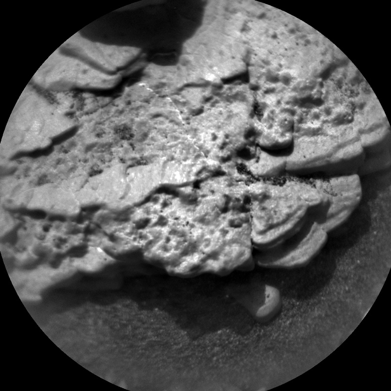
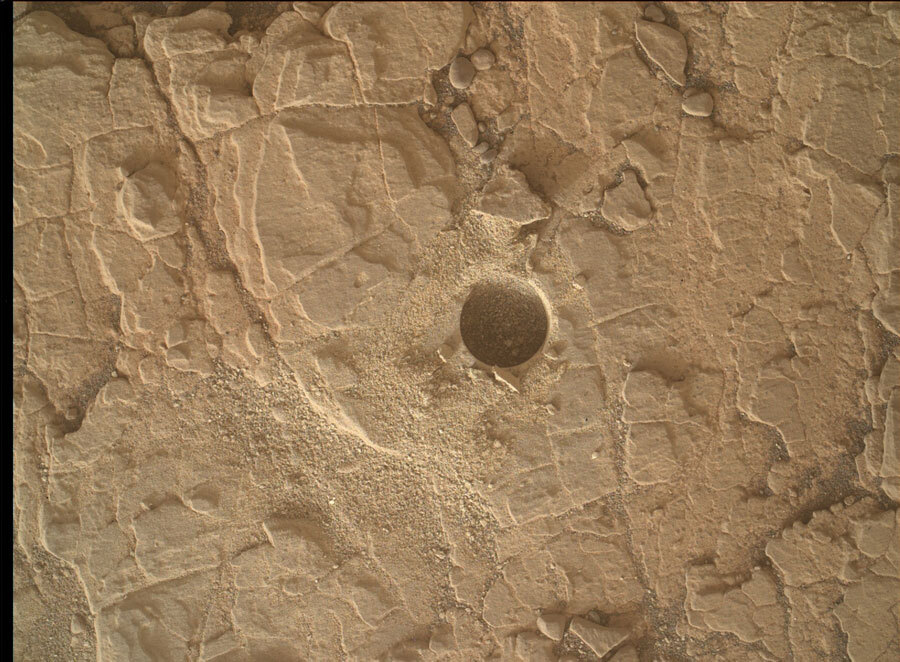
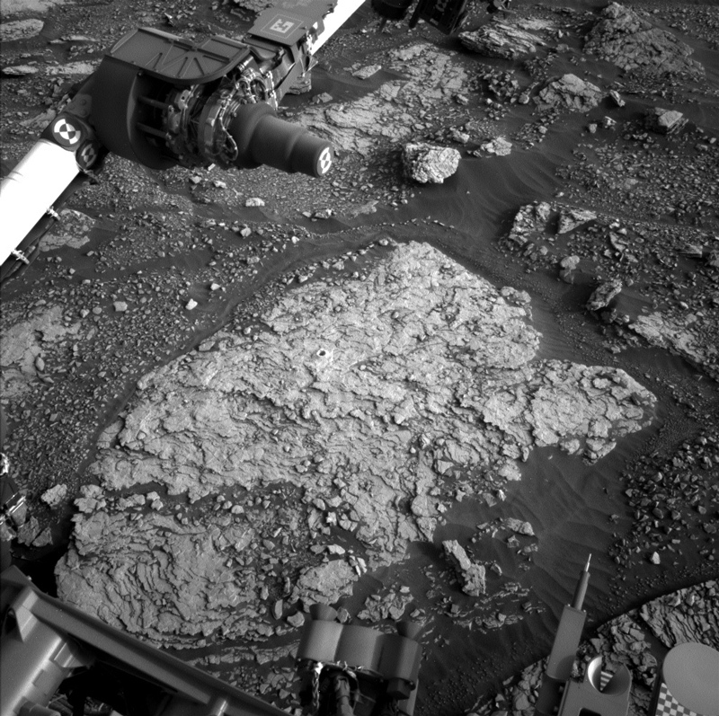
This image was taken by Chemistry & Camera (ChemCam) onboard NASA's Mars rover Curiosity on Sol 2867. Credits: NASA/JPL-Caltech/LANL. Download image ›

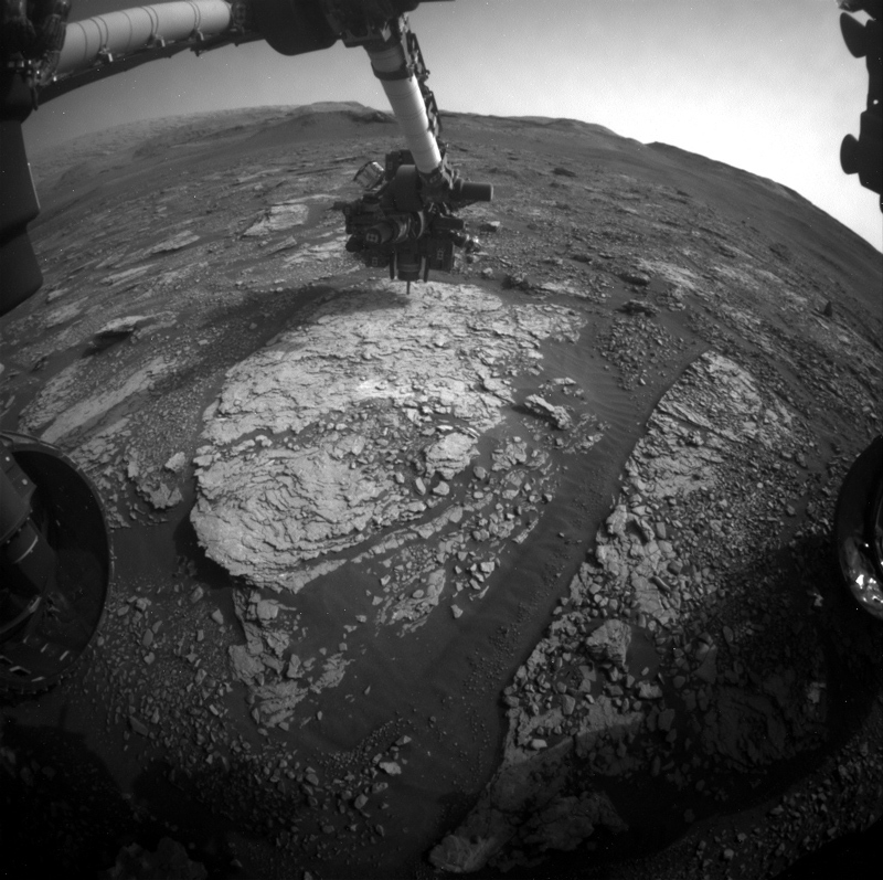
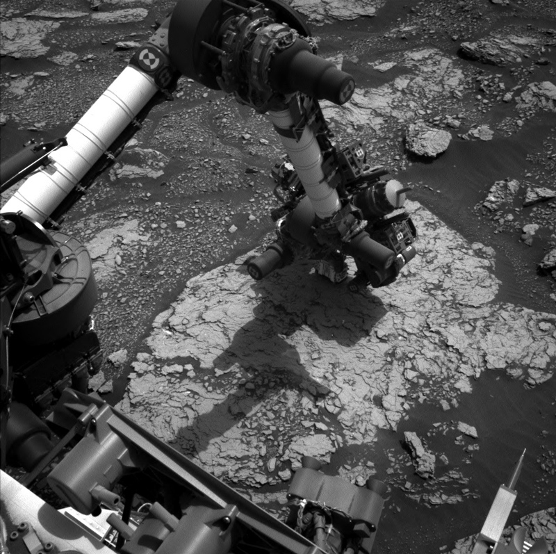
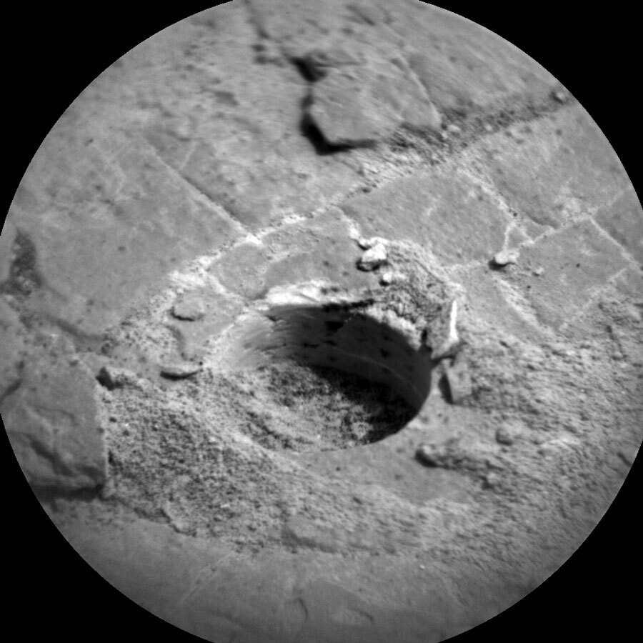
Curiosity has been in the area of the “Mary Anning” targets for a while now, and that’s for a very good reason: she came here to find the ideal rocks for a very special SAM experiment (see the blog from sols 2867-2869). First, we confirmed we had the rock-type we desired. Appearance can always deceive (and yes, that’s not just for rocks, we all know that!). Chemistry, however, doesn’t lie, and ChemCam and APXS have confirmed that we have under the drill what we came for. SAM has confirmed that all procedures are now ready to go. Thus, the big headline today is: We are "go" for drilling the “Mary Anning 3” target in this plan and to perform the SAM wet chemistry experiment later this week.

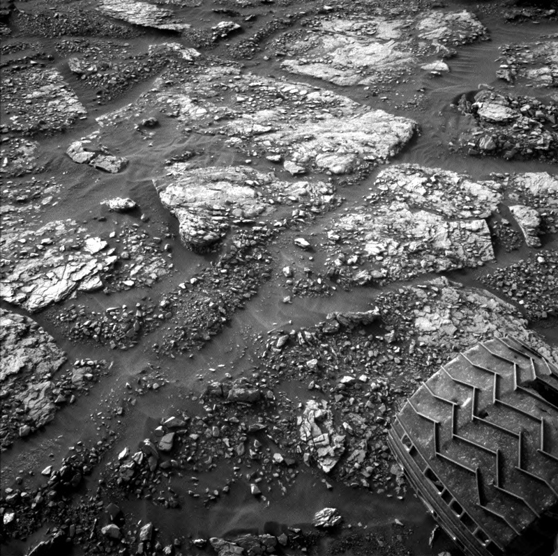
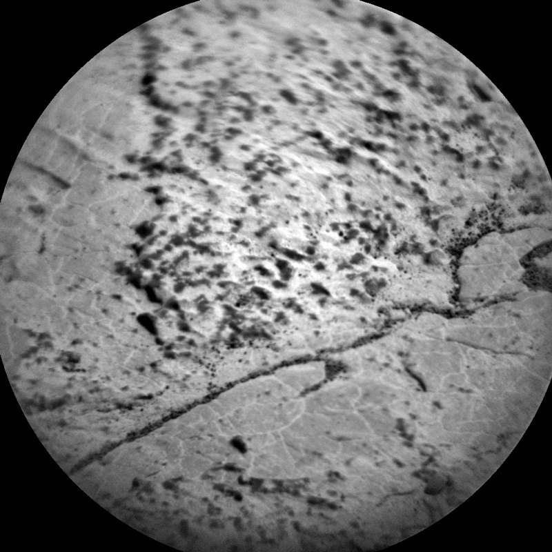
As it’s well-tested routine for our drill sequence by now, the first thing to do after the drilling is to image the drill hole. ChemCam will perform a passive spectral investigation, and Mastcam will do a multispectral measurement on the drill fines. While at it, Mastcam also takes a small 5x1 mosaic of the nearby target “Upper Ollach” again. We are taking advantage of the fact that – for the drilling – we are in the same place for several sols in a row. Using repeated imaging of this target we can detect changes that occur over time, and this way judge the current wind regime. Remember the blog “Sols 2864-2866: Spot the Difference!”? Those dust devils are one way to watch out for wind, looking at how grains shift over time is another.

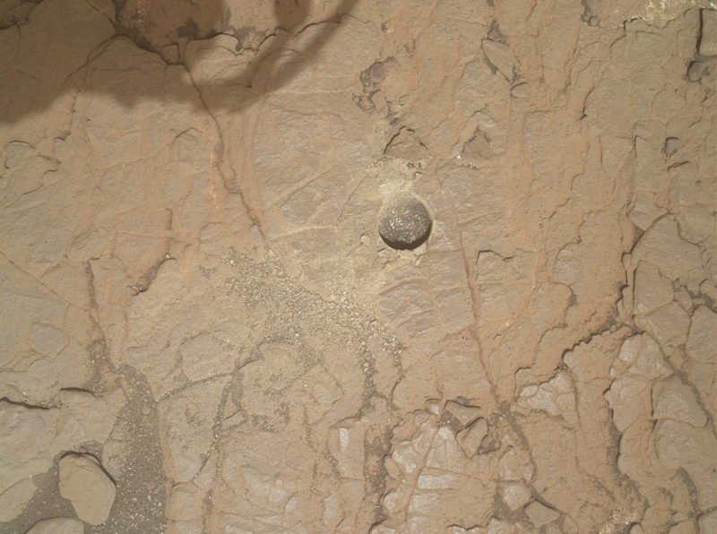
Today’s image at the top of this blog features the third topic of the day: While we are here, we are of course also looking for all the small features we can spot in our surroundings. Tiny dark layers in a nearby target “Ayton” caught our eye a few sols ago and were investigated by ChemCam. MAHLI is looking at them this sol. We are also investigating their chemistry further, as ChemCam will add more measurements on those features to improve measurement statistics and thus understand better what the dark nodular features are made of. ChemCam targets for that are "Toab" and another raster on the Ayton block. ChemCam is also looking at the target “Sartle,” which has a bit more greyish appearance and some white material – suspected calcium sulfate, at least if it is what it looks like. Let’s see, if looks deceive – or not!

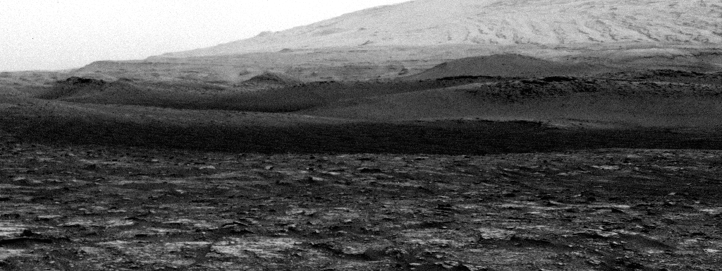
In other parts of the plan, DAN is doing a DAN passive, and ENV continues to observe the current atmospheric situation with dust opacity and dust devil observations. Mastcam is also adding to the mosaic they are building over the past sols with a 14x3 mosaic. All the things one can do while drilling, and that are very exciting for science to analyse a wider area for relationships of the observed structures and textures … but the big nail-biting moment will be when we learn if the wet chemistry experiment was successful. Fingers crossed for SAM!

August 28, 2020

Sols 2867-2869: Final Dress Rehearsal

Written by Scott Guzewich, Atmospheric Scientist at NASA's Goddard Space Flight Center
Curiosity's wheel is visible in this image of Mars

This image was taken by Left Navigation Camera onboard NASA's Mars rover Curiosity on Sol 2865. Credits: NASA/JPL-Caltech. Download image ›

Studying the clay-rich rocks of Gale Crater is one of the reasons it was chosen as the landing site for our rover. Curiosity has spent eight years driving and searching for a rock sample that is the best choice for using a precious and expendable resource of the SAM instrument: tetramethylammonium hydroxide, or TMAH for short. SAM flew to Mars with two of its sample cups containing a tiny amount of this special compound, which makes it easier for the SAM instrument to detect the organic (carbon-rich) compounds in the rocks that could help us understand whether the necessary ingredients for life were present in Gale Crater when it was better termed "Gale Lake."

This weekend, we will conduct a dry run of the TMAH experiment to finetune the procedures and make sure everything goes smoothly when we drop off a tiny bit of powdered rock from our upcoming drill hole (on the same piece of bedrock as the Mary Anning drill hole) into one of the two TMAH-containing sample cups. If all goes well, when we conduct the experiment for real in the sols ahead, we’ll get a fascinating view into the chemistry of Gale Lake.

August 26, 2020

Sols 2864-2866: Spot the Difference!

Written by Claire Newman, Atmospheric Scientist at Aeolis Research
Dust devils on Mars

Curiosity captured an impressive dust devil at the border between the darker and lighter slopes. Credit NASA/JPL-Caltech. Download image ›​

Mars is often a very dynamic place due to its atmosphere and how it interacts with the surface. At present, we’re in the “windy season” in Gale crater, as described in the Sols 2851-2852 blog post “Working Around the Wind.” This means that we’re seeing increased aeolian (meaning “related to the wind”) activity at the surface. In recent sols, we’ve taken Mastcam images of the same surface ripples on multiple sols. We’ve been able to see the ripples moving from sol to sol, due to wind moving the sand grains that make up the ripples, which tells us both the dominant wind direction and how strong the wind is. Today’s plan included more observations designed to look for changes on the surface and rover deck: a MARDI image of the region below the rover, to prepare for making more images of that location over the next few sols so we can look for changes, and a Navcam deck pan, to look for changes to dust and sand grains on the rover deck.

It’s almost summer in Gale crater, which puts us in a period of strong surface heating that lasts from early spring through mid-summer. Stronger surface heating tends to produce stronger convection and convective vortices, which consist of fast winds whipping around low pressure cores. If those vortices are strong enough, they can raise dust from the surface and become visible as “dust devils” that we can image with our cameras. The animated GIF shows a dust devil movie we took with Navcam on Sol 2847, covering a period of about five minutes. We often have to process these images, by enhancing what’s changed between them, before dust devils clearly show up. But this dust devil was so impressive that - if you look closely! - you can just see it moving to the right, at the border between the darker and lighter slopes, even in the raw images.

In today’s planning, we added both a short and a long Navcam dust devil movie, which take lots of images of the same region over respectively a five or 30 minute period. These give us the most information about dust devils, such as where they initiate, how they evolve, and how much variety there is in size, dust-content, and duration. Looking at how fast they’re moving and in what direction also tells us about the background wind speed and direction at their location. We also made sure to take meteorological measurements with REMS throughout each movie, in case we image a vortex that’s close enough for us to also measure its pressure drop, impact on local temperatures, or even UV radiation if it’s dusty enough to partially block out the Sun. Combining imaging with other observations can tell us more about the size and dust content of a dust devil and how far it is from us. We also added a five-minute Navcam dust devil survey. This takes three images in eight directions, covering the whole 360° around the rover, and helps us gather statistics on when and where dust devils occur.

We also continued to explore the clay-bearing unit, where our primary goal at present is to drill and sample material for SAM’s “wet chemistry” experiment. This involves transforming less volatile organics into forms that can be detected using SAM’s Gas Chromatograph Mass Spectrometer. It turned out that we weren’t positioned perfectly to drill at the “Mary Anning 2” target, so we included a short drive or “bump” to put us in the right place by the next plan. In the meantime, we added three ChemCam observations of the nodular layers in the “Howwood,” “Maligar,” and “North Fearns” targets, plus a Mastcam image to document those targets. We also added a ChemCam RMI long-distance mosaic and a Mastcam workspace image.

Finally, the plan included our usual RAD, DAN passive and active, and REMS cadence of observations, plus cloud movies and measurements of how much dust we see above us and across the crater. The dust measurements will help us to track the regional dust activity on Mars that has been seen from the surface and orbit in recent sols.

August 21, 2020

Sols 2860-2863: The Dog Days of Summer

Written by Lauren Edgar, Planetary Geologist at USGS Astrogeology Science Center
Curiosity's arm at work on Mars

This image was taken by Front Hazard Avoidance Camera (Front Hazcam) onboard NASA's Mars rover Curiosity on Sol 2858. Credits: NASA/JPL-Caltech. Download image ›​

Curiosity is still at the "Mary Anning" drill location, investigating the chemistry and sedimentary structures in this vicinity. As we continue to dig into the science at this location, the team is having some fun with naming targets. Today the team decided to name a nearby ChemCam target “Tray,” after paleontologist Mary Anning’s faithful dog who helped her with fossil hunting. But as one team member pointed out, while it might be the dog days of summer for those of us in the northern hemisphere on Earth, it’s actually the dog days of spring for Curiosity in the southern hemisphere of Mars!

Today was an extra big weekend plan in which we planned 4 sols instead of the usual 3, because we gave up our uplink on Monday so that DSN could support the Mars 2020 and Emirates Mars Missions that are en route to Mars. While we prepare SAM to do a wet chemistry experiment on the next drill sample, we had even more time for science activities today!

The first sol of this 4-sol plan kicks off with a midday science block for Mastcam deck monitoring, a change detection observation of some nearby ripples, and a Mastcam mosaic to document local troughs and patterned ground. In the evening ChemCam planned a dark spectra experiment, which is a nighttime test for the CCD dark level. The second sol includes a ChemCam passive observation of the sky to assess water vapor and dust in the atmosphere, along with several other environmental monitoring activities to characterize atmospheric opacity, search for clouds, and constrain aerosol scattering. The third sol starts with a big science block, including a Mastcam multispectral observation of the second site that we plan to drill at Mary Anning, a few different change detection observations of ripples and troughs, ChemCam observations of bedrock targets “Tain” and “Tray,” and additional environmental observations. Then MAHLI will image some dark nodules at the target “Falkirk Wheel” and APXS will investigate its chemistry. Early in the morning of 2863 Curiosity will conduct more atmospheric monitoring with Mastcam and Navcam, and then most of the 4th sol will be devoted to REMS observations. Throughout the plan there are also a number of MARDI change detection activities to try to better constrain when the wind is moving sand grains around.

And speaking of the dog days of summer here in Flagstaff, I write this as my dog is curled up on my feet under the desk, assisting me with my duties as SOWG Chair today. Telework does have its perks!

August 19, 2020

Sols 2858-2859: Ready for Round Two

Written by Michelle Minitti, Planetary Geologist at Framework
an image of Mars soil

NASA's Mars rover Curiosity acquired this image using its Mars Hand Lens Imager (MAHLI), located on the turret at the end of the rover's robotic arm, on Aug. 16, 2020. Credits: NASA/JPL-Caltech/MSSS. Download image ›

It was just a few short weeks ago that we acquired sample from the “Mary Anning” drill target. In those intervening weeks, CheMin, SAM, ChemCam, APXS and MAHLI have all thoroughly investigated the resulting sample and drill hole, and found it compelling enough that we are ready to dig into the bedrock in our workspace again. Today’s plan focused on analyzing the "Mary Anning 2” drill target, but we had enough time to fit in other observations as well.

MAHLI will start the fun by imaging the second Mary Anning target before the DRT brushes it to hopefully better resolve the laser spots from when ChemCam shot the target on Sol 2831. After DRT brushing, MAHLI will image the target again to give APXS a look at the newly-cleaned place it will analyze. Next, the rover engineers will push the drill bit into the target to see how the rock responds ahead of drilling. MAHLI will image the target yet again to see what kind of impression, if any, the drill bit made in the rock. APXS has its chance to acquire data from within the DRT-cleaned area overnight on Sol 2858. CheMin will also be getting ready for the next Mary Anning sample by running an analysis of the empty cell that is waiting to receive the sample.

With all this arm activity right in front of the rover, ChemCam selected a target off to rover right called “Falkirk Wheel.” Falkirk Wheel appears to be another collection of dark nodules like the “Ayton” target analyzed by ChemCam, MAHLI, and APXS in previous plans. Comparing and contrasting these targets will hopefully help us understand more about their origin. The MAHLI image above of the first Mary Anning drill hole, which shows the disappearance of the drill tailings around the hole, makes it abundantly clear that winds are moving material around. Both Mastcam and MARDI will acquire images aimed at tracking these wind-induced changes. Mastcam will image a patch of ripples at the “Skelmorlie” target for comparison to previous images of that area. MARDI will image three times - twice in the early evening and once early in the morning - to figure out when the winds are at their strongest. Are the winds kicking up dust devils? Navcam will acquire a movie to look for them! REMS, RAD, and DAN dot the plan keeping their regular eyes on the state of the environment above and below the rover.

August 17, 2020

Sols 2856-2857: In Between Drill Holes

Written by Roger Wiens, Geochemist at Los Alamos National Laboratory
Part of Curiosity's arm on the surface of Mars

This image was taken by Left Navigation Camera onboard NASA's Mars rover Curiosity on Sol 2854. Credits: NASA/JPL-Caltech. Download image ›

On this Earth day in Mars exploration history 15 years ago, Spirit was approaching the summit of ~100-meter tall “Husband Hill” in "Gusev Crater," which it conquered by the end of that month. Meanwhile, Opportunity was analyzing targets named after various berries and fruits on its way to “Erebus” crater in Meridiani Planum. At that point in time, Curiosity was little more than a gleam in a lot of engineers’ eyes and a pile of engineering drawings. You’ve come a long way, baby!

Sol 2851: Mars Hand Lens Imager - 500w
MAHLI image of "Mary Anning" drill hole from Sol 2851. Credits: NASA/JPL-Caltech/MSSS. Download image ›​
Today’s activities direct the arm to investigate a target off to the side of the first drill hole and prepare for eventual analysis of a second drill hole. SAM will do a cleaning of gas chromatograph #4 along with collecting diagnostic information. ChemCam will do a 10-point laser raster on “Tom Molach,” and Mastcam will image this target. APXS will do an overnight integration on “Ayton,” and MAHLI will image the target. It is on the same block as the drill hole and is characterized by some dark nodules that were observed several times with ChemCam). The Hazcams will take several images, Mastcam will take a sun tau image and a crater rim extinction image, and Navcam will take a movie looking for dust devils. REMS and RAD will also take data.

August 14, 2020

Sols 2853-2855: Wrapping up at 'Mary Anning'

Written by Vivian Sun, Planetary Geologist at NASA's Jet Propulsion Laboratory
"Mary Anning" drill hole

This image was taken by Chemistry & Camera (ChemCam) onboard NASA's Mars rover Curiosity on Sol 2852. Credits: NASA/JPL-Caltech/LANL. Download image ›​

Over this weekend, Curiosity will focus on wrapping up the sequence of drill-related activities at the “Mary Anning” target while the team considers if we want to drill a second location here. On sol 2853, APXS will make a long overnight observation of the drill tailings, giving us a detailed look at the chemical composition of this rock. The next day on sol 2854, CheMin will have its turn at a long overnight measurement to determine the mineralogy of Mary Anning.

ChemCam will also make a passive observation of the sample dump pile, adding to our rich collection of remote sensing observations characterizing: the pre-drilled surface, the drill hole and drill tailings, and now the dump pile. The extensive documentation that we do in all drill campaigns, involving both arm and mast instruments to study the drill hole and surrounding environment, goes a long way in helping scientists understand the history of these rocks and how they formed.

Other activities in this plan chipped away at the long list of desired observations we’ve accumulated while parked at this drill site. We planned additional Mastcam imaging to extend coverage of our workspace, and for change detection as we are now in the windy season at Gale crater – for example, compare the drilled powder in the sol 2852 image above to the same view on sol 2839! ChemCam will also do long distance imaging to get a higher resolution look at some of the upcoming terrains in the fractured intermediate unit. Atmospheric observations abound throughout the plan, with a comprehensive collection of: Mastcam and Navcam measurements of the atmospheric dustiness above us and across the crater, ChemCam ‘passive sky’ measurements (from which we can retrieve trace gas amounts and dust and water ice amounts and properties), Navcam imaging looking for dust devil vortices all around us, and early morning ‘zenith’ and ‘suprahorizon’ movies looking for clouds, and background REMS and DAN measurements. Whew, what a list! As always there will be plenty of data for us scientists to study from this drill site!

August 13, 2020

Sols: 2851-2852: Working Around the Wind

Written by Mariah Baker, Planetary Geologist at Center for Earth & Planetary Studies, Smithsonian National Air & Space Museum
"Mary Anning" drill hole

MAHLI image of "Mary Anning" drill hole from Sol 2851. Credits: NASA/JPL-Caltech/MSSS. Download image ›​

Tosol’s planning session began with discussion of recent images of the "Mary Anning" drill hole, which sparked the team’s interest for both scientific and operational reasons. Over the last few sols, images (like the one shown above) have revealed that wind is steadily eroding the fine material that originally surrounded our drill hole, providing observational evidence that we have once again entered the windy season here in Gale crater. As exciting as this is for those of us who study wind and have been patiently awaiting the return of the windy season, it is also important for the operations team. When we determine that wind is blowing material around on the surface, certain steps need to be taken to ensure safe and successful data collection. Timely assessment of wind activity is especially valuable when we are trying to study fine material that is susceptible to being blown away, both because wind-induced movement can impact our measurements but also because we don’t want any material blowing onto our instruments when we put them in close proximity to the surface. As a major component of today’s plan was to create and analyze a dump pile of fine drilled material, the team had to carefully consider the wind conditions and adjust the plan accordingly.

But a little wind wasn’t going to deter us. The team pushed on, scheduling almost two hours’ worth of science observations aimed at studying features both near and far. Within the immediate workspace, efforts will focus on the drill hole and the dump pile that will be created on the first sol of the plan. The drill hole will be targeted with the ChemCam LIBS instrument and imaged with Mastcam in order to confirm that the laser hit the intended target. This Mastcam image will also be added to the set of drill hole images we’ve already acquired, allowing us to continue monitoring wind activity here. Similarly, a single Mastcam image of the rover deck (which is acquired regularly by the team) will be used to track wind-induced accumulation of sand on the deck. The dump pile will be studied with Mastcam multispectral images, as well as with APXS and MAHLI, but the closest-approach MAHLI images will be taken with the cover on in order to keep the camera safe from wind-blown material. A ChemCam depth profile observation and Mastcam documentation image will also be acquired on target Ayton, which is located on the same bedrock slab as the drill hole and dump pile.

Two distant targets also captured the team’s attention: a light-toned area of the Vera Rubin Ridge will be analyzed with a Mastcam multispectral observation and a long-distance ChemCam RMI, and Mount Sharp’s sulfate unit will be targeted with a second long-distance ChemCam RMI. Three Navcam observations aimed at assessing dust and cloud activity (a dust devil movie, a line-of-sight image, and a suprahorizon cloud movie) were also included in this large science block. Two additional environmental observations, a Mastcam tau image and a Navcam zenith movie, were also planned for later in the day when lighting conditions were more optimal.

Although uncontrollable factors such as wind can pose an additional challenge for rover operations, it’s nothing we can’t handle. Doing science on another planet often requires adapting to quickly-changing conditions, and the rover team is very accustomed to working around whatever is thrown – or blown – at us.

August 11, 2020

Sol 2850: Wishing On ... Mars

Written by Lucy Thompson, Planetary Geologist at University of New Brunswick
The “Mary Anning” drill area on Mars

The “Mary Anning” drill area as seen by the left navigation camera. The “Ayton” target is towards the top left corner of the same block that the drill hole is in. Credits: NASA/JPL-Caltech. Download image ›​

As many of us look up at the night sky this evening and perhaps wish on a Perseid meteor shower shooting star, today we spent time making a wish list on Mars. We are keeping a list of observations we would like to make before we leave the “Mary Anning” drill site. Because we are trying to conserve power in order to complete all the upcoming SAM activities on the Mary Anning drilled sample, we are only able to plan ~30 minutes of science observations. It doesn’t take long to come up with 30 minutes worth of observations at this interesting location, hence our wish list!

When this plan is uplinked, Curiosity will spend the 30 minutes of science time using her Mastcam to: 1) image the drill site, to monitor movement of drill fines and sand during this windy period on Mars, and 2) extend imaging of the drill site area. The majority of other activities will be centered around preparing the Sample Acquisition, Processing and Handling (SA/SPaH) system to dump the remaining Mary Anning drilled sample in the next plan. A Navcam dust devil survey and standard background REMS, DAN and RAD activities are also included in this plan.

As the APXS strategic planner today, and with sample still in SA/SPaH, which means that we are unable to use the APXS until the drilled sample is dumped, I concentrated on our APXS wish list for this particular location. We will analyze the Mary Anning drilled sample (both the material dumped from SA/SPaH, and the powder surrounding the drilled hole) as part of our standard, upcoming drill-related activities. However, we are also hoping to squeeze in an extra observation of a close by, compositionally and texturally interesting area, previously analyzed by ChemCam (“Ayton”). I worked with the Long Term Planner and the Science Operations Chief to try and fit this observation in (we have to take into consideration power, timing, how complex the proposed activity is, etc.). We’ll have to see how many activities we get to cross off our wish list before we leave here!

August 10, 2020

Sol 2849: ChemCam Does a Double Take

Written by Melissa Rice, Planetary Geologist at Western Washington University
small, dark nodules embedded in a Mars rock

The small, dark nodules embedded in the "Ayton" rock shown in the Remote Micro-Imager. This image was taken by Chemistry & Camera (ChemCam) onboard NASA's Mars rover Curiosity on Sol 2837. Credits: NASA/JPL-Caltech/LANL. Download image ›

The most important activity for Curiosity on sol 2849 is an analysis of the "Mary Anning" drill sample with SAM’s gas chromatograph (GC) and quadrupole mass spectrometer (QMS). The operation of these instruments together, in what we call GCMS mode, is how we can identify the organic compounds that may be preserved in this clay-bearing outcrop. This is a big day for the Mary Anning drill campaign, and the results of the GCMS will help determine how we will continue our investigation of this site.

During extensive drill campaigns such as these, while Curiosity parked in one location for several weeks, the science team has ample time to scrutinize the rocks, pebbles and sands in the immediate vicinity of the rover. This is a luxury, because when Curiosity is driving, we usually get just a quick glimpse of the terrain in front of the rover before leaving it behind forever. Often, an instrument such as ChemCam will measure the chemistry of a rock, and by the time we have received and analyzed that chemistry data, that rock is just a speck in the rearview mirror. But during a drill campaign, when ChemCam reveals something interesting about a nearby target, we have the chance to follow up with more measurements.

So that’s exactly what ChemCam is doing today: a double take on a rock called “Ayton.” ChemCam’s first LIBS measurement of Ayton on sol 2837 targeted the small, dark nodules embedded in the rock (shown in the Remote Micro-Imager picture above). On sol 2849, ChemCam will look back at Ayton for a second LIBS observation to investigate why the chemistry is so different from its surroundings. Although Ayton is adjacent to the Mary Anning drill target, it looks completely unrelated, as Mary Anning does not have any of those dark speckles at all. It is amazing how much variability there is over such small spatial scales here – and it sure is nice to have some time to peer around and take it in!