January 7, 2022

Sol 3350-3352: A Rock Under the Wheel

Written by Susanne Schwenzer, Planetary Geologist at The Open University
It nicely shows the rocks at the current parking position, and the veins criss-crossing them.

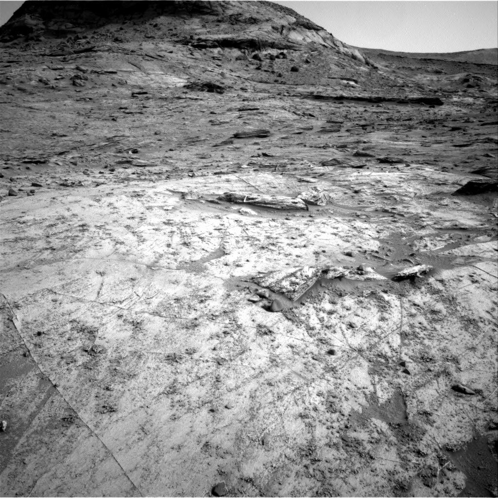
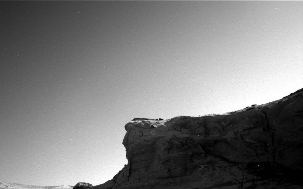
This image was taken by Left Navigation Camera onboard NASA's Mars rover Curiosity on Sol 3349. It nicely shows the rocks at the current parking position, and the veins criss-crossing them. Credits: NASA/JPL-Caltech. Download image ›

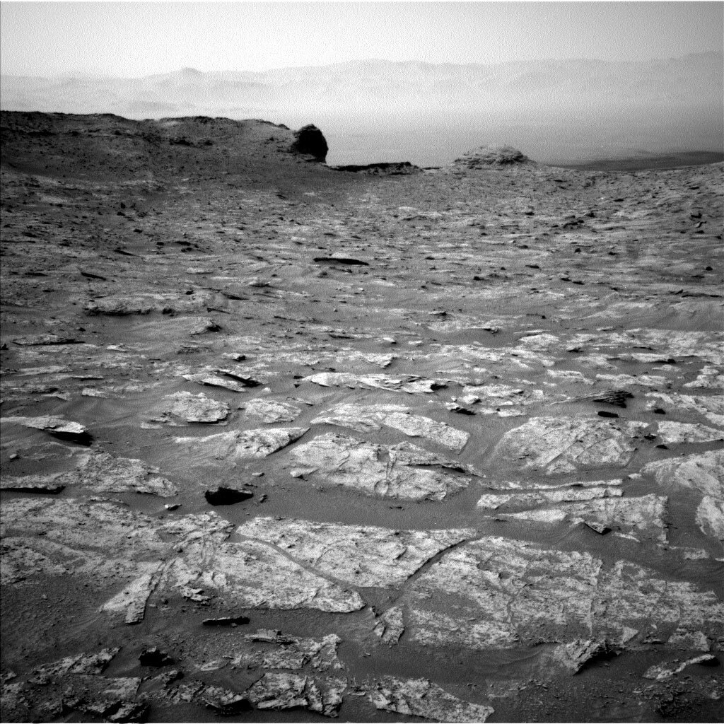
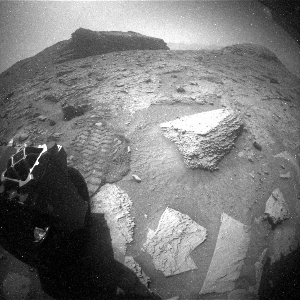
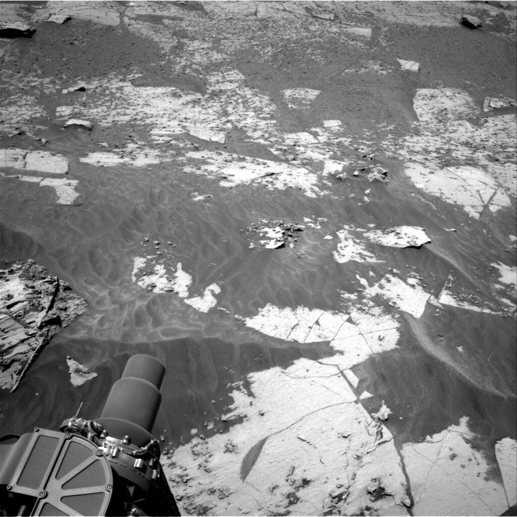
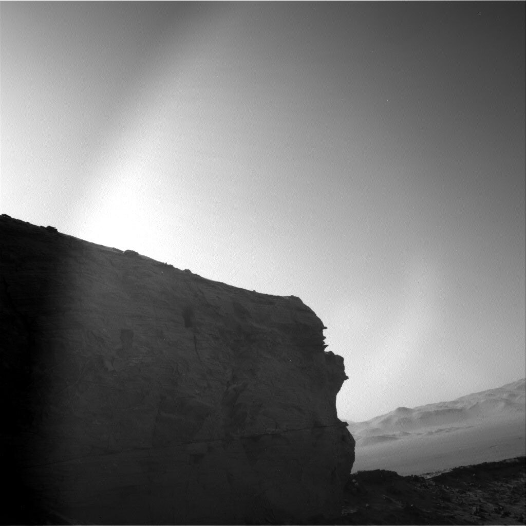
We are back into our planning routine after the Christmas break. In fact, today was the third plan in the new year, and the third plan that Curiosity executes within the Roraima quadrant my colleague introduced a few days ago. While we are getting used to new sounds of our names, we are marvelling at the landscape in front of us, which is very diverse, both in the rover workspace and in the walls around us. It’s a feast for our stratigraphers (those who research the succession in which rocks were deposited and deduce the geologic history of the area from this). We are all looking forward to the story they will piece together when they’ve had a bit of time to think!

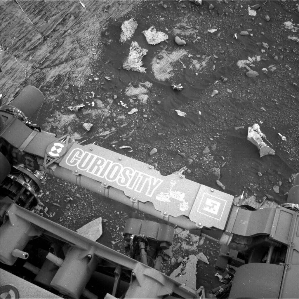
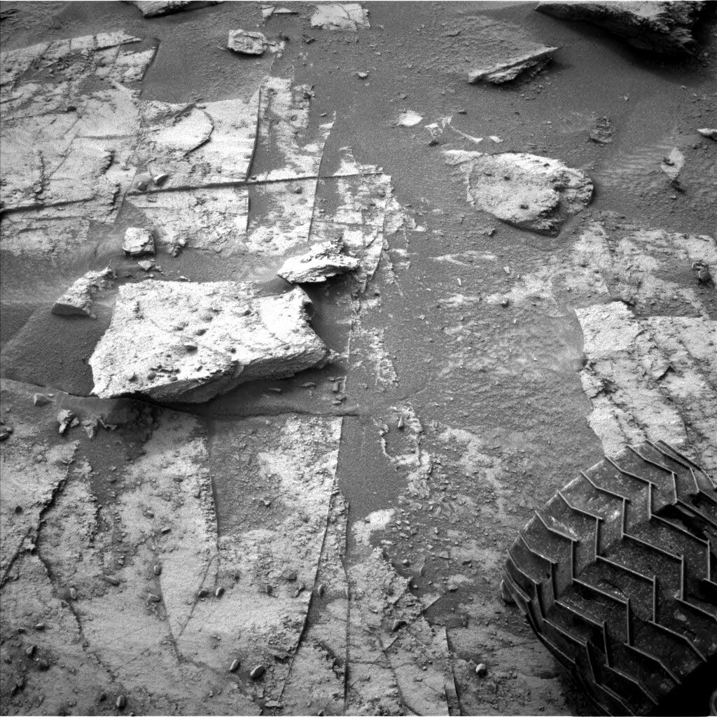
Planning is all about getting the data, and here are three new sols to do so. Unfortunately, the diversity of the landscape means one of the rover wheels is parked right on top of a rock, and that’s not a safe situation for the use of the arm. This is because the rover could shift if the rock suddenly moved or broke under the wheel while the arm is out and close to a target. The engineers are working diligently to keep all our instruments safe, so they called a weekend with no contact science. It happens occasionally, and except for that little rock squeezed under the rover wheel, all is happy and safe on Mars and on Earth. The team quickly turned to the instruments that do not need arm use to add a few more of those observations. It’s all about getting all the data we can at this interesting location.

So, here is what’s in the plan: True to the fact that the walls around us have a lot of interesting layers and features, we have two large Mastcam mosaics, target ‘Maringama’ and ‘Prow,’ to get higher resolution colour images for assessment by our stratigraphers (and all others, too, of course). ChemCam also looks at the sedimentological structures in the walls at even higher resolution doing two long distance imaging investigations on target ‘Mirador’ and ‘Ptari.’ But, of course, there also is a desire for understanding the chemistry, and therefore ChemCam has two LIBS investigations on the targets ‘Araopan’ and ‘Arai,’ which Mastcam will also document with an image each, and an AEGIS observation after the drive. Mineralogy will be investigated through a Mastcam multispectral observation on the target ‘Indio.’

Curiosity has a few other items on her to-do list over the weekend. CheMin is investigating a sample we drilled a while back and that has been kept in the sample cell since: Zechstein. If you now wonder when and where Zechstein was, look here. There is a drive and a routine MARDI image afterwards. DAN looks for water and chlorite in the subsurface, and it’s time for MAHLI wheel imaging, for which the rover will bump slightly to get off the rock and then start its cadence to look at all the wheels. Of course, the weather will be observed through temperature, pressure and atmospheric imaging observations, which include a dust devil movie. Looks like Curiosity has a busy weekend ahead, while I get to put my feet up on my sofa and stare out the window watching the rain that’s in the weather forecast here in England.

January 5, 2022

Sol 3349: Ridges, Big and Small

Written by Lucy Thompson, Planetary Geologist at University of New Brunswick
This image was taken by Left Navigation Camera onboard NASA's Mars rover Curiosity on Sol 3347.

Navcam right image showing the drive direction and the dark, low resistant ridge that we are driving towards in this plan. Credits: NASA/JPL-Caltech. Download image ›

Another successful drive on Mars resulted in a dusty bedrock workspace with nodules and small raised ridges in front of the rover. Curiosity also has a view towards larger scale, dark, resistant ridges that we have noticed within the more subdued and lighter coloured, more typical bedrock in this area.

The science team decided to investigate the chemistry and texture of one of the small, raised ridges in the workspace (“El Fosso”) with APXS and MAHLI. Is the ridge there because of the presence of a harder, more resistant mineral that might have formed as fluid flowed through the rock? Determining the chemistry of the feature could help to figure out why the ridge is there. To complement this observation, the bedrock target “Kamarkawarai” will be analyzed with ChemCam LIBS and imaged with Mastcam.

Looking further afield, Curiosity will image one of the larger scale, dark, resistant ridges with a ChemCam RMI mosaic. The drive planned tosol should take us closer to one of these ridges, which we hope to investigate in future plans. Mastcam will document an area that may have been the site of recent movement of sand around a block (“The Pit”), as well as an area of a butte that may contain cross bedding (“Maringma”).

Our plan was also full of atmospheric and environmental observations, particularly as we are expecting an increase in dust within the atmosphere as a regional storm passes by. We planned Mastcam basic tau, crater rim extinction and sky survey observations as well as a Navcam line of sight observation and suprahorizon movie.

After the drive, we will acquire a DAN active measurement and a MARDI observation to document the terrain beneath the rover. Standard DAN, REMS and RAD activities round out the plan.

As the APXS payload uplink and downlink lead today, I was responsible for reporting on the downlink from the previous plan and uplinking our observation for this plan. I also helped to pick the El Fosso target. Today was one of those planning days when everything went smoothly. It is not always easy to place the APXS and MAHLI instruments (situated on the end of the robotic arm) on the rocks that we want to investigate. We have to ensure the safety of our instruments and the rover. However, tosol our target of interest was relatively easy to place APXS and MAHLI on.

January 3, 2022

Sols 3347-3348: Bem Vindo a Roraima!

Written by Ashley Stroupe, Mission Operations Engineer at NASA's Jet Propulsion Laboratory
This image was taken by Left Navigation Camera onboard NASA's Mars rover Curiosity on Sol 3345.

This image was taken by Left Navigation Camera onboard NASA's Mars rover Curiosity on Sol 3345. Credits: NASA/JPL-Caltech. Download image ›

Tosol, Curiosity woke up in a new mapping quadrant, Roraima. The Roraima quadrant is named after the northern-most state of Brazil and Mount Roraima, which is the highest peak in the Pakaraima mountains which sits between Brazil, Venezuela, and Guyana. The terrain in the Roraima region on Earth looks somewhat similar to the area Curiosity is in – with flat-topped hills and some steep slopes. Curiosity will be heading toward a narrow pass bordered by some small flat-topped mesas worthy of the Roraima name. Looking back, Curiosity can see all the way to the Torridon quadrant and see Mars’ “Scottish highlands” with the attached beautiful view of the Maria Gordon notch; you can also see the rim of Gale crater in the distance.

As we head southward, we will likely be parking near some of these tall hills and cliffs in order to get close-up images. Parking near such tall terrain can sometimes block our view of the orbiters if they are low in the sky, impacting the amount of data we may receive. We saw this kind of an effect when we parked near the tall steep cliff of Maria Gordon notch, where there was a significant reduction of data on one of our communication passes with the Trace Gas Orbiter (TGO). We will take this into account to make sure we will still get down the data we need for planning.

On the first sol of today’s plan we are doing a “touch-and-go” which includes some contact science, targeted science, and a drive. Our contact science target, “Verde,” is a small piece of bedrock with nodules in it, similar to many of the other rocks we have investigated recently. The science team will be able to compare its composition with those prior targets to continue to build up a picture of the changing geology and chemistry preserved in the region. The Rover Planners will then leave the arm stowed again in preparation for driving and to leave a clear view of the target for the cameras.

The targeted science in the plan will also investigate the nodules by looking at “Maurak,” another nearby target, with ChemCam and Mastcam. ChemCam is also taking RMI images of a distant butte named “Mirador,” both its top and its face, which has an interesting and significant textural transition.

Once ready to drive away, Curiosity will head about 15m southward. Due to some significant rocks and the uphill climb ahead of us, this is only as far as the Rover Planners can see. Even if that distance, the rover is going to need to wind around to skirt some more significant rocks so that we don’t add damage to the wheels. The drive should leave us parked where we have a better view of the road ahead, as well as leave bedrock within the rover’s workspace for the next plan.

After the drive, Curiosity will do some evening environmental observations, Navcam suprahorizon and zenith movies, to look at the atmosphere. Overnight, the SAM instrument will be doing an engineering maintenance activity to check out the optics on the tunable laser spectrometer (TLS).

On the second sol of the plan, after the drive, Curiosity will do some untargeted science using AEGIS autonomous target selection and observation and a long Navcam dust devil movie.

December 22, 2021

Sols 3344-3346: Planning for the New Year

Written by Ryan Anderson, Planetary Geologist at USGS Astrogeology Science Center
This is a black and white image of the Mars landscape taken by the Curiosity rover. A clear sky, some low, rocky hills and sandy ground are present in the horizon of the image.

This image was taken by Left Navigation Camera onboard NASA's Mars rover Curiosity on Sol 3333. Credits: NASA/JPL-Caltech. Download image ›

On Monday, the team uplinked an eleven-sol plan that will take us through the end of December. Today is the last planning day of 2021, and the plan will cover sols 3344 through 3346: the first few days of 2022 and the beginning of the rover’s sixth Mars year on the surface!

We’ll start off with a Mastcam panorama of one of the spectacular buttes visible from our current location, followed by ChemCam on the vein target “Unst Ophiolite” and a long distance RMI mosaic of Gediz Valles ridge. After that, Navcam will spend some time watching for dust devils.

Later in the day on sol 3344, we have another short science block with just enough time for a Mastcam panorama of some nice layers in the target “Port Logan” and routine “clast survey” images near the rover’s wheels with both Mastcam and MARDI. That is followed by some MAHLI images and APXS observations of the target “Maes Howe.” APXS will also do an overnight measurement of the amount of argon in the atmosphere.

On Sol 3345, we’ll start off with some more Navcam dust devil observations and measurements with Navcam and Mastcam to measure atmospheric dust. Mastcam will then take a mosaic of the target Unst Ophiolite, and stereo images of the targets “Achinduich” and “Achriesgill.” Next up is ChemCam with a LIBS observation of the target “Maes Howe,” followed by a Mastcam multispectral observation of the same target.

We’ll then drive for a bit and collect post-drive imaging, including another Mastcam and MARDI clast survey. After the drive, Navcam has several atmospheric observations, watching for clouds and cloud shadows, and measuring the “phase function” of the sky – essentially how the brightness of the sky varies with angle from the sun.

On Sol 3346, the rover’s AEGIS software will pick a target to analyze with ChemCam LIBS, and Navcam will make some more atmospheric observations to watch for dust devils. The plan ends with the early morning of Sol 3347, when Navcam will watch for clouds again, and Navcam and Mastcam will measure the amount of dust in the atmosphere.

It should be a busy few sols, and a great start to the new year!

December 20, 2021

Sols 3333-3343: Holiday Prepping on Mars

Written by Catherine O'Connell-Cooper, Planetary Geologist at University of New Brunswick
This image was taken by Left Navigation Camera onboard NASA's Mars rover Curiosity on Sol 3331.

This image was taken by Left Navigation Camera onboard NASA's Mars rover Curiosity on Sol 3331. Credits: NASA/JPL-Caltech. Download image ›

On Mars, like Earth, we are prepping for the holidays. Today we planned an eleven sol plan which will take us to the end of December. For this plan, the ENV instruments take the main stage, with lots of REMS activities and a rare day-long DAN passive experiment.

With such a long complex plan, contact science had to be short and sweet today. This current location is dotted with large nodular features, also identified in other recent workspaces like the one shown above from sol 3331, and we would have liked to analyze them with both APXS and MAHLI, but it was not to be. Today’s plan featured Touch and Go contact science, where APXS and MAHLI analyze a target early in the morning and then we drive to a new location. These plans need complexity to be kept low, so the challenging topography of the nodules meant they were a little too much for today. We will keep our eyes peeled for these in the coming workspaces, in the New Year!

Instead today, APXS will analyze some flatlying bedrock “Shinnel” and ChemCam will investigate “Castle Sween” which appears to be a small vertical vein face in the workspace. Mastcam will document both targets, before we drive around 60 metres to our holiday workspace, which will hopefully be chock full of gifts for all the hardworking MSL scientists and rover planners, in the form of fantastic science targets to analyze and vistas to image!

December 17, 2021

Sols 3330-3332: Cliff Back…

Written by Susanne Schwenzer, Planetary Geologist at The Open University
This image shows the rear hazard camera view onto the landscape. Remember that the hazard camera is mounted below the rover body, so we are looking from very low to the ground upwards. This image was taken by Rear Hazard Avoidance Camera (Rear Hazcam) onboard NASA's Mars rover Curiosity on Sol 3329.

This image shows the rear hazard camera view onto the landscape. Remember that the hazard camera is mounted below the rover body, so we are looking from very low to the ground upwards. This image was taken by Rear Hazard Avoidance Camera (Rear Hazcam) onboard NASA's Mars rover Curiosity on Sol 3329. Credits: NASA/JPL-Caltech. Download image ›

We had quite a few special investigations lately, which took the front seat (read: all our power and time) lately. They ranged from boulders to DAN investigations that saw the rover parked very close to a cliff face. We are starting this 3 sol plan with DAN passive observations to wrap up before driving away from the cliff face and a post drive DAN active.

The atmospheric investigations had to take a little bit of a step back while we were doing our investigations near the cliff, so they feature very prominently in today’s plan to make up for it. Curiosity has a lot to do over the next three sols to catch up with the atmospheric investigations. This weekend we’ve panned several imaging activities including a tau or atmospheric opacity observation, a ChemCam passive sky spectroscopy observation to retrieve water column abundances and aerosol properties, and images to search for dust devils. Later in the same sol we have another opacity observation, a cloud altitude movie, which allows us to determine cloud height to be extracted as well as velocity, and finally a phase function sky survey which is a whole sky atmospheric monitoring activity to look at scattering phase functions of clouds. Finally we have our weekly suite of morning observations which include a line of sight observation of the crater rim to determine dust loading within the crater, a zenith movie which looks for clouds and wind direction near the zenith, and another opacity measurement.

As we continue to travel through the notch, geologists marvel at the outcrops presented by the high walls, and when geologists marvel, they take lots of pictures. Mastcam will take three mosaics to cover the most impressive parts of the cliffs and two on the rocks right in front of us. “Corncockle Sandstone” and “Catcastle Sandstone” are targets in the workspace, and three larger mosaics on the walls and cliffs are documenting interesting sedimentary features that we can see from our current vantage point. It’s not all that easy where we are, because the steepness of the cliffs means we need to carefully plan to find the best light conditions. But with a weekend plan, there is a lot of opportunities to try to fit it all. Curiosity will also perform a multispectral analysis on the target “Clochoderick.”

ChemCam will add long distance RMIs to the feast of images and get even more detailed images on some of the most interesting parts of the cliffs. ChemCam is also hitting two targets with the active mode, “Clochoderick” and “Aros Park” to measure the bedrock and to get a joint measurement of a float rock that APXS is measuring, respectively. Talking of APXS, it’s looking at the float rock Aros Park and the bedrock target Clochoderick. And, of course, we will also do our standard REMS (the weather station) observations to measure atmospheric pressure, temperature, humidity, winds, plus ultraviolet radiation levels. Plenty of data to come – “an amazing amount of science in this plan,” to quote today’s long term planner – just before we plan for the Christmas break. But more about that on Monday – terrestrially speaking.

December 15, 2021

Sols 3328-3329: Out of the Shadows

Written by Michelle Minitti, Planetary Geologist at Framework
This image was taken by Right Navigation Camera onboard NASA's Mars rover Curiosity on Sol 3327.

This image was taken by Right Navigation Camera onboard NASA's Mars rover Curiosity on Sol 3327. Credit: NASA/JPL-Caltech. Download image ›

Our Sol 3326 drive was successful, completing our shot through the Maria Gordon notch, with its spectacular structures and deep shadows, and continuing our climb up Mount Sharp. To keep MAHLI safe over the upcoming holiday break, this plan was the last chance to take images with MAHLI’s cover open until we plan the sols post-holiday, so the team was on the hunt for a good target. For MAHLI and APXS, we started trying to target one of the thin, gray vein features cutting across the bedrock directly in front of the rover. However, their small size and the topography on and around them prevented the arm from gaining easy access to them. So we pivoted to some of the flatter bedrock off the right front wheel of the rover (in the image above), and landed on “Korskellie” for MAHLI and APXS analysis.

ChemCam was, and will be, busy off the rover’s starboard side, as well. After the drive that brought us to this location, ChemCam used its autonomous targeting capabilities to shoot a target on the right of the rover. As we were planning, we did not know exactly where that raster hit, but given the expanse of bedrock available, we assumed we already had one bedrock analysis in the bag. That allowed us to add a little variety to the nature of the targets for today. We selected “Achentoul,” another bedrock target but one that appeared to cross a color change in the bedrock. We also selected “Carragheen,” a round, roughly ping pong ball-sized resistant feature standing proud above the bedrock. The terrain has been increasingly scattered with gray rounded features presumably shed from the local bedrock, so Carragheen will give us a chance to investigate one of these things in-situ.

We were still close enough to the cliffs and buttes that form Maria Gordon notch that they got lots of imaging attention. Mastcam will acquire large mosaics of the floor of the notch that we just drove over to capture bedrock textures and structures, and the butte to the rear left of the rover to gain yet another perspective on its internal structure and evaluate its relationship to the rock above it. Early in the morning of Sol 3329, when the sun is still shining on the cliff to our west, Mastcam will image the structures at the cliff base and acquire a multispectral analysis higher up the cliff where previous mosaics have indicated color variations. Lastly, Navcam will image the cliff in a small stereo mosaic at this early morning time to improve our three-dimensional picture of the amazing structures in the cliff face.

ChemCam RMI will also get in on the imaging act, but looking farther uphill at buttes that will be increasingly hard to see along the particular path we plan to take up Mount Sharp. Both buttes are features we have imaged previously, but from farther away and from different angles. Today we will get a new perspective on them.

We will acquire atmospheric-focused measurements throughout the plan, with imaging to measure the dust load in the atmosphere at different times of sol, a Navcam cloud movie and dust devil survey, and measurement of argon in the atmosphere with APXS. RAD and REMS run systematically over both sols. DAN will acquire nearly seven hours of passive data from the subsurface in addition to one 20 minute active observation right after the we complete our ~30 m drive uphill.

December 13, 2021

Sols 3326-3327: Backing Away From the Cliff

Written by Kenneth Herkenhoff, Planetary Geologist at USGS Astrogeology Science Center
This is a black and white image of the sandy, rocky surface of Mars.

This image was taken by Left Navigation Camera onboard NASA's Mars rover Curiosity on Sol 3324. Credits: NASA/JPL-Caltech. Download image ›

As we continue exploring Maria Gordon notch, we are planning a touch and go with lots of remote sensing activities between the "touch" and the "go." MSL is parked near the base of the cliff to the west, and the science team is interested in investigating the bedrock in this area. Unfortunately, none of the bedrock targets shown near the top of the image above are suitable for close APXS placement, so we will not be able measure the bedrock chemistry here using APXS. Rather, MAHLI will take images of a bedrock target named "Portgower" and ChemCam will sample the chemistry of another bedrock target "Thornhill" higher up the cliff face. Mastcam and Navcam will be used to monitor the dust content of the atmosphere and search for dust devils, then Mastcam will acquire 3 stereo mosaics of the cliffs and boulders near the rover. After the ~20-meter drive and post-drive imaging, another MARDI twilight image is planned. Because more power is available that initially expected, we were able to add an overnight CheMin wheel move and empty cell analysis to the plan. The second sol is much simpler, with a ChemCam observation of an autonomously-selected bedrock target and more Navcam and Mastcam observations of the atmospheric dust.

December 11, 2021

Sols 3323-3325: In the Shadow of Maria Gordon Notch

Written by Abigail Fraeman, Planetary Geologist at NASA's Jet Propulsion Laboratory
This is a black and white image of the Maria Gordon notch, which is a hill the Curiosity rover has been exploring.

This image was taken by Right Navigation Camera onboard NASA's Mars rover Curiosity on Sol 3322. Credits: NASA/JPL-Caltech. Download image ›

Curiosity ended its Wednesday afternoon drive in shadow when it parked just a few meters away from the towering western wall of Maria Gordon notch. While this location gives us spectacular views of the layering, veins, and nodules exposed on the side of the outcrop, it was actually chosen to support an experiment with Curiosity’s neutron spectrometer, DAN (Dynamic Albedo of Neutrons). DAN has the ability to measure the amount of hydrogen, a proxy for water, around the rover. The instrument is sensitive to surroundings all around Curiosity, although usually the only interesting signature comes from the ground beneath the rover where the instrument can detect water bound within hydrated minerals. Parking close to the side of Maria Gordon notch gives us an exciting opportunity to see information with DAN from both the ground and the wall next to the rover, which will help us refine our understanding of DAN data throughout the mission. We’re actually going to measure the area with DAN in three different positions: our current parking position and two more planned during today’s drive. The drive will place Curiosity perpendicular to the cliff and then parallel again, but a little bit closer than we are now. It’s a little like a rover version of an almost three-point turn!

In addition to the DAN experiments, we’ll also collect APXS and MAHLI observations on two pebbles in front of Curiosity, one with pits ("Helens Bay") and one without pits ("Lakeheads"), as well as ChemCam observations of "Orlock Ridge" and "Hailes Quarry." And of course since we’re at such an amazingly scenic location, we’ll make sure to take lots and lots of Mastcam mosaics throughout the day.

December 9, 2021

Sols 3321-3322: Old Martian in the Mountain

Written by Scott Guzewich, Atmospheric Scientist at NASA's Goddard Space Flight Center
This is a black and white image of the Maria Gordon notch which is a low hill on Mars.

This image was taken by Right Navigation Camera onboard NASA's Mars rover Curiosity on Sol 3319. Credits: NASA/JPL-Caltech. Download image ›

After a challenging day yesterday due to issues on Mars and Earth, today went far smoother as we planned 2 sols that will continue our activities in the visually stunning Maria Gordon notch. On the first sol we will have ChemCam activities with a LIBS target on a nearby bedrock slab and then a passive observation to study atmospheric dust, ice, and gases. Then we’ll place the arm on “Cladh Hallan” for contact science with APXS and MAHLI.

On the second sol, Curiosity will wake up early to catch the morning sunlight on the west face of the cliff wall lining the notch and image it with Mastcam and Navcam. Then after additional science with Navcam, Mastcam, and ChemCam, the rover will drive just to the right of the corner of the cliff seen in the image above. From our current location, it can’t help but remind me of the Old Man in the Mountain that used to be in New Hampshire. At this parking location, we’ll conduct a focused science campaign with DAN over the weekend to study the makeup of the cliff wall itself.